Читать книгу Ridges of Snowdonia - Steve Ashton - Страница 7
ОглавлениеINTRODUCTION
This guide brings together the best ridge walks in Snowdonia. In describing them I have tried to be both readable and accurate, which explains the unusual ordering of the text. A summary of route information is given first, followed by a route description. The main routes are accompanied by a route profile and a map. The numbered points on the route profile are referred to in the route description by a small number (e.g. 1). General chit-chat follows, and this means you have the option to glance through one or the other section according to need, and without having to plough through an unnecessary amount of verbiage.
Because the book is designed primarily for the hill-walking enthusiast, I have comandeered space traditionally reserved for introductory notes and lengthy topographical descriptions (using photographs to help compensate in this latter respect) in order to explore the hill-walking experience beyond what is normally allowed or admitted in a guide book. The resulting descriptions are progressive, to a certain extent, so that they can be read one after the other like chapters in a book.
A more serious omission in the text is that of a discussion on natural history. However, it was felt that the subject is more than adequately covered in specialised publications. One inclusion – as an appendix – is a guide to pronunciation and meaning of some Welsh words used in the main body of the guide.
For the benefit of those new to the area, or new to this style of walking, there are one or two general points and definitions worth emphasising.
Ridge Walking
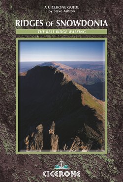
The term is applied loosely throughout; so that in addition to following a narrow crest, a ridge walk may also be said to follow the high ground between summits, however broad it may be.
Scrambling
Sections of some of these routes follow narrow exposed ridges involving rock scrambling where hands are used to assist the ascent. While even the most awkward of those included here should be within the capability of seasoned walkers, it is worth remembering that adverse conditions of any kind may dramatically increase their difficulty.
Ridge Walking in Winter
These routes – without exception – are severely affected by winter weather and its ground conditions, making great demands on winter skills and navigating ability. An ice-axe is essential (so are crampons – even if these are held in reserve); but so too is the stamina and experience to cope with what can suddenly develop into a very serious expedition. Some of the scrambling routes – Snowdon Horseshoe and Bristly Ridge among them – can be totally transformed by winter conditions, becoming potential winter climbs of some difficulty.
Variants to Routes
Some of these are merely alternative starts or finishes, chosen to help ease a logistical problem with transport; whereas others – full ridge walks in their own rights – are included to broaden the scope in the more popular central areas.
Access
While access to all routes – as described – is presently accepted (though not guaranteed), the situation can be expected to change from time to time. This is especially true for ‘sensitive’ areas like Nantlle or the Arans. The Snowdonia National Park Authority have been effective in resolving recent access difficulties; but if an awkward situation should develop unexpectedly, then maintaining a diplomatic and considerate approach can only help in smoothing your passage.
Distance, Heights, Times
All such figures are approximate. To ease compatibility with current maps, the metric figure has been given priority. Route distances and height gains take some account of terrain (e.g. zig-zag paths), so that distances and gains measured straight from the map will always give a lower figure than the one stated in the summary. Times are given for good weather and without rest stops, and they should be treated with suspicion. They have been included primarily as a measure of relative – rather than absolute – time. That is, they are indicators of the time-consuming nature of the terrain as compared with another section of the route, or with another route altogether. Compare, for instance, the times/ distances given for the Snowdon Horseshoe and Carneddau Western Ridges.
Maps
There are a number of maps available – of various sizes, scales, and surveys – dealing with the Snowdonia area. However, the following combination is recommended for conciseness:
Landranger Series: OS Sheet 115 (Snowdon), Scale 1:50,000; OS Sheet 124 (Dolgellau)
Outdoor Leisure Series: 17 Snowdonia – Snowdon & Conwy Valley
Weather Forecasts
Consult the phone book for details of recorded weather forecasts. Daily forecasts are also pinned at strategic points around the park (e.g. Pen y Pass and Ogwen Cottage). These services are provided by the Snowdonia National Park Authority.
Acknowledgements
I would like to thank Tony Jones, Honorary Chairman of the Ogwen Valley Mountain Rescue Organisation, and Dr. Ieuan Jones, Specialist in Accident Surgery, for help in compiling the ‘Emergency Checklists’.
I would also like to thank Del Davies for some route suggestions, and the staff of Plas y Brenin for the use of their library.