Читать книгу Walking Cincinnati - Danny Korman - Страница 10
На сайте Литреса книга снята с продажи.
Оглавление1 Ohio Riverfront
Bridges, Parks, and Three Cities
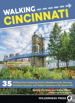
Tulips bloom near the Purple People Bridge along the Cincinnati riverfront.
BOUNDARIES: Smale Riverfront Park, Theodore M. Berry International Friendship Park, Third St. in Newport, Fourth St. in Covington, Greenup St. in Covington
DISTANCE: 4.2 miles
DIFFICULTY: Easy
PARKING: Metered parking on streets; or inside Central Riverfront Garage, 99 E. Second St., underneath Moerlein Lager House
PUBLIC TRANSIT: Metro (go-metro.com) and TANK (tankbus.org) buses serve downtown Cincinnati and Northern Kentucky, respectively. Southbank Shuttle Trolley (tankbus.org/routes/ss) connects the riverfront cities of Newport, Covington, and downtown Cincinnati, with signs marking each stop. Cincinnati Bell Connector streetcar (cincinnatibellconnector.com) connects the Cincinnati riverfront, downtown Cincinnati, and Over-the-Rhine with 18 stations. Cincinnati Red Bike (cincyredbike.org) has bicycle rental stations at 122 E. Second St. (Great American Ball Park), 97 E. Freedom Way (Freedom Center), 5 W. Merhring Way (Smale Riverfront Park), and elsewhere.
Cincinnati Riverfront Park is the place where locals and visitors alike go for recreation and relaxation, mostly during warmer months, although hardy outdoorsy city lovers visit year-round. The action happens in four separate and connecting parks along the Ohio River, with Theodore M. Berry International Friendship Park to the east, Sawyer Point Park and Yeatman’s Cove in the middle, and John G. and Phyllis W. Smale Riverfront Park tucked between Paul Brown Stadium and Great American Ball Park.
The activities along here run the gamut, from sitting on a swing overlooking the river and having a picnic under a grove of trees, to walking through interactive fountains and a meditative labyrinth, or simply biking along the Ohio River Trail. Just north of the river and between both sports stadia are National Underground Railroad Freedom Center and The Banks, a mixed-use development designed to complement the massive public improvements along the riverfront. The initial phase, which opened in summer 2011, included Current at The Banks apartments atop 96,000 square feet of street-level retail, which includes mostly bars and restaurants.
Walk Description
Start your walk at the top of the Walnut Street Steps at Theodore M. Berry Way, which serves as the entrance to Smale Riverfront Park. Opened in 2012, Smale Riverfront Park was designed to be the new front yard for the region. The park is situated on 45 acres along the riverfront. It flanks the city’s beloved John A. Roebling Suspension Bridge, which allows pedestrians to get between the sports venues in Cincinnati and attractions in Northern Kentucky. When the first pedestrians crossed on January 1, 1867, its 1,057-foot span made it the longest suspension bridge in the world, a record it retained until 1883 when Roebling’s most famous project—the Brooklyn Bridge—opened. It’s designated a National Historic Civil Engineering Landmark.
Next to the steps is Schmidlapp Event Lawn & Stage, a venue for concerts, small community festivals, and picnicking. Proceed down the steps past the interactive fountains and bike runnel, which helps facilitate walking a bicycle up and down the stairway. Once at the bottom of the steps, cross the Ohio River Scenic Byway to enter the park.
Walk through the Women’s Committee Garden, which honors women who made the park possible. Turn left at the first walking path and pass through the meditative labyrinth on your left. Opposite the labyrinth and down the sloping lawn is Race Street Promenade, which follows the Ohio River. Walk past the Black Brigade Monument, the first piece of public art to be commissioned in Smale Riverfront Park and a monument to Cincinnati’s little-known Black Brigade, an African American military unit that served during the Civil War.
Keep walking toward Main Street Fountain on the left. Across the Ohio River Scenic Byway at Joe Nuxhall Way is the Moerlein Lager House. This popular microbrewery and restaurant houses the Beer Barons Hall of Fame. Continue walking east past the swings—after you sit down and swing back and forth a little—and eventually back to the Ohio River Scenic Byway. Across the street is the Great American Ball Park, home field of the Cincinnati Reds, established in 1881. The Cincinnati Reds Hall of Fame and Museum is located on the west side of the ballpark, which has panoramic views of downtown, Mount Adams, the Ohio River, and Northern Kentucky.
Turn right on the Ohio River Scenic Byway and walk east past the U.S. Bank Arena on the left. Just past the Taylor-Southgate Bridge overhead is Yeatman’s Cove. Opened in 1976 and the first big effort to reconnect downtown with the city’s riverfront, the park features Serpentine Wall, a contoured concrete wall of steps used for special events and lounging. Along the northern edge of the park and in the shadow of One Lytle Place Apartments is Lytle Place Fountain, a respite on a hot summer day.
Continue eastward through the brick archways underneath the Purple People Bridge. Greeting you on the other side is a 12-foot statue of Cincinnatus, the Roman soldier and farmer after whom Cincinnati is named. Sawyer Point Park opened in June 1988, in celebration of Cincinnati’s 200th birthday. Initially designed to educate natives and visitors with a riverwalk filled with late-1980s environmental sculpture, Sawyer Point has evolved into a lush park with maturing trees and gardens, concessions, tennis and volleyball courts, and a playground.
The National Steamboat Monument sits across from the Great American Ball Park.
Veer left along the north edge of the central lawn past P&G Pavilion, host to concerts and other events during warmer months. North of the pavilion is the main entrance to Bicentennial Commons, which includes a whimsical flying pig sculpture and a model of the Ohio River and accompanying locks. Gateway Sculpture honors the Ohio River with a spectacular environmental installation by Andrew Leicester. This 250-foot-long by 50-foot-wide sculpture depicts Cincinnati’s history in 18 sections and offers a child’s-eye view of the city.
Backstory: CROWN
This section of the Ohio River Trail bears significance on a local, regional, and national scale. A plan has emerged in recent years to link this riverfront haven for pedestrians and bicyclists to several other multiuse trail corridors in development in Cincinnati. CROWN (Cincinnati Riding Or Walking Network) is a vision for a 104-mile active transportation network connected by a 30-mile trail loop traversing many Cincinnati neighborhoods. Led by local advocacy organization Tri-State Trails, CROWN plans to connect the Ohio River Trail, Mill Creek Greenway Trail, Wasson Way, Lunken Airport Trail, and Little Miami Scenic Trail to other local trails and on-road bicycling infrastructure. CROWN will improve bike and pedestrian connectivity between residential neighborhoods and destinations like employment centers, schools, parks, retail establishments, recreation areas, and entertainment hubs. Benefits include expanding active transportation options, encouraging economic development, improving public health, increasing transportation equity, and promoting environmental sustainability. Information: tristatetrails.org.
Continue east under the Daniel Carter Beard Bridge, past the fitness area, playground, volleyball courts, tennis complex, and all-weather skating rink. To the right are limestone foundation ruins of the old Front Street Pumping Station, which supplied the Mount Adams reservoirs and is used today as a performance venue. Running parallel to this path is a walkway with jutting overlooks offering relaxing views of the river and Northern Kentucky’s hillsides. Continue walking east past The Boathouse, which houses veteran barbecue chain Montgomery Inn–The Boathouse and gives diners impressive views. Look east from the railroad tracks in front of Montgomery Inn–Boathouse to see where the Oasis Trail will connect Lunken Airport to Sawyer Point.
Past the long parking lot is the Theodore M. Berry International Friendship Park, featuring an impressive display of sculpture and flora representing five continents. It has two intertwining walkways guiding park visitors through gardens of the continents in a celebration of international peace and friendship. Named for Cincinnati’s first African American mayor, the park draws inspiration in part from a child’s friendship bracelet. One of Cincinnati Parks’ premier rental facilities is the pavilion toward the middle of the park. You can choose to walk the winding path past the pavilion to the end of the park for a longer walk, or turn around at any point to return to the Purple People Bridge, just beyond the statue of Cincinnatus.
Climb the stairs of the Purple People Bridge (purplepeoplebridge.com) and begin your interstate walk into Newport, Kentucky. Formerly the L&N Railroad Bridge, this is the only bridge in the region that is designated exclusively for pedestrians. Rails-to-Trails Conservancy named the Purple People Bridge one of the nation’s top five pedestrian bridges in 2015. Follow the bridge to Third Street and turn right to walk in front of Newport on the Levee. The Levee is a hub of activity, with people seeking out bars and restaurants and first-run films at AMC Newport on The Levee 20.
Continue west along Third Street, past Newport on the Levee, and cross York Street before turning right on Columbia Street. Climb the steps to the top of the levee. Completed for the city’s 1995 bicentennial, Newport’s Riverwalk is a pleasant stroll through the town’s 200-year history, with views of the Ohio River and Cincinnati skyline. Newport’s history is depicted on seven weather vanes individually mounted on 30-foot poles. At the end of the levee sidewalk, you’ll come to the Fourth Street Bridge, officially known as Veterans’ Memorial Bridge. Turn right and cross the Licking River into Covington. Continue until you reach Greenup Street.
Turn right on Greenup Street and enter the tiny Roebling Point business district, home to multiple restaurants and bars and an independent bookstore. On the left across the large parking lot along Fourth Street is Molly Malone’s Irish Pub & Restaurant, a three-story eatery with a good beer selection. Continue north on Greenup Street past Park Place for more dining options. Blinkers Tavern specializes in steak and seafood, while Keystone Bar & Grill is known for its macaroni and cheese menu. At the corner of Third and Greenup Streets is Roebling Point Books & Coffee, a compact coffee shop and bookstore that is also home to Wilderness Press’s Ohio office. Continue north on Greenup Street past E. Third Street. On the left at E. Second Street is The Gruff, a spacious outpost serving Neapolitan-style pizza, sandwiches, and craft brews steps from the Roebling Suspension Bridge. Cross E. Second Street and follow the elevated sidewalk around the small brick building to the bridge expanse. Cross the Roebling and return to the start.
Points of Interest
National Underground Railroad Freedom Center 50 E. Freedom Way, 513-333-7739, freedomcenter.org
The Banks Freedom Way, thebankscincy.com
Moerlein Lager House 115 Joe Nuxhall Way, 513-421-2337, moerleinlagerhouse.com
Great American Ball Park 100 Joe Nuxhall Way, 513-765-7000, cincinnati.reds.mlb.com/cin/ballpark
Montgomery Inn–The Boathouse 925 Riverside Dr., 513-721-7427, montgomeryinn.com
Newport on the Levee 1 Levee Way, Newport, 859-291-0550, newportonthelevee.com
AMC Newport on The Levee 20 1 Levee Way, Newport, 859-291-0550, amctheatres.com
Molly Malone’s Irish Pub & Restaurant 112 E. Fourth St., Covington, 859-491-6659, covington.mollymalonesirishpub.com
Blinkers Tavern 318 Greenup St., Covington, 859-360-0840, blinkerstavern.com
Keystone Bar & Grill 313 Greenup St., Covington, 859-261-6777, keystonebar.com
Roebling Point Books & Coffee 306 Greenup St., Covington, 859-815-7204, roeblingpointbooks.com
The Gruff 129 E. Second St., Covington, 859-581-0040, atthegruff.com