Читать книгу East Bay Trails - David Weintraub - Страница 28
На сайте Литреса книга снята с продажи.
Оглавление◆ East Bay Skyline National Recreation Trail ◆
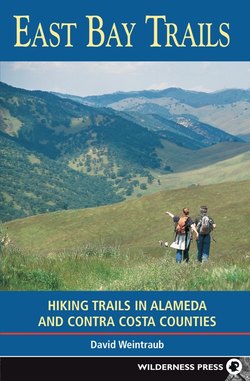
The East Bay Skyline National Recreation Trail was the nation’s first nonfederal national recreation trail, a designation granted by the U.S. Department of the Interior to publicly owned or controlled routes that are close to an urban or metropolitan area; have scenic value; are wide enough to provide for hiking, horseback riding, nature study, and, in some cases, bicycling; and do not allow motor vehicles. The Skyline Trail certainly fulfills all of these requirements and more: it is one of the gems of our East Bay parklands.
When the Skyline Trail opened in 1970, it ran through only Anthony Chabot and Redwood regional parks. Today the 31-mile route stretches from the Wildcat staging area in Wildcat Canyon Regional Park to Proctor Gate in Anthony Chabot Regional Park, meaning it is possible to walk or ride a horse on an unbroken path from Richmond to Castro Valley. (Bicycles are not permitted on a 6.3-mile section from Lomas Cantadas in Tilden Regional Park to Skyline Gate in Redwood Regional Park.) The Skyline Trail passes through six EBRPD regional parks and preserves: Wildcat Canyon, Tilden, Redwood, Anthony Chabot, Sibley Volcanic, and Huckleberry Botanic. The route also briefly crosses EBMUD land between Tilden Regional Park and Sibley Volcanic Regional Preserve.
While it is possible to hike or jog the entire trail in one day, most people do it in stages. In this book, the trail is divided into four segments, each of which is easily completed in a day, with a not-too-difficult car shuttle. Be sure to take plenty of water and snacks; there is only limited water along the way. Food, drinks, and cold beer are available at the Willow Park Golf Course, near Proctor Gate, the trail’s southern end. There is currently only one overnight camp for individuals and groups, at Anthony Chabot Campground near the southern end of the route. For campground information call (510) 636-1684.
WILDCAT CANYON TO LOMAS CANTADAS
Length: 10.2 miles
Time: 4 to 6 hours
Rating: Difficult
Regulations: EBRPD
Facilities: Water and picnic tables are available in the Alvarado Area picnic grounds, northwest of the parking area in Wildcat Canyon, and at Lomas Cantadas near Tilden Regional Park’s Steam Trains parking area. Toilets are available at the Wildcat staging area, Inspiration Point, and Lomas Cantadas.
Directions: This is a car shuttle trip, starting at the Wildcat Canyon staging area in Wildcat Canyon Regional Park, and ending at Lomas Cantadas, near the Steam Trains in Tilden Regional Park. Drive first to Lomas Cantadas, leave a car there, and proceed to the Wildcat Canyon staging area.
To reach Lomas Cantadas: From Highway 24 just east of the Caldecott Tunnel, take the Fish Ranch Road exit and go uphill 1 mile to a four-way intersection with Claremont Ave. and Grizzly Peak Blvd. Turn right on Grizzly Peak Blvd. and go 1.1 miles to Lomas Cantadas Dr. Turn right and then immediately left onto a road signed for Tilden Regional Park’s Steam Trains, Fire Station, and Corporation Yard. Pass the entrance to the Steam Trains, left, and at a fork bear right and slightly uphill to a large gravel parking area.
To reach the Wildcat Canyon staging area: From Lomas Cantadas, return to Highway 24 and follow it west to Interstate 580 westbound, then get on Interstate 80 eastbound. From Interstate 80 in Richmond, take the Solano Ave. exit, which puts you on Amador St. Turn left and go 0.4 mile to McBryde Ave. Turn right and follow McBryde Ave. 0.2 mile, staying in the left lane as you approach a stop sign. (Use caution at this intersection; traffic from the right does not stop.) Continue straight, now on Park Ave., for 0.1 mile to the parking area, left. The trailhead is at the east end of the parking area.
This northernmost segment of the 31-mile East Bay Skyline National Recreation Trail uses the Wildcat Creek, Belgum, San Pablo Ridge, Curran, Sea View, Lupine, and Vollmer Peak trails, along with Nimitz Way, to traverse Wildcat Canyon and Tilden regional parks. Although there is steep climbing at the outset, much of the point-to-point route is along the top of San Pablo Ridge, a generally level course, and views are among the best in the East Bay.
From the east end of the parking area, head uphill past stands of coast live oak, eucalyptus, acacia, and Monterey pine on paved Wildcat Creek Trail, a remnant of Wildcat Canyon Road, which was closed in the early 1980s by landslides. After about 0.3 mile the pavement ends, and you continue on a rocky and eroded dirt road, past an unsigned path, left. Willows signal the presence of Wildcat Creek, downhill and right, which gets its start high on Vollmer Peak and empties into San Pablo Bay north of the Richmond–San Rafael Bridge.
Nimitz Way offers a paved route between Wildcat Canyon and Tilden regional parks.
At about the 0.5-mile point, you come to a junction with the Belgum Trail, here a paved road, where you turn left and begin to climb. There is a trail post at the junction with an emblem for the East Bay Skyline National Recreation Trail. As you walk uphill, you pass an area, left, that has been invaded by cardoon, an artichoke relative in the thistle family. A program by EBRPD to control this nonnative pest is underway. Passing through a gate, you stay on pavement for about 100 feet and then the Belgum Trail continues as a dirt road. There is a large eucalyptus grove ahead, and if you turn and look west, you have a beautiful view of Mt. Tamalpais.
The route alternates between wooded and open areas, and at one point passes several large palm trees, the site of Belgum’s Grand Vista Sanitarium, which has since burned down. As you gain elevation on a moderate grade, the view gets even better, taking in Angel Island and the Golden Gate Bridge. Open areas here, mostly grassland, will be decorated in spring with blue bush lupine and California poppy. Beyond another large stand of eucalyptus, the route stays in the open, passing occasional groves of California bay. With every step, more of the Bay Area is revealed, including the San Francisco skyline, which on a clear day appears etched on a background of hills and blue sky.
After reaching a shoulder, the route passes a rest bench, bends left and continues its climb, aiming for the high ground of San Pablo Ridge, just east across an open valley. As the route levels and then drops slightly, the vista extends north across San Pablo Bay to the hills of Napa and Sonoma counties and Mt. St. Helena. At the next flat spot, several junctions sprout trails in different directions. The first junction is a fork; here an unsigned road heads straight but you veer left, reaching a trail post in about 50 feet. At the post, the Clark–Boas Trail heads left and downhill, a faint trail climbs right, and your route, the Belgum Trail to San Pablo Ridge Trail, continues straight. A field of California buttercup brightens the scene here, and nearby is an active California ground squirrel colony. You may see an American kestrel hovering overhead, on the lookout for small reptiles and rodents.
Soon you reach the next junction, a fork marked by a trail post, where you veer right and steeply uphill on the San Pablo Ridge Trail, a rough dirt road. As you crest San Pablo Ridge, you have your first view today of Mt. Diablo, dead ahead. The route now climbs over several high summits, each one affording 360-degree views of almost the entire Bay Area; this park provides some of the best vantage points in the East Bay hills. As you head southeast along the ridgetop, the side of San Pablo Ridge drops steeply left to the narrow valley filled by San Pablo Reservoir. Ahead in the distance lies Tilden Regional Park, crowned by Vollmer Peak (1913’), a forested summit with communication towers; a parking area just south of the peak is your goal for today.
Descending in open terrain, the San Pablo Ridge Trail ends at a junction, at about the 2.8-mile point, with the Mezue Trail, which goes left and right. You turn right and walk past a large cattle pen. Whatever trees and shrubs grow here, mostly bay and coyote brush, are kept low and flat-topped by the wind, which usually blows from the west. About 100 yards beyond the previous junction, you pass a dirt road, left. Some 50 feet farther, you pass Old Nimitz Way, another dirt road merging from the left. Now on Nimitz Way, you continue southeast on a mostly level course, go through a cattle gate, and soon reach a T-junction at the base of a hill used during the Cold War as a Nike missile site.
Here a gravel road heads left to the concrete base of the Nike site, and your route, Nimitz Way, now a paved road, goes right. As you curve around the hill, Oakland’s skyline appears, and you begin to get views toward the south end of San Francisco Bay. In spring, poppies, red maids, and other wildflowers color the grassy hills beside Nimitz Way. A short distance beyond the Nike site you pass a junction, right, with the Havey Canyon Trail. Soon a rest bench beckons, and you can enjoy a glorious view of Mt. Diablo and, to its right, Las Trampas and Rocky ridges, the high walls that form Bollinger Canyon. A bit farther, the Eagle’s Nest Trail, a segment of the Bay Area Ridge Trail, joins from the left. From here to near the south end of Anthony Chabot Regional Park, the Bay Area Ridge and East Bay Skyline National Recreation trails follow the same route.
Continuing on Nimitz Way, a poplar route for hikers, bicyclists, in-line skaters, equestrians, and joggers, you next pass the Conlon Trail, which goes straight and uphill to the edge of Tilden Regional Park, then switches back and descends to the Wildcat Creek Trail. Stay left to continue on Nimitz Way. At about the 5-mile point, you cross into Tilden Regional Park and enter the shade of a large eucalyptus grove. Soon a connector to the Peak Trail, signed WILDCAT PEAK TRAIL, joins Nimitz Way from the right, and if you look up the trail you can see a planted stand of cone-shaped trees, giant sequoias, called the Rotary Peace Grove. (These trees achieve their giant status only on the western slope of the Sierra Nevada, their natural habitat.)
Now you are walking in filtered sunlight and shade, thanks to the eucalyptus and bay trees that line the route. Beside the road you may find snowberry, blackberry, vine honeysuckle, and much poison oak. At the next junction, Laurel Canyon Road leads right and downhill through the Tilden Nature Area. As you continue on Nimitz Way, you pass several large stands of mostly Monterey pine, right, and a seasonal wetland bordered with willows, left. Another collection of giant sequoias, right, called the Redwood Grove, was planted by the Berkeley Hiking Club.
The route soon swings left and follows a set of power lines, and now, rounding a bend, you can see Inspiration Point and its parking area ahead. Rest benches on this part of Nimitz Way are strategically placed to take advantage of the best views, especially of Mt. Diablo and Mt. Tamalpais. Just before reaching Inspiration Point, a little past the 7-mile point, Nimitz Way bends left and comes to a gate. Before the gate, just past some toilets, look for a trail post, right, with the Bay Area Ridge Trail and East Bay Skyline National Recreation Trail emblems. Here you turn right, descend a dirt-and-gravel path, and in about 30 feet turn right again on the Curran Trail, a dirt road.
Continuing to descend over rough ground, you enter an area shaded by bay, coast live oak, and pine. A few hundred yards down the road you pass the Meadows Canyon Trail, right, and in about 50 feet come to a junction with a single-track trail going left and uphill. Climbing up it on a moderate grade across a brushy hillside, you soon reach Wildcat Canyon Road, a paved thoroughfare that runs through the heart of Tilden Regional Park. Cross the road carefully and find the Sea View Trail, a dirt road, taking off left and uphill. This rocky road makes a sweeping S-bend to gain altitude on a moderate grade. Eucalyptus trees, which here shade the route, look and smell lovely, but besides being a fire hazard they can fall during wind storms.
As the route bends left you pass a trail, right, to the Quarry picnic area, then continue on a moderate uphill grade, with views extending from Mt. St. Helena to the San Francisco skyline. If you look carefully, you can even pick out your earlier route along San Pablo Ridge in Wildcat Canyon Regional Park. Soon you pass the Big Springs Trail, right; afterwards the uphill grade eases somewhat as you enter a stand of Monterey and Coulter pines. The view now extends west past the Golden Gate Bridge to the Pacific Ocean, and east to Briones Reservoir and the hills of Briones Regional Park. On this stretch you will pass several paths that head left to viewpoints, but your route continues straight and soon begins to climb steeply over rocky, eroded ground.
Reaching a high point, you are rewarded by a 360-degree panorama and a conveniently placed picnic table. In spring, large sunflower-like blossoms of mule’s ear appear, giving a festive appearance to the grassy slopes, which are also decorated with lupine and fiddleneck, sporting yellow-orange flowers along a coiled stem. Now the route descends, in preparation for the final push up Vollmer Peak. Reaching a flat spot at about the 9-mile point, you pass the Big Springs Trail, heading right and downhill. Beginning to climb again on a moderate grade, you pass a west-facing hillside covered with clumps of California sagebrush and black sage, chaparral plants that seem out of place in the fog belt. The road now makes a series of S-bends to gain elevation, and soon reaches a junction marked by a trail post.
Here the Lupine Trail, a single track, goes right, bending away from Vollmer Peak, and the Sea View Trail continues over the peak, then descends to the Lomas Cantadas parking area. (Bicyclists must use the Sea View Trail.) Turning right, you pass in about 20 feet a junction with the Arroyo Trail, right, but you continue straight on the Lupine Trail. After several hundred feet, you pass an unsigned trail, right, and then climb through a brushy area to a clearing and a T-junction marked with a trail post. Here the Lupine Trail turns right, but you turn left onto an unsigned trail and continue to climb, now on a rocky path. In about 150 feet you meet the Vollmer Peak Trail, which goes straight (uphill) and also right. You veer right and contour around the west side of the peak. Crossing a steep hillside brightened by buttercups, lupine, mule’s ear, and poppies, you soon reach a junction. Here the Vollmer Peak Trail turns right, but you angle left and enter a dense bay forest. After about 200 feet you emerge at the Lomas Cantadas parking area.
LOMAS CANTADAS TO SKYLINE GATE
Length: 6.3 miles
Time: 3 to 4 hours
Rating: Moderate
Regulations: EBMUD, EBRPD; no bicycles, no dogs; horses in Huckleberry Regional Preserve are allowed only on the East Bay Skyline National Recreation Trail.
Facilities: Water and toilets are available at Lomas Cantadas in the Steam Trains parking area; at Sibley Volcanic Regional Preserve visitor center (about half way); and at Skyline Gate. There are picnic tables across the road from the Steam Trains entrance. A phone is available at Skyline Gate.
Directions: This is a car shuttle trip, starting at Lomas Cantadas, near the Steam Trains in Tilden Regional Park, and ending at Skyline Gate in Redwood Regional Park. Drive first to Skyline Gate, leave a car there, and proceed to Lomas Cantadas.
To reach Skyline Gate: From Highway 24 just east of the Caldecott Tunnel, take the Fish Ranch Road exit and go uphill 1.0 mile to a four-way intersection with Claremont Ave. and Grizzly Peak Blvd. Turn left on Grizzly Peak Blvd. and go 2.5 miles to Skyline Blvd. Turn left and follow Skyline Blvd. for 2 miles, staying left at an intersection with Snake Road, to Skyline Gate, on the left, 0.1 mile beyond Shepherd Canyon Road.
To reach Lomas Cantadas: From Skyline Gate, return on Skyline Blvd. 2 miles to Grizzly Peak Blvd., which is just beyond the entrance to Sibley Volcanic Regional Park. Turn right onto Grizzly Peak Blvd. and go 3.6 miles, passing the four-way intersection with Claremont Ave. and Fish Ranch Road, to Lomas Cantadas Dr. Turn right and then immediately left onto a road signed for Tilden Regional Park’s Steam Trains, Fire Station, and Corporation Yard. Pass the entrance to the Steam Trains, left, and at a fork bear right and slightly uphill to a large gravel parking area. The trailhead is at the southeast end of the Lomas Cantadas parking area.
From Highway 24 just east of the Caldecott Tunnel, take the Fish Ranch Road exit and go uphill 1 mile to a four-way intersection with Claremont Ave. Grizzly Peak Blvd. Turn right on Grizzly Peak Blvd. and go 1.1 miles to Lomas Cantadas Dr. Turn right and then immediately left onto a road signed for Tilden Regional Park’s Steam Trains, Fire Station, and Corporation Yard. Pass the entrance to the Steam Trains, left, and at a fork bear right and slightly uphill to a large gravel parking area. The trailhead is at the southeast end of the Lomas Cantadas parking area.
This segment of the East Bay Skyline National Recreation Trail, here also part of the Bay Area Ridge Trail, heads southeast from the edge of Tilden Regional Park, crosses EBMUD land and the Caldecott Tunnel, and then traverses Sibley Volcanic and Huckleberry Botanic regional preserves on its way to the northwest corner of Redwood Regional Park. A point-to-point trip of many ups and downs, and terrains ranging from open grasslands to deep wooded canyons, its rewards include dramatic views of Mt. Diablo and a wonderful assortment of trees, shrubs, and wildflowers. (Much of this trail follows the ridgeline, where tall trees collect water from the fog and drop it onto the paths below, making for possibly muddy trails even in summer.)
From the southeast end of the parking area, walk along the entrance road—passing a paved road that climbs Vollmer Peak, left, and a road to the Steam Trains, right—until you reach a crosswalk at Lomas Cantadas Dr. Cross carefully and look left for a trail post with emblems for the East Bay Skyline National Recreation Trail and the Bay Area Ridge Trail. Here you get on a single-track trail and follow it downhill, passing through several gates into a weedy area overgrown with coyote brush, cow parsnip, vine honeysuckle, and poison oak. You are now on EBMUD lands, and the view, when you reach a clearing, extends east toward Orinda and Mt. Diablo. The trail is rough and eroded in places, lined with California sagebrush, bush monkeyflower, toyon, and thimbleberry, and shaded by California bay and California buckeye.
The route levels, then climbs, and soon reaches a T-junction with the deLaveaga Trail, a dirt road. Here you turn right, climb a short steep section, and then enjoy a level walk with a beautiful view, left, of Mt. Diablo. (Another beautiful, if startling, sight when I hiked here was a large male peacock, perhaps someone’s pet.)
The road bends sharply left, descends slightly, then levels and comes to a four-way junction, poorly signed, with a dirt fire road, closed to the public. Here you proceed straight, finding a single-track trail that leads through a brushy area decorated with Chinesehouses, mule’s ear, and woodland star.
The trail crosses a steep hillside, reinforced to help prevent landslides, that drops left, and then alternates between open and wooded areas, where blackberry, coffeeberry, and hillside gooseberry grow in the shade of bay and coast live oak. Passing the Berkeley Hills Reservoir, a large EBMUD water tank, you soon you reach an open grassy area where the trail turns sharply west toward the Golden Gate Bridge. Below you is Fish Ranch Road, which you will soon cross. Entering a stand of eucalyptus, you pass a faint trail heading right and uphill, but here your route bends sharply left and goes downhill over rough ground. Then, at about the 1.5-mile point, you reach two gates and a paved path leading, in approximately 200 feet, to Fish Ranch Road.
Huckleberry Botanic Regional Preserve is within easy access of Berkeley and Oakland.
Fish Ranch Road is a busy, high-speed thoroughfare, so take care when crossing. Once on the other side, you will see signs for the East Bay Skyline and Bay Area Ridge trails. Now on a wide dirt trail, you wind on mostly level ground through a wooded area of coast live oak, bay, and blue elderberry. Soon the route begins a moderate descent, then rises slightly to a four-way junction with an overgrown dirt road. The Caldecott Tunnel, built in 1937, runs through the Berkeley Hills near this spot. Here you continue straight, descending past bigleaf maple, hazelnut, and madrone, on a trail lined with French broom, coyote brush, and poison oak. Several tight S-bends take you downhill quickly, but then a short climb wins back some of the lost elevation.
Where Old Tunnel Road merges from the right, you join it briefly, then continue straight as the road makes a sharp left-hand bend. You are now on a dirt road, heading southeast and climbing on a gentle grade. Willows beside the road indicate water is near; in fact it may be flowing across your path. Soon the road narrows, crosses several eroded gullies that may have water in them, and then begins a gradual climb beside a creek nestled in a shallow ravine, right. This is a beautiful area, deep in a shady forest. A wooden bridge takes you across the creek, and now the route climbs on a moderate grade below a high ridge, right, topped with eucalyptus.
After a long, steady climb, you arrive at the Sibley Volcanic Regional Preserve visitor center, just a few paces north of a small parking area off Skyline Blvd. Here are water, toilets, and an interpretive display with information about the preserve’s geology, plants, and animals. You have come about 3.4 miles, and have approximately 2.9 miles more to reach Skyline Gate at Redwood Regional Park. When you are ready to continue, follow a paved road around the west side of the visitor center. Just before reaching a gate, angle right and uphill on a single-track trail, signed for the East Bay Skyline/Bay Area Ridge Trail and the Round Top Loop Trail.