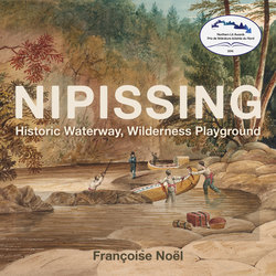
Читать книгу Nipissing - Françoise Noël - Страница 5
На сайте Литреса книга снята с продажи.
Chapter 1
ОглавлениеA Historic Waterway
It was not scenery, however pleasant, that first drew visitors of European origin to the Nipissing area. Like the aboriginals who had used the Nipissing Passageway for thousands of years to travel by canoe from the St. Lawrence River to the Great Lakes, the first Europeans to travel through were on their way elsewhere. Etienne Brulé would be the first, but Samuel de Champlain, who made his voyage in 1615, was the first to leave a written record of his trip. With the eyes of a colonizer, Champlain saw only a barren land: “This whole region is even more unprepossessing than the former;” he wrote, “for I did not see in the whole length of it ten acres of arable land, but only rocks and a country somewhat hilly.”[1] For the next two centuries, missionaries, fur traders, and explorers alike continued to travel this route, many of them leaving a written record of their travels. The illiterate French Canadian voyageurs that paddled their canoes left behind an oral tradition that was often recorded by their bourgeois masters, as well as a legacy by way of the colourful names of portages found along their route. Some names refer to the physical characteristics of the portage: Les Epingles, La Dalle, and the Grande and Petite Faucille; others refer to incidents in the travels of the voyageurs themselves. One story goes that when a party of voyageurs lost one of their canoes they had to send two of their party back to get another; when they returned they found their companions still camped in the same spot, not yet having carried their loads across the portage. This portage is known as Portage des Paresseux, or “Lazy Portage,” to this day.[2]
The first visual record of the Nipissing Passageway sketched “on the spot” was by John Elliott Woolford, a talented artist who accompanied Lord Dalhousie on his journey through the area in 1821. The newly appointed governor general of the Canadas wanted to see for himself the territory over which he ruled. Woolford made sketches whenever they stopped, often at Lord Dalhousie’s specific request. Later, Woolford and Charles Ramus Forrest, also associated with Lord Dalhousie, used these sketches to create finished watercolour images. As a military and topographical artist, Woolford was interested in showing how things were done, particularly at the portages. Occasionally, however, he simply captured the picturesque nature of the landscape.[3]
The fur traders abandoned this route in favour of Hudson Bay after 1825. Lumbermen and surveyors were the next to take an interest in the area. As early as 1837, the possibility of linking the St. Lawrence to the Great Lakes by canalizing the Nipissing Passageway route was raised, but before this or any other form of exploitation could take place, scientific knowledge of the territory was sought. In 1845, William Logan of the Geological Survey of Canada spent seven miserable weeks (it rained almost every day) in the field surveying the upper Ottawa River to the head of “Lake Temiscamang” and the Mattawa River from the Ottawa River to Lake Nipissing. His detailed description of the river included the measured height of each of the falls and an estimate of the total rise to Lake Nipissing. The old canoe route on the Mattawa, Logan noted, was a river that ran between Lake Talon and Turtle Lake (Lower Trout Lake), whereas the new canoe route passed through Pine Lake and its two portages.[4] As late as the early twentieth century, Logan’s maps were still recommended as the best available for someone undertaking a canoe trip in the area without a guide.
This image of the La Dalle portage on the French River demonstrates how the canoes were towed from the shore with a line. It clearly shows the river flowing through a fault line with sharp cliffs on one side and slightly less so on the other. This watercolour by John Elliott Woolford was prepared based on sketches he made while making the journey through the Nipissing Passageway with Lord Dalhousie in 1821.
Courtesy of the Toronto Public Library, TPL 902-1-5.
Unlike many of the other watercolours produced from this trip, Woolford’s image of the source of the Mattawa River has a picturesque quality to it and in this image, the landscape is empty, much like those of the landscape artists of the early twentieth century. The Mattawa was often referred to as the Petite Rivière, or “Little River,” to distinguish it from the Ottawa, which was the Grande Rivière.
Courtesy of the Toronto Public Library, TPL 902-1-6.
The beauty of the landscape near Mattawa, where tall hills rise up over the wooded shoreline of the Ottawa and the Mattawa Rivers, has been recorded in countless travel accounts. Here, John Elliott Woolford captures the beauty of the river at sunset, with the hillsides muted, almost like clouds, and a small island in the foreground.
John Elliott Woolford, Petite Riviere Joins Ottawa near Lake Nippissing, 1821. Watercolour over graphite on wove paper, mounted on cardboard, 14.3x 23.7cm. Purchased 1979 with the assistance of a grant from the Government of Canada under the terms of the Cultural Property Export and Import Act. National Gallery of Canada, Ottawa. Photo © National Gallery of Canada.
Even before Logan’s report was published, his data had been passed along to Joseph Bouchette, who was working on a new map of the Canadas. The ink on Bouchette’s map was hardly dry before it was used to make the case for roads that would reduce the cost of bringing pork to the timber areas of the Ottawa River watershed. At the time, supplies were transported from the western United States, down the Great Lakes to Kingston, then up the Ottawa River. Bouchette’s map showed that roads through the Ottawa-Huron tract would link the timber production areas of the Ottawa Valley with the back of the settlements on Lake Ontario that could supply produce. The red pine areas of the Upper Ottawa and the hardwood area that extended to the Amable du Fond River would be well served by a main road extending from Pembroke to the mouth of the French River.[5]
In this detail from Logan’s map to accompany his 1845 survey, both the route he followed through Lake Talon and the old canoe route through a river to the northwest of the lake can be seen.
Courtesy of Library and Archives Canada, H1/410/Mattawa/1846 (2 sections), NMC n0014270k_a1.
Despite all this activity, this land was still Anishinaabe territory. As the timber industry moved up the Ottawa Valley and agricultural land in southern Ontario (Canada West) filled, the colonial government decided to clear the way for settlement and resource development by signing a treaty with the First Nations people of this area. The Robinson-Huron Treaty of 1850 opened the way for such development, although the aboriginal population was, according to this treaty, free to continue to hunt and fish on crown land so long as it remained crown land.[6] Three reserves were created in the Lake Nipissing area by the Robinson-Huron Treaty and surveyed in 1853, although it is possible that the survey information for No. 9 and No. 13 was not in general use until after 1889.[7] The location of Reserve No. 10, set aside for Shabokeshick and his band, however, appeared on Colton’s map of 1869.
This detail from Bouchette’s 1846 map shows the Nipissing Passageway from Mattawa to Lake Nipissing. Details from the Logan survey, which were incorporated into this map, include elevations above sea level and the drop at each fall. On this map he still uses the name “Grand River” for the Ottawa, but the Mattawa is given as the “Mattawan.” Talon Falls are also indicated as “Hang Falls,” but there are no other translations. Unlike Logan, he does not refer to Upper and Lower Trout Lake, but to “L. la Tortue” and “L. Talon,” which creates confusion with the other Lake Talon. He also refers to the Mattawan Falls rather than the Paresseux Falls at that portage.
Courtesy of David Rumsey Map Collection, www.davidrumsey.com .
This detail from Colton’s 1869 map of the Province of Ontario shows the progress of land surveys in the Ottawa-Huron tract. Closer to Lake Nipissing, only a few townships had been surveyed, and in the area south of Lake Nipissing there were still significant gaps in the topographical delineation of the rivers. The whole Pickerel River network still had not been added, although Lake Restoule was shown. Indian Reserve No. 10 was shown on this map, but not the other reserves in the area. A prime meridian has been surveyed to the north of Georgian Bay, providing a starting point for the surveys to the west of this. The survey of the Wanapitei River are incorporated and the outlines of the West Bay and West Arm of Lake Nipissing are better delineated than they had been by Bouchette in 1846.
Courtesy of David Rumsey Map Collection, www.davidrumsey.com.
Surveyors were sent into the field to evaluate the resources of the area. Provincial Surveyor Salter and Murray of the Geological Survey of Canada both conducted surveys in the area west and north of Lake Nipissing in the 1850s.[8] Both noted the “rocky and barren” nature of the land in much of this area. Only to the north of the French River did Salter find some “very fine land” — an area suitable for agriculture sufficient enough for sixty townships. At the time of these surveys, the aboriginal inhabitants collected the cranberries that grew in the great marshes along the banks of Lake Nipissing and along the Sturgeon River and shipped them out by the barrel from Lake Huron. The greatest difficulty faced by the harvesters was the small amount that could be taken down the French in one load by canoe. White fish was an important resource to them as well. They also constructed birch bark canoes and collected limestone for mortar and building on the Manitou islands and made maple sugar there and on Iron Island. They had several “habitations” on the lake, including one at Dokis Point. Murray noted specifically that their “little huts are tidy and orderly, and have an air of comfort about them.” There was some cultivation at the First Nations settlements, but the very high level of water every spring, according to the occupant of the Hudson’s Bay post on the Sturgeon River, made it difficult to grow things in these areas.
South of Lake Nipissing in the area that extended from Georgian Bay to the Ottawa River, generally known as the Ottawa-Huron Tract, surveyors found only a few tracts of land suitable for agriculture; much of it was of value only for its timber. The area was divided into three natural zones: White Pine Country, Red Pine Country, and Hardwood Country. In the Nipissing area, agricultural land was found to the west of Mattawa and in the interior along South River. In the second half of the nineteenth century, the timber trade became the chief activity throughout the area, with logs descending either to Georgian Bay or down the Ottawa River.[9] The Ottawa timber baron, J.R. Booth, held extensive timber berths in the Lake Nipissing area. Rather than extend his operation into Georgian Bay, he had a short rail link constructed that transported logs from Callander across the height of land to Lake Nosbonsing and into the Ottawa River watershed.
In the 1850s, serious consideration was given to improving the water route from Georgian Bay to Ottawa. Surveys were conducted and maps prepared, but nothing came of it at this time.[10] The Montreal, Ottawa, and Georgian Bay Canal Company began to lobby for a canal along this route again in 1896, but by then the size of the boats being used on the Great Lakes had changed, and extensive revisions to the earlier plans were required if such a structure were to be built. New estimates of costs were prepared for a twenty-two-foot canal and detailed new plans of the proposed route were produced by the Department of Public works in 1908.[11] Had this canal been built, flooding would have altered the historic landscape of the Passageway and the history of the area would have been quite different. In the end, the government chose to improve the Welland Canal instead, and with the exception of a few dams the historic waterway remained largely unchanged.
In 1907, the Department of Public Works prepared twenty-three sectional plans of the proposed Georgian Bay Ship Canal to accompany their estimate of costs. Plan No. 16, shown here, provided details of the section between Lake Talon and North Bay. The plan called for a lock and several dams between Lake Nipissing and Trout Lake, creating a considerable amount of flooding on the shore of Lake Nipissing. This waterway would have joined Lake Nipissing and Trout Lake following the approximate course of Parks Creek through Jennings, Twin, and Déspensiers Lakes.
Courtesy of the University of Connecticut Libraries
In the 1870s, the first surveys for a railroad through the Nipissing area were conducted and changes to the first proposed route were made.[12] The Canada Central Extension from Renfrew reached Mattawa in 1881, the same year that the Canada Central was amalgamated with the newly organized Canadian Pacific Railway (CPR). The CPR chose a location later renamed Bonfield as the eastern terminus of its transcontinental line. The line crossed the Nipissing Passageway at the eastern end of Lake Nipissing and continued along its north shore to what is now Sudbury, then to Algoma Mills at the mouth of the Spanish River on Lake Huron, a harbour that allowed them to connect to transportation available on the Great Lakes.[13] It reached the Northeast Bay of Lake Nipissing, now North Bay, in 1882. The Nipissing area had entered the railway era, studied more extensively in the chapters to follow.