Читать книгу The Pioneer Woodsman as He Is Related to Lumbering in the Northwest - George Henry Warren - Страница 8
На сайте Литреса книга снята с продажи.
CHAPTER IV.
ОглавлениеTable of Contents
Surveying and Selecting Government Timber Lands.
Our party of land surveyors, or "land lookers" as they were often called, being thus supplied with water transports, proceeded in their canoes a short distance down the Flambeau River, where the work of selecting government or state lands timbered with pine trees was to begin.
The questions have been so often asked, "How do you know where you are when in the dense forest away from all roads and trails, and many miles from any human habitation?", "How can you tell one tract of land from another tract?", and "How can you tell what land belongs to the United States and what to the State?", that it seems desirable to try to make these points clear to the reader.
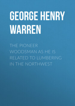
The "V" shaped baker is a valuable part of the cook's outfit. (Page 36.)
The Continental Congress, through its committee appointed expressly for the work, inaugurated the present system of survey of the public lands in 1784. For the purposes of this explanation it will be sufficient to recite that the system consists of parallel lines six miles apart running north and south, designated as "range lines"; also of other parallel lines, six miles apart running east and west, designated as "township lines". Any six miles square bounded by four of these lines constitutes a "township". The territory within these two range lines and two township lines is subdivided into "sections", each one mile square, by running five parallel lines north and south across the township, each one mile from its nearest parallel line, and, in like manner, by running five other parallel lines east and west across the township from the east range line to the west range line, each line one mile from its nearest parallel line. In this manner, the township is subdivided into thirty-six sections each one mile square. The four township corners are marked by posts, squared at the upper end, and marked on the four sides by the proper letters and figures cut into the four flat faces by "marking irons", each flat surface facing the township for which it is marked.
In addition, one tree in each of the four township corners is blazed (a smooth surface exposed by chopping through the bark into the wood) on the side of the tree facing the stake, and the same letters and figures as are on the nearest face of the stake are marked thereon. These letters and figures give the number of the township, range and section touching that corner. On another blaze below the first, and near the ground, are marked the letters "B T", meaning "bearing tree".
The surveyor writes in his field book the kind and diameter of tree, the distance and direction of each bearing tree from the corner post, and these notes of the surveyor are recorded in the United States land office at Washington.
Even if the stake and three of the bearing trees should be destroyed, so that but one tree be left, with a copy of the notes, one could relocate the township corner.
The section corners within the township are marked in a similar manner.
Midway between adjacent section corners is located a "quarter corner", on the line between the two adjacent sections. This is marked by a post blazed flat on opposite sides and marked "¼ S". There are also two "witness trees" or bearing trees marked "¼ S".
By running straight lines through a section, east and west and north and south, connecting the quarter corners, the section of six hundred and forty acres may be divided into four quarter sections of one hundred and sixty acres each. These may in turn be divided into four similar shaped quarters of forty acres each called "forties", which constitute the smallest regular government subdivisions, except fractional acreages caused by lakes and rivers which may cut out part of what might otherwise have been a forty. In such cases the government surveyor "meanders" or measures the winding courses, and the fractional forties thus measured are marked with the number of acres each contains. Each is called a "lot" and is given a number. These lots are noted and numbered on the surveyor's map or plat which is later recorded.
The subdivision of the mile square section is the work of the land looker, as the government ceases its work when the exterior lines are run.
On the township plat which one buys at the local United States land office, are designated by some character, the lands belonging to the United States, and, by a different character, the lands owned by the State.
The country presented an unbroken forest of the various kinds of trees and underbrush indigenous to this northern climate. The deer, bear, lynx, porcupine, and wolf were the rightful and principal occupants. Crossing occasionally, the trail of the first named, served only to remind us of our complete isolation from the outside, busy world.
The provisions yet remaining were sufficient to feed our party for less than three weeks. In the meantime two of the Indians had gone down the river in a canoe with Mr. Patrick to the mouth of the Flambeau, to await the arrival of fresh supplies which he was to send up to that point from Eau Claire by team. The experienced and skilled woodsmen had divided the working force into small crews, which began subdividing the sections within the townships where there were government or state lands, to ascertain whether there were any forty acre tracts that contained enough valuable pine to make the land profitable to purchase at the land offices. Two thousand acres were thus selected during the first cruise, but, on our agent reaching the land office where the lands had to be entered, only twelve hundred acres were still vacant (unentered), other land lookers having preceded our representative and arrived first at the land office with eight hundred acres of the same descriptions as our own.
As there were many land lookers at this time in the woods, all anxious to buy the good pine lands from the government and the state, conflicts like the above were not unusual.
Through a misunderstanding of orders, our working party, now nearly out of everything to eat, assembled at The Forks, a point forty-five miles above the mouth of the Flambeau, and waited for the Indians to bring up fresh supplies. They did not come, and, after waiting three days, while each man subsisted on rations of three small baking powder biscuits per day, all hands pushed down to the mouth of the river where the Indians were awaiting us with plenty of raw materials, some of which were soon converted into cooked food of which all partook most heartily.
Corrected plats, showing the unentered lands of each township which we were directed to examine, were sent to us.