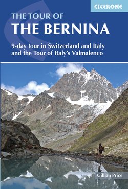
Читать книгу The Tour of the Bernina - Gillian Price - Страница 11
На сайте Литреса книга снята с продажи.
ОглавлениеINTRODUCTION
Piz Bernina (right) from the south (photo: Jonathan Williams)
It’s enormously rewarding to circle a giant of the Alps, entirely under your own steam, and return to where you started. Thanks to this new long-distance route – the Tour of the Bernina – glorious day after glorious day can be spent on foot around the Bernina, an awesome glaciated massif belonging to the Rhaetian Alps and straddling the Swiss-Italian border. Global warming notwithstanding, bevvies of magnificent peaks are still draped with vast frozen rivers of ice that are sliding silently downhill and shaping a succession of scooped-out glens as they go.
Stunning variety comes into play as the trek progresses. In the words of RLG Irving, ‘No part of the frontier Alps offers a more striking illustration of the contrast between the snowy beauties of the northern slopes and the great bare walls that extend along the south side of the watershed’ (The Alps, 1938). Walkers will have ample opportunities to test this out. The trek is as exciting and as scenic as the immensely popular Tour of Mont Blanc, but without the crowds.
And there’s more good news: as a bonus, the multi-day Alta Via Valmalenco trek is also described here. This is a circular route round the southernmost valley, in close contact with another awesome icy giant – Monte Disgrazia.
Both of these superb treks meander on clear marked paths through glaciated valleys, sweet-smelling forests alive with squirrels, and meadows brilliant with wildflowers. They also visit serene pastoral landscapes dotted with traditional stone-roofed hamlets and tiny age-old alpine farms, still very much active in the 21st century, where cows and goats are milked by hand and delicious cheeses are crafted.
While the Tour of the Bernina is a great choice for first-time alpine trekkers, preferably with some basic experience, the Alta Via Valmalenco includes several tougher stages requiring a surer foot. However, for both, enthusiasm is the main requisite – although that is hardly going to be in short supply once you’ve glimpsed the scenery. A string of excellent refuges is perched on belvedere ridges at convenient points the whole way round, so that long spells can be enjoyed in these awe-inspiring surroundings. Alongside cosy village guesthouses and hotels, they offer hospitality and meals to walkers, who can set out with minimum baggage. Almost every stage of both treks can be accessed from a valley floor and public transport, opening the door to multiple variants, excellent short walks and memorable bespoke walking holidays.
The Tour of the Bernina
Lovely views over Val Roseg during the ascent to Fuorcla Surlej (TB, Stage 1)
Starting near the swish resort of St Moritz in Switzerland, the tour heads without delay up a pristine glacial valley for superb views of the Bernina massif. Cutting west, it makes a high traverse over the elongated Swiss valley of the Upper Engadine, which features orderly villages set beside medium-altitude lakes. A historic col that has witnessed the passage of smugglers, traders and refugees over the centuries then links with neighbouring Italy. This leads south into rugged Valmalenco, which accounts for the Bernina’s plunging southern flanks. A drawn-out traverse through dramatic glens incorporates a thrilling sortie into the high altitude heart of the massif, on a stretch that overlaps with the Alta Via Valmalenco trek. The concluding stages see the Tour of the Bernina head back into Switzerland and Val Poschiavo to end in the company of the spectacular St Moritz–Tirano railway line and a memorable lookout.
In all, the trek covers 119km in nine stages, which correspond to nine fantastic days on the move, with five days spent in Switzerland and four in Italy. However, a number of inviting extensions and detours are described, and to follow them all means adding at least two days to the total – warmly recommended! On the other hand, so as to squeeze the whole of the Tour of the Bernina into a shorter holiday, a six-day version is given.
In terms of difficulty it rates an overall average (Grade 2), and alternatives are provided for the handful of harder Grade 3 bits on rough terrain. While the highest point reached is 3002m, there are no glacier crossings en route.
The trek is described anti-clockwise here, with stage timings given in the information boxes, as well as times between key points in blue bold text throughout the route descriptions. Naturally it is also feasible in the reverse direction, and relevant approximate times for each stage when walked clockwise are also provided in the stage information boxes. Accommodation is in seven alpine refuges, one hostel and a hotel.
The start/finish of Pontresina was chosen for its convenient location as it is well served by trains from all of Switzerland as well as from northern Italy. Naturally, you could begin anywhere you like, as all the villages can be reached by handy public transport – see the introduction to the Tour of the Bernina chapter for details.
The name ‘The Tour of the Bernina’ has been coined for the purposes of this guide.
The Alta Via Valmalenco
Alpe Prabello and Rifugio Cristina are dominated by Pizzo Scalino (AVV, Stage 7)
This well-established long-distance trek begins in the depths of Italy’s Valmalenco, whose middle reaches host modest quarries for roofing tiles and attractive green-veined serpentinite. From Torre di Santa Maria it makes its way northwest through strikingly beautiful and desolate stretches for an encounter with a major landmark – glaciated Monte Disgrazia. A loop via an unmissable belvedere concludes at the route’s only village – hospitable Chiareggio. Now in common with the Tour of the Bernina, it heads into the lofty southern realms of the Bernina massif, dotted with welcoming alpine refuges. The concluding stages see the Alta Via circling west to traverse little-frequented pastoral landscapes beneath elegant Pizzo Scalino, on its return to the valley floor.
A tad tougher than the Tour of the Bernina, the Alta Via Valmalenco has eight memorable stages accounting for 93.5km. Allow eight full days, unless you are tight for time, in which case you could do the six-day version outlined in the relevant chapter. On the other hand, by all means stretch it out into 11 days – several stages lend themselves to earlier stopovers at well-run refuges located at handy intermediate spots. Unsuitable for novice trekkers, the route requires a decent level of fitness along with some experience in alpine environments. Rough terrain is encountered at times, although straightforward alternatives are always given. The highest point reached is 2813m, but there are no glacier crossings. Accommodation is in six alpine refuges and two hotels.
The start/finish – the villages of Santa Maria/Chiesa in Valmalenco – are easily reached by bus (see Getting there, below) and several other entry or exit points are suggested in the trek chapter. The Alta Via is described clockwise here in accordance with the creators’ original plan, with stage timings given in the information boxes, as well as times between key points in blue bold text throughout the route descriptions. You could, however, choose to walk it in the reverse direction, and relevant approximate times for each stage when walked anti-clockwise are also provided in the stage information boxes.
LANGUAGES
Quite a kaleidoscope of tongues can be heard in the area. In Switzerland’s Engadine district German prevails, although coming a close second is the ancient Romansch language, which is still widely used – both orally and in place names – and taught at the valley schools. The neighbouring Swiss Val Poschiavo, on the other hand, is 90% Italian speaking; a glance at the map will explain why, as geographically it ‘belongs’ to Italy. In the adjacent Valmalenco Italian is the dominant language, although the local Malenco dialect is common in villages and pasture alike.
English is fairly widely spoken in the Swiss valleys, a little less so in Italy.
It’s common habit to greet other walkers on the path, so in Switzerland there’s the choice between grüezi (Swiss German), allegra (Romansch) or Grüss Gott (German); and in Italy buongiorno.
A glossary of the German, Italian and Romansch terms you’re likely to encounter along the way can be found in Appendix A.
About glaciers
The flow of the Pers glacier from Diavolezza (TB, Stage 8)
Glaciers are a fundamental feature of these landscapes, and the snail-slow downhill movement of these immense bodies of ice, dragged by gravity, shapes the terrain. Curiously, in Valmalenco the majority of the alp summer farms are located at around the 2000-metre mark, which coincides with the ancient level of the valley floor prior to the great glaciation.
Ice ages come and go, and when the rate of melting during the warmer months exceeds that of maintaining the glaciers’ status quo, the masses gradually lose volume and retreat, often leaving behind a typical U-shaped trough. The bedrock surface thus exposed is both smooth and scratched, being grooved by rocks that are trapped in the ice and drawn along.
Roches moutonnées
Glacially rounded outcrops are known as roches moutonnées – the name making for a curious tale. It would suggest their resemblance to recumbent sheep, but in fact the term was first coined by 18th-century Swiss explorer and pioneer mountaineer Horace-Bénédict de Saussure in a totally different vein: in his eyes, the modelled rocks looked like the wigs in vogue at the time, and mutton fat (thus moutonnée) was applied to smooth down the hair!
Moraine ridge
Moreover, the passage of a glacier rips rock off mountainsides, carrying it downhill on its surface. Over time it rattles off to the sides and forms elongated rows of moraine, which, when the ice mass shrinks, are left behind as giant witnesses.
Plants and flowers
This glorious array of alpine flowers includes (clockwise from top right) leopardsbane, white poppies, purple gentian, orange lily and alpine asters
The different terrains and habitats around the Bernina – from low-altitude meadows, woods and scrub to high-altitude rock and icescapes – are home to an incredible range of alpine flora, usually seen at their flowering best between July and August. They include some astonishing examples of adaptation to harsh environments.
Apparently barren rock surfaces host myriad coloured lichen; these prepare the way for a pioneer moraine coloniser – ground-hugging mountain avens – which has robust evergreen leaves and eight white petals, as well as for hardy cushion plants such as the ‘rock-breaker’ par excellence saxifrage, with its penetrating roots and tiny delicate blooms.
One of the first flowers to appear on the edge of the snow line is the dainty, fringed, blue-violet alpine snowbell, which actually melts the snow with the heat it releases as it breaks down carbohydrates. Another early bloom is the perfumed sticky primrose with its petite clusters of deep purple. A lover of siliceous scree and the vicinity of ice is the white glacier crowfoot, whose leaf cells contain a rich fluid that acts as antifreeze, protecting the plant from the cold.
The attractive parsley fern is a common sight peeking out from under stones. Stony grasslands with calcareous soil are ideal for the well-loved, creamy, star-shaped edelweiss, their leaves equipped with fine felty hairs to trap heat. Another classic, the gentian, comes in the form of a distinctive blue trumpet or as tiny iridescent stars, in addition to a showy yellow spotted type, a purple variety and delicate autumn mauve blooms. Eye-catching white alpine moon daisies are a common sight on rock-strewn slopes, which they share with clumps of golden-yellow leopardsbane and lilac alpine asters; and a rare delight are the paper-thin poppies with either golden or pale white petals.
Common alongside marshy lakes is the fluffy white cotton grass, while purple or white insectivorous butterwort is found in damp places, often near streams. Pasture slopes and alpine meadows are dotted with exquisite wine-red martagon and orange lilies, delicate columbines, purple orchids and the unpretentious triangular-headed black vanilla orchids, which have a delicate scent of cocoa.
Vast forests of conifers cloak mid-altitude slopes; their needles often filter the daylight, resulting in pink-tinged light below their outspread branches. Gnarled Arolla pines, ‘sculpted’ by lightning strikes, are common, often sprouting from unlikely rock crannies. Dwarf mountain pines are found on sunny scree slopes in dense, low clusters that often invade paths, obliging walkers to push through scratchy branches. Another constant is the larch tree with its delicate lacy fronds; it is the only non-evergreen conifer and loses its needles with the onset of autumn. It is commonly accompanied by bushes of miniature rhododendrons, or alpenrose, with delightful pink blooms.
Wildlife
Old farm huts on the edge of thick conifer forest at Forbesina (AVV, Stage 3)
Birds
Where Arolla pines dominate the forest, you can be sure there will also be nutcrackers. As the name suggests, these brown-white spotted birds are experts at cracking open the pine nuts, and are in fact responsible for the tree’s survival. This voracious – and forgetful – bird hoards kernels in secluded rock crannies where they sprout and grow. What’s more, from their perches at the very top of the trees, nutcrackers act as lookouts for forest dwellers, their piercing squawk a clear warning of danger.
Another treat is the charming, pale brown-cream treecreeper that climbs up tree trunks in spirals, searching for food. Rarer and more showy is the wallcreeper, which utters a shrill, piping call. Its outspread black wings reveal flashes of red panels and white dots as it flutters at high-altitude rock faces on its quest for insects, which it captures with a slender down-turned beak. Over meadows the summer sky is alive with swarms of darting crag martins with short wings and white bellies.
On a larger scale, birds of prey such as the magnificent golden eagle may be spotted gliding high overhead. With a wingspan exceeding two metres, this alpine giant visits many a valley in the course of a single day’s hunting for mammals such as hares and young marmots (although they do not disdain birds and small ungulates). In winter the eagle has been known to scavenge carcasses of animals such as chamois that have been the victim of avalanches, putting the bird in direct competition with the successfully re-introduced bearded vulture.
In springtime the lammergeier, as this vulture is also known, keeps an eye out for birds dropping from exhaustion during the demanding migration flights north. Its diet is composed of 80 per cent bones, which it cracks open by dropping them from a height onto rocks. With a wingspan up to 2.8m and a body of over one metre long, the bearded vulture is easily recognised, especially as its eyesight is not the best, meaning it often flies close to the ground.
Animals
A young chamois
The vast woods around the Bernina are home to shy, majestic red deer, and pretty roe deer can occasionally be seen flitting through tree cover. Loftier rocky terrain is preferred by nimble-footed chamois – a mountain goat with a striped face, crochet-hook horns and an amazing lack of concern for precipitous cliffsides. Stocky ibex, with massive grooved horns, can be spotted above the high refuges; they are inquisitive and unbothered by humans. Alpine hare are not unusual, their outsized ears a giveaway. However, it’s likely you’ll see more of all the above on restaurant menus than you will in nature, as hunting (strictly controlled) is a common practice.
An adult marmot
The adorable alpine marmot is by far the easiest wild animal to see and observe at length. A bit like a beaver or ground hog in appearance, it lives in large underground colonies but spends daytime hours romping in meadows and devouring flowers, along with the occasional insect. A community sentinel is always on guard for the approach of predators such as foxes or eagles, and if threatened it will emit a shrill, ear-splitting whistle that inevitably sends young and old alike scampering down the nearest burrow. Marmots hibernate from October to April, waking but once a month to urinate. Now protected, they were once hunted for their skins and fat, and paraded in street fairs.
Darting, elegant ermine or stoat live under rocks but venture out towards dusk in search of dinner, which will sometimes consist of scraps from a refuge kitchen.
Snakes are not uncommon, however the viper or adder is the only venomous one. Tawny brown, it has a diamond-shaped head and distinctive zigzag markings down its back and it grows up to 70cm in length. Vipers are commonly encountered on open terrain in the vicinity of abandoned huts, where they hunt small rodents. They sun themselves to raise their body temperature so may seem sluggish if disturbed, reacting with a threatening hiss in self-defence. Step back and give them time to slither away. In the extremely unlikely case that you are bitten, waste no time calling for help and in the meantime immobilise the bite area with a bandage. If possible stay put. Attacks are rarely fatal, although it’s best to get expert medical assistance as quickly as possible.
The huge nests constructed by the red wood ant house hundreds and thousands of workers
Lastly, a humble ant deserves a mention. Enormous conical nests, towering up to two metres in height, are constructed by the red wood ant in conifer woods, which they protect by devouring damaging parasites. The nests are home to hundreds of thousands of workers, which live to the incredible age of 10 years, and queens that can survive to the ripe old age of 20!
Getting there
The Tour of the Bernina
For the trek start of Pontresina in southeast Switzerland, the country’s most convenient airport is Zurich (www.zurich-airport.com, 200km/3hr 30min by train via Chur). There’s also nearby St Moritz (www.engadin-airport.ch), although flights from overseas destinations are limited. East across the border in Austria is Innsbruck (www.innsbruck-airport.com, 190km/5hr by train). Other good options are the Italian airports of either Malpensa or Linate on the outskirts of Milano (www.sea-aeroportimilano.it, 175km/4hr 30min by train via Tirano, otherwise train to Chiavenna and then a Swiss bus via Maloja) or Bergamo (Orio al Serio: www.sacbo.it,145km/4hr 30min by train via Lecco and Tirano).
The Alta Via Valmalenco
The trek start, Torre di Santa Maria, is in Valmalenco, which branches off the broad Valtellina at the township of Sondrio. Buses serve this route year-round. Sondrio, on the other hand, is easily reached by train from Milano Centrale via Lecco and Lake Como.
Getting around
Routes and timetables for trains in Switzerland can be found at www.sbb.ch, and for buses at www.autopostale.ch. Also SBB Mobile is a very useful app which covers all public transport information. It’s worth noting that a complimentary local Swiss travel card covering buses, trains and lifts is free for visitors who stay at least two nights at a hotel or hostel in the Engadine.
Information about trains in Italy can be found at www.trenitalia.com, Tel 892021, and about Valmalenco buses at www.stps.it, Tel 0342 511212. It’s important to remember that for Italian trains, unless you’ve a booked seat (in which case your ticket will show a date and time), you should validate (stamp) your ticket in one of the machines on the platform before boarding. Failure to do so can result in a fine.
THE BERNINA EXPRESS
A train threads its way between houses at Tirano
The northern Italian town of Tirano lies at 429m above sea level, while St Moritz in southeastern Switzerland is located at 1856m. In between them stands the Bernina Pass at 2329m. Remarkably, they are linked by the Bernina Express railway, which takes two and a half hours to cover the 60km and operates year-round. With spectacular switchbacks, 13 tunnels and cuttings, 52 bridges and viaducts, long ramps and astonishingly steep gradients (the maximum incline is 7%), and no help at all from a rack and pinion system, the trains climb steadily on a narrow gauge track. Constructed between 1906 and 1910 with the purpose of encouraging tourism, it is one of the steepest adhesion railways in the world – not to mention the highest-altitude transalpine railway of all. En route, picturesque villages, forests, lakes and glaciers can be admired. In combination with the northern stretch from St Moritz to Thusis, the Bernina Express was in 2008 assigned World Heritage status by UNESCO.
It is run as a normal service and advance booking is not necessary (unless you hanker after an open-sided observation car). Tickets are sold on the spot and unmanned stations have automatic ticketing machines that accept both cash and credit cards. Timetables at www.sbb.ch.
Tourist information
The Italian Tourist Board has offices all over the world and can help intending travellers with general information (www.enit.it). Switzerland’s main info service is www.myswitzerland.com. All local tourist offices can provide help with accommodation and transport enquiries.
Chiesa in Valmalenco Tel 0342 451150 www.sondrioevalmalenco.it
Maloja Tel 081 8243188 www.maloja.ch
Pontresina Tel 081 8388300 www.pontresina.ch
Poschiavo Tel 081 8440571 www.valposchiavo.ch
Sils Maria/Segl Maria Tel 081 8385050 www.sils.ch
Sondrio Tel 0342 219246 www.sondrioevalmalenco.it
St Moritz Tel 081 8373333 www.engadin.stmoritz.ch
When calling from overseas, preface Italian numbers with +39 and Swiss numbers with +41. Also, to call an Italian landline phone number locally or from overseas, always include the initial zero of the area code; the exceptions being mobile numbers (which begin with ‘3’) and emergency services (which begin ‘1’). Conversely, to call a Swiss phone number from overseas, always remove the initial zero – but include it if calling locally.
When to go
These are alpine routes, so there are restrictions due to snow cover and the opening period of the high-altitude refuges. The answer is to go from late June through to late September but always check individual refuge openings at the beginning and end of that period. Up until mid-July there may still be extensive late-lying snow, although this will of course depend on the extent of snowfall over the previous winter. Early summer walkers may need to verify the condition of access paths to north-facing locations such as Diavolezza – ask locally. August to early September is probably the optimum time; later on, October can be a magical month with crisp conditions and autumn colours – although, alas, the majority of huts will be closed, with a handful open only on weekends.
Accommodation
The marvellously positioned Rifugio Cometti Grandi (AVV, Stage 1)
Walkers on these treks will enjoy overnight stays in a string of comfortable hotels and guesthouses, as well as in mountain huts that are only accessible on foot.
Hotels and guesthouses naturally have separate rooms, sometimes with an en suite bathroom. Always ask what choice is offered.
The alpine refuge is a life-saving establishment for walkers across the Alps. It is known as a rifugio in Italy, a Berghaus or Berghütte in the German-speaking part of Switzerland, and chamanna in the Romansch-speaking part. Old, modern, rambling, tiny, cosy, spartan, cramped, family-run, miles from anywhere… whatever the description, the huts all have the same mission: to provide beds and meals for walkers and mountaineers during the summer months. They also act as café-restaurants and can be relied on for a drink and meal if you’re passing through.
The majority are owned by alpine clubs – either CAS (Club Alpin Suisse) or CAI (Club Alpino Italiano) – but anyone is welcome to stay, members and non-members alike. The manager (gestore/Wirt) and their hardworking, versatile, multilingual staff welcome guests and deal with the day-to-day chores, which range from baking cakes to chopping wood, backpacking in supplies and handling emergencies. They can also be consulted for information about the condition of local paths.
The refuge routine
Inside Chamanna Coaz, on the extension to TB Stage 1
So what’s the procedure at a refuge? When you arrive at a hut, the first thing to do is announce yourself to a staff member, who will check your reservation and tell you which bed and room to occupy. This is a good opportunity to ask what time dinner’s served.
Walking boots are never worn into the bedrooms, but are left on shelves or racks in the hut entrance. Here you change into your own sandals or use hut slippers if available. Sleeping quarters range from 2–4 beds or bunkrooms up to cavernous dormitories (dormitorio/Lager) with mattresses lined up along the walls. Duvets or blankets and a pillow are always provided, to be used in combination with your personal sheet sleeping bag, and a lightweight pillowcase. Space restrictions mean there is not usually much privacy.
You will probably feel like a wash and change at this point – using your own towel and possibly soap too. Bathrooms are mostly simple affairs with a couple of hand basins, mirrors and toilet cubicles (toilet paper is always provided). There is always a hot shower (doccia calda/warme Dusche) unless specified otherwise. Some huts charge for the privilege, in which case you’ll be given a token to insert in the shower box: don’t forget that the hot water is time-limited. Afterwards you may consider washing out your day’s clothes; these can be hung outside on the clothesline unless there happens to be a drying room. Don’t leave your washing hanging outside overnight, as the dew will soak everything.
The refuge café/bar is always open if at any time you feel like a soft drink, cup of tea, slice of cake, glass of beer or whatever. Tap water is drinkable unless specified non potabile/kein Trinkwasser. Dinner is generally a set meal, the same for everyone who has opted for half board. A three-course affair, it begins with soup or pasta, proceeds with a meat dish and vegetables, and concludes with some sort of dessert or fresh fruit.
Breakfast (colazione) tends to be a light affair in Italy, with a choice between caffé latte (coffee with milk) and tè (tea) served with bread, butter and jam (pane, burro, marmellata). The superior quality Swiss version (Frühstuck) usually means cereals, yogurt, cheese and cold meat as well.
Meals are covered by half board – mezza pensione/Halbpension – with drinks such as beer, wine, and hot beverages billed extra. At the time of writing, charges were around €50/SF60 for members in Alpine Club huts in Switzerland and €58/SF70 for non-members. On the other side of the border, charges in Italy are a third lower – around €43 for members and €56 for non-members. For non-alpine club refuges expect anything between €35 and €60.
Hut lights-out and silence is usually from 10.00pm to 6.00am. The generator may be switched off, so keep your torch or headlamp handy in case you need it during the night.
During the refuges’ closed period, unmanned premises are accessible at most alpine club huts for emergency use. The Winterraum in German and bivacco/locale/ricovero invernale in Italian usually contains bunk beds, sometimes blankets, a stove, basic food and a note about where to find water. Self-sufficient walkers passing through when the refuges are not operating will greatly appreciate these facilities.
One well-equipped unmanned bivouac hut is encountered (on Stage 7 of the Tour of the Bernina), but unless you split the stage in two you should not need to use it. If you do, take your own provisions. Please note that where a refuge is described as being open ‘some weekends’, this refers to weekends outside of the main summer and autumn periods.
Reservations
Advance booking is a good idea for both hotels and refuges in midsummer. Some of the places listed accept reservations by email, but by no means all, so book by phone to be sure.
At the huts, members of affiliated overseas alpine clubs are eligible for reduced rates; UK residents may wish to join a British branch of the Austrian Alpine Club (http://aacuk.org.uk), if not the Italian (www.cai.it) or Swiss (www.sac-cas.ch) counterparts. At the time of writing, membership of the Swiss club does not include insurance cover, unlike the other two clubs – see Emergencies below.
Reservation is not compulsory at the huts, but it is a good idea for all concerned: for the staff as it helps them calculate the food that needs preparing (and whether to cater for vegetarians or guests with special allergy issues), and for intending guests as it guarantees a bed for the night – you may be turned away if a hut is full, if not bedded down in the attic. A reservation also acts as a safety mechanism for walkers: if you don’t show up, search procedures may be set in action. So be warned, should you change your mind and route, do phone to cancel or you may be billed for unnecessary and costly rescue operations.
For payment, while credit cards are usually taken at most hotels, it’s always a good idea to check beforehand. It’s best to assume that huts do not accept credit cards (unless specified otherwise), so carry a reserve of euros and Swiss francs in cash for paying your bill. All main towns and important villages have ATMs.
Remember that while euros are the currency of Italy, Switzerland uses the Swiss franc: as a rough guide, calculate CHF10 = €8.10. Just to confuse things, payment is often accepted in euros as cash in Swiss establishments (including all Swiss Alpine Club huts) – and change given in Swiss francs.
Full contact details of places to stay are given at the appropriate spot in the Tour of the Bernina and Alta Via Valmalenco route descriptions, as well as in Appendix B.
Food and drink
Grocery shop at Maloja
Specialities of the Engadine include compact creamy cheeses, dark malt-flavoured bread and warming soups. Baked cabbage rolls stuffed with rich cheese and sausage are known as Capuns, while Maluns are grated potato and flour cooked in butter and served with apple. Pastry cooks excel in divine walnut tart.
Things to look out for in Valmalenco and Val Poschiavo include manfrigole – little crepes filled with local cheese. Many traditional restaurants serve taròz, a filling vegetable purée with a golden crust – usually potato, green beans, onion – blended with melted butter and flavoursome cheese. But the most popular dish is wholesome pizzocheri – short flat strands of buckwheat pasta tossed with potato and greens and a rich sauce of melted cheese. Another pasta combination to look out for is tagliatelle con ragù di cervo/lepre (ribbon pasta with venison/hare sauce). Polenta – a filling soft corn porridge that accompanies stewed meat, melted cheese or mushrooms – is also common. Once cooked, it may also be grilled. Bresaola is fragrant air-dried beef, usually sliced paper-thin and seasoned with oil and lemon.
On the sweet front there is panùn, made with wholewheat flour and dried figs and walnuts, while delicious cupèta bars of chopped walnuts and honey travel well and make perfect snack food.
The Bernina region yields some excellent wines. The south-facing Valtellina in Italy is crowded with terraced vineyards that produce notable red wines such as Inferno, Sassello and Grumella. Veltins is the German version of Valtellina, often found on labels, and Swiss wines include Blauburgunder/Pinot Noir.
As regards drinking water, the majority of alpine villages and farms have a drinking fountain or taps where passers-by can replenish their bottle – unless a sign says non potabile/kein Trinkwasser (unsuitable for drinking). Tap water (acqua da rubinetto/Leitungswasser) is always safe to drink and can be requested in cafés and restaurants instead of the bottled mineral water that causes so much unnecessary pollution as it is transported back and forth across Europe.
For picnics, hotels and refuges sell snacks such as biscuits and chocolate bars, and will prepare simple packed lunches (sandwiches or a roll) for walkers if given a little advance warning – preferably the evening before. It’s worth bearing in mind that many of the summer dairy farms encountered on the way sell their homemade cheeses (formaggio/Käse), made with blends of tangy goat, sheep and cow’s milk. A special treat!
What to take
Rifugio Carate Brianza (TB Stage 5, AVV Stage 5)
The bottom line is… much less than you think. Basic items for personal comfort and gear to cover all weather extremes are essential, but be strict with yourself and remember you have to lug your stuff over the mountains for days on end. Do you really need to take that paperback? The 10.00pm ‘lights out’ rule in huts precludes bedtime reading, and communal meals are perfect for socialising and trying out your language skills with Italian- and German-speaking walkers.
Moreover, the safety factor should not be underestimated: a heavy rucksack can become a hazard, tiring walkers and putting them off-balance, possibly leading to unpleasant falls and serious accidents. Thankfully a huge choice of reasonably priced lightweight gear is available these days at outdoor shops.
The following checklist will help new trekkers:
comfortable boots with ankle support and non-slip Vibram-type soles; preferably not brand new
rucksack – 35-litre capacity should do; plastic or stuff bags for separating contents
layers of clothing for dealing with everything from scorching sun to a snowstorm: T-shirts and shorts, comfortable long trousers (jeans are unsuitable), warm fleece, woolly hat and gloves
waterproofs: jacket, over-trousers and rucksack cover; a fold-up umbrella is a godsend for people who wear spectacles
light footwear such as sandals for evenings
sleeping sheet – silk is perfect
small towel, soap and personal toiletries – small quantities in plastic containers
water bottle
high-energy snack food such as muesli bars can be life-saving in an emergency or if that refreshment stopover happens to be closed
maps, altimeter and compass
credit card and supply of cash in euros and Swiss francs
alpine club membership card
telescopic trekking poles to help wonky knees on steep descents
small headlamp or torch and whistle for calling for help in an emergency
sunglasses, hat, chapstick and protective cream. For every 1000m you climb the intensity of the sun’s UV rays increases by ten per cent, augmented by reflection on snow. This, combined with the lower levels of humidity and pollution that act as filters in other places, means you need a cream with a much higher protection factor than at sea level.
mobile phone, recharger with adaptor
camera with extra batteries, recharger and adaptor. Hint: make sure your camera has a panoramic option
foam ear plugs – they occupy next to no space and ensure a good night’s sleep in a dormitory of snorers
first aid kit and essential medicines
microspikes (walkers’ version of crampons) can be very helpful for crossing extended snow expanses if it has been a snowy year and you plan on trekking before mid-July.
Waymarking and maps
Italian signpost showing path numbers and timings
Waymarking is good all the way round both treks. In Switzerland paths are indicated by a frequently placed painted red stripe on a broad white background, while in Italy there are equal red/white stripes, often with a distinguishing number. Markings are found on prominent fence posts, tree trunks and rocks. Path junctions also have a clutch of signposts. It’s helpful to remember that signs may bear the name of the final destination of the route, so check your map if you need an intermediate point.
All these numbers and routes are shown on commercial walking maps. While sketch maps are provided in this guide, limitations of space make it impossible to include full details, essential in an emergency, so it’s imperative that walkers obtain the recommended maps.
Luckily a single map covers both the Tour of the Bernina and the Alta Via Valmalenco: Kompass 1:50,000 sheet 93 – ‘Bernina Valmalenco Sondrio’, available from specialised booksellers such as www.stanfords.co.uk, outdoor suppliers and shops in the Bernina region.
If desired, more detailed 1:25,000 maps are available: for the Engadine Valley on the Swiss side of the Bernina there’s Landeskarte der Schweiz (Swiss National Survey maps) n.2521 – ‘St Moritz Bernina’; whereas for the southern valleys there’s ‘Valmalenco – Carta dei Sentieri’, published by the Consorzio Turistico Sondrio Valmalenco and sold locally.
Dos and don’ts
Bird’s-eye view of the hamlet of Son (AVV, Stage 1)
It’s better to arrive early and dry, than late and wet
Maxim for long-distance walkers