Читать книгу The Yellowstone National Park: Historical and Descriptive - Hiram Martin Chittenden - Страница 4
На сайте Литреса книга снята с продажи.
ОглавлениеOpp. page 11.
Click on image to view larger size.
Such were the Indian tribes who formerly dwelt within or near the country now embraced in the Yellowstone National Park. That the Sheepeaters actually occupied this country, and that wandering bands from other tribes occasionally visited it, there is abundant and conclusive proof. Indian trails, [F] though generally indistinct, were every-where found by the early explorers, mostly on lines since occupied by the tourist routes. One of these followed the Yellowstone Valley entirely across the Park from north to south. It divided at Yellowstone Lake, the principal branch following the east shore, crossing Two-Ocean-Pass, and intersecting a great trail which connected the Snake and Wind River Valleys. The other branch passed along the west shore of the lake and over the divide to the valleys of Snake River and Jackson Lake. This trail was intersected by an important one in the vicinity of Conant Creek leading from the Upper Snake Valley to that of Henry Fork. Other intersecting trails connected the Yellowstone River trail with the Madison and Firehole Basins on the west and with the Bighorn Valley on the east.
[F] See historical chart, opposite.
The most important Indian trail in the Park, however, was that known as the Great Bannock Trail. It extended from Henry Lake across the Gallatin Range to Mammoth Hot Springs, where it was joined by another coming up the valley of the Gardiner. Thence it led across the Black-tail Deer plateau to the ford above Tower Falls; and thence up the Lamar Valley, forking at Soda Butte, and reaching the Bighorn Valley by way of Clark’s Fork and the Stinkingwater River. This trail was certainly a very ancient and much-traveled one. It had become a deep furrow in the grassy slopes, and it is still distinctly visible in places, though unused for a quarter of a century.
Additional evidence in the same direction may be seen in the wide-spread distribution of implements peculiar to Indian use. Arrows and spear heads have been found in considerable numbers. Obsidian Cliff was an important quarry, and the open country near the outlet of Yellowstone Lake a favorite camping-ground. Certain implements, such as pipes, hammers, and stone vessels, indicating the former presence of a more civilized people, have been found to a limited extent; and some explorers have thought that a symmetrical mound in the valley of the Snake River, below the mouth of Hart River, is of artificial origin. Reference will later be made to the discovery of a rude granite structure near the top of the Grand Teton, which is unquestionably of very ancient date.
Dr. A. C. Peale, prominently connected with the early geological explorations of this region, states that the Rustic Geyser in the Hart Lake Geyser Basin is “bordered by logs which are coated with a crystalline, semi-translucent deposit of geyserite. These logs were evidently placed around the geyser by either Indians or white men a number of years ago, as the coating is thick and the logs firmly attached to the surrounding deposit.” [G]
[G] Page 298, Twelfth Annual Report of Dr. Hayden. See Appendix E. It is more than probable that this was the work of trappers.
More recent and perishable proofs of the presence of Indians in the Park were found by the early explorers in the rude wick-e-ups, brush inclosures, and similar contrivances of the lonely Sheepeaters; and it is not improbable that many of the arrow and spear heads were the work of these Indians.
The real question of doubt in regard to Indian occupancy of, or visits to, the Park, is therefore not one of fact, but of degree. The Sheepeaters certainly dwelt there; but as to other tribes, their acquaintance with it seems to have been very limited. No word of information about the geyser regions ever fell from their lips, except that the surrounding country was known to them as the Burning Mountains. With one or two exceptions, the old trails were very indistinct, requiring an experienced eye to distinguish them from game trails. Their undeveloped condition indicated infrequent use. Old trappers who have known this region for fifty years say that the great majority of Indians never saw it. Able Indian guides in the surrounding country became lost when they entered the Park, and the Nez Percés were forced to impress a white man as guide when they crossed the Park in 1877.
An unknown writer, to whom extended reference will be made in a later chapter, visited the Upper Geyser Basin in 1832, accompanied by two Pend d’Oreilles Indians. Neither of these Indians had ever seen or apparently heard of the geysers, and “were quite appalled” at the sight of them, believing them to be “supernatural” and the “production of the Evil Spirit.”
Lieutenant Doane, who commanded the military escort to the Yellowstone Expedition of 1870, says in his report: [H]
“Appearances indicated that the basin [of the Yellowstone Lake] had been almost entirely abandoned by the sons of the forest. A few lodges of Sheepeaters, a branch remnant of the Snake tribe, wretched beasts who run from the sight of a white man, or from any other tribe of Indians, are said to inhabit the fastnesses of the mountains around the lakes, poorly armed and dismounted, obtaining a precarious subsistence, and in a defenseless condition. We saw, however, no recent traces of them. The larger tribes never enter the basin, restrained by superstitious ideas in connection with the thermal springs.”
[H] Page 26, “Yellowstone Expedition of 1870.” See Appendix E.
In 1880, Col. P. W. Norris, Second Superintendent of the Park, had a long interview on the shore of the Yellowstone Lake with We-Saw, “an old but remarkably intelligent Indian” of the Shoshone tribe, who was then acting as guide to an exploring party under Governor Hoyt, of Wyoming, and who had previously passed through the Park with the expedition of 1873 under Captain W. A. Jones, U. S. A. He had also been in the Park region on former occasions. Colonel Norris records the following facts from this Indian’s conversation: [I]
“We-Saw states that he had neither knowledge nor tradition of any permanent occupants of the Park save the timid Sheepeaters. … He said that his people (Shoshones) the Bannocks and the Crows, occasionally visited the Yellowstone Lake and River portions of the Park, but very seldom the geyser regions, which he declared were ‘heap, heap, bad,’ and never wintered there, as white men sometimes did with horses.”
[I] Page 38, Annual Report of Superintendent of the Park for 1881.
It seems that even the resident Sheepeaters knew little of the geyser basins. General Sheridan, who entered the Park from the south in 1882, makes this record in his report of the expedition: [J]
“We had with us five Sheep Eating Indians as guides, and, strange to say, although these Indians had lived for years and years about Mounts Sheridan and Hancock, and the high mountains south-east of the Yellowstone Lake, they knew nothing about the Firehole Geyser Basin, and they exhibited more astonishment and wonder than any of us.”
[J] Page 11, Report on Explorations of Parts of Wyoming, Idaho and Montana, 1882. See Appendix E.
Evidence like the foregoing clearly indicates that this country was terra incognita to the vast body of Indians who dwelt around it, and again this singular fact presents itself for explanation. Was it, as is generally supposed, a “superstitious fear” that kept them away? The incidents just related give some color to such a theory; but if it were really true we should expect to find well authenticated Indian traditions of so marvelous a country. Unfortunately history records none. It is not meant by this to imply that reputed traditions concerning the Yellowstone are unknown. For instance, it is related that the Crows always refused to tell the whites of the geysers because they believed that whoever visited them became endowed with supernatural powers, and they wished to retain a monopoly of this knowledge. But traditions of this sort, like most Indian curiosities now offered for sale, are evidently of spurious origin. Only in the names “Yellowstone” and “Burning Mountains” do we find any original evidence that this land of wonders appealed in the least degree to the native imagination.
The real explanation of this remarkable ignorance appears to us to rest on grounds essentially practical. There was nothing to induce the Indians to visit the Park country. For three-fourths of the year that country is inaccessible on account of snow. It is covered with dense forests, which in most places are so filled with fallen timber and tangled underbrush as to be practically impassable. As a game country in those early days it could not compare with the lower surrounding valleys. As a highway of communication between the valleys of the Missouri, Snake, Yellowstone, and Bighorn Rivers, it was no thoroughfare. The great routes, except the Bannock trail already described, lay on the outside. All the conditions, therefore, which might attract the Indians to this region were wanting. Even those sentimental influences, such as a love of sublime scenery and a curiosity to see the strange freaks of nature, evidently had less weight with them than with their pale-face brethren.
Summarizing the results of such knowledge, confessedly meager, as exists upon this subject, it appears:
(1.) That the country now embraced in the Yellowstone National Park was occupied, at the time of its discovery, by small bands of Sheepeater Indians, probably not exceeding in number one hundred and fifty souls. They dwelt in the neighborhood of the Washburn and Absaroka Ranges, and among the mountains around the sources of the Snake. They were not familiar with the geyser regions.
(2.) Wandering bands from other tribes occasionally visited this country, but generally along the line of the Yellowstone River or the Great Bannock Trail. Their knowledge of the geyser regions was extremely limited, and very few had ever seen or heard of them. It is probable that the Indians visited this country more frequently in earlier times than since the advent of the white man.
(3.) The Indians avoided the region of the Upper Yellowstone from practical, rather than from sentimental, considerations.
The legal processes by which the vast territory of these various tribes passed to the United States, are full of incongruities resulting from a general ignorance of the country in question. By the Treaty of Fort Laramie, dated September 17, 1851, between the United States on the one hand, and the Crows, Blackfeet and other northern tribes on the other, the Crows were given, as part of their territory, all that portion of the Park country which lies east of the Yellowstone River; and the Blackfeet, all that portion lying between the Yellowstone River and the Continental Divide. This was before any thing whatever was known of the country so given away. None of the Shoshone tribes were party to the treaty, and the rights of the Sheepeaters were utterly ignored. That neither the Blackfeet nor the Crows had any real claim to these extravagant grants is evidenced by their prompt relinquishment of them in the first subsequent treaties. Thus, by treaty of October 17, 1855, the Blackfeet agreed that all of their portion of the Park country, with much other territory, should be and remain a common hunting ground for certain designated tribes; and by treaty of May 17, 1868, the Crows relinquished all of their territory south of the Montana boundary line.
That portion of the Park country drained by the Snake River was always considered Shoshone territory, although apparently never formally recognized in any public treaty. By an unratified treaty, dated September 24, 1868, the provisions of which seem to have been the basis of subsequent arrangements with the Shoshonean tribes, all this territory and much besides was ceded to the United States, and the tribes were located upon small reservations.
It thus appears that at the time the Park was created, March 1, 1872, all the territory included in its limits had been ceded to the United States except the hunting ground above referred to, and the narrow strip of Crow territory east of the Yellowstone where the north boundary of the Park lies two or three miles north of the Montana line. The “hunting ground” arrangement was abrogated by statute of April 15, 1874, and the strip of Crow territory was purchased under an agreement with the Crows, dated June 12, 1880, and ratified by Congress, April 11, 1882, thus extinguishing the last remaining Indian title to any portion of the Yellowstone Park.
CHAPTER III.
JOHN COLTER.
Lewis and Clark passed the second winter of their expedition at the mouth of the Columbia River. In the spring and summer of 1806 they accomplished their return to St. Louis. Upon their arrival at the site of their former winter quarters among the Mandans, an incident occurred which forms the initial point in the history of the Yellowstone National Park. It is thus recorded in the journal of the expedition under date of August 14 and 15, 1806: [K]
“In the evening we were applied to by one of our men, Colter, who was desirous of joining the two trappers who had accompanied us, and who now proposed an expedition up the river, in which they were to find traps and give him a share of the profits. The offer was a very advantageous one, and, as he had always performed his duty, and his services might be dispensed with, we agreed that he might go provided none of the rest would ask or expect a similar indulgence. To this they cheerfully answered that they wished Colter every success and would not apply for liberty to separate before we reached St. Louis. We therefore supplied him, as did his comrades also, with powder, lead, and a variety of articles which might be useful to him, and he left us the next day.”
[K] Pages 1181–2, Coues' “Lewis and Clark.” See Appendix E.
To our explorers, just returning from a two years' sojourn in the wilderness, Colter’s decision seemed too remarkable to be passed over in silence. The journal continues:
“The example of this man shows us how easily men may be weaned from the habits of civilized life to the ruder but scarcely less fascinating manners of the woods. This hunter has now been absent for many years from the frontiers, and might naturally be presumed to have some anxiety, or some curiosity at least, to return to his friends and his country; yet just at the moment when he is approaching the frontiers, he is tempted by a hunting scheme to give up those delightful prospects, and go back without the least reluctance to the solitude of the woods.”
Colter seems to have stood well in the esteem of his officers. Besides the fair character given him in his discharge, the record of the expedition shows that he was frequently selected when one or two men were required for important special duty. That he had a good eye for topography may be inferred from the fact that Captain Clark, several years after the expedition was over, placed upon his map certain important information on the strength of Colter’s statements, who alone had traversed the region in question. In another instance, when Bradbury, the English naturalist, was about to leave St. Louis to join the Astorians in the spring of 1811, Clark referred him to Colter, who had returned from the mountains, as a person who could conduct him to a certain natural curiosity on the Missouri some distance above St. Charles. Colter had not seen the place for six years. In the Missouri Gazette, for April 18, 1811, he is referred to as a “celebrated hunter and woodsman.” These glimpses of his record, and a remarkable incident to be related further on, clearly indicate that he was a man of superior mettle to that of the average hunter and trapper.
Colter’s whereabouts during the three years following his discharge are difficult to fix upon. It may, however, be set down as certain that he and his companions ascended the Yellowstone River, not the Missouri. Captain Clark’s return journey down the first-mentioned stream had made known to them that it was better beaver country than the Missouri, and Colter’s subsequent wanderings clearly indicate that his base of operations was in the valley of the Yellowstone near the mouth of the Bighorn, Pryor’s Fork, or other tributary stream.
In the summer of 1807, he made an expedition, apparently alone, although probably in company with Indians, which has given him title to a place in the history of the Yellowstone Park, and which was destined in later years to assume an importance little enough suspected by him at the time. His route appears upon Lewis and Clark’s map of 1814, and is there called “Colter’s route in 1807.” There is no note or explanation, and we are left to retrace, on the basis of a dotted line, a few names, and a date, one of those singular individual wanderings through the wilderness which now and then find a permanent place in history.
The “route,” as traced on the map, starts from a point on Pryor’s Fork, the first considerable tributary of the Yellowstone above the mouth of the Bighorn. Colter’s intention seems to have been to skirt the eastern base of the Absaroka Range until he should reach an accessible pass across the mountains of which the Indians had probably told him; then to cross over to the headwaters of Pacific or gulf-flowing streams; and then to return by way of the Upper Yellowstone.
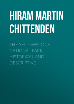
Opp. page 22.
Colter's Route in 1807.
Click on image to view larger size.
Accordingly, after he had passed through Pryor’s Gap, he took a south-westerly direction as far as Clark’s Fork, which stream he ascended for some distance, and then crossed over to the Stinkingwater. Here he discovered a large boiling spring, strongly impregnated with tar and sulphur, the odor of which, perceptible for a great distance around, has given the stream its “unhappy name.”
From this point Colter continued along the eastern flank of the Absaroka Range, fording the several tributaries of the Bighorn River which flow down from that range, and finally came to the upper course of the main stream now known as Wind River. He ascended this stream to its source, crossing the divide in the vicinity of Lincoln or Union Pass, and found himself upon the Pacific slope. The map clearly shows that at this point he had reached what the Indians called the “summit of the world” near by the sources of all great streams of the west. That he discovered one of the easy passes between Wind River and the Pacific slope, is evident from the reference in the Missouri Gazette already alluded to and here reproduced for the first time. It is from the pen of a Mr. H. M. Brackenridge, a contemporary writer of note on topics of western adventure. It reads:
"At the head of the Gallatin Fork, and of the Grosse Corne of the Yellowstone [the Bighorn River], from discoveries since the voyage of Lewis and Clark, it is found less difficult to cross than the Allegheny Mountains. Coulter, a celebrated hunter and woodsman, informed me that a loaded wagon would find no obstruction in passing."
The “discoveries” are of course those of Colter, for no other white man at this time had been in those parts.
From the summit of the mountains he descended to the westward; crossed the Snake River and Teton Pass to Pierre’s Hole, and then turned north, recrossing the Teton Range by the Indian trail in the valley of what is now Conant Creek, just north of Jackson Lake. [L] Thence he continued his course until he reached Yellowstone Lake,[L] at some point along its south-western shore. He passed around the west shore to the northernmost point of the Thumb, and then resumed his northerly course over the hills arriving at the Yellowstone River in the valley of Alum Creek. He followed the left bank of the river to the ford just above Tower Falls, where the great Bannock Trail used to cross, and then followed this trail to its junction with his outward route on Clark’s Fork. From this point he re-crossed to the Stinkingwater, possibly in order to re-visit the strange phenomena there, but more probably to explore new trapping territory on his way back. He descended the Stinkingwater until about south of Pryor’s Gap, when he turned north and shortly after arrived at his starting point.
[L] For the names given by Captain Clark to these bodies of water, see Appendix A, “Jackson Lake” and “Yellowstone Lake.”
The direction of Colter’s progress, as here indicated, and the identification of certain geographical features noted by him, differ somewhat from the ordinary interpretation of that adventure. But, while it would be absurd to dogmatize upon so uncertain a subject, it is believed that the theory adopted is fairly well supported by the facts as now known. It must in the first place be assumed that Colter exercised ordinary common sense upon this journey and availed himself of all information that could facilitate his progress. It is probable that he was under the guidance of Indians who knew the country; but if not, he frequently stopped, like any traveler in an unknown region, to inquire his way. He sought the established trails, low mountain passes, and well-known fords, and did not, as the map suggests, take a direction that would carry him through the very roughest and most impassable mountain country on the continent. It is necessary to orient his map so as to make both his outgoing and return routes extend nearly due north and south, instead of north-east and south-west, in order to reconcile his geography at all with the modern maps. With these precautions some of the difficulty of the situation disappears.
Colter, it is therefore assumed, followed the great trail along the Absarokas to the Wind River Valley, and crossed the divide by one of the easy passes at its head. His two crossings of the Teton range were along established trails. He evidently lost his bearings somewhat in the vicinity of the Yellowstone Lake, but as soon as he arrived at the river below the lake he kept along the trail until he reached the important crossing at Tower Falls. If he was in company with Indians who had ever been through that country before, he learned that it would be no advantage to cross at Mud Geyser, inasmuch as he would strike the great Bannock Trail at the next ford below. Moreover, the distance below the lake to the point where Colter touched the Yellowstone is clearly greater than that to the Mud Geyser Ford. The bend in the river at the Great Falls, and the close proximity of the Washburn Range to the river, are distinctly indicated. The locality noted on the map as “Hot Springs Brimstone” is evidently not that near the Mud Geyser, as generally assumed, but instead, that of the now world-renowned Mammoth Hot Springs. As will be seen from the map, it is nearer the Gallatin River than it is to the Yellowstone where Colter crossed. If Colter visited the Springs from Tower Falls, as is not unlikely, a clue is supplied to the otherwise perplexing reference to the Gallatin River in the above extract from the Missouri Gazette, for it would thus appear that he was near the sources of both the Grosse Corne and of the Gallatin.
The essential difficulties in the way of this theory (and they exist with any possible theory that can be advanced) are the following: (1.) There is no stream on the map that can stand for the Snake River either above or below Jackson Lake, although Colter must have crossed it in each place. “Colter’s River” comes nearest the first location, and may possibly be intended to represent that stream; but Clark’s evident purpose to drain Jackson Lake into the Bighorn River doubtless led to a distortion of the map in this locality. (2.) The erroneous shape given to the Yellowstone Lake will be readily understood by any one who has visited its western shore. The jutting promontories to the eastward entirely conceal from view the great body of the lake and give it a form not unlike that upon Clark’s map. (3.) The absence of the Great Falls from the map is not easily accounted for, although the location and trend of the Grand Cañon are shown with remarkable accuracy. (4.) The absence of the many hot springs districts, through which Colter passed, particularly that at the west end of the Yellowstone Lake, may be explained by the same spirit of incredulity which led to the rejection of all similar accounts for a period of more than sixty years. It is probable that Clark was not willing to recognize Colter’s statements on this subject further than to note on his map the location of the most wonderful of the hot springs groups mentioned by him.
The direction in which Colter traveled is a matter of no essential importance, and that here adopted is based solely upon the consideration that the doubling of the trail upon itself between Clark’s Fork and the Stinkingwater River, and the erratic course of the route around Yellowstone Lake, can not be well accounted for on the contrary hypothesis. [M]
[M] In adopting, as Colter’s point of crossing the Yellowstone, the ford at Tower Creek, the author has followed the Hon. N. P. Langford, in his reprint of Folsom’s “Valley of the Upper Yellowstone.” (See Appendix E.) All other writers who have touched upon the subject have assumed the ford to be that near the Mud Geyser.
Such, in the main, is “Colter’s route in 1807.” That he was the discoverer of Yellowstone Lake, and the foremost herald of the strange phenomena of that region, may be accepted as beyond question. He did not, as is generally supposed, see the Firehole Geyser Basins. But he saw too much for his reputation as a man of veracity. No author or map-maker would jeopardize the success of his work by incorporating in it such incredible material as Colter furnished. His stories were not believed; their author became the subject of jest and ridicule; and the region of his adventures was long derisively known as “Colter’s Hell.” [N]
[N] This name early came to be restricted to the locality where Colter discovered the tar spring on the Stinkingwater, probably because few trappers ever saw the other similar localities visited by him. But Colter’s descriptions, so well summed up by Irving in his “Captain Bonneville,” undoubtedly refer in large part to what he saw in the Yellowstone and Snake River Valleys.
The story of Colter’s subsequent experience before he returned to St. Louis is thrilling in the extreme. Although it has no direct bearing upon this narrative, still, since it is part of the biography of the discoverer of the Upper Yellowstone, it can not be omitted. The detailed account we owe to the naturalist Bradbury, already referred to. He saw Colter above St. Louis in the spring of 1811, one year after his return from the mountains, and received the story directly from him. All other accounts are variations from Bradbury. Irving, who has made this story an Indian classic, borrows it in toto. Perhaps in all the records of Indian adventure there is not another instance of such a miraculous escape, in which the details are throughout so clearly within the range of possibility. It is a consistent narrative from beginning to end. In briefest outline it is as follows:
When Colter returned from his expedition of 1807, he found Manuel Lisa, of the Missouri Fur Company, already in the country, where he had just arrived from St. Louis. With him was one Potts, believed to be the same person who had been a private in the party of Lewis and Clark. In the spring of 1808, Colter and his old companion in arms set out to the headwaters of the Missouri on a trapping expedition. It was on a branch of Jefferson Fork that they went to work, and here they met with their disastrous experience.
One morning while they were in a canoe examining their traps they were surprised by a large party of Blackfeet Indians. Potts attempted resistance and was slain on the spot. Colter, with more presence of mind, gave himself up as the only possible chance of avoiding immediate death. The Indians then consulted as to how they should kill him in order to yield themselves the greatest amount of amusement. Colter, upon being questioned as to his fleetness of foot, sagaciously replied that he was a poor runner (though in fact very swift), and the Indians, believing that it would be a safe experiment, decided that he should run for his life. Accordingly he was stripped naked and was led by the chief to a point three or four hundred yards in advance of the main body of the Indians. Here he was told “to save himself if he could,” and the race began—one man against five hundred.
The Indians quickly saw how they had been outwitted, for Colter flew away from them as if upon the wings of the wind. But his speed cost him dear. The exertion caused the blood to stream from his mouth and nostrils, and run down over his naked form. The prickly pear and the rough ground lacerated his feet. Six miles away across a level plain was a fringe of cottonwood on the banks of the Jefferson River. Short of that lay not a shadow of chance of concealment. It was a long race, but life hung upon the issue. The Indians had not counted on such prodigious running. Gradually they fell off, and when Colter ventured for the first time to glance back, only a small number were in his wake. Encouragement was now added to hope, and he ran even faster than before.
But there was one Indian who was too much for him. He was steadily shortening the distance between them, and at last had arrived within a spear’s throw. Was Colter to be slain by a single Indian after having distanced five hundred? He would see. Suddenly whirling about, he confronted the Indian, who was astounded at the sudden move and at Colter’s bloody appearance. He tried to hurl his spear but stumbled and broke it as he fell. Colter seized the pointed portion and pinned the Indian to the earth.
Again he resumed his flight. He reached the Jefferson, and discovered, some distance below, a raft of driftwood against the head of an island. He dived under this raft and found a place where he could get his head above water. There, in painful suspense, he awaited developments. The Indians explored the island and examined the raft, but Colter’s audacious spirit was beyond their comprehension. It did not occur to them that he was all the time surveying their movements from his hiding place under the timber, and they finally abandoned the search and withdrew. Colter had saved himself. When evening came he swam several miles down the river and then went ashore. For seven days he wandered naked and unarmed, over stones, cacti, and the prickly pear, scorched by the heat of noon and chilled by the frost of night, finding his sole subsistence in such roots as he might dig, until at last he reached Lisa’s trading post on the Bighorn River.
Even this terrible adventure could not dismay the dauntless Colter, and he remained still another year in the mountains. Finally, in the spring of 1810, he got into a canoe and dropped down the river, “three thousand miles in thirty days,” reaching St. Louis, May 1st, after an absence of six years.
Colter remained in St. Louis for a time giving Clark what information he could concerning the places he had seen, and evidently talking a great deal about his adventures. Finally he retired to the country some distance up the Missouri, and married. Here we again catch a glimpse of him when the Astorians were on their way up the river. As Colter saw the well appointed expedition setting out for the mountains, the old fever seized him again and he was upon the point of joining the party. But what the hardships of the wilderness and the pleasures of civilization could not dissuade him from doing, the charms of a newly-married wife easily accomplished. Colter remained behind; and here the curtain of oblivion falls upon the discoverer of the Yellowstone. It is not without genuine satisfaction that, having followed him through the incredible mazes of “Colter’s Hell,” we bid him adieu amid surroundings of so different a character.
CHAPTER IV.
THE TRADER AND TRAPPER.
For sixty years after Lewis and Clark returned from their expedition, the headwaters of the Yellowstone remained unexplored except by the trader and trapper. The traffic in peltries it was that first induced extensive exploration of the west. Concerning the precious metals, the people seem to have had little faith in their abundant existence in the west, and no organized search for them was made in the earlier years of the century. But that country, even in its unsettled state, had other and important sources of wealth. Myriads of beaver inhabited the streams and innumerable buffalo roamed the valleys. The buffalo furnished the trapper with means of subsistence, and beaver furs were better than mines of gold. Far in advance of the tide of settlement the lonely trapper, and after him the trader, penetrated the unknown west. Gradually the enterprise of individuals crystallized around a few important nuclei and there grew up those great fur-trading companies which for many years exercised a kind of paternal sway over the Indians and the scarcely more civilized trappers. A brief resumé of the history of these companies will show how important a place they occupy in the early history of the Upper Yellowstone.
The climax of the western fur business may be placed at about the year 1830. At that time three great companies operated in territories whose converging lines of separation centered in the region about Yellowstone Lake. The oldest and most important of them, and the one destined to outlive the others, was the world-renowned Hudson’s Bay Company. It was at that time more than a century and a half old. Its earlier history was in marked contrast with that of later years. Secure in the monopoly which its extensive charter rights guaranteed, it had been content with substantial profits and had never pushed its business far into new territory nor managed it with aggressive vigor. It was not until forced to action by the encroachments of a dangerous rival, that it became the prodigious power of later times.
This rival was the great North-west Fur Company of Montreal: It had grown up since the French and Indian War, partly as a result of that conflict, and finally took corporate form in 1787. It had none of the important territorial rights of the Hudson’s Bay Company, but its lack of monopoly was more than made up by the enterprise of its promoters. With its bands of Canadian frontiersmen, it boldly penetrated the north-west and paid little respect to those territorial rights which its venerable rival was powerless to enforce. It rapidly extended its operations far into the unexplored interior. Lewis and Clark found its traders among the Mandans in 1804. In 1811 the Astorians saw its first party descend the Columbia to the sea. Two years later the American traders on the Pacific Coast were forced to succumb to their British rivals.
A long and bitter strife now ensued between the two British companies. It even assumed the magnitude of civil war, and finally resulted in a frightful massacre of unoffending colonists. The British government interfered and forced the rivals into court, where they were brought to the verge of ruin by protracted litigation. A compromise was at last effected in 1821 by an amalgamation of the two companies under the name of the older rival.
But in the meantime a large part of their best fur country had been lost. In 1815 the government of the United States excluded British traders from its territory east of the Rocky Mountains. To the west of this limit, however, the amalgamated company easily forced all its rivals from the field. No American fur company ever attained the splendid organization, nor the influence over the Indians, possessed by the Hudson’s Bay Company. At the time of which we write it was master of the trade in the Columbia River valley, and the eastern limit of its operations within the territory of the United States was nearly coincident with the present western boundary of the Yellowstone Park.
The second of the great companies to which reference has been made was the American Fur Company. It was the final outcome of John Jacob Astor’s various attempts to control the fur trade of the United States. Although it was incorporated in 1809, it was for a time overshadowed by the more brilliant enterprises known as the Pacific Fur Company and the Southwest Fur Company. The history of Mr. Astor’s Pacific Fur Company, the dismal experiences of the Astorians, and the deplorable failure of the whole undertaking, are matters familiar to all readers of Irving’s “Astoria.”
The other project gave for a time more substantial promise of success. A British company of considerable importance, under the name of the Mackinaw Company, with headquarters at Michilimacinac, had for some time operated in the country about the headwaters of the Mississippi now included in the states of Wisconsin and Minnesota. Astor succeeded in forming a new company, partly with American and partly with Canadian capital. This company bought out the Mackinaw Company, and changed the name to South-west Fur Company. But scarcely had its promising career begun when it was cut short by the War of 1812.
The failure of these two attempts caused Mr. Astor to turn to the old American Fur Company. The exclusion Act of 1815 enabled him to buy at his own price the North-west Fur Company’s posts on the upper rivers, and the American Company rapidly extended its trade over all the country, from Lake Superior to the Rocky Mountains. Its posts multiplied in every direction, and at an early date steamboats began to do its business up the Missouri River from St. Louis. It gradually absorbed lesser concerns, such as the Missouri Fur Company, and the Columbia Fur Company, and in 1823 was reorganized under the name of The North American Fur Company. In 1834, Astor sold his interests to Chouteau, Valle and Company, of St. Louis, and retired from the business. At this time the general western limit of the territory operated in by this formidable company was the northern and eastern slope of the mountains which bound the Yellowstone Park on the north and east. Its line of operations was down the river to St. Louis, and its great trading posts were located at frequent intervals between.
The third of the great rival companies was the Rocky Mountain Fur Company, which originated in St. Louis in 1822, and received its full organization in 1826 under the direction of Jedediah Smith, David Jackson and William Sublette. Among the leading spirits, who at one time or another guided its affairs, was the famous mountaineer James Bridger to whom frequent reference will be made.
This company had its general center of operations on the head waters of Green River to the west of South Pass. Unlike the other companies, it had no navigable stream along which it could establish posts and conduct its operations. By the necessities of its exclusively mountain trade it developed a new feature of the fur business. The voyageur, with his canoe and oar, gave way to the mountaineer, with his saddle and rifle. The trading post was replaced by the annual rendezvous, which was in many points the forerunner of the later cattle “roundups” of the plains. These rendezvous were agreed upon each year at localities best suited for the convenience of the trade. Hither in the spring came from the east convoys of supplies for the season’s use. Hither repaired also the various parties of hunters and trappers and such bands of Indians as roamed in the vicinity. These meetings were great occasions, both in the transaction of business and in the round of festivities that always prevailed. After the traffic of the occasion was over, and the plans for the ensuing year were agreed upon, the convoys returned to the States and the trappers to their retreats in the mountains. The field of operations of this company was very extensive and included about all of the West not controlled by the Hudson’s Bay and American Fur Companies.
Thus was the territory of the great West practically parceled out among these three companies. [O] It must not be supposed that there was any agreement, tacit or open, that each company should keep within certain limits. There were, indeed, a few temporary arrangements of this sort, but for the most part each company maintained the right to work in any territory it saw fit, and there was constant invasion by each of the proper territories of the other. But the practical necessities of the business kept them, broadly speaking, within the limits which we have noted. The roving bands of “free trappers” and “lone traders,” and individual expeditions like those of Captain Bonneville and Nathaniel J. Wyeth, acknowledged allegiance to none of the great organizations, but wandered where they chose, dealing by turns with each of the companies.