Читать книгу Berkshire - Horace Woollaston Monckton - Страница 7
На сайте Литреса книга снята с продажи.
4. Surface and General Features.
ОглавлениеTable of Contents
We have already mentioned that Berkshire may be divided into three natural divisions. The northern or Vale of White Horse district is for the most part rather low-lying ground, but there is a small range of hills along the course of the Thames or Isis from Faringdon towards Oxford. Badbury Hill, 530 feet above the sea, and Faringdon Clump, 445 feet, are quite prominent from a distance, and some of the other hills from Buckland to Wytham look imposing when seen from the river. Much of this district was to a large extent swampy and boggy ground in old days, and a part of it is still spoken of as “the moors” by the country people. Some of the village names end in “ey,” suggesting that they were islands in the marsh district. Goosey and Charney are examples. A good deal of the district is stiff clay, and there is difficulty in getting a supply of good water, hence we find a number of towns and villages, like Wantage for instance, close to the chalk downs, where there are many springs.
The second or central division of Berkshire is the district of the chalk land. The downs of Berkshire are separated from the Chiltern Hills, which are the chalk hills of Oxfordshire, by the valley of the river Thames, whilst on the west the chalk downs run on into Wiltshire without any natural break. The chalk ridge rises sharply up from the Vale of White Horse, and a large part of the crest is over 700 feet above the sea. White Horse Hill attains a height of 856 feet, and the village of Farnborough is 712 feet above sea level. There is a general slope of the chalk surface downwards towards the south, so that even the high part of Lambourn Downs is well below the 700-feet contour line, and long and beautiful valleys run up from the Newbury district into the chalk downs.
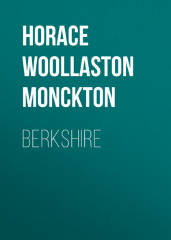
Crown Hill, South Ascot
(Showing characteristics of a sandy district)
The northern border of the chalk district is a well defined line; not so the southern border. The chalk gradually bends downwards underground and is covered by sand, gravel, and clay, so that in many places we find the upper part of the hills sandy or clayey whilst the valleys beneath them are chalk. Thus Bussocks Camp and Snelsmore Common near Newbury are situated upon a ridge of gravel, sand, and clay, but the road from Chieveley to Newbury in the valley below the camp runs for most of the way along a chalk valley, and the chalk extends all around, but underneath the sand, gravel, and clay. Hence there is no definite southern boundary to the chalk district, and there is a bit of chalk country near Inkpen. The projecting part of Berkshire, bounded on the south by a line drawn from Twyford to Maidenhead and on the other sides by the river Thames, is also mainly a chalk district.
Cookham Dean
(Showing characteristic chalk country)
The southern division of the county has in consequence no definite northern border, but a line drawn from Hungerford in the west to Maidenhead in the east will have very little of chalk district to the south and very little forest country to the north, and is consequently a good practical boundary between the second and third divisions of Berkshire.
The scenery of the southern division is quite different from that of the other two divisions. The country consists to a great extent of wide and flat table-land 300 to 400 feet above the sea, in which the rivers and streams have cut valleys. There are also extensive tracts of clay land, but the clay is often concealed under a few feet of gravel.