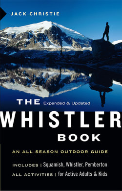
Читать книгу The Whistler Book - Jack Christie - Страница 10
На сайте Литреса книга снята с продажи.
Оглавление> 1 Squamish Area
> LOCATION : East end of Howe Sound, 60 km (37 mi) north of Vancouver, 58 km (36 mi) south of Whistler, 95 km (59 mi) south of Pemberton
> ACTIVITIES : Camping, cycling, fishing, hiking, kiteboarding, nature observation, picnicking, mountain biking, rock climbing, viewpoints, walking, whitewater rafting, windsurfing
> HIGHLIGHTS : Waterfalls, climbing walls, estuary trails— all within sight of each other
WELCOME TO the self-proclaimed outdoor recreation capital of Canada. That may seem like a grandiose claim, but a quick scan of the recreational opportunities in Squamish— or “Squish,” as it’s affectionately known—offers quick verification. Despite the town’s veneer of newness, however, this diversity is not a recent phenomenon. For more than a century, day-trippers have been exploring the mountains, rivers and lakes that surround this tight-knit community of 16,000 at the head of Howe Sound. Members of the Vancouver Natural History Society, for example, regularly journeyed here by boat in the early 1900s on their way to the alpine meadows of nearby Mount Garibaldi. The society, bolstered by the local government, successfully lobbied in the 1920s for the creation of 1947-square-km (752-square-mi) Garibaldi Provincial Park. By the 1930s, hundreds of hikers were trekking and skiing in the provincial park’s Diamond Head region, which affords panoramic views of the Squamish area.
New road and rail connections—including the Squamish Highway (Highway 99), which first connected Whistler and Vancouver in the 1960s—conveniently coincided with a flood of interest in the area’s natural charms. Rock climbing on the Stawamus Chief, a freestanding granite monolith that rises beside the highway at the town’s southern entrance, caught national attention in 1961 when Jim Baldwin and Ed Cooper made the first successful ascent while crowds of more than 10,000 looked on.
SQUAMISH AND AREA
Climbers put Squamish on the map—and more than a few magazine covers—as the town began to quietly cement its reputation in outdoor recreation circles. And success bred success. In the 1970s, when the upstart sport of windsurfing took off, a new kind of tourist blew into town. There may not be much surf where the Squamish River meets Howe Sound along the town’s western perimeter, but this confluence is one of the most challenging and easily accessible stretches of water for windsurfers on the West Coast. Predictable winds fan the shoreline. Thanks to these strong blasts, kiteboarding is the latest extreme sport to hit Squamish.
Another technologically innovative piece of sports equipment, the mountain bike, arrived on the scene in the 1980s. The trailbuilding efforts of volunteer groups such as the Squamish Off-Road Cycling Association (www.sorca.com) and the Squamish Trails Society (www.squamishtrails.ca) ensure that new routes appear each year. At last count there were 122.
Roll all these activities together, and you can see why past decades have seen scores of fresh-air enthusiasts leave their footprints— and fingerprints—in and around Squamish. It’s one of my favorite year-round destinations, with a sea-level location that guarantees its low-elevation trails remain snow-free most of the year. The Test of Metal (www.testofmetal.com) endurance mountain bike race in June, softball tournaments in July, and Squamish Days Loggers’ Sports (www.squamishdays.org) on the first weekend in August draw crowds throughout the warm-weather months. Just as numerous are the birdwatchers who gather in January for the annual eagle count or to stroll the estuary dike trails with binoculars in hand looking for trumpeter swans.
It’s important to note that Highway 99 isn’t the town’s main street. That honor more properly belongs to Cleveland Avenue. Not that you’d know it. Any sense of the historic downtown core is all but shuttered from view, thanks to a strip of fast-food franchises that line the west side of Highway 99, which the late Squamish pioneer Rose Tatlow labeled “Hamburger Row.” Tatlow, who was named honorary senator by the municipal council in recognition of her lifelong service to the community, lived on the shore of the Mamquam Blind Channel directly across from Cleveland’s intersection with Highway 99. Little evidence of her modest residence remains other than several fragrant honeysuckle vines. Instead, leafy Rose Park (see page 20) offers a tranquil resting place from which to contemplate the placid surroundings. While Tatlow, who died in 1998, might have condemned town planners for allowing the likes of Taco Bell to dominate the landscape, I’m certain she would have been tickled to have the architecturally pleasing Squamish Adventure Centre as her neighbor.
With the opening of the Whistler Olympic/Paralympic Park, Squamish has also begun to position itself as a snowshoeing and Nordic skiing destination. Aside from the well-known trails at Diamond Head in Garibaldi Park (see chapter 2), local businesses are promoting the 2010 Olympic cross-country skiing facilities in the Callaghan Valley (see chapter 9), which are just a 30 -minute drive north. Squamish presents another choice besides Whistler for people looking for affordability, right in the middle of the action.
> SHANNON FALLS PROVINCIAL PARK
Access: Entrance to the park is well marked, at the traffic lights on the east side of Highway 99, south of the Stawamus Chief roadside pullout.
There is a fine viewpoint at the Squamish lower town limits, 1.6 km (1 mi) south of Shannon Falls on the west side of Highway 99. This is just above the spot where British naval captain George Vancouver and his crew camped while surveying Howe Sound in 1792. The Garibaldi viewpoint marks the approach to a remarkable series of geographical formations, including the eye-catching granite Stawamus Chief Mountain and B.C.’s third-highest waterfall—Shannon Falls, linked to the Chief by a 2.5-km-long (1.5-mi) trail. The white veil of water drops 335 m (1099 ft) from an easily spotted ridge above Highway 99 to a creekbed below that empties into nearby Howe Sound. In the late 1800s, the falls drove a wooden waterwheel to provide energy to a nearby sawmill. In the 1970s, their pure water was used to brew beer. These days the falls deliver mental refreshment to those seeking a soothing getaway from life’s hectic pace.
Shannon Falls is a tourist magnet during summer months, with a parking lot that’s usually full by noon on weekends May through September. A fee of $3 per vehicle per day is charged year-round, or $1 per hour if you’re just stopping by for a quick look. Two large picnic areas accommodate families and groups who like room to stretch out and play while barbecuing. The falls maintain a constant roar while the nearby Chief’s south face looms on high; many visitors understandably take advantage of this striking backdrop for photographs.
It takes only a few minutes to walk up to the falls from the parking lot. A well-built system of smooth trails, wooden staircases, and bridges leads to two viewing platforms near the base of the falls. On a hot day, the combination of mist from the falls and shade from some impressive large trees provides the perfect tonic, especially if you climb the stairs leading off to the left just before the main viewing spot to a higher vantage point at the base of the falls where fewer visitors venture. A breeze stirred by tons of falling water whips the mist into billowing clouds, making this an ideal place to get a natural facial. I particularly enjoy visiting here in fall when leaves on broadleaf and vine maple trees display vibrant colors.
To combine a visit to the falls with a walk to the Stawamus Chief, take the well-marked trail that leads 2.5 km (1.5 mi) north from the parking lot along the base of Goat Ridge. It crosses a small bridge at Oleson Creek that links with the Chief’s primary hiking route.
SLITHERIN’ SAY-NOTH-KA First Nations mythology tells of a two-headed sea serpent whose expeditions wore the spillway for Shannon Creek. Indeed, the falls’ rock face does look like snakeskin.
> STAWAMUS CHIEF MOUNTAIN
Access: The main entrance to Stawamus Chief Provincial Park, along with nearby climbers’ access parking lot, lies on the east side of Highway 99 south of the Mamquam Forest Service Road intersection. Ability Level: Strenuous
The Stawamus Chief is the sentinel of the Squamish Valley. As you journey north on the Sea to Sky Highway from Vancouver, the sight of this 702-m (2303-ft) granite monolith comes as a relief, the signal that the highway’s sinuous twists and turns lie behind now. To appreciate its majesty, pull over for a good look from the provincial park’s roadside viewpoint on Highway 99.
To the trained eye, the mountain’s smooth-faced apron of blue-gray rock reveals dozens of vertical routes to ledges from which to take in the bigger picture. The action in the parking lot below, where climbers spread out their ropes and pitons, carabiners and camming tools, daisies and aiders, belay and rappel devices, harnesses and chalk bags and all-important gear slings, is evidence of the amount of equipment and serious preparation required to make even a basic climb of the Chief’s west face. (Information on climbing routes on the Chief and other climbs in the Squamish region can be gleaned from Kevin McLane’s The Climbers Guide to Squamish.)
From the Base: One of the easiest routes at the base of the Chief begins at the well-marked climbers’ access parking lot beside Highway 99 just north of the Chief’s more prominent viewing zone. Follow the welcoming Apron Trail that leads a short distance uphill through the forest and connects with the Grand Wall area. An easy stint of free climbing deposits you on a ledge from which most climbers begin to rope up. Even if you go no higher, you can now claim to have climbed on the Chief. Enjoy an unobstructed view of the town spread below. Unlike the monolith, which took an estimated 60 million years to assume its present shape, the transformation of Squamish’s formerly industrial waterfront seems to be occurring in the blink of an eye.
Hiking Up: If you’re more inclined to slip on a pair of lightweight hiking shoes and throw some snacks and water into a backpack, consider two alternatives to storming the walls. These routes may make you feel like you’re climbing a clandestine staircase to gain access to the turrets of a castle—especially if you begin early, before everyone else who knows the way shows up too.
There are two approaches to the Chief’s trailhead. One leads from nearby Shannon Falls Park (see above); the other begins a short distance above the Highway 99 roadside viewpoint. From Shannon Falls, signs point the way. Travel time to the Chief is 30 minutes on this well-maintained trail, the first half of which leads over level ground through an alder forest. Once it reaches the base of the mountain, the trail begins to climb beside the smooth granite rock face, which is covered in places by green lichen. A small bridge over Olesen Creek, gurgling through a cleft in the mountainside, provides a good glimpse of Howe Sound below. The Chief Peaks Trail begins across the creek.
Squamish Spit
The trailhead in Stawamus Chief Park lies beside the 63-site campground (16 vehicle and 47 walk-in sites; see www.env.gov.bc.ca/bcparks for details). This is where out-of-town climbers are typically ensconced. Park here. Once on foot, you’ll pass a spacious cooking shelter with picnic tables, stainless steel counters, and food lockers to help deter bears.
Pay particular attention to the cautionary signs posted at the foot of the first of a series of steep staircases. As BC Parks takes pains to point out, “This is not a ‘walk in the park.’” Also listed are recommendations to dress properly and avoid injury. Equally telling are the older markers affixed to the trees by the Federation of Mountain Clubs of B.C., which maintained the trail before the establishment of the provincial park here in 1997. They say: “To all peaks carry water.” There is little shade on much of the trail, so pack plenty of fluids.
Stawamus Chief Mountain has three summits, each one progressively higher and separated by deep clefts. At the outset, a common trail leads upwards towards all three. It then divides into two separate routes. Along the trail the handrails are smooth and well oiled from constant use. The bridge to the Shannon Falls Trail soon appears over Olesen Creek where a bench provides good views over Howe Sound and the ripples where the outflow of the Squamish River meets the tidal action. Several distinct shades of green delineate the zones of dissolution as fresh and salt water blend. This is a good place to assess how much higher you want to climb. It helps if you are as psyched as the climbers on the Chief’s smooth face.
Wood and stone stairs lead upwards beside Olesen Creek. Potholes in the creek brim with clear water. The cool sounds of the rushing water help your frame of mind on a hot day. At the junction 40 minutes beyond the bridge, the majority of hikers head for the South (or First) Summit, a 7-km (4.3-mi) round trip. There’s no loss of face in joining the relatively easier conga line to the South Summit (elevation 600 m/1969 ft), particularly if you are hiking with young children or dogs. That said, I recommend the numerous rewards—such as some modest rock climbing and a great view of a notch on the Chief’s north face—if you choose the slightly more challenging route to the modestly higher Centre (Second) and North (Third) Summits, an 11-km (6.8-mi) round trip. In fact, one of the most pleasant options, particularly if you have an extra hour’s time, is to follow the loop that links both.
No matter which summit you choose, be prepared for an unrelenting regime of up, up, and up (and the resultant knee-knackering corollary of down, down, down). Pace yourself by monitoring your breathing. Never climb so fast that you can’t breathe through your nose—the most effective way to feed your oxygen-starved muscles. This also ensures you take the time to enjoy your surroundings. Unlike the stark openness of the Chief’s apron, its hiking trails lead beneath tall stands of ramrod-straight Douglas fir. These provide shade as welcome as the steady breeze that funnels round the mountain off Howe Sound. The constant owl-like hooting of one or more male blue grouse accompanies you.
> SOUTH SUMMIT
During the entire climb, you will find yourself walking up, around, next to, and under the solid granite of the Chief. The trail is smooth and wide in most places. And the higher you climb, the more exhilarating it becomes, until, finally, near the top and above the tree-line, you reach a broad and open windswept spot. The most difficult part is now behind you; relax and contemplate the lunch menu on this final section. From here you can see Shannon Falls in profile to the south, with the ribbon of Highway 99 curving beyond until it goes out of sight past the Garibaldi viewpoint. To the north, the Squamish River cuts through the valley between Brackendale and Howe Sound. Across the water to the west are the glaciated peaks of the Tantalus Range.
Your imagination may begin to work overtime as you approach the edge of the cliffs. Thinking about the sheer walls below is dizzying. My legs always tremble involuntarily up on the Chief, as if the Earth were moving—strange, considering that underfoot is one enormous piece of rock. It’s a bit of a test of will to get close to the edge as the wind blows over the top. If you’re feeling particularly intrepid, have someone hold onto your ankles while you lean over for a look. It’s not as dangerous as it feels, but obviously it’s best to be cautious.
> CENTRE AND NORTH SUMMITS
If you take inspiration from rock-climbing tales yet are not prone to tackle the Chief’s sheer front face, you can still thrill to visceral contact with the rough granite walls via the Chief’s back route—just below the Centre Summit, where bolted lengths of chain and a metal ladder have been placed to assist hikers. Once on top, views quickly open up as the forest gives way to low-lying scrub pine, evidence of the summit’s dry and windswept environment. Note: Keep careful track of the orange markers designating the route. Owing to the scarcity of trees, the markers thin out at both the Centre and North summits, where dabs of orange paint on rock indicate the way. As you look across to the South Summit, the geography of the Squamish Valley is suddenly revealed.
Several rewards await you for carrying on as far as the North Summit (elevation 650 m/2133 ft). For one, as you make your way up the cleft between the two, you pass a dramatic viewpoint at the top of the North Gulch, where the walls are fortress-steep. Even better, once on the summit, the sound of an unnamed waterfall cascading down the slopes of an adjacent ridge drowns out the buzz of traffic, the drone of airplanes, and the nattering of hiking groups rising from far below. Find yourself a picnic spot sheltered from the constant breeze (which does help keep the bugs at bay in summer) and spread out.
To the north, Mamquam Glacier’s white face shares the horizon with the Diamond Head formation (see chapter 2); to the south, the peak of Sky Pilot Mountain dominates Goat Ridge, where the headwaters of Shannon Creek gather above the falls. As you make your way down off the North Summit and descend through a narrow, boulder-filled canyon, pay careful attention to the route markers. Your spirits will be buoyed by the satisfaction of having made the climb and a sense of relief at getting safely down after all the drama up top, but your toes will be shoved into the front of your hiking shoes for the next 90 minutes, so choose socks and footwear accordingly. This hike is an adventure and an accomplishment. You’ll never pass the Chief again without remembering that wonderful shaky feeling you had at the summit.
> SMOKE BLUFF SPARK
Access: Turn east off Highway 99 onto Loggers Lane at the Cleveland Avenue intersection. Head north past Rose Park for 1 km (0.6 mi) to a gravel driveway and a paved parking lot opposite the Squamish Adventure Centre where a sign depicts a climber. Outhouses and a notice board flank the trail. Ability Level: Moderate
Rock climbing around Squamish is not limited to the Chief. Just as popular are the Smoke Bluffs, a ridge that rises above the Mamquam Blind Channel to the north, on the east side of Highway 9 9. These small cliffs are laced with cracks that appeal to climbers of all abilities. And unlike many of the routes on the Chief, those on the Smoke Bluffs (or simply the Bluffs) are shorter—though no less intimidating in places—and much easier to reach. Thanks to their southern exposure, the granite walls also dry quickly in the morning sun. In fact, it’s the moisture evaporating from the walls that gave the bluffs their name. Climbers groom the rock faces with wire brushes to obtain an ideal smoothness.
After years of lobbying by the Federation of Mountain Clubs of B.C. and the Climbers Access Society of B.C., in 2006 a public climbing park was created at the Bluffs, not just for rope hangers but for everyone to enjoy. An aerial map posted in the climbers’ parking lot details various trails and several viewpoints—the best lie above Pixie Corner and beside Penny Lane, as well as beside Burgers & Fries, the most frequently climbed cliff in Canada. Wood and rock staircases lead up to one section called the Octopus’s Garden. Farther west, the loop trail narrows as it curves between two smooth granite walls where small groups of climbers regularly practice. They won’t mind you watching if you are quiet; safe climbing requires complete concentration.
> SQUAMISH ESTUARY TRAILS
Access: Turn south from Highway 99 onto Cleveland Avenue (the town’s main drag) to Vancouver Street; then head three blocks west to the trailhead and the Squamish estuary. Ability Level: Easy
The interpretive loop trail that leads through the town’s oceanfront estuary makes a fine wildlife-viewing walk. A wooden sign posted at the Vancouver Street trailhead bears a detailed map of the estuary and the grassy dike trail that rambles west past a massive new housing development and log-sort yard beside channeled waterways to Cattermole Slough, home to two hundred bird species, such as meadowlarks and sandpipers as well as overwintering waterfowl such as goldeneye, bufflehead, mergansers, and trumpeter swans.
Meadow Trail leads out on the estuary proper where uncluttered views really open up, with the smooth granite walls of the Stawamus Chief displayed to great effect. Equally arresting, if the skies are clear, is the dagger point of Atwell Peak and its broad-shouldered companion, Dalton Dome. Together they dominate the skyline of Garibaldi Provincial Park to the north. The trail follows the Central Channel atop the Heritage Dykes, the oldest human-made structures in Squamish. In the 1890s, Chinese laborers built these ramparts to reclaim the marshland for hayfields. Herons, Canada geese, and a host of ducks and seabirds work the channel. Strategically placed benches provide good viewing perches. Allow 45 minutes to complete the loop.
The narrow dike path is bordered by brick-red rosehips, and drifts of sedges pattern the surface of the slough. The white stalks of pearly everlasting rival Shannon Falls’ snowy tresses, which can be seen cascading down the slopes to the south of the Chief. Spires of solitary, stunted Sitka spruce anchor the estuary’s perimeter. Bright yellow cedar waxwings flit among the snags, seemingly oblivious to the strong winds, which power kiteboarders aloft in the distance. Wild roses scent the air. Breezes riffle the tall grass. From midsummer through fall, a palette of colors is on display, from blond cattails backed by an evergreen forest to silver poplar leaves framed against a robin’s-egg-blue sky.
Farther inland, two additional estuary trails—Forest Loop and Swan Walk—lead through wooded areas to the west of the BC Rail spur line. The easiest way to reach both trails is to follow Bailey Street, an industrial gravel road that curves around the north end of Chieftain Centre off Cleveland Avenue near Highway 99. Several approaches to the estuary trails are clearly marked here. Take Swan Walk for the best chance of spotting the trumpeter swans. These majestic honkers sport the largest wingspan of all West Coast birds.
> SQUAMISH HARBOUR DOCK
Access: At the intersection of Vancouver Street and Loggers Lane in downtown Squamish.
Until rail and road connections were opened in the 1950s, visitors from Vancouver arrived via boats, which often docked in the Mamquam Blind Channel. Prior to a disastrous flood in 1921, the Mamquam River flowed into Howe Sound along this channel. These days, the quiet backwater that extends to Rose Park (see below) almost drains dry at low tide. A paddle in this tranquil spot provides an excellent way to appreciate many of Squamish’s natural features, such as the Malamute—the “mini-Chief”—that rises sharply from the water directly across the Mamquam Blind Channel from the harbor dock adjacent the Squamish Yacht Club. A ramp here provides easy access to the channel for both hand-carried vessels and boat trailers. Best times to put in are early in the day before breezes begin to freshen on Howe Sound. One of my favorite sights out on the water is an oceangoing canoe paddled by a dozen or more members of the Squamish First Nations.
> SQUAMISH MUNICIPAL PARKS
Access: Adjacent to the district Forest Service office on the east side of Highway 99, on the south side of the Mamquam River Bridge.
At Brennan Park, a large community leisure center with an indoor swimming pool anchors the playing fields. There are tennis courts beside the Mamquam River and picnic tables dotting the recreation trail. You can explore the Mamquam via this dike path to its mouth at the Squamish River. In summer, when water levels are low, there are also good sandbars to fish from.
Loggers Lane leads south beside the park and its campground for visitors, many of whom come to compete in tournaments or the annual Squamish Days Loggers’ Sports on the first weekend in August. It then meanders past the Smoke Bluffs trailhead to Rose Park, named in honor of Squamish pioneer Rose Tatlow, whose home once stood beside the Mamquam Blind Channel. The recently minted park is dedicated to the memory of Squamish’s pioneer families, such as the Carsons and the Wrays, and their sections of the park are formally planted with flowers, cherry trees, and trellised Interlaken seedless grapes that will soon bear fruit. Rose Tatlow, whose homesite, along with an adjacent property to the north, is more sheltered from the sounds of highway traffic, would have approved of the new picnic table on a small deck by Lily’s Garden, with its views of the slough and the climbing bluffs.
> NEXEN BEACH
Access: From Highway 99, follow Cleveland Avenue, the town’s main street, to its south end. Cross the train tracks, then turn right onto an access road which leads to the beach.
Piles of driftwood lie jackstrawed along the shoreline of Nexen Beach. At first glance, Nexen’s hard-packed, dark surface appears more like a mudflat where it stretches out into the shallow reaches of Howe Sound, the southernmost fiord on the North American coastline.
Bounded by an abandoned wharf to the south and an active cargo dock on the north, Nexen Beach is the centerpiece of an ambitious waterfront redevelopment plan set to unfold over the next decade. A passenger-ferry terminal, hotel, conference center, arts center, and more are envisioned to rise on the 28-ha (69 -acre) site. Dozens of wave riders gather at Nexen Beach in July for the North American Windsurfing Championships. An onshore wind blows here with the same sustained intensity that draws windsurfers and kiteboarders to the Squamish Spit, north of Nexen at the mouth of the Squamish River. Nexen Beach is envisaged as a wind-sport training area. Design modifications in windsurfing boards make Nexen Beach the logical place to launch. These newer boards are fatter, a tad shorter, and more rectilinear than previous models. Their most radical design feature is a meter-long (yard-long) center fin that provides greater stability and allows these boards to carry a much larger sail. Launching one is best done in shallower water than is found at the Spit, which makes Nexen Beach an ideal place to practice.
An extensive paved area behind the beach also offers a place for novice kiteboarders to practice their kite-handling skills. If you find Nexen Beach somewhat underwhelming, for instant relief just raise your eyes to the twin sights of Stawamus Chief Mountain’s Grand Wall and nearby Shannon Falls’ white scarf of cascading water. The view is reason enough to pay the beach a visit. One of the beach’s most novel features is a curved straw bale-and-adobe “fort” above the high-tide line, a legacy of the popular Squamish Equinox Music Festival (SERF) held in June. “Fort Nexen” provides a much-needed windbreak behind which bathers can warm up while at the same time offering unobstructed views of ocean action.
> WHAT ’S IN A NAME?
Although there have been attempts to translate “Squamish” as a First Nations expression meaning “mother of the wind,” there is no linguistic root for the name. The original European explorers rarely recorded the names of the native people they encountered; according to noted Northwest Coast anthropologist and linguist Dr. Wayne Suttles, none can be identified with names used later. The name appeared in a 1907 study as “Squawmish,” referring to the aboriginals who still inhabit two dozen settlements along the Squamish River.
> SQUAMISH SPIT
Access: Windsurfer signs indicate the Squamish Spit turnoff, west from Highway 99 at the traffic lights onto Industrial Way, then guide travelers past the West Coast Railway Heritage Park to the unpaved dike access road.
The Squamish Spit is a 4-km (2.5-mi) finger of dike at the mouth of the Squamish River where it flows into Howe Sound. This narrow piece of land helps keep the harbor free of silt so that large freighters can tie up nearby. But as windsurfers have long known, there’s also no finer place to catch an ocean breeze. As predictable as the sunrise, each day around noon a strong wind carries across Howe Sound. And woe betide those caught out on the turquoise-toned waters unprepared to ride this zephyr. It blows with such force that the unwary can’t right themselves once dunked. Fortunately, there is an emergency rescue service available courtesy of the Squamish Windsports Society (www.squamishwindsurfing.org). Launch fees at the spit are currently $20 per day or $75 for a season’s pass.
At the very tip of the spit is the launch area. You can drive to a drop-off point beside it, unload your board, then park if you’re here for sport. If you just want to watch, come out by bicycle to avoid the inevitable congestion, though be warned: the surface of the dike is loose gravel, not the best material on which to ride.
Kiteboarders are the new kids on the spit, and these high flyers are turning heads and rapidly attracting converts from the ranks of windsurfers, wakeboarders, snowboarders, and even motocross riders. They’ve also created controversy. That’s because laying out the lines of one kiteboard prior to launch takes up the same amount of room that six windsurfers need, and space is already at a premium on the spit, which boasts more high-performance sailing days than almost anywhere else in North America.
Out on the spit, due west of the Stawamus Chief, kiteboarders take wind sports to new heights—literally. These latter-day Icaruses enjoy what are arguably the biggest and best views in the entire Sea to Sky corridor: Shannon Falls, the Stawamus Chief, Sky Pilot Mountain, Goat Ridge, Mamquam Mountain, Atwell Peak, and Mount Garibaldi—all revealed in one 360 -degree panorama. Far below, the dike in summer is lined with pink Douglas spirea, or hardhack, which at a glance can be mistaken for fireweed.
There are often a hundred or more vehicles parked on the shoulders of the spit on summer afternoons. But don’t let that stop you from checking out the action. Find a spot on the bank to watch where you’re not in the way, then marvel at these aerialists as they ride the wind high above the waves.
> SQUAMISH ADVENTURE CENTRE
Access: Turn east off Highway 99 just north of the Cleveland Avenue intersection (38551 Loggers Lane; 604-815-5084; www.adventurecentre.com)
Squamish styles itself as the outdoor-recreation capital of Canada, and that’s what its boldly designed, almost 3,000 square-meter (9,500 square-foot) Adventure Centre silently proclaims to passersby on Highway 99 at the entrance to the city’s downtown core. Designed to emulate a bald eagle spreading its wings, the soaring glass structure is composed of 210 panels of half-inch tempered glass, one of the few building materials not sourced locally. The building’s main columns were milled from Douglas fir, which, along with the crushed basalt granite pad, came from the Squamish Valley.
The center promotes the joys of kayaking, river rafting, mountain biking, eagle viewing, windsurfing, kiteboarding, skateboarding, camping, and above all else, rock climbing, a sport that first put Squamish on the adventure map in the 1960s. Guided outdoor-adventure trips can be booked here while you enjoy a snack at the center’s Pause-Cafe or shop for guidebooks, maps, and souvenirs. As well, a series of carved wooden panels details the history of Squamish, particularly the events of the twentieth century.
> THE INSIDE TRACK
> Camping: Valhalla Pure Outfitters for equipment rentals (1-877-892-9092; www.squamishgear.com)
> Cycling: Corsa Cycles (604-892-3331; www.corsacycles.com) for parts and service; Tantalus Bike Shop (604-898-2588; www.tantalusbikeshop.com)
> Fishing: River’s Edge Sportfishing Outfitters for licenses, gear, guided tours, and tips on where the fish are biting (604-898-5656)
> Rock Climbing: Climb On Equipment (604-892-2243; www.onsightequipment.com), Squamish Rock Guides (604-892-7816; www.squamishrockguides.com); Vertical Reality (604-892-8248)
> Skateboarding and Snowboarding: Sequence Board Supply (604-892-6314)
> Tourist Information: 604-815-4991 or 1-866 -333-2010; www.tourismsquamish.com
> Whitewater Rafting: Sunwolf Outdoor Centre (1-877-806 -8046; www.sunwolf.net); Canadian Outback Adventures (1-800 -565-8735; www.canadianoutback.com)