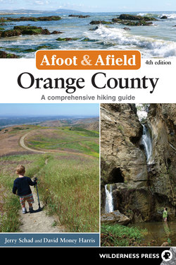
Читать книгу Afoot and Afield: Orange County - Jerry Schad - Страница 30
На сайте Литреса книга снята с продажи.
Оглавлениеtrip 4.2 Laurel Canyon Loop
Distance 3.5 miles (loop)
Hiking Time 2 hours
Elevation Gain 700’
Difficulty Moderate
Trail Use Good for kids
Best Times All year
Agency OC Parks: LCWP
Permit OC Parks parking fee required
DIRECTIONS Park at Laguna Coast Wilderness Park’s Willow Canyon staging area on the west side of Laguna Canyon Road, 3 miles north of Laguna Beach. This point is 5 miles south of the 405 Freeway, 0.7 mile south of the 73 Toll Road, and 0.2 mile south of the intersection of El Toro and Laguna Canyon Roads.
The best single hike within the Laguna Coast Wilderness Park is surely the secluded Laurel Canyon loop. Though it lies close to the San Joaquin Hills Transportation Corridor tollway, that roadway and much of its associated urban development is hidden from both sight and sound along most of the route.
Volunteers frequently staff a booth at the Willow Canyon staging area, offering tips about the logistics of hiking in the park as well as the area’s natural history. Follow the fire road beyond—Willow Canyon Road, which gains nearly 600 feet of elevation in the next 1.5 miles. Springtime wildflowers bloom in profusion along this stretch, which cuts along east- and north-facing slopes smothered in thick chaparral.
Banshee Rock, in Laurel Canyon, was formed by sandstone weathering.
At 1.5 miles, turn right on the first intersecting pathway. Traverse a grassy meadow, and then follow the trail as it plunges down through more dense growths of chaparral toward the narrow bottom of Laurel Canyon. The deeper you go, the more you gain a sense of seclusion. Once you arrive in the canyon bottom (2 miles), don’t miss the turn onto the narrow trail that branches right and goes down (not up) the canyon.
Graced with gorgeous oaks and sycamores (and copious amounts of poison oak), Laurel Canyon has recovered from the extremely hot, fast-moving Laguna Beach Fire of October 1993. Nearly all of the vegetation you see here is no stranger to periodic fires. Centuries ago, coastal Southern California landscapes, such as this one, were visited by fire every decade or so.
At 2.4 miles, you pass near the lip of a dramatic dropoff—a seasonal waterfall nearly 100 feet high. During the extraordinarily wet winter of 2005, hikers beheld a spectacular sight of plunging water, but most years, this declivity sports only a modest trickle.
Past the lip of the falls, you swing to the left side of the canyon bottom and descend along a dry, south-facing slope. By 3 miles, you emerge in a grassy meadow that is either green, golden, or transitional in color, depending on the season. Cavernous sandstone outcrops dot the meadow on the left and the slope on the right. The shapes of some suggest grotesque skulls and other figures. The path through the meadow soon flanks busy Laguna Canyon Road, climbs south to an exposed earthquake fault, and returns you to your starting point.