Читать книгу Fly Fishing the Mountain Fork River - Jesse King - Страница 3
ОглавлениеMountain Fork River (Southeast Oklahoma)
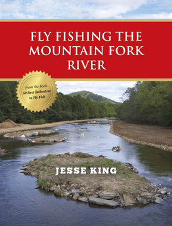
Location: Eight miles north of Broken Bow in southeast Oklahoma and near Beavers Bend State Park. About a 3-hour drive from Dallas/Fort Worth, Shreveport, Tulsa, and Oklahoma City.
When you think fly fishing, you probably imagine Wyoming, Colorado, Alaska, or Montana. But Oklahoma? Not hardly. But then, it’s unlikely you’ve ever heard of the Mountain Fork River in the foothills of the Kiamichi Mountains in the Sooner State. The Mountain Fork was dammed in the early 1970s, forming 22-mile long, 14,000-acre Broken Bow Lake. The 170-foot-deep lake serves for flood control and hydropower generation.
This is historic Native American country. The town of Hochatown—subsequently inundated by Broken Bow Lake—was settled by the Choctaw in the 1830s. It is one of the largest lakes within the State of Oklahoma, and a popular destination for locals and visitors from neighboring Texas.
The dam, which backs up to Beavers Bend State Park, does not discharge high volumes of water from the hydropower plant through the park. Instead, a spillway was constructed approximately ½ mile to the west side of the dam, where water is released via a gate valve and flows about 4 miles before converging with the powerhouse discharge. Thus, the park is not affected by high water flows during periods of generation.
The 12-mile trout fishery is divided into three zones. Although each zone is approximately 4 miles long, they are quite different.