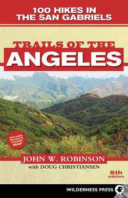
Читать книгу Trails of the Angeles - John W. Robinson - Страница 14
На сайте Литреса книга снята с продажи.
ОглавлениеMaps
It is important to know where you are in relation to roads, campgrounds, landmarks, and so on, and to have a general understanding of the lay of the land. For this orientation there is no substitute for a good map. Unless your trip is very short, and over a well-marked route, you should carry a map.
Besides the shaded relief trail map that accompanies this book, there are two other types of maps that will give you the picture you need of the San Gabriel Mountains. Each type has its advantages and disadvantages.
1. The US Forest Service sells recreation maps of each national forest. For the San Gabriels, you will need the maps of Angeles and San Bernardino National Forests. These maps show the highways, dirt roads, maintained trails, campgrounds, and major landmarks of the range, but not the topography. Their main advantages are that they give you an overall picture of the mountains and are fairly up-to-date, being revised frequently. Because they don’t show topographic features or ground cover, they are virtually useless for cross-country travel. These maps can be obtained at most ranger stations in the two national forests. Or write to the forest headquarters:
Angeles National Forest
701 N. Santa Anita
Arcadia, CA 91006
626-574-1613
San Bernardino National Forest
602 South Tippecano Ave.
San Bernardino, CA 92408
909-382-2600
2. If you do much hiking, particularly cross-country, you will want to use topographic (“topo”) maps because they afford accurate information about the topography and the forest or brush cover. Topo maps are available in several sizes and scales, but the best for the San Gabriels, because they are the most up-to-date and show the greatest detail, are the U.S. Geological Survey’s 7.5-minute topographic quadrangle series. Their scale is approximately 2.5 inches to a mile; the contour interval (elevation difference between contour lines) is 40 feet, and the area covered by each map is about 7 miles by 9 miles. They show most maintained and many unmaintained trails, as well as elevations, relief, watercourses, forest and brush cover, and man-made structures. Learning to read these maps takes some practice, but the savings in shoe leather and frayed temper make it a worthwhile undertaking. Twenty-seven topo maps (in the 7.5-minute series) cover the San Gabriel Mountains. The appropriate topo map(s) for each trip is cited in the individual trip headings. Topo maps can be bought at many sporting goods and mountaineering-ski shops, or can be ordered online from the USGS website: store.usgs.gov.
