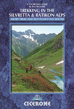
Читать книгу Trekking in the Silvretta and Rätikon Alps - Kev Reynolds - Страница 12
На сайте Литреса книга снята с продажи.
ОглавлениеINTRODUCTION
A clutter of limestone is turned into a natural rock garden on the way to the Schesaplana Hut (Trek 2, Stage 4)
Defining the borders of Switzerland, Austria and Liechtenstein south of Lake Constance (the Bodensee), the Rätikon Alps give the appearance of an abrupt wall of limestone erupting from meadows and screes full of flowers. That frontier wall pushes southeastwards to blend into the glacier-daubed range of the Silvretta Alps which extends as far as the Samnaun Group above the River Inn.
What mountains these are!
Although they form an almost continuous line, the two ranges are scenically and geologically very different. One is almost dolomitic in character, the other is reminiscent of the Western Alps. The Rätikon displays big blank faces of rock topped by turrets and towers; the Silvretta boasts snowfields and a number of retreating glaciers. No Rätikon summit reaches 3000 metres (the highest is the Schesaplana at 2964m), while the Silvretta claims at least 40 peaks in excess of that figure. To the south the Rätikon falls away into the lush green meadows of the Prättigau, to the north into Austria’s Montafon valley in Vorarlberg, while the Silvretta is partly contained by the upper reaches of the Prättigau on one side, by the lower Inn valley in Switzerland’s Graubunden on another, and by the Paznauntal east of the Bielerhöhe where the Austrian Tyrol contains its northern limits.
Despite many contrasts, the Rätikon and Silvretta Alps share glorious scenery, a wealth of alpine flowers, attractive villages in their outlying valleys, a fine selection of mountain huts, an abundance of walkers’ passes, and wonderful trekking opportunities.
This book is a guide to the huts, peaks and passes, and to three of the best multi-day routes of the district, each of which is ideal for fit trekkers. Easy of access and infinitely rewarding, these treks, and the mountains they traverse, will appeal to all hillwalkers with a love of high places.
Trek outlines
A Tour of the Silvretta Alps
This fairly strenuous hut-to-hut tour makes a counter-clockwise circuit of the Silvretta Alps over the course of about a week. With magnificent scenery throughout, there are several rugged passes to negotiate and a number of beautiful valleys to wander through – some of which exude a surprising sense of remoteness. Add to that the glorious flower meadows, one or two extremely attractive villages and a variety of accommodation, and you have a trek to savour. The route crosses and recrosses the international border that runs along a high crest of peaks, providing wild but inspiring views, but there are some extremely steep ascents and descents to make, and several exposed sections that might deter anyone with a history of vertigo.
The Prättigauer Höhenweg
The Prättigauer Höhenweg is a medium-grade multi-day route that works its way along the south flank of the Silvretta and Rätikon mountains between Klosters and Landquart. Signed with the number 72, the route is described in this guide from its official starting point of Klosters Platz as far as Seewis, a village overlooking the Prättigau valley into which a bus descends to the railway station at Grüsch, a short distance from Landquart. This very fine trek is demanding in places, but it rewards with numerous memorable views, especially of the abrupt walls of the Rätikon mountains.
The Rätikon Höhenweg
The Rätikon Höhenweg Nord runs along the Austrian flank of the mountains, while a roughly parallel route known as the Rätikon Höhenweg Sud takes a similar course on the Swiss flank. For much of the way the two routes are never far apart, but are separated by a crest of frontier mountains. By linking them at either end of the range, a first class hut-to-hut circuit can be achieved.
There are two obvious starting points for this clockwise tour; one on the Swiss side of the mountains, the other on the Austrian. Both St Antönien and Brand are accessible by public transport (see Getting there). The route described in this guide begins in St Antönien, but trekkers preferring to start in Brand on the Austrian flank should go to the end of Stage 4 and follow the route from there.
Linking all three treks
Given sufficient time and energy, it would be possible to link all three treks in a 14-stage, figure-of-eight tour, as outlined below.
Begin by following the Tour of the Silvretta Alps from Berghaus Vereina (Stage 1) to Schlappin (Stage 6A). Since Schlappin is reached at the end of the first day’s walk along the Prättigauer Höhenweg, it’s possible to join that route at the start of Stage 2. This heads northwest to St Antönien and continues to the Schesaplana Hut at the end of Stage 4.
The Rätikon Höhenweg also visits the Schesaplana Hut, but then departs from the final stage of the Prättigauer Höhenweg by going up to the frontier ridge leading to Liechtenstein. This is on Stage 3, continuing into Austria at the Gamperdonatal and returning eastwards via the Douglass, Lindauer and Tilisuna Huts before returning to St Antönien in Switzerland at the end of Stage 7.
Now that would make a great fortnight’s holiday (plus two days for travel)!
Hut-to-hut routes
The route to the Schlappiner Joch is well signed (Hut-to-Hut, Route 4)
The three treks described above represent the best multi-day walking routes in the Silvretta and Rätikon Alps. But a glance at a map of the region will reveal numerous possibilities for creating shorter hut-to-hut tours and pass crossings. In fact when it comes to walkers’ passes, the Silvretta/Rätikon district must be one of the richest for its size in the whole Alpine range. The 12 outline routes, working from east to west, described in the fourth section of this book, represent a small sample of what is possible.
Wildlife and flowers
No summer trek in the Alps would be complete without the sighting of wildlife, while the flowers that adorn both meadow and rock face add their own undeniable beauty. The Silvretta and Rätikon Alps are not short of either.
Alpine animals
Marmots may be seen in many Silvretta and Rätikon valleys
Undoubtedly the most common mammal to be seen here is the marmot, a sociable and endearing creature that lives in colonies below the snowline in a range of habitats, their burrows sometimes having been excavated beside the busiest of trails. Growing to the size of a large hare and weighing as much as 10kg, the marmot spends five or six months each winter in hibernation, emerging in springtime looking rather lean and scrawny, but soon fattening up on the summer grasses. The well-known shrill whistle – given to warn of danger – is emitted from the back of the throat by an alert adult sitting up on its haunches.
Chamois are likely to be seen from a distance. These shy, agile members of the antelope family have short curved horns, a distinctive white lower jaw and a dark, reddish-brown coat with a black stripe along the spine. The chamois has acute hearing and an incomparable sense of smell, which makes it notoriously difficult to approach; if you should disturb one, it will probably give a sharp, wheezing snort of warning before racing away.
The ibex is more elusive in the Silvretta and Rätikon Alps than the chamois, but when sighted, the adult male is a noble-looking creature, with its large, knobbly, scimitar-shaped horns. Short-legged and of stocky build, the adult male leads a more-or-less solitary existence until the autumn rut, when one dominant buck fights all-comers for the prize of a harem of females. Less stocky and with shorter horns than the male, the female ibex feeds within a group of other females and their young. Their coat is similar to that of the chamois, but without the black stripe along the spine or the white lower jaw.
The small, streamlined and long-tailed stoat inhabits the upper pasturelands and preys on ground-nesting birds, marmot cubs and even the mountain hare. In the summer months its fur is a russet fawn, with white underbelly and throat. In winter its coat turns completely white.
Both red and roe deer may be seen in the forested lower slopes and outlying meadows, while the red squirrel scampers among the pine and larch woods. In these same woods, jays and nutcrackers make their presence known with their distinctive cries of alarm; the nutcracker is well-named as it uses its strong beak to break open pine cones to get to the fatty seeds hidden inside.
Perhaps seen more than any other bird in the Alps, the ubiquitous alpine chough scavenges for picnic leftovers on accessible summits and around mountain huts. This member of the crow family has an unmistakable yellow beak and coral-red feet, and is often seen in small, boisterous flocks among the high rocky places.
Alpine flowers
Clockwise from top left: Trumpet gentian; Gentian lutea; Glacier crowfoot; Daphne cneorum (all photos: Linda Reynolds)
But it is the sheer volume and variety of alpine flowers that in the early summer transform the Silvretta and Rätikon Alps with a bewitching palette of colour. Wandering along the track that leads to the Chamanna Tuoi (Tuoi Hut) on one occasion, we were struck by open meadows in the lower Val Tuoi in which there were so many flowers in bloom that we could imagine there was no space left for a single blade of grass to intrude. Elsewhere the screes and boulder fields below the southern face of the Drusenfluh and Sulzfluh were transformed into magnificent rock gardens, whose visual beauty was matched by the fragrance of scores of tiny daphne flowers (Daphne cneorum).
All the main zones and habitats of mountain flowers are represented, from lush valley meadows to glacial moraines and bare, windswept rock ridges, and everything in between; and with the glaring white limestone of the Rätikon range being especially productive, the botanist will have a fine time. Next to the Lindauer Hut a long-established and well-laid-out alpine garden is a good place to check out the names of plants you’re likely to see as you trek among these mountains.
This is not the place to give a comprehensive list, but the following notes will provide an idea of what to expect.
With the melting snowfields in late spring and early summer, the tiny tassel-flowered alpine snowbell, Soldanella alpina, is among the first to appear, followed by drifts of Crocus albiflorus and C. vernus (the white and purple crocus). The lovely white glacier crowfoot (Ranunculus glacialis) is amazingly adaptable, being found among both dry moraine banks and in damp soil beside streams, and even on high ridges and in the gravel of a broad snow-free pass in the Silvretta range.
There are several types of orchid and primula, and at least two varieties of pasque flower (Pulsatilla alpina and P. vernalis). In rocky places succulents from the stonecrop family usually flower in July and August, while the showy alpenrose (Rhododendron ferrugineum) spreads its pink or red blooms across the mountainsides any time between late June and the end of August.
Cushions of saxifrage and androsace spill over rocks, while both the meadows and rocky places have their fare share of gentians – the great yellow gentian (Gentiana lutea) standing upright, and perhaps most eye-catching of all, the bright blue trumpet gentian (G. acaulis) taking pride of place in the early summer.
When to go
The season for trekking and high-level walking in the Alps is dictated by the timing and amount of the previous winter’s snowfall, and the availability of accommodation – in other words when the huts are open. Most of these are staffed from mid-June until October, assuming reasonable conditions, that is.
In a ‘normal’ summer the most favourable period to tackle routes described in this guide should be from the end of June until the end of September. But you should be aware that late-lying snow or ice in sheltered high places and north-facing gullies could hamper the crossing of the most challenging passes – even as late as August in some years – and neither sudden storm nor snowfall at any time in the summer can be ruled out.
Late June and early July is when the flower meadows are at their best, and when natural rock gardens among screes and boulder fields add a dazzling array of colour. July is often a month of increasingly warm or very warm weather, when the valleys and hut dormitories can be stifling, and a cool mountain breeze is a welcome gift. August is when most Europeans take their summer holidays, so the trails and huts are at their busiest. A build-up of heat during the day can lead to severe thunderstorms in the late afternoon and evening.
September sees the return of cooler weather and the onset of autumn; the number of visitors decreases and there’s more room in the huts. But while September used to be known for having fairly settled weather, in recent years climate change has made such predictions unreliable.
For a five-day weather forecast before you go, check the website of MeteoSwiss – http://www.meteoswiss.admin.ch/web/en.html which gives frequent updates in English.
Getting there
Travel to the Alps by public transport is straightforward from the UK, with several options available, depending on your preferred starting point in the mountains. My own preference is for a flight to Zürich, followed by train for the Swiss side. Zürich is also useful for those intending to approach the Rätikon Alps from the Austrian valleys.
By air
Air travel information is notoriously vulnerable to change. In addition to complex fare structures, schedules are often rearranged at short notice, new routes introduced and abandoned, and airlines go out of business with little or no advanced warning. Readers are therefore advised to check the current situation either through the internet or via a High Street travel agent.
Zürich is far and away the most convenient international airport for these mountains, with easy access to mainline trains from the airport building. Regular scheduled flights from major UK airports are currently operated by British Airways (www.ba.com) and Swiss International Airlines (www.swiss.com), along with low-cost operator EasyJet (www.easyjet.com). Aer Lingus (www.aerlingus.com) also flies to Zürich from Dublin in conjunction with the Swiss national carrier.
Innsbruck airport is useful for walkers planning to visit the Austrian flank of the Silvretta Alps, but do check current flight information on the internet, as carriers and schedules here change more frequently than those to Zürich.
Onward from the airport by train
Zürich airport is but an escalator ride away from the Swiss rail network. Here you can buy a ticket to your destination whether it be a Swiss or an Austrian station. You will probably have to change trains at Zürich Hauptbahnhof, then continue to Landquart (for approach to the Swiss side of the mountains) where you change trains again for Küblis (bus to St Antönien) or Klosters.
If you intend to begin your trek from Brand in Austria, take a train from Zürich Hauptbahnhof to Bludenz, with a possible change at Feldkirch. A regular bus service runs from Bludenz to Brand. A branch line feeds through the lower Montafon valley as far as Schruns, giving opportunities to access other Rätikon valleys, while a minibus taxi service operates during the summer from Nenzing (between Bludenz and Feldkirch) to Nenzinger Himmel in the lovely Gamperdonatal west of the Brandnertal.
The onward journey from Innsbruck airport involves a short bus ride to Innsbruck Hauptbahnhof where you take a train to Landeck. From there catch the Bielerhöhe bus with the option of leaving it at either Ischgl or Galtür.
By train
A combination of Eurostar from London’s St Pancras station to Paris via the Channel Tunnel, followed by high-speed trains to Zürich or Innsbruck provides a viable, albeit possibly more expensive alternative, to air travel. For up-to-date information contact www.raileurope.com
Please note that the Switzerland Travel Centre at 30 Bedford Street, London WC2E 9ED (stc@stlondon.com) can make bookings for Eurostar, TGV and Swiss rail journeys, and also flights to Switzerland.
Under 26?
Consider purchasing a Billet International de Jeunesse to claim discounts of up to 50 per cent on international rail journeys. Contact Rail Europe (tel 08705 848 848 www.raileurope.com) for details.
Accommodation
Mountain huts
Gathered outside the Carschina Hut, trekkers contemplate their day’s activities
Accommodation on each of the treks described relies largely on mountain huts (hütten), most of which are owned by individual sections of the Swiss, Austrian, German or Liechtenstein Alpine Clubs – a small minority are privately owned but open to all. Details of these, and others in the Silvretta and Rätikon Alps, are given in Appendix B.
Although their size and construction may vary, huts are usually managed by a warden (hüttenwirt) and his team, who allocate bed space and provide meals, snacks and drinks. Facilities on offer follow a similar pattern right across the Alpine chain, with sleeping arrangements being in communal dormitories (matratzenlager) or, where available, in smaller family-size rooms. Most huts will have a boot room (schuraum) or porch in which to leave outdoor footwear, trekking poles and so on; and a simple washroom – perhaps with warm showers (but don’t rely on it) – and some form of drying facility for wet clothes. Unless you are a member of another European Alpine Club, membership of the UK branch (Sektion Britannia) of the Austrian Alpine Club is highly recommended (www.aacuk.org.uk). Not only do members gain a sense of ‘belonging’ when using an Alpine Club hut, they also receive worthwhile discounts on overnight fees, and free worldwide mountain rescue insurance.
Hut conventions
On arrival at a mountain hut remove boots and leave them in the porch or boot room, along with trekking poles. Select a pair of hut shoes, clogs or crocs for indoor wear if available. Boots must not be worn indoors.
Locate the warden, who will normally be found near the kitchen (küche) to announce your arrival, seek a bed for the night and present your Alpine Club membership card if you have one.
Make your bed using a sheet sleeping bag – pillows and blankets or duvets are provided. Keep a torch handy, as the room may not be lit when you need to go there after dark. Respect the lights-out time, and if you leave early in the morning, pack your rucksack outside the dormitory to avoid disturbing others.
A typical hut dormitory in which duvets replace blankets – you provide your own sheet sleeping bag
Snacks and drinks are normally available throughout the day, but meals are served at set times: breakfast (fruhstück) is generally served between about 6.00 and 8.00am; dinner (abendessen) from 6.00 to 7.30pm – but check first. Not every hut offers menu choices, but in Austrian huts a bergsteigeressen will often be available. Literally a mountaineer’s meal, this low-cost alternative is variable in content but it must contain at least 500 calories and is usually good value. Austrian huts also enable users to make their own drinks by providing a litre of hot water (teewasser) for a small charge. If you want to take advantage of this service carry a few teabags or coffee sachets with you. You can borrow cups from the warden. Where needed packed lunches should be ordered the night before you leave.
In most huts it is customary to pay (by cash only) for meals and accommodation the night before you depart.
Before departing fold the blankets at the end of your bed, and write your name in the hut book along with a note of your planned destination.
Berghausen and other options
A few berghausen (mountain inns) are also found in some of the high valleys, and these often provide atmospheric overnight lodging that falls midway between that of a traditional mountain hut and a hotel; some of these give the option of a small dormitory as a slightly cheaper alternative to a twin-bedded room.
In resort villages located in outlying or feeder valleys, more mainstream accommodation is usually plentiful, depending on the size and location of the resort in question. The main resorts here are Klosters (www.klosters.ch) in Switzerland and Brand (www.brand.at) in Austria, both of which have hotels of practically all standards, as well as holiday apartments for rent.
Notes for walkers
Knees aching from the steep descent to Alp Sardasca receive ‘treatment’ (Trek 1, Stage 6)
Getting fit before setting out on any of the treks will be of great benefit, and you should be comfortable with the prospect of walking for five or six hours each day – excluding rests – over rough ground carrying a rucksack weighing up to 9kg (20lb). Although the three main treks are of a modest duration compared with the Tour of Mont Blanc or Chamonix to Zermatt Walkers’ Haute Route, for example, a few stages – especially on the Tour of the Silvretta Alps – cross challenging terrain where for a good part of the summer you may see no-one else for several hours. Navigational skills and good ‘mountain sense’ will be important, and while no technical climbing ability is called for, there are a number of narrow, exposed sections that could be unsettling for first-time trekkers. Often such exposed or difficult areas will be protected by fixed cables or chains, a length of metal ladder bolted to a rock face, or an iron stanchion or rung for foot placement. Check each item of protection before committing your weight on it.
In late spring and early summer snowmelt will invariably raise water levels, and where such streams have to be crossed – and there are no bridges, or a bridge has been washed away – it will be necessary to wade through a torrent. Choose your crossing place with care, and only attempt the manoeuvre with caution.
When snowmelt raises stream levels and there are no bridges, it may be necessary to remove boots and wade through
The majority of trails are straightforward and well maintained, but if they are wet, covered with snow or skimmed with ice, there could be potentially dangerous sections calling for additional care. Remain alert throughout each day.
Where trails cross cattle-grazing pastures you may well find an electric fence barring your way. There is almost always a ‘gateway’ to enter or exit these pastures, with a rubber- or plastic-covered grip to enable you to unhook a section of wire and pass through without receiving a minor shock. Always re-attach these behind you.
As mentioned above, accommodation will mostly be in mountain huts or the occasional berghaus, each of which is manned throughout the summer. Meals are provided for those who stay overnight, as well as snacks and/or packed lunches to eat on the trail, thus enabling trekkers to travel light, unencumbered by large rucksacks. Backpacking and wild camping are not options here; Alpine trekking is a delight of small sacks, big horizons and the conviviality of a cosy hut at night.
Note that on practically every stage of the treks in this guide, there will be no opportunities to buy refreshments (food or drink) between leaving the hut in the morning and arriving at the next one later in the day. Before setting out for the day make sure you have enough provisions to sustain you on your walk.
Please be considerate when making a toilet stop while on trek. Keep well away from water sources, burn used toilet paper and bury faeces as effectively as possible. Remote buildings or ruins should not be used as public toilets; they could serve as a shelter from storm by a shepherd, other walkers – or yourself. Please leave no litter, but take packaging with you for proper disposal in a village or town out of the mountains.
Clothing and equipment
On the final stage of the Silvretta tour, trekkers contemplate the wild upper reaches of the Seetal (Trek 1, Stage 6)
What you select in regard to clothing and equipment could be crucial to your comfort and enjoyment. Weight is an important factor; carry too much and you’ll regret it on every uphill trail, so choose with care and pare your load down to a minimum. With plenty of versatile and durable lightweight equipment available, there’s no point in using a heavier alternative, and it should be possible to limit your load to about 8–9kg (17–20lbs).
As camping is not an option on any of these treks, a conventional sleeping bag will not be required, although you will need a sheet sleeping bag (sleeping bag liner) for use in mountain huts – blankets and pillows are provided. Silk liners are much lighter and easier to pack than the cotton variety. As for what to wear and to have spare, one complete change of clothing should be sufficient, for it’s usually possible to wash and dry clothing overnight.
Experienced trekkers will have their own tried-and-tested favourites, but the following list may be useful.
2 shirts, 2 T-shirts, 2 pairs trousers, 3 pairs underwear, 3 pairs socks, 1 pair lightweight sandals or crocs (for indoor wear).
Boots should fit well, be comfortable and tested on long walks before leaving home. They need to provide sound ankle support and have thick cleated soles with plenty of grip. For early-season trekking a pair of lightweight crampons or microspikes could be useful. Change your socks daily to avoid discomfort.
Good waterproofs are essential, not only for protection against rain, but to double as windproofs. Jacket and overtrousers made from a ‘breathable’ fabric are recommended, as is a lightweight collapsible umbrella – indispensable for those who wear glasses.
Even in mid-summer conditions can turn wintry above 2000m on sunless or windy days, so a fleece or pile jacket should also be taken, plus a warm hat and gloves. (One of the simplest and most effective ways of regulating body temperature is to either wear or remove your hat and gloves.)
In addition to protection against inclement weather, it is essential to avoid overexposure to extremes of sunshine and heat – the intensity of ultraviolet rays increases by ten per cent with every 1000m of height gained. A brimmed hat, ultra-high factor suncream, lipsalve and sunglasses should therefore be taken.
Carry a first aid kit, water bottle (1 litre minimum capacity), guidebook, map, compass, headtorch with spare batteries and bulb, and a whistle. Also a penknife and emergency food.
Take a lightweight towel and personal toiletries (plus toilet paper and lighter), and a sheet sleeping bag for use in huts and dormitories.
Telescopic trekking poles have many uses, including aid when crossing streams or snow slopes; they help maintain balance on uneven ground and ease the strain on legs during steep descents, of which there will be many.
Your rucksack needs to fit comfortably, with the waist belt adjusted to take the weight and eliminate unnecessary movement when walking. A waterproof cover is highly recommended, and a large thick polythene bag in which to store your spare clothing and gear inside the rucksack will safeguard items from getting damp in the event of bad weather. A selection of plastic bags of assorted sizes will also be useful.
Non-essential items you might consider carrying include a camera (plus spare batteries) – but keep it lightweight – and a notebook and pen to record your experiences. For many outdoors folk a GPS is a must-have item – but this should not be an alternative to map and compass, which you ought to know how to use. A mobile phone could be useful in an emergency – if you can get a signal, that is.
Recommended maps
All but a very small section of the Tour of the Silvretta Alps is found on the Kümmerley + Frey Wanderkarte, Unterengadin (Engiadina Bassa) map at 1:60,000 scale. The only section missing includes Klosters and Monbiel at the start and finish of the trek, but this is covered by the same publisher’s Prättigau-Albula sheet. Trails and huts are clearly marked in red on both maps, whose scale should be perfectly adequate for most occasions. Should you require greater detail, the DAV has produced an excellent 1:25,000 sheet covering all the Austrian side of the Silvretta, as well as a good proportion of the Swiss flank, under the heading Alpenvereinskarte 26 Silvrettagruppe.
Kümmerley + Frey’s Prättigau-Albula not only overlaps a section of the Tour of the Silvretta, it’s also ideal for trekkers following the Prättigauer Höhenweg where the whole route is covered.
The same sheet (Prättigau-Albula) includes all of the Rätikon Höhenweg, although if you plan to approach Nenzinger Himmel or Brand from the north, you will need an Austrian map such as Freytag & Berndt’s 1:50,000 scale WK374 which covers the Austrian flank of the Rätikon and Silvretta Alps as far east as the Fimbertal.
Available locally, a very fine map at a scale of 1:40,000 with the title Schesaplana Wanderkarte shows all the huts and footpaths highlighted in red (the Prättigauer Höhenweg is marked in green). On the reverse is a depiction of the main footpaths with estimated walking times between selected points. This sheet includes the whole of the Prättigauer Höhenweg trek and that of the Rätikon Höhenweg, but does not extend into the Silvretta range.
Safety in the mountains
Near the alp building of Marangun d’Urschai, a stream is crossed by footbridge (Trek 1, Stage 3)
While the vast majority of trails adopted by treks in this guide are waymarked and clearly defined under normal summer conditions, in a very few places the route is not obvious and concentration will be called for. There are also several remote sections where an accident could have serious consequences. Mountains contain a variety of objective dangers, and it is the responsibility of all who tackle a multi-day route to be alert to such dangers and be prepared to cope with them and their consequences. The following list of dos and don’ts therefore contains common-sense suggestions to help avoid mishaps.
Safety dos and don’ts
Plan each day’s stage with attention to detail. Study the route outline, taking account of the amount of height gain and loss, and the estimated time needed to reach your destination. Don’t over-estimate the physical ability of you or your companions, but make a generous allowance for delays and interruptions, for bad weather and imperfect trail conditions.
Check the weather forecast with the hut keeper before setting out.
Write your details in the hut book before embarking on your day’s trek – this is important in case of accident.
Watch for signs of deteriorating weather, and do not be too proud to turn back should it be safer to do so than continue in the face of an oncoming storm, or on a trail that has become unjustifiably dangerous.
Do not venture onto exposed ridges if a storm is imminent. In the event of being caught out by a storm avoid isolated trees, prominent rocks or metallic objects (temporarily discard trekking poles), and refrain from taking shelter in caves, beneath overhanging rocks or in gullies. Instead kneel or squat on your rucksack with head down and hands on knees.
Know how to read your map and compass, and consult the map and guidebook frequently to anticipate any obstacles, change of direction or fork in the path. Do not stray from the marked way in foggy conditions.
Carry a first aid kit and a few emergency rations.
In the unhappy event of an accident stay calm. Move yourself and, if feasible, the injured person (being careful not to exacerbate the injury) away from any imminent danger of stonefall or avalanche, and apply first aid. Keep the patient warm, using any spare clothing available. Make a written note of exactly where the patient can be found, and either telephone for assistance (if you can get a signal for your mobile phone) or send for help while someone remains with the injured person – assuming, that is, you’re in a party of more than two. Should a mountain hut or farm be nearby, seek assistance there. If valley habitation is nearer, find a telephone and dial
112 (Europe-wide emergency number)
117 (Switzerland – police)
140 (Austria – mountain rescue)
Should it be impossible to go for help, the international distress signal (given at the front of this book) is six blasts on a whistle (and flashes with a torch after dark) spaced evenly for one minute, followed by a minute’s pause. Repeat for as long as necessary. The response is three signals per minute, followed by a minute’s pause.
Remember …
There is no free mountain rescue service in the Alps such as we have in the UK, and costs incurred by an emergency, including hospitalisation, are likely to be considerable. However, one of the benefits of membership of the Austrian Alpine Club (www.aacuk.org.uk – see Appendix C) is mountain rescue insurance in the event of an accident. At the time of writing (2013) the value of this is up to €25,000 per person.
Note, however, this does not provide a comprehensive travel or medical insurance and you are strongly advised to take out additional cover adequate to your needs. Read the small print of any policy with care, make a note of the assistance number to call in the event of a problem, and carry a European Health Insurance Card (EHIC).
It is advisable to leave a copy of your insurance details and travel and trek itinerary with a responsible person at home, and to carry with you photocopies of important documents – information pages of your passport, insurance certificate etc – as well as an emergency home contact address and telephone number.
Using this guide
Alpenrose in front of the Kirchlispitzen, as seen from Trek 2, Stage 4
The treks described in this book have all been walked over a number of visits to the region, during which time a few variations to the original routes became necessary when changing conditions made one or two stages unsafe. The ‘unchanging, eternal hills’ belong only to the poet’s imagination. Reality is different – the Alps are in a state of flux. So it’s quite possible that during the lifetime of this edition, more physical changes to the landscape will take place as a result of natural events such as rockfall or shrinking glaciers and snowfields. Should you discover any sections of a route in this guide have altered in any significant way I would welcome a note to that effect, sent to me by email or letter via the Cicerone office in Milnthorpe.
Routes have been described as accurately as possible, but anyone choosing to follow them will also need a map and compass and be prepared to adapt to conditions as found. This guidebook only reflects trail conditions as they existed during my most recent visit in the summer of 2013, and the sketch maps illustrating the route are provided as a planning aid and are not intended as an alternative to the topographical map or maps recommended above.
Route profiles have been devised to give a rough idea of the undulating nature of each route in a simplified form. They do not attempt to give an accurate representation of every up and down experienced along the way.
Each trek is broken into ‘stages’ of unequal length dependant on the existence of accommodation. On the Rätikon Höhenweg some of the huts are spaced little more than a morning’s walk apart, giving an opportunity for the fit trekker with limited time available to complete two stages in a single day. However, the majority of itineraries outlined in this guide remain inflexible and equate to a day’s travel.
At the beginning of each stage description, a summary of the route is given in terms of distance, approximate time needed to reach that day’s destination, height gain and/or loss, and the highest point reached. Heights and distances are given throughout in metres and kilometres, but please note that while heights quoted are usually taken from the recommended map, inconsistencies occur between sheets produced by different cartographers. Of necessity distances have been estimated by measuring the route on a map – by its very nature this will not provide an accurate reading, especially where there are numerous zigzags on the trail, but a rough idea should suffice since most trekkers measure their progress by the amount of time it takes to walk from point A to point B rather than by distance.
It is important to remember that times quoted are approximate only, and make no allowance for rest stops, picnics, or photographic interruptions, for which you should add 25 to 50 per cent to the day’s total.
It is inevitable that times quoted here will be considered fast by some trekkers, slow by others. By comparing your times with those quoted in the text, you should soon discover how much our pace differs and make the necessary adjustments to your day’s schedule. These treks have been devised to gain maximum enjoyment from wandering through a magnificent mountain environment, and the guidebook’s intention is to reflect that aim. To get the most out of the trekking experience don’t be tempted to hurry, unless the weather dictates, and when walking in a group adapt your speed to that of the slowest member.
Features of interest seen along the way are described in more detail in boxes or a sidebar to accompany the text on specific trek stages.
Abbreviations are used sparingly. While most should be easily understood, the following list is given for clarification.
AVAlpenverein (Alpine Club – usually refers to Austrian & German Clubs)
CHFSwiss francs
DAVthe German Alpine Club
EUEuropean Union
F&BFreytag & Berndt (map publishers)
K&FKümmerly + Frey (map publishers)
OeAVAustrian Alpine Club
SACSwiss Alpine Club
INFORMATION AT A GLANCE
Currencies Austria uses the euro (€): 100 cents = €1 while Switzerland and Liechtenstein both use the Swiss franc (CHF): 100 centimes or rappen = CHF1. Euros are usually accepted as payment in Swiss huts and hotels close to a border, but change will be given in Swiss francs. Credit cards are welcome in most hotels and berghausen, but cash is usually required when paying for goods and services in mountain huts.
Emergency number The Europe-wide emergency number is 112.
Formalities Visas are not required by UK passport holders, or other EU nationals.
Health precautions At the time of writing no vaccinations are required of visitors to the region covered by this guide. There are no endemic contagious diseases here, but be aware that tick-borne encephalitis (TBE) is spread by a bite from the Ixodes tick which is prevalent among these mountains. Risk is seasonal, from March to September, and those who take part in outdoor activities are particularly vulnerable. An injection of TBE immunoglobulin gives short-term protection; ask your GP for advice. Any medical treatment received while abroad must be paid for, but the European Health Insurance Card (EHIC) which entitles the holder to receive certain medical benefits in an emergency is also valid in Switzerland (a non-EU country). However, it is no substitute for proper health insurance, so make sure you have adequate cover that includes personal accident, sickness and mountain rescue.
International dialling codes When phoning to Austria from the UK use 0043; the code for Switzerland is 0041, for Liechtenstein use 00423. In each case after dialling the country code, ignore the initial 0 of the area code which follows. To call the UK from abroad use 0044.
Language spoken German is spoken throughout the Silvretta and Rätikon Alps, and although some hut wardens and hoteliers understand English, visitors should make an effort to speak some of the host country’s language. A brief German language primer and glossary will be found in Appendix D.
Mobile phones Coverage is reasonable throughout the area, but by the very nature of the terrain ‘black spots’ exist where it’s almost impossible to get a signal.