Читать книгу Walking in Austria - Kev Reynolds - Страница 12
На сайте Литреса книга снята с продажи.
ОглавлениеROUTE 1
Douglass Hut (1976m) – Lünersee Circuit – Douglass Hut
| Start | Douglass Hut (1976m) |
| Valley base | Brand |
| Distance | 5.5km |
| Height gain | c100m |
| Height loss | c100m |
| Grade | 1 |
| Time | 1¾ hrs |
| Location | At the head of the Brandnertal |
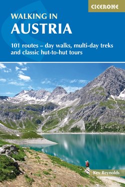
Lying in a natural basin below and to the east of the Schesaplana, the Lünersee was enlarged in the late 1950s by the construction of a dam at its northern end, which flooded the original Douglass Hut. Being accessible by cable-car, the undemanding lake circuit described here is understandably popular and likely to be very busy in summer. Although it is perfectly feasible to walk all the way from Brand to the Douglass Hut along the Schattenlagantweg and Böser-Tritt-Steig (3hrs), the normal approach is by car or bus to the Brandnertal roadhead, with the final 400m ascent via cable-car. The Douglass Hut is located a few metres east of the upper cable-car station, and its terrace is usually crowded with visitors when the sun shines.
Lünersee Alm
For the clockwise lake circuit simply continue eastwards across the dam along the Lünersee-Uferweg. Ignore the path breaking left to the Heinrich-Hueter Hut and follow the lake’s curving outline heading south and southwest towards a building on the Lünersee Alm (2000m) where there’s another junction. The left branch here climbs to the Cavelljoch on the Austro–Swiss border, and is also taken by the Rätikon Höhenweg Nord. For the lake circuit, however, wander westwards to yet another junction by the goods lift for the Totalp Hut, then veer right to return to the Douglass Hut along the lakeside in a further 30mins.
