Читать книгу Walking the Lake District Fells - Patterdale - Mark Richards - Страница 11
На сайте Литреса книга снята с продажи.
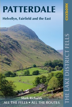
ОглавлениеINTRODUCTION
Looking up Grisedale towards Nethermost Pike with St Sunday Crag looming on the left
Valley bases
The area covered by this guide lies between the primary valley roads that strike through the heart of the Lake District linking Windermere, Keswick and Penrith – core corridors of travel, popular from the birth of tourism. Walks springboard from Rydal, Grasmere and, over Dunmail Raise, from Thirlmere and Threlkeld, at the far side of St John’s in the Vale. To the east, just below the A66, the area also takes in gentler fell country from Pooley Bridge to the foot of Ullswater and along its gracious shores by Glenridding and Patterdale, then over the wild passage of Kirkstone Pass and down by Stock Ghyll to Ambleside.
The fells are held in tight rein between Ullswater and Thirlmere with deep sylvan valley approaches leading to impressive hanging valleys (coves) and soaring peaks (pikes). This extended family of fells running north by Fairfield and Helvellyn to Clough Head and sustaining the highest continuous ground in the National Park is the great focus of this guide. For the most scenic introduction to the massif, arrive from the northeast, along the shore of unparalleled Ullswater, taking time to stop, stare and anticipate some truly great fell days.
Facilities
Being right in the thick of the accessible scenic action has its upsides. No surprise that there is an abundance of luxury hotels, cosy B&Bs and self-catering cottages, as well as hostels and camp sites, all in close proximity to these fells. Your search engine will home in swiftly on the choice, as a first port of call the Visit Cumbria website www.visitcumbria.com (click Accommodation) is a reliable database.
Getting around
Year-round bus services ply the main roads giving added flexibility for route planning. Only the Kirkstone Rambler service from Bowness to Patterdale is necessarily seasonal – the narrow-walled road over the Kirkstone Pass is tough driving even for cars in summer, let alone buses. The 555 service runs at an almost-urban frequency on the southern and western side of the range, between Ambleside and Keswick, the Patterdale Rambler 108 service from Penrith travels by Ullswater to Glenridding, turning tail at the head of the lake in Patterdale, and the X4/5 service between Keswick and Penrith calls in at Threlkeld.
Parking is not to be taken for granted anywhere in the Lake District. Always allow time to find an alternative parking place or be prepared to switch to a different plan for the day. Alternatively just set out directly from your door – perfectly possible if you choose to stay in one of the nearby valleys. Always take care to park safely and only in laybys and car parks and avoid the side of the narrow country roads. Depending on where you are basing yourself, consider joining the National Trust (www.nationaltrust.org.uk) in order to use their several car parks for free. Consult the Starting Points table to locate suitable car parking areas and designated car parks.
Fix the Fells
Rydal Head from Heron Pike
The Fellranger series has always highlighted the hugely important work of the Fix the Fells project in repairing the most seriously damaged fell paths. The mighty challenge has been a great learning curve and the more recent work, including complex guttering, is quite superb. It ensures a flat footfall where possible, easy to use in ascent and descent, and excess water escapes efficiently minimising future damage.
The original National Trust and National Park Authority partnership came into being in 2001 and expanded with the arrival of Natural England, with additional financial support from the Friends of the Lake District and now the Lake District Foundation (www.lakedistrictfoundation.org). But, and it’s a big but, the whole endeavour needs to raise £500,000 a year to function. This enormous figure is needed to keep pace with the challenges caused by the joint tyranny of boots and brutal weather. The dedicated and highly skilled team, including volunteers, deserve our sincerest gratitude for making our hill paths secure and sympathetic to their setting. It is a task without end, including pre-emptive repair to stop paths from washing out in the first place.
Mindful that a metre of path costs upwards of £200 there is every good reason to cultivate the involvement of fellwalkers in a cause that must be dear to our hearts… indeed our soles! Please make a beeline for www.fixthefells.co.uk to make a donation, however modest. Your commitment will, to quote John Muir, ‘make the mountains glad’.
Using this guide
Unlike other guidebooks which show a single or limited number of routes up the Lakeland fells, the purpose of the Fellranger series has always been to offer the independent fellwalker the full range of approaches and paths available and invite them to combine them to create their own unique experiences. A valuable by-product of this approach has been to spread effects of walkers’ footfall more widely over the path network.
This guide is divided into two parts: ‘Fells’ describes ascents up each of the 35 fells covered by this volume, arranged in alphabetical order. ‘Ridge routes’ describes a small selection of popular routes linking these summits.
Fells
Helvellyn massif from Deepdale Hause
In the first part, each fell chapter begins with an information panel outlining the character of the fell and potential starting points (numbered in blue on the guide overview map and the accompanying 1:40,000 HARVEY fell map, and listed – with grid refs – in Starting points in the introduction). The panel also suggests neighbouring fells to tackle at the same time, including any classic ridge routes. The ‘fell-friendly route’ – one which has been reinforced by the national park or is less vulnerable to erosion – is also identified for those particularly keen to minimise their environmental impact.
After a fuller introduction to the fell, summarising the main approaches and expanding on its unique character and features, come the route descriptions. Paths on the fell are divided into numbered sections. Ascent routes are grouped according to starting point and described as combinations of (the red-numbered) path sections. The opportunities for exploration are endless. For each ascent route, the ascent and distance involved are given, along with a walking time that should be achievable in most conditions by a reasonably fit group of walkers keen to soak up the views rather than just tick off the summit. (Over time, you will be able to gauge your own likely timings against these figures.)
In many instances a topo diagram is provided, alongside the main fell map, to help with visualisation and route planning. When features shown on the maps or diagrams appear in the route descriptions for the first time (or the most significant time for navigational purposes), they are highlighted in bold, to help you trace the routes as easily as possible.
As a good guide should also be a revelation, panoramas are provided for a small number of key summits and panoramas for every fell in this guide can be downloaded free from www.cicerone.co.uk (see ‘Additional online resources’ below). These name the principal fells and key features in the direction of view.
Advice is also given at the end of each fell chapter on routes to neighbouring fells and safe lines of descent should the weather close in. In fellwalking, as in any mountain activity, retreat is often the greater part of valour.
Ridge routes
The second part of this guide describes some classic ridge routes in the Patterdale area. Beginning with an information panel giving the start and finish points, the summits included and a very brief overview, each ridge route is described step by step, from start to finish, with the summits highlighted in bold in the text to help you orientate yourself with the HARVEY route map provided. Some final suggestions are included for expeditions which you can piece together yourself from the comprehensive route descriptions in ‘Fells’.
Appendices
For more information about facilities and services in the Lake District, some useful phone numbers and websites are listed in Appendix A. Appendix B offers a glossary to help newcomers decode the language of the fells as well as some explanations of some of the most intriguing place names that you might come across in this area. Appendix C is a comprehensive list of all the fells included in this 8-volume series to help you decide which volume you need to buy next!
Safety and access
Always take a map and compass with you – make a habit of regularly looking at your map and take pride in learning how to take bearings from it. (Note, however, that the maps in this guide do not have grid lines so an accurate compass bearing cannot be made from them.) In mist this will be a time-, and potentially a life-, saver. The map can enhance your day by showing additional landscape features and setting your walk in its wider context. That said, beware of the green dashed lines on Ordnance Survey maps. They are public rights of way but no guarantee of an actual route on the ground. There are many anomalies, such as the ‘footpath’ indicated southeast off Red Screes which sweeps down impossible rock steps! Take care to study the maps and diagrams provided carefully and plan your route according to your own capabilities and the prevailing conditions.
Please do not rely solely on your mobile phone or other electronic device for navigation. Local mountain rescue teams report that this is increasingly the main factor in the incidents they attend.
The author has taken care to follow time-honoured routes, and kept within bounds of access, yet access and rights of way can change and are not guaranteed. Any updates that we know of to the routes in this guide will be made available on the Cicerone website, www.cicerone.co.uk, and we are always grateful for information about discrepancies between a guidebook and the facts on the ground, sent by email to updates@cicerone.co.uk or by post to Cicerone Press, Juniper House, Murley Moss, Oxenholme Road, Kendal, Cumbria, LA9 7RL.
Additional online resources
Summit panoramas for all of the fells in this volume can be downloaded for free from the guide page on Cicerone website (www.cicerone.co.uk/1034). You will also find a ticklist of the summits in the Walking the Lake District Fells series here, should you wish to keep a log of your ascents. For further information about the series, visit www.cicerone.co.uk/fellranger.