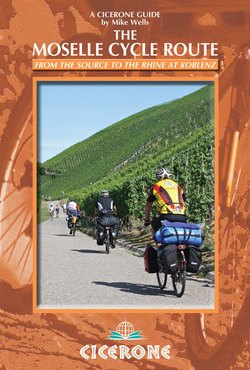
Читать книгу The Moselle Cycle Route - Mike Wells - Страница 9
На сайте Литреса книга снята с продажи.
ОглавлениеINTRODUCTION
The cycle route follows the Canal des Vosges through Lorraine (Stage 3)
To many people the greatest thing about the Moselle is not the water that flows in the river: rather it is the wine that is produced along its banks. And what great wine it is. The Riesling grape grows at its very best on the slatey slopes of the Moselle gorge and the best of the resulting wines, from famous villages like Bernkastel and Piesport, are among Germany’s finest. But for the cyclist, the Moselle offers much more than either wine or water.
Rising in the Vosges Mountains in eastern France, the Moselle flows generally north through the French region of Lorraine and the German Land (state) of Rheinland-Pfalz. Once in Germany it follows a deep meandering gorge between the Hunsrück and Eifel Mountains before joining the Rhine at Deutsches Eck (‘German corner’) in Koblenz.
The great attraction to a cyclist of following a river from its source is that, once you have reached the start, it’s all downhill. From the easily reached source near the Col de Bussang, the Moselle cycle route descends over 650m to the Rhine at Koblenz, 512km distant. The cycling is straightforward, with much of the route following well-surfaced cycle tracks, often along the riverbank or canal towpaths. On those occasions where roads are used, these are usually quiet country routes. All three of the countries passed through – France, Luxembourg and Germany – are highly cycle-friendly, and motorists will generally give you plenty of room. This route is suitable both for experienced long-distance cyclists, and for those who have not done much cycle touring and wish to start with a straightforward, easily followed route.
The route mostly follows French and German national cycle trails, with a high standard of waymarking for most of the journey. This guide breaks the route into 14 stages, averaging just over 36km per stage. A fit cyclist, covering two stages per day, should be able to complete the trip in a week. In addition, there are two variants and two excursions that visit attractive locations just off the main route. Allowing two weeks would enable these to be included, provide more time for sightseeing and allow the route to be cycled at a leisurely pace. You can break the journey at almost any point, as there are many places to stay along the way. These are suitable for all budgets, varying from 13 Hostelling International youth hostels through B&Bs, guesthouses and hotels. If you don’t mind the extra weight of camping gear, there are many official campsites.
The Moselle offers variety: from the delights of French cuisine to the pleasures of German Riesling; from rolling foothills and wide valleys in Lorraine to the narrow meandering gorge in Rheinland-Pfalz; from great historic cities like Nancy, Metz and Trier to pretty villages on the Boucles de la Moselle and spread out along the gorge; from Roman fortifications to 20th-century defence lines; and from two of Europe’s largest countries to Luxembourg, one of its smallest.
The sheer beauty of the route running through the narrow Moselle gorge between Trier and Cochem is rightly regarded as one of Europe’s great tourist attractions, evidenced by the large number of cyclists you will find along this section. Fortunately there is infrastructure, in the form of accommodation, restaurants, campsites and asphalt cycle tracks, to cope with it. The rest of the river is much less well-known, although no less attractive to the cycle tourist. Apart from two easily bypassed sections of rough canal towpath north and south of Nancy and a quiet country road between Remiremont and Épinal, asphalt cycle tracks have been provided along almost the whole route. While there are fewer places to stay overnight before the route reaches Trier, demand is consequently smaller and no problems should be found obtaining accommodation, food and beverages.
Huge quantities of wine are produced along the German part of the Moselle gorge, but this is not the only beverage you will find along the way. Quality wine is also produced around Toul on the Boucles de la Moselle and the Luxembourg side of the gorge is a large producer, particularly famous for its Crémant sparkling wine. Lorraine has a growing number of local micro-breweries, producing a wide variety of styles of beer. In Lorraine too, golden Mirabelle plums are used to make fruit schnapps and in the Saar valley viez, a local form of cider, is produced. Be sure to sample these local beverages, but do so in the evening: cycling and alcohol do not mix!
The steepest part of the Moselle Gorge between Brem and Eller (Stage 13)
Background
Geographically, the Moselle has three distinct sections:
Haute-Moselle (Upper Moselle, Stages 1–4) is the non-navigable part of the river running through the limestone Vosges foothills from the source to Neuves-Maisons, south of Nancy. Below Épinal, the river is followed by the Canal des Vosges.
Moselle canalisée (Middle Moselle, Stages 5–8) is the navigable, partly straightened section through a broad, partly industrialised valley from Nancy to the Franco–German–Luxembourg border.
Moseltal (Moselle Gorge, Stages 9–14) is the lower part of the river where it has cut a tight, meandering gorge between the Hunsrück and Eifel Mountains. This is the section famous for the production of Mosel wine.
Nowadays the point where the Moselle reaches the Hunsrück is the national border between the French region of Lorraine, the German state of Rheinland-Pfalz and the small independent Duchy of Luxembourg. But historically, political control has seldom replicated geography. Indeed the history of the Moselle basin for the past 500 years has been of control passing back and forward between two often bellicose nations.
The Holy Roman Empire
In medieval times Lorraine, Trier and Luxembourg were three semi-independent states and members of the mainly Germanic Holy Roman Empire (HRE), along with a plethora of other small independent states across what is now Germany. These states each had their own government structures led by a ruler with a title such as prince, duke, margrave (‘marquis’) or, in some places – like Trier – bishop. The titular leader of the HRE was the Holy Roman Emperor. When it became necessary to appoint a new emperor, these various rulers would gather together in conclave and elect one of their number as emperor. As a result they became known jointly as Electors, an early, although very limited, form of democracy. Over time the larger, stronger states came to dominate these arrangements and the Habsburg rulers of Austria more or less assumed the title of Holy Roman Emperor, while at the same time the central unifying influence and power of the HRE declined.
Trier’s Porta Nigra Roman gate (Stage 9)
Growth of French influence
To the west of the HRE was France, a country that grew steadily, first by ejecting the English from their territories in continental Europe and then by assimilating other smaller states. As France spread east so it started to come into conflict with the Empire. The first parts of Lorraine (the three bishoprics of Metz, Toul and Verdun) were annexed in 1552 but the main turning point came during the Thirty Years’ War (1618–1648). While this was in essence a religious struggle for power between catholic and protestant elements within the HRE, many neighbouring states, including France, were drawn into the conflict. In 1641 the French captured the whole of Lorraine, only to withdraw again in 1648 under the terms of the Treaty of Westphalia, which ended the war. This treaty also confirmed French rule over the three bishoprics, which then became the French province of les Trois-Évêchés.
The French returned in 1670, during the reign of Louis XIV, this time going on to invade Trier and the Rhineland too. They withdrew again in 1697. During this period of French control the Duke of Lorraine, Charles V, sought refuge in Austria, where his son Leopold was brought up in the Habsburg court. Return to full independence was short-lived. In 1736, at the end of the war of the Polish Succession, Francis Stephen, who had succeeded his father Leopold as Duke, was deposed and replaced by a French-nominated successor. This was Stanislas, former king of Poland, whose daughter was married to Louis XV, and who commissioned the beautiful palaces and squares that make up the centre of Nancy. Incidentally, Francis Stephen did not do too badly out of this arrangement: created Duke of Tuscany by the Habsburgs, he went on to marry Maria Theresa, become Archduke of Austria and Holy Roman Emperor! During Stanislas’s rule, French influence over Lorraine steadily grew and, on his death in 1766, control passed directly to the French crown. Shortly after, during the French Revolutionary Wars (1789–1799), Lorraine was reorganised into four French départements (counties) of Moselle (north), Meurthe (centre), Meuse (west) and Vosges (south).
During the reign of the Emperor Napoleon, French power reached its zenith. A series of military campaigns saw the French gain control of much of western and central Europe. Trier and the Rhineland were integrated into France, with towns such as Koblenz and Mainz assuming French names (Coblence and Mayence respectively). In Trier the electoral bishopric was abolished after 900 years. By sweeping away the multiplicity of small states that formed the HRE, Napoleon effectively ended the Empire. When he was defeated in 1815 by the combined forces of Britain and Prussia, the latter was one of two German states that emerged in a strong position (the other was Bavaria). These two states stepped into the void created by the end of the HRE, with the Prussians taking control of much of northern Germany including Trier and the northern Rhineland.
The equestrian statue of Kaiser Wilhelm I at Deutsches Eck in Koblenz (Stage 14)
The Prussians arrive
Despite a final rally to arms in 1840, when France threatened to invade the Rhineland, this was the end of France as the expansionary aggressor. Power now turned steadily to the east. By 1870 the Prussians, led by the ‘Iron Chancellor’ Bismarck, had succeeded in unifying Germany, and during the Franco–Prussian War (1870–1871) they captured much of eastern France and threatened Paris. The treaty that ended this war gave the west bank of the Rhine (Alsace) and the Moselle département of Lorraine (including the industrial cities of Metz and Thionville) to a newly established German Empire. French refugees from these areas arrived in the rest of Lorraine, giving a stimulus to the growth of industry, particularly textiles, in towns like Épinal along the Moselle.
German occupation lasted nearly 50 years. During this period the French language was supressed and a process of Germanisation carried out (as a legacy of this time, the trains in Alsace and northern Lorraine run on the right, compared with on the left in the rest of France). German control lasted until 1919, when the treaty of Versailles, which ended the First World War (1914–1918), returned Alsace and the Moselle département to France, ordered German military withdrawal from the Rhineland and created a small buffer state (Saarland) between France and Germany. Under French rule (1919–1940) a reverse process occurred, with the German language banned. In 1935 Germany, now under Nazi control, reoccupied the Rhineland and Saarland. A brief period of draconian German occupation of France (1940–1944) occurred during the Second World War, followed by a final return to French rule after the defeat of Nazi Germany. There were families whose sons fought for Germany in 1914–1918, then began the Second World War fighting for France, only to be re-conscripted into the German army in 1940, most probably fighting and dying on the eastern front.
All these years of conflict have left the region peppered with military hardware, from Roman fortifications, through medieval castles and fortified military towns to integrated defensive lines and concrete anti-tank defences, each passing into history as the technological progress of warfare made them redundant. The great French fort builders Vauban (1633–1707), Séré de Rivières (1815–1895) and Maginot (1877–1932) all left their mark. Riverside settlements still show the scars of battle, particularly from the Second World War, where intensive bombing was followed by destructive land warfare and fierce fighting as Allied forces tried to cross the river. This is evident especially in the bridges, which were almost all destroyed during 1944–1945 and have been subsequently rebuilt.
Sentry duty outside Luxembourg Grand Ducal Palace (Stage 9A)
Luxembourg
Throughout this period, Luxembourg too has suffered at the hands of its French and German neighbours. Having been an important member of the HRE (three of its 14th and 15th-century dukes became Holy Roman Emperor) it lost its independence in 1437 when power passed to the Burgundians. Over the following centuries control alternated between Bourbon French, Austrian and Spanish Habsburgs, Napoleonic French, Prussia and the Netherlands, with Luxembourg losing over 75 per cent of its original territory in land grabs by France (1659), Prussia (1815) and Belgium (1839). Since 1815 the country has had a close relationship with the Netherlands, even sharing a joint monarchy until 1890. Despite a policy of neutrality, Luxembourg was invaded by Germany in both the First and Second World Wars.
The modern era
The 500-year history of the Moselle basin being a pawn between French- and German-speaking nations may now finally have ended with the entry of France, Germany and Luxembourg into the European Union (1958), as well as the highly symbolic 1985 Schengen Agreement, a treaty signed on a boat on the Moselle near the village of Schengen, at the point at which the borders of French Lorraine, German Rheinland-Pfalz and the Grand Duchy of Luxembourg meet. This treaty led to the free movement of people across European borders and the removal of border controls between countries. As a result, many of the residents of Thionville in France now work across the old ‘border’ in Luxembourg or Germany, and the borderlands have been designated as a European cross-border super region called Saarlorlux.
The birthplace of Karl Marx in Trier, now a museum (Stage 9)
River transport
The river itself has a history independent of the political struggle happening around it. Navigation has been going on since at least Roman times. At Neumagen a stone carving of a Roman wine ship was discovered in the 19th century. This is now in the Landesmuseum in Trier, but a concrete copy stands in Neumagen and a full-size replica wooden Roman galley is moored nearby.
A steady process of improving navigation over the centuries led to the removal of tolls and riverine obstructions, the installation of locks and dams to control water flow and the construction of towpaths. Haulage, which had been initially manual or horse-drawn, gave way in the 20th century to moto-tractors and then motorised barges. A major post-Second World War canalisation programme resulted in the opening of the river to larger vessels (up to 110m long) as far as Metz in 1964, Frouard (for Nancy) in 1972 and Neuves-Maisons, 392km and 28 locks upstream from Koblenz, in 1979. Between Frouard and Toul this led to the closure of a short stretch of the Canal de la Marne au Rhin and redirection of its traffic onto the Moselle. Traffic on the river is mostly bulk cargoes and includes oil products, coal, iron ore, scrap metal, finished steel products and building aggregates. Unlike the neighbouring Rhine navigation, there is only a little conveyance of containerised general cargo. The Saar, which joins the Moselle near Trier, has also been canalised to take large barges and there is much interconnecting traffic. Navigation on the Moselle is regulated by an international control commission.
Above Neuves-Maisons the Canal des Vosges (formerly known as the southern section of the Canal de l’Est), which runs alongside the Moselle, allows narrowboats to progress upstream as far as Épinal and provides a connection via the Saône and Rhone with the Mediterranean. There are long-term plans to upgrade this route to take large barges. The Canal de la Marne au Rhin provides a connection for narrowboats from Toul west to the Paris basin (and ultimately the North Sea) and from Frouard east to the middle Rhine at Strasbourg. These canals have little commercial traffic nowadays and are mostly used by leisure craft.
The route
The major part of the route described in this book follows two long-distance cycle tracks, the French Véloroute de la Moselle from Épinal to Schengen, which is part of a much longer north–south route across eastern France called the Véloroute Charles-le-Téméraire; and the German Mosel-Radweg from Schengen to Koblenz. These two tracks differ markedly in their continuity and state of completion.
In France a national network of véloroutes (cycle tracks) is under development. These are being built to a national standard that includes the following desirable features, wherever possible: that the track is on an asphalt surface; that it spans a width of three metres; and that it is separated from vehicular traffic. While the driving force for this programme is regional government (in this case Lorraine), under the French system of local government the implementation and actual construction is the responsibility of local départements. The Véloroute de la Moselle runs through three different départements, between which the degree of completion of the track varies greatly.
The route starts in Vosges département with a short descent, from the river’s source in the Vosges Mountains, along a very quiet mountain pass road. In Bussang the first long section of dedicated cycle path is reached (Stage 1). This is the voie verte (‘greenway’) des Hautes Vosges, constructed to national standards along the trackbed of a disused railway through a valley once filled with silver and copper mines. After the first sizeable town (Remiremont), the route continues (Stage 2) using quiet country roads to reach the département capital Épinal. It is unlikely that this stretch will ever be provided with a separate cycle path, although there are plans to mark cycle lanes along the road. The road, however, is so quiet that this hardly seems necessary. Beyond Épinal, the Véloroute de la Moselle is reached, in the form of a more or less complete cycle path (Stage 3) along the towpath of the Canal des Vosges to a point just past Charmes.
Cycling through the Michelsberg vineyards opposite Piesport (Stage 11)
Beyond this point, where Vosges ends and you enter Meurthe et Moselle département, very little progress has been made building the véloroute. It is possible to continue (Stage 4) on rough gravel and dirt tracks along the towpath, and this guide does so wherever practical, but some sections on road are necessary where the towpath is impassable. After Méréville, things improve when the route joins the Boucles de la Moselle, a circular véloroute from Nancy via Neuves-Maisons to Toul and back via Frouard along various canal and river towpaths (this is followed in its entirety by using Stages 4A and 5A). Continuing north from Nancy (Stage 5), once the Boucles is left behind beyond Frouard, the surface deteriorates and it is again necessary to use sections of road until Novéant, where Moselle département is reached.
Once in Moselle, things change permanently for the better. A more or less complete cycle path (Stages 6–8), built to national standards and completed in 2012, runs from Novéant past Metz and through Thionville all the way to the German border at Schengen. Waymarked as Véloroute Charles-le-Téméraire, this mostly follows the river or canal banks, although there are sections away from the river circumnavigating riverside lagoons and industrial developments.
North from Schengen the Moselle leaves France, becoming, for a while, the border between Germany (east of the river) and Luxembourg (west of it). It then turns to run through Germany in a deep, iconic gorge meandering between the Hunsrück and Eifel Mountains. A waymarked cycle route, known in German as the Mosel-Radweg, closely follows the river through the gorge, with signposted alternatives on both sides of the river. Apart from a few short sections, usually when passing through nature reserves, the track is wide with an asphalt surface. This guide follows the right bank (east of the river) from Konz, at the confluence of the Saar, to Neef before Cochem (Stages 10–13), then switches to the left (west) bank (Stages 13–14) to reach Koblenz, where the Moselle joins the Rhine. While this is the route described in detail, in practice you can cycle on either bank, as there is little to choose between them. The stretch through the gorge is characterised by steep slatey slopes, covered in either vines on the sunnier slopes or forest on the inhospitable north-facing side of the valley.
In addition to the main route, variants are given using the Boucles de la Moselle to visit Toul (see above) and via the small country of Luxembourg (Stage 9A) using mostly dedicated asphalt cycle tracks for a circular tour, visiting the capital. Further excursions, up the Saar valley to Merzig (Excursion 1) and through the Rhine gorge to St Goar (Excursion 2), use waymarked and mostly asphalt cycle tracks.
Natural environment
Physical geography
The Moselle is a left-bank tributary of the Rhine, draining a basin of over 28,000km2. Its main catchment includes the western side of the Vosges Mountains through tributaries Meurthe, Seille and Saar, and the southern part of the Eifel range through the Sauer and Kyll. In its length of 538km it falls 653m, flows through France for 296km, forms the German–Luxembourg border for 36km, then flows 206km through Germany.
There are three distinct geological parts to the Moselle basin, all shaped by geomorphic events further south approximately 30 million years ago, when the Alps were pushed up by the collision of the African and European tectonic plates. This caused rippling of the landmass to the north, creating successive ridges that form the limestone Jura (northern Switzerland) and Vosges (France). Further north, pre-existing sandstone and slate mountains (Hunsrück) and volcanic remnants (Eifel) were raised further. The Moselle rises high on the western slopes of the Vosges and firstly flows down through the foothills. Secondly, it enters a wide valley between limestone hills filled with tertiary deposits of sand and gravel. Much of this has been extracted for building aggregates, creating a large number of man-made lakes. Finally, when the river reaches the Hunsrück it flows through a deep meandering gorge, caused by the river cutting down through the slate rocks as they were pushed up by the rising Alps.
The Moselle enters the Rhine at Deutsches Eck in Koblenz (Stage 14)
Wildlife
While a number of small animals (including rabbits, hares, red squirrels, voles, water rats and weasels) may be seen scuttling across the track, and deer glimpsed in forests, this is not a route for observing mammals. However, there is a wide range of interesting birdlife. White swans, geese and many varieties of ducks inhabit the river and its banks. Cruising above, raptors, particularly buzzards and kites, are frequently seen hunting small mammals, with kites diving occasionally into the river to catch fish. Other birds that live by fishing include cormorants – noticeable when perched on rocks with their wings spread out to dry – and kingfishers. These live in many locations, mostly on backwaters, perching where they can observe the water. Despite their bright blue and orange plumage, they are very difficult to spot. Grey herons, on the other hand, are very visible. Common all along the Moselle, they can be seen standing in shallow water waiting to strike or stalking purposefully along the banks.
Preparation
When to go
The route is generally cycleable from mid-April to late October. Indeed, much of the route can be cycled at any time of year, although some of the rougher sections of towpath in Meurthe et Moselle département may be muddy after heavy rain. During July and August (the school holiday season) the popular tourist area through the Moselle gorge between Trier and Cochem (Stages 10–13) can become very busy. However, there is such a wide variety of accommodation available that it is seldom difficult to find somewhere to stay.
How long will it take?
The main route has been broken into 14 stages that average a distance of 36km each, while three variant stages and two one-day excursions visit interesting locations just off the main route. A fit cyclist, cycling an average of 72km per day, should be able to complete the main route in a week. Allowing time for sightseeing, and completing all routes in this guide, cycling the Moselle would make an attractive two-week holiday. There are many places to stay all along the route and it is easy to tailor daily distances to your requirements.
What kind of cycle is suitable?
While most of the route is on asphalt cycle tracks or quiet country roads, there are some stretches of unmade canal towpath with all-weather dirt or gravel surfaces, particularly in Meurthe et Moselle département between Charmes and Méréville (Stage 4, south of Nancy) and between Pont-à-Mousson and Novéant (Stage 6, north of Nancy). As a result, cycling the route by staying true to the river is not recommended for narrow-tyred racing cycles. There are, however, on-road alternatives for both these stages that can be used to bypass the rougher sections. The most suitable type of cycle is either a touring cycle or a hybrid (a lightweight but strong cross between a touring cycle and a mountain bike, with at least 21 gears). There is no advantage in using a mountain bike. Front suspension is beneficial as it absorbs much of the vibration. Straight handlebars, with bar-ends enabling you to vary your position regularly, are recommended. Make sure your cycle is serviced and lubricated before you start, particularly the brakes, gears and chain.
As important as the cycle is the choice of tyres. Slick road tyres are not suitable and knobbly mountain bike tyres not necessary. What you need is something in-between, with good tread and a slightly wider profile than would be used for everyday cycling. To reduce the chance of punctures choose tyres with puncture-resistant armouring, such as a Kevlar™ band.
Ehrenbreitstein fortress, opposite Koblenz (Stage 14)
Getting there and back
By rail
The start of the route at Col de Bussang (715m) is not directly accessible by train. However, Fellering station (442m) (reached from Mulhouse by regular local trains, which carry cycles) is only 10km east of the pass, and the ascent is fairly easy. From the west, provided you are happy to double Stage 1, Remiremont station (388m) is 36km away, and the ascent is very gentle. Both of these stations can be reached by connections across the SNCF (French railway) network.
People travelling from the UK can take cycles on Eurostar from London St Pancras (not Ebbsfleet or Ashford) to Paris (Gare du Nord) or Brussels (Midi). Cycles booked in advance travel in dedicated cycle spaces in the baggage compartment of the same train as you. Bookings, which cost £30 for a single journey, can be made through Eurostar baggage (0844 822 5822). Cycles must be checked in at St Pancras Eurostar luggage office (beside the bus drop-off point) at least 40mins before departure. Numbers are limited and if no spaces are available your cycle can be sent as registered baggage (£25). In this case it will travel on the next available train and is guaranteed to arrive within 24hrs. In practice, 80 per cent of the time it will travel on the same train as you. There is no requirement to package or dismantle your cycle. More information may be found at www.eurostar.com.
In Continental Europe, people travelling with cycles face the problem that many of the most convenient long-distance services are operated by high-speed trains that have either limited provision for cycles (French TGV) or no space at all (Thalys service from Paris and Brussels to Köln, and German ICE services). Trains from Paris to Nancy, Strasbourg, Mulhouse, Épinal and Remiremont depart from Gare de l’Est, a short ride from Gare du Nord. Services on this route are operated by TGV or ICE high-speed trains, but there are some trains with reserveable space for cycles. To find out which departures these are, look on the SNCF (French Railways) website (www.voyages-sncf.com). Less complete information is available at www.bikes.sncf.com. Booking for French trains is through the SNCF website or via Rail Europe (www.raileurope.co.uk). From Brussels, conventional EuroCity services with cycle space run three times daily to Mulhouse via Luxembourg and Strasbourg.
Alternative access from the UK is to use Stena Line ferries to reach Hoek van Holland from Harwich or the P&O service to Rotterdam from Hull, then Dutch NS (Dutch Railways) trains to Rotterdam. Here you can connect via Venlo and Dusseldorf with DB (German Railways) services, with cycle provision, that will take you on to Karlsruhe. From Karlsruhe there are trains to Strasbourg (France) for connections to Mulhouse. On Hoek van Holland ferries, through tickets allow UK travellers leaving from London (or any station in East Anglia) to reach any station in the Netherlands. Booking for German trains can be done at www.bahn.com. Up-to-date information on travelling by train with a bicycle can be found on a website dedicated to worldwide rail travel, ‘The man in seat 61’, www.seat61.com.
By air
The most convenient airport for the start is Basle–Freiburg–Mulhouse, 6km north-west of Basle, which is served by direct flights from many UK and European airports. Airlines have different requirements regarding how cycles are presented and some, but not all, make a charge – this should be paid when booking, as it is usually greater at the airport. All airlines require tyres to be partially deflated, handlebars turned and pedals removed (loosen pedals beforehand to make them easier to remove at the airport). Most will accept your cycle in a transparent polythene bike-bag, although some insist on the use of a cardboard bike-box. These can be obtained from cycle shops, often for free. You do, however, have the problem of how you get the box to the airport!
FROM BASLE AIRPORT
From Basle–Freiburg–Mulhouse airport, it is a short (2km) ride to St-Louis-la-Chausée station, from which local trains run to Mulhouse. Leave the airport terminal building by the exit to France. Follow the service road ahead with car parks L. Pass under a road bridge and turn L at the first roundabout. Continue with car parks L and motorway R and go straight ahead at the next roundabout. Turn R and immediately R again (D12bis), crossing the motorway and entering St-Louis. Follow the road bearing R, pass under a railway bridge and turn immediately L (Rue de la Barrière) to reach the station entrance L.
By road
The start and finish points at Mulhouse (for Col de Bussang) and Koblenz are sufficiently close to be able to leave a vehicle at one end and return by train with your cycle to collect it after completing the ride. If driving from the UK, the distance from the Channel to Mulhouse is approximately 650km; from the Channel to Koblenz is 500km.
European Bike Express operates a coach service with a dedicated cycle trailer from northern England, picking up en route across England to the Mediterranean, with a drop-off point at Nancy in eastern France. Details and booking are through www.bike-express.co.uk. Trains link Nancy and Strasbourg, with connections on to Mulhouse.
Intermediate access
There are international airports at Metz–Nancy–Lorraine (17km north-east of Pont-à-Mousson; Stage 6), Luxembourg (Stage 9A) and Frankfurt Hahn (which is nowhere near Frankfurt, but is in the Hunsrück Mountains 18km south-east of Enkirch on Stage 12).
Much of the route is closely followed by railway lines. Stations en route are listed in the text and shown on the stage maps.
A novel use of an old bike in Archettes (Stage 2)
Onward travel
From Koblenz, DB trains with bicycle accommodation run to stations all over Germany, with international connections available through Frankfurt and Köln. For those traveling to the UK the most direct route would involve using Thalys trains from Köln to Brussels and then Eurostar to London. Unfortunately, as Thalys trains do not carry cycles, this route is not practicable. A better route is to take a train from Koblenz to Trier, then to continue on to Luxembourg and Brussels to connect with Eurostar. Most trains on this route carry cycles.
Alternatively, those bound for the UK can travel via Köln and Venlo (Netherlands) to Rotterdam and Hoek van Holland, from where Stena Line (www.stenaline.co.uk) runs two ferries daily (afternoon and overnight) to Harwich. On overnight sailings, passengers must reserve cabins. From Harwich, trains with cycle provision run to London (Liverpool St) and to Cambridge, where connections to the rest of the UK can be made. In addition, P&O ferries (www.poferries.com) sail every night from Rotterdam (Europoort) to Hull. Reaching the terminal involves travelling by train from Rotterdam station to Maassluis, then crossing the Rhine on the Maassluis–Rozenburg ferry. From the Rozenburg ferry ramp, cyclists can follow LF1 signs through Rozenburg for 2.5km, then turn right and follow a cycle track on the left of the Europaweg for 9km, which leads to the P&O terminal at berth 5805.
Frequent trains from Koblenz run to Frankfurt International airport (often via a connection at Mainz or Wiesbaden), where there are flights to worldwide destinations. Köln–Bonn airport, which has a wide variety of flights, can also be reached by train from Koblenz.
Navigation
Waymarking
The route described is made up from a number of waymarked cycle routes as well as some unsignposted stretches to link these together. As a result, style and consistency of waymarking varies from country to country and stage to stage. In the introduction to each stage an indication is given of the predominant waymarks followed. The route varies from that waymarked in a few places, where alternative routes are more suitable than the waymarked route.
SUMMARY OF CYCLE ROUTES FOLLOWED
| France | Voie Verte des Hautes Vosges |
| Véloroute/Chemin de la Moselle (incomplete) | |
| Boucles de la Moselle | |
| Véloroute Charles-le-Téméraire | |
| Luxembourg | Piste cyclable (PC plus number) |
| Germany | Mosel-Radweg (MR) |
| Saar-Radweg | |
| Rhein-Radweg (RR) |
French cycle route signs for (clockwise from top-left): Voie Verte des Hautes Vosges; Véloroute de la Moselle; Chemin de la Moselle; Boucles de la Moselle; Charles-le-Téméraire
In France a number of different routes are followed. Stage 1 from Bussang to Remiremont is excellently waymarked as a voie verte. The route from Golbey, just north of Épinal (Stage 3), all the way to Apach on the Franco–German border (Stage 8) is designated as the Véloroute Charles-le-Téméraire and it is part of a much longer, nationally promoted north–south cycle route across eastern France. As this route is still under development, waymarking is inconsistent and in some parts is non-existent, although waymarks are more or less continuous north of Metz, where it is also known as the Chemin de la Moselle. The circular route from Nancy to Toul via Neuves-Maisons and back to Nancy via Frouard (see Stages 4, 4A, 5A and 5) is waymarked as Les Boucles de la Moselle.
Luxembourg cycle route sign
Luxembourg has a network of numbered cycle routes designated as Piste cyclable (‘PC’ plus a number). These are in development, but most sections of the routes described in Stages 8, 9 and 9A are complete and signposted. These follow a mixture of asphalt-surfaced farm lanes, routes following old disused railway lines, dedicated cycle tracks and cycle lanes alongside main roads. Full details of the network, with maps, can be found at www.pch.public.lu.
German Mosel-Radweg sign
In Germany, cycle routes along both sides of the Moselle are waymarked as Mosel-Radweg; those along the Saar and Rhine are waymarked as Saar-Radweg and Rhein-Radweg respectively.
Maps
There is no specific series of maps that provides comprehensive coverage of the whole route. For France, sheet 516 of the Michelin map Alsace, Lorraine (at a scale of 1:200,000) or sheets 314 and 307 (at a scale of 1:150,000) give an overview of the route across Lorraine without specifically showing cycle routes. As the route is under development, things change frequently and the best way to ascertain the up-to-date position is via the Lorraine tourist office, which publishes a map showing sections open, those under construction and those planned (http://lorraine.voie.verte.free.fr).
For the latter stages between Metz and Koblenz, Esterbauer Bikeline publish a cycling guide (see below), which includes strip maps of the route along both sides of the river at 1:75,000. The stretch from Schengen, on the Franco–Luxembourg–German border, to Koblenz, is also covered by a laminated folding strip map of the Mosel-Radweg (sheet 198), published by Publicpress publications (www.publicpress.de). They publish a similar map for the Saar-Radweg (sheet 617). Although these are at 1:50,000, they contain less detail and are less accurate than Bikeline guides.
Various online maps are available to download, at a scale of your choice. Particularly useful is Open Street Map (www.openstreetmap.org), which has a cycle route option showing the route in its entirety, including the planned but not yet constructed stages. This can be a little misleading, as when a track is built it does not always take the exact route originally proposed, and moreover it leaves you to make your own choice of alternative road routes to bypass missing sections.
Guidebooks
Bikeline (www.esterbauer.com) publish a Radtourenbuch und Karte (cycle tour guidebook with maps) in both English and German, covering the route from Metz to Koblenz.
Although neither a map nor guidebook, a topographic strip map of the Saar and Mosel from Merzig (Saar) to Koblenz, produced by Rahmelverlag (www.rahmel-verlag.de), gives a good overall impression of the route and makes an attractive souvenir. It is published in a number of languages, including English, and is sold in gift shops along the route.
In the UK, most of these maps and guidebooks are available from leading bookshops including Stanford’s, London and The Map Shop, Upton upon Severn. Relevant maps are widely available en route.
Accommodation
Hotels, inns, guesthouses, and bed & breakfast
For most of the route there is a wide variety of accommodation. The stage descriptions identify places known to have accommodation, but the list is by no means exhaustive. Hotels vary from expensive five-star properties to modest local establishments. Hotels and inns usually offer a full meal service, guesthouses do sometimes. B&Bs, which in Germany can be recognised by a sign zimmer frei (‘room available’), generally offer only breakfast. Tourist information offices will often telephone for you and make local reservations. After hours, some tourist offices display a sign outside showing local establishments with vacancies. Booking ahead is seldom necessary, except on popular stages in high season, although it is advisable to start looking for accommodation after 1600. Most properties are cycle-friendly and will find a secure overnight place for your pride and joy.
Prices for accommodation in both France and Germany are similar to, or slightly cheaper than, prices in the UK.
Bett+Bike
Bett+Bike (www.bettundbike.de) is a German scheme run by ADFC (German cycling club), which has over 5000 registered establishments providing cycle-friendly accommodation. It includes a wide variety of properties, from major hotels to local B&Bs, listed by state in an annually updated guidebook. Participating establishments display a Bett+Bike sign.
Bett+Bike sign
Youth hostels
There are 13 official youth hostels, many in historic buildings, on or near the route (three French, eight German and two in Luxembourg). These are listed in Appendix E. To use a youth hostel you need to be a member of an association affiliated to Hostelling International. If you are not a member you will be required to join the local association. Rules vary from country to country but generally all hostels accept guests of any age, although visitors over 27 may face a small surcharge (€3 in Germany). Rooms vary from single-sex dormitories to family rooms of two to six beds. Unlike British hostels, most continental European hostels do not have self-catering facilities but do provide good-value hot meals. Hostels can get very busy, particularly during school holidays, and booking is advised through www.hihostels.com.
Camping
If you are prepared to carry camping equipment this may appear the cheapest way of cycling the Moselle. However, good-quality campsites with all facilities are often only a little cheaper than B&Bs or hostels. The stage descriptions identify many official campsites, but the list is by no means exhaustive. Camping may be possible in other locations with the permission of local landowners.
Food and drink
Where to eat
There are thousands of places where cyclists can eat and drink, varying from snack bars, hotdog stands and local inns to Michelin-starred restaurants. The locations of many places to eat are identified in the stage descriptions below, but the list is by no means exhaustive. Days and opening times vary. Try to be flexible when planning your day, as a number of inns and small restaurants do not open at lunchtime and may observe one day a week, known in German as ruhetag, on which they remain closed. A local inn offering food and drink is typically known as auberge in France and gaststätte in Germany. A weinstube is a winebar, often attached to a vineyard. Some restaurants in big cities and tourist areas may have English-language menus, but these are less common in smaller towns and rural locations.
When to eat
Breakfast in France is usually continental: breads, jam and a hot drink; in Germany it is the same but with the addition of cold meats, cheese and a boiled egg. In Germany lunch was traditionally the main meal of the day, but this is slowly changing, and a large lunch is unlikely to prove suitable if you plan an afternoon in the saddle. The most common lunchtime snacks everywhere are soups or sandwiches. In France croque monsieur (toasted ham and cheese sandwich) and quiche Lorraine are widely available, while in Germany wurst mit senf und brot (sausages with mustard and bread) and wurst salat (thin strips of slicing sausage served with sauerkraut – pickled cabbage) are popular.
For dinner, a wide variety of cuisine is available. In France cooking is treated almost as a religion, with even the smallest restaurant offering a variety of good-quality dishes cooked on the premises, often using locally sourced ingredients. German cuisine is less varied, but quality is always good and portions are generally large. There are many restaurants offering other options including Italian, Greek, Turkish and Chinese. Much of what is available is pan-European and will be easily recognisable. There are, however, national and regional dishes you may wish to try.
Quiche Lorraine
What to eat
In France the route is entirely in Lorraine, which has a typically French cuisine with some Alsatian and German influences. This includes the popular Alsatian dish of choucroute garnie, a dish of various cuts of pork meat and sausages served with sauerkraut heated in white wine. A typical light meal is tarte flambée or flammekueche, a thin pizza-style base covered with white cheese, onions and bacon and cooked in a wood oven. The most famous local speciality is quiche Lorraine, an open savoury tart filled with egg, cream and bacon. French patisseries (cake shops) offer a mouth-watering selection of cakes and pastries including local specialities like macaroons from Nancy and madeleines. Mirabelles are small golden plums, harvested in August and used to make both fruit tarts and a strong fruit brandy.
Germany is the land of the schwein (pig) and pork, gammon, bacon and ham dishes dominate German menus. Traditionally, pork was pot-roasted or grilled rather than fried. There are over 1500 types of German wurst (sausage), the most common being bratwurst (made from minced pork and served grilled or fried), wienerwurst (smoked sausages served boiled, known as frankfurters in English) and blutwurst (blood sausage). Sauerbraten is marinated roast beef, while fleischkaese and leberkaese are kinds of meat loaf. Forelle (trout) and lachs (salmon) are the most popular fish. The most common vegetable accompaniments are sauerkraut and boiled potatoes. Reibekuchen are potato pancakes, served with apple sauce. Spargel (white asparagus) is consumed in huge quantities during Spargelzeit (asparagus season), between mid-April and 24 June. Germans tend to eat kuchen (cakes) in mid-morning or mid-afternoon and as a result desserts offered with main meals are rather limited, often to just apple strudel or ice cream.
Wine
The Moselle gorge, together with its close neighbours Ruwer and Saar, is one of Germany’s major wine-producing regions. The vineyards of the German wine-producing gebiet (region) of Mosel (formally known as Mosel-Saar-Ruwer) lie almost as far north as grapes can be persuaded to ripen. Vines, planted on steep, slatey slopes, grow on land unfit for normal agriculture. But despite these conditions they are capable of producing some of Germany’s finest white wines. This is made possible by a favourable combination of terroir (ground conditions), climate, grape variety and production methods. The vines send roots deep down into the hillside, drawing upon constant supplies of mineral-rich water from far below the surface. South-facing slopes are favoured, where direct sunlight is enhanced by light reflected from the river. Slatey surfaces store the heat of the day, encouraging ripening and deterring early frosts.
A glass of local Riesling at Piesport (Stage 11)
The grape most suited to these conditions is the Riesling, which is planted on all the most favourable slopes and produces all the finest wines. At its best, Mosel Riesling can compete with the great wines of the world. Despite having a lower alcohol content, the natural balance between dry slatey acidity and fruitiness gives a flavour that can compete with other fuller-bodied wines. But the price of quality is limited quantity. Riesling is a low-yielding grape compared to Müller-Thurgau, a grape that is equally at home in the conditions but produces a lower-quality wine. Secondary slopes and flat land by the river are mostly planted with this grape. This has had an adverse effect upon worldwide perception of Mosel wine, and German wine in general. Nowhere is this more obvious than in Piesport. Here the great south-facing slope of Goldtröpfchen, which rises behind the village and is planted exclusively with Riesling, produces Piesporter, one of the region’s best wines. Opposite, on a flat bend in the river around Michelsberg, there are extensive vineyards of Müller-Thurgau, which produce large quantities of the much cheaper and far inferior Piesporter-Michelsberg. This wine is exported throughout the world and has unfortunately come to be seen by many as ‘typical’ German white wine.
Historically, most wine production (mainly for German consumption) was dry white wine produced from Riesling and Silvaner grapes. In the 1960s, in order to satisfy a perceived demand for sweeter wines in export markets (particularly the UK and US), considerable acreage of Müller-Thurgau was planted at the expense of Silvaner. However, as the UK wine market developed, tastes became steadily drier and German (usually medium–sweet) wine’s share of UK sales has declined significantly. There has been some movement back towards producing drier wines and an alteration to the strict German wine classification rules in 2000 has encouraged this. Nowadays the acreage of Müller-Thurgau declines each year. An older local grape, Elbling, is also grown, although this is mostly used for non-varietal production of sekt (sparkling wine).
German wine labels can only show varietals (Riesling for instance) if at least 85 per cent of grapes are from a single variety. If no varietal is shown, the wine is either a blend or even pure Müller-Thurgau. Labels also indicate increasing levels of wine quality, Tafelwein, Landwein, Qualitätswein, and Prädikatswein (roughly equivalent to the French designations Vin de Table, Vin de Pays, VDQS and Appellation Contrôlée). The best-quality wine (Prädikatswein) is further divided into six categories, which tell you little about the characteristics of the wine in the bottle but indicate increasing levels of ripeness of the grapes used. The first three of these (Kabinett, Spätlese and Auslese) can be dry (trochen), medium (halbtrochen) or sweet (lieblich, although this is often not shown on the label) depending upon the production process followed in the winery: basically, a longer fermentation allows more sugar to turn to alcohol, giving a stronger, drier wine, but in practice things are more complicated. The other three descriptions (Beerenauslese, Eiswein and Trochenbeerenauslese) denote sweet dessert wines. Classification changes made in 2000 introduced two categories that are specific to dry wines intended mostly for the export market: ‘Classic’ is a dry wine made from traditional local grape varieties with an alcohol level of at least 11.5 per cent, and ‘Selection’, which is another name for a trochen Auslese.
Winningen, home of Germany’s oldest wine festival (Stage 14)
Weinorten (wine-producing villages) spread right along the gorge, from the French border to Koblenz, and extend short distances down the Saar and Ruwer valleys. Most villages have a number of vineyard slopes, some on more favourable ground than others, and individual growers have strips of vines in different vineyards. Each grower has their own regime of pruning, weeding and application of pesticides. As a result, when seen from a distance, every vineyard appears as a patchwork of plots. The most renowned ‘great first-class vineyards’, all on south-facing slopes, tend to be in the middle part of the gorge between Schweich and Zell and include Goldtröpfchen and Domherr in Piesport, Juffer and Sonnenuhr slopes in Brauneberg, Bernkasteler Doctor, Wehlener Sonnenuhr and the Würzgarten, Prälat and Treppchen vineyards between Ürzig and Erden. There is also one in the Saar Valley (Schwarzhofberg) and two in the Ruwer (Karthäuserhofberg and Grünhauser Abtsberg). Other famous vineyards, often with associated local legends include the Kröver Nacktarsch (bare bottom), Zeller Schwarze Katz (black cat) and Bullayer Brautrock (bridal gown). Most weinorte have an annual wine festival, the oldest being in Winningen near Koblenz.
Not surprisingly, prices vary from reasonable to very expensive, although you will be surprised at how affordable much of the wine is. Perhaps the best way to sample the various wines is to try a small glass of Kabinett with a lunchtime snack and a Spätlese or Auslese with your evening meal (ask for trochen if you want dry!). To go the whole hog, you could finish with an after dinner glass of sweet dessert wine – ask for Trochenbeerenauslese. One way to compare a wide variety of wines at one time is to buy a €15 sampling ticket at the Vinothek, a co-operative wine merchant in the cellars of the Cusanus St Nikolaus monastery in Kues (Stage 11), where you can taste over 100 wines.
Other parts of the Moselle valley also produce wine. Lorraine was once a major wine-producing region, but after the industry was wiped out by the 19th-century phylloxera epidemic, little replanting was carried out. Nowadays production is limited to a small area around Metz and a larger area around Toul (Côtes de Toul) that is best known for Vin Gris, a rosé wine made from a blend of Gamay, Pinot Noir and local white grape varieties. In Luxembourg wine is produced all along the Moselle, with Rivaner (a local name for Müller-Thurgau) being the dominant, although declining, grape. The best-known wine is Crémant de Luxembourg, a champagne-style sparkling wine.
Vinothek cooperative wine cellars in St Niklolaus Monastery, Kues (Stage 11)
Beer and other beverages
Although the part of the country through which the Moselle flows is a wine-producing and -consuming region, Germany is predominantly a beer-drinking nation. France, by contrast, is a wine-drinking nation where consumption of beer is higher in northern and eastern regions, including Lorraine. In Germany, purity laws controlling the production and content of beer have limited the mass consolidation of brewing compared to other European countries, beer still being brewed in a large number of local breweries. Lager and pilsner are the most widely drunk forms, although weizenbier (wheat beer), found in both helles (pale) and dunkles (dark) varieties, is growing in popularity. Very refreshing and slightly sweet tasting, wheat beer is unfiltered and thus naturally cloudy. Glass sizes vary, but common sizes are kleines (small, 300ml) and grosses (large, half-litre). Weizenbier is traditionally served in half-litre vase-shaped glasses. Radler in Germany is shandy, a 50/50 mix of beer and carbonated lemonade. With a long history of German influence, Alsace and Lorraine are the main beer-producing regions of France, and a wide variety of beers are available. Blanche is wheat beer similar to German weizenbier, while blonde is a pale-coloured lager.
All the usual soft drinks (including colas, lemonade, fruit juices and mineral waters) are widely available. Apple juice mixed 50/50 with carbonated water, known as apfelschorle, is widely consumed in Germany. Cidre (France), apfelwein and viez (Germany) are cider-like alcoholic drinks produced from apples. Tap water is safe to drink everywhere.
Amenities and services
Grocery shops