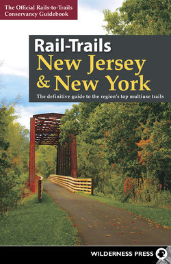
Читать книгу Rail-Trails New Jersey & New York - Rails-to-Trails Conservancy - Страница 22
На сайте Литреса книга снята с продажи.
Оглавление4 Columbia Trail
Counties
Hunterdon, Morris
Endpoints
Main St. between Church St. and Center St. (High Bridge) to Bartley Road/County Road 625 between Bartley-Chester Road and S4 Bridges Road (Long Valley)
Mileage
15.0
Type
Rail-Trail
Roughness Index
2
Surface
Crushed Stone
The Columbia Trail has the distinction of being named for a natural gas pipeline that runs beneath it for 15 miles in rural northern New Jersey. The crushed-stone trail rolls along the South Branch of the Raritan River, passing through historical communities such as High Bridge and Califon, as well as a steep, natural gorge.
The Columbia Gas Transmission Corporation buried the gas pipeline beneath the old railbed of the High Bridge Branch of the Central Railroad of New Jersey in the 1990s. The railroad dates to 1876, when it started hauling iron ore from local mines. Passenger service ended in 1935, followed by cancellation of freight in 1976. After installing the pipeline, the company donated a trail easement to Hunterdon and Morris Counties to develop and maintain a recreational trail.
The Columbia Trail travels through mature deciduous and evergreen forests that create a canopy from the summer sun. White-tailed deer, raccoons, and coyotes, as well as the occasional black bear, make their home here. Heading north, the trail passes farm- and pastureland. There are several towns in which to stop for snacks along the way.
Nearly the entire length of the Columbia Trail is lushly forested.
Starting in High Bridge, you’ll have a slight uphill grade all the way to Long Valley in the north. High Bridge gets its name from a former 112-foot-high bridge across the South Branch of the Raritan River on the main line of the Central Railroad. The bridge was replaced by an earthen embankment in the 1860s.
On the way out of town, you’ll pass a connection at 0.4 mile to the Taylor SteelWorkers Historic Greenway. The 6.5-mile trail passes ruins of a historical ironworks complex that dates to the American Revolution. Back on the main trail, you’ll soon pass the falls at the Lake Solitude dam and begin following the South Branch, one of the state’s best fly-fishing rivers.
Not far upstream, the trail passes through the Ken Lockwood Gorge Wildlife Management Area for 2.5 miles. The steep slopes and boulders create a whitewater paradise for kayakers. The trail crosses a bridge here that was the scene of a tragic train wreck in 1885 when an engine and 45 cars plunged off a wooden trestle, which was later replaced.
Two-and-a-half miles past the bridge you’ll arrive in the Victorian-style town of Califon, which has more than 240 structures on the National Register of Historic Places. Local legend says the town was originally called California, but a sign painter ran out of room and abbreviated the name.
Another 6 miles up the trail is Long Valley, where you’ll find diners south of the trail on NJ 24. Leaving the community, you’ll cross three junctions with the Patriots’ Path, a 35-mile-long multiuse trail. The second heads north a short distance to Schooley’s Mountain County Park.
Columbia Trail ends about 3 miles past Long Valley on Bartley Road, just shy of the Mount Olive community.
CONTACT: co.hunterdon.nj.us/depts/parks/guides/parkareas.htm and m66.siteground.biz/~morrispa/index.php/parks/columbia-trail
DIRECTIONS
To reach the northeast trailhead from I-80, take Exit 27A to US 206 S toward Somerville. Go 4 miles, and turn right onto Bartley Flanders Road. Then go 0.9 mile, and bear left onto Bartley Road. Go 0.3 mile, and turn right to stay on Bartley Road/County Road 625. Go 0.5 mile, and look for parking on the right.
To reach the southwest trailhead from I-78 W, take Exit 17 toward NJ 31. Merge onto NJ 31 N, go 1.9 miles, and turn right onto W. Main St. Go 1.1 miles, and turn right onto Bridge St. Then go 400 feet, and turn left onto Main St. Go 0.2 mile, and look for parking on the left.
To reach the southwest trailhead from I-78 E, take Exit 16. Merge onto NJ 173/Old Hwy. 22, and go 0.3 mile. Turn left onto CR 626. Go 0.1 mile and merge onto NJ 31 N. Go 1.5 miles, and turn right onto W. Main St. Go 1.1 miles, and turn right onto Bridge St. Then go 400 feet, and turn left onto Main St. Go 0.2 mile, and look for parking on the left.
