Читать книгу Rail-Trails Washington and Oregon - Rails-to-Trails Conservancy - Страница 11
ОглавлениеHow to Use This Book
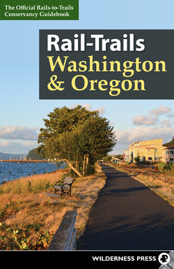
Rail-Trails: Washington and Oregon provides the information you’ll need to plan a rewarding rail-trail trek. With words to inspire you and maps to chart your path, it makes choosing the best route a breeze. Following are some of the highlights.
Maps
You’ll find three levels of maps in this book: an overall regional map, state locator maps, and detailed trail maps.
Each chapter details a particular state’s network of trails, marked on locator maps in the chapter introduction. Use these maps to find the trails nearest you, or select several neighboring trails and plan a weekend hiking or biking excursion. Once you find a trail on a state locator map, simply flip to the corresponding page number for a full description. Accompanying trail maps mark each route’s access roads, trailheads, parking areas, restrooms, and other defining features.
Key to Map Icons
Trail Descriptions
Trails are listed in alphabetical order within each chapter. Each description leads off with a set of summary information, including trail endpoints and mileage, a roughness index, the trail surface, and possible uses.
The map and summary information list the trail endpoints (either a city, street, or more specific location), with suggested points from which to start and finish. Additional access points are marked on the maps and mentioned in the trail descriptions. The maps and descriptions also highlight available amenities, including parking and restrooms, as well as such area attractions as shops, services, museums, parks, and stadiums. Trail length is listed in miles.
Each trail bears a roughness index rating from 1 to 3. A rating of 1 indicates a smooth, level surface that is accessible to users of all ages and abilities. A 2 rating means the surface may be loose and/or uneven and could pose a problem for road bikes and wheelchairs. A 3 rating suggests a rough surface that is only recommended for mountain bikers and hikers. Surfaces can range from asphalt or concrete to ballast, cinder, crushed stone, gravel, grass, dirt, and/or sand. Where relevant, trail descriptions address alternating surface conditions.
All trails are open to pedestrians, and most allow bicycles, except where noted in the trail summary or description. The summary also indicates wheelchair access. Other possible uses include in-line skating, fishing, horseback riding, mountain biking, and cross-country skiing. While most trails are off-limits to motor vehicles, some local trail organizations do allow all-terrain vehicles and snowmobiles.
Trail descriptions themselves suggest an ideal itinerary for each route, including the best parking areas and access points, where to begin, your direction of travel, and any highlights along the way. The text notes any connecting or neighboring routes, with page numbers for the respective trail descriptions. Following each description are directions to the recommended trailheads.
Each trail description also lists a local website for further information. Be sure to visit these websites in advance for updates and current conditions. TrailLink.com is another great resource for updated content on the trails in this guidebook.
Trail Use
Rail-trails are popular destinations for a range of users, often making them busy places to enjoy the outdoors. Following basic trail etiquette and safety guidelines will make your experience more pleasant.
Keep to the right, except when passing.
Pass on the left, and give a clear audible warning: “Passing on your left.”
Be aware of other trail users, particularly around corners and blind spots, and be especially careful when entering a trail, changing direction, or passing, so that you don’t collide with traffic.
Respect wildlife and public and private property; leave no trace and take out litter.
Control your speed, especially near pedestrians, playgrounds, and heavily congested areas.
Travel single file. Cyclists and pedestrians should ride or walk single file in congested areas or areas with reduced visibility.
Cross carefully at intersections; always look both ways and yield to through traffic. Pedestrians have the right-of-way.
Keep one ear open and volume low on portable listening devices to increase your awareness of your surroundings.
Wear a helmet and other safety gear if you’re cycling or in-line skating.
Consider visibility. Wear reflective clothing, use bicycle lights, or bring flashlights or helmet-mounted lights for tunnel passages or twilight excursions.
Keep moving, and don’t block the trail. When taking a rest, turn off the trail to the right. Groups should avoid congregating on or blocking the trails. If you have an accident on the trail, move to the right as soon as possible.
Bicyclists yield to all other trail users. Pedestrians yield to horses. If in doubt, yield to all other trail users.
Dogs are permitted on most trails, but some trails through parks, wildlife refuges, or other sensitive areas may not allow pets; it’s best to check the trail website before your visit. If pets are permitted, keep your dog on a short leash and under your control at all times. Remove dog waste in a designated trash receptacle.
Teach your children these trail essentials, and be especially diligent to keep them out of faster-moving trail traffic.
Be prepared, especially on long-distance rural trails. Bring water, snacks, maps, a light source, matches, and other equipment you may need. Because some areas may not have good reception for mobile phones, know where you’re going, and tell someone else your plan.
Key to Trail Use
Learn More
While Rail-Trails: Washington and Oregon is a helpful guide to available routes in the region, it wasn’t feasible to list every rail-trail in these two states, and new trails spring up each year. To learn about additional rail-trails in your area or to plan a trip to an area beyond the scope of this book, visit Rails-to-Trails Conservancy’s trail-finder website, TrailLink.com—a free resource with information on more than 30,000 miles of trails nationwide.
