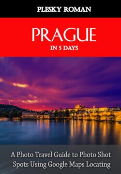
Читать книгу Prague in 5 Days - Roman Plesky - Страница 3
На сайте Литреса книга снята с продажи.
ОглавлениеUser Information
The use of this photo-travel-guide differs from the usual use of e-books. This guide should be used with a Book-Reader-App on a tablet or smartphone with internet access preferably. After the user has been inspired by the pictures enough, he can touch the pictures with one click or one tap, in order to see the location (where the picture is taken from) in Google Maps ❶. By pressing the pictures for a longer time, most e-book readers allow you to enlarge the image. ❷.
The same principle applies to the included maps or routes ❸. In this way, the reader learns how he can reach the famous and beautiful places of the destination.
In rare cases, GPS-Data can have a difference of up to 200 meters. There is a small disadvantage in this system, if a picture has been photographed strongly zoomed or if the some shots has been caught from the plane or helicopter. However, a trained eye usually recognizes the position and direction of the photo shot position. ❹.
Behind the many symbols are useful links hidden, to make your holiday planning easier. In this manner, the described topic can be extend in an individual way ❺.
Via the table of contents, you will be able to reach every in this e-book described destination quickly and easily.
In the first part of this e-book, the reader learns some basic information about the route and the country. The second part describes the destinations and the tours that can bee done.
In the last part, I mention a few tips in relation to the photo-equipment and daylight conditions. The last chapter also contains countless useful web-links.
The e-book is not intended to be a perfect Encyclopedia, but it should help to plan your stay in Egypt effectively.
❶ Clicking or tapping the image will take you to the location on Google Maps, where the picture was taken.
❷ The image can be enlarged by a longer tap. The enlarged image can be closed by clicking on the cross.
❸ Tap the route maps to go to the Google Maps routes.
PLEASE NOTE THAT YOUR GOOGLE-MAPS APPLICATION IS IN PEDESTRIAN MODE OR TRANSPORTATION MODE.
❹ For images where it is difficult to see the position and direction, I recommend switching to the satellite view. In some photos I have already selected the satellite view because the default view is absolutely useless. In extremely difficult cases I have devised a system. The place mark was shifted in the opposite direction to the side edge, so that the viewing direction takes up most of the space for itself. The arrow on the lower figure illustrates the direction of view.
❺ Behind the many small icons and symbols are hidden many useful internet links.
EXAMPLES:
Behind this symbol is a reference, which provides you more interesting information on the web (mostly from Wikipedia).
This symbol is linked to the route maps and leads to the same routes on Google Maps.
Behind this symbol is always an Internet reference to the described airport.
This icon will lead you to a website of a local transport company in the public space.
This symbol takes you to my 360 degree panoramas, which are also geo-located.
Apart from these examples, I have inserted other countless symbols with more information for you.
