Читать книгу Walking in the Pentland Hills - Susan Falconer - Страница 9
На сайте Литреса книга снята с продажи.
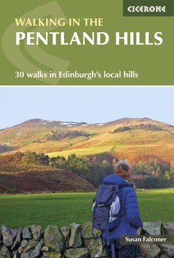
ОглавлениеINTRODUCTION
‘The Pentland Hills are homely and friendly hills; they lie near the bounds of our city habitation, and frequent visiting begets an intimacy and friendship that is real and lasting. The most outlying parts may be reached in the course of a day’s walk, and places of silence, where none will intrude, are easily accessible.’ Will Grant’s words from his 1927 book The Call of the Pentlands are as relevant today as when they were first written. The Pentland Hills comprise a rich tapestry of landscapes and landforms, all neatly packaged within an area easily accessible from Scotland’s majestic capital city. Although principally a grass-and heather-clad, softly rounded hill range, the hills reward further exploration by revealing stunning summit vistas, quiet waterside strolls, deeply incised rocky valleys and wooded walks, as well as a fascinating natural and cultural heritage.
The Pentlands are well known to the people of Edinburgh; even for those who have not actually visited them, they form a familiar backdrop to city life. This hill range – Robert Louis Stevenson’s ‘hills of home’ – arouses strong feelings, and on their return to Edinburgh, either by road, rail or air, many people regard their first glimpse of the Pentlands as confirmation of finally arriving home.
The Pentland Hills run southwest from Edinburgh towards Biggar, covering an area of 210 sq km, and their generally rounded appearance is the result of sculpting by glaciers and meltwater, They reach a maximum height of 579m at Scald Law, although most lie between 400m and 550m in height.
Approximately 90 sq km in the northern sector of the Pentlands was designated a regional park (the Pentland Hills Regional Park) in 1986, with the aim of acknowledging and safeguarding the landscape, wildlife and recreational value of this important location. The regional park benefits from a ranger service (now called the Natural Heritage Service), which assists land managers and visitors by maintaining the path infrastructure, providing waymarking and interpretation, and giving advice on responsible access. The path network is well signposted, and a diverse range of cultural and natural heritage adds interest to the scenery.
The Pentlands offer good variety for the walker, with the excellent path system, interesting but not too rugged terrain, and proximity to civilisation adding up to a superb introduction to hill walking in Scotland. These hills are especially suitable for beginners (Walks 1 to 7), although the longer and more remote routes (Walks 11, 13, 14 and 15) in the southern end, which is a more open, exposed and remote landscape, with less obvious waymarking and more challenging navigation on some routes, should satisfy the more seasoned hiker. Walks 19, 20, 24 and 25 should also appeal to more experienced walkers. A basic level of navigational skills is required, but none of the routes should cause any wayfinding difficulties.
My approach to writing this guidebook is to imagine that I, as a countryside ranger, am taking the reader on a walk. It reflects what I would point out and note as a ranger on patrol, with the addition of snippets of research that I have found interesting along the way.
The Pentlands are included in many walking guides about the Lothians and Scotland, but to my knowledge there has, so far, been no walking guide dedicated solely to the Pentland Hills. This shortage of comprehensive walking guides led to the writing of this book.
Approaches and accommodation
The Pentlands is one of the most accessible hill ranges in Scotland, well served by roads on all sides: the A720 Edinburgh city bypass to the north; the A70 Lanark road to the west; the A721 to the south; the A702 (T) Biggar road to the east. This network of roads means that the hills are readily accessible by car or bicycle, although bus services are variable. The northern end is well served by public transport from Edinburgh, eg Lothian Buses number 4 to Hillend (Walks 1, 2, 30), number 10 to Torphin and Bonaly (Walks 4, 5, 29), and number 44 to Balerno (Walks 9 and 10), all leaving from Princes Street in the city centre. A regular service from central Edinburgh to Dumfries, via MacEwen’s Coach Services number 100, uses the A702 (Walks 12, 16, 17, 22, 23, 24 and 25).
Approaching Scald Law from the Kirk Road end (Walk 21)
Loganlee dam and carnethy (Walk 29)
A comprehensive leaflet entitled How to Get to the Pentland Hills by Bus, with a map and route suggestions, is available from the Pentland Hills Ranger Service. It can be downloaded from www.pentlandhills.org, or is available from the visitor centres at Flotterstone or Harlaw. Check with local operators for the latest service information, or phone Traveline 0871 200 2233.
For those who need accommodation, Edinburgh offers a great choice – campsites, hostels, bed and breakfasts, guesthouses and hotels are all within easy reach. Penicuik, West Linton and Lanark are alternatives, and www.visitscotland.com has details of accommodation for all these locations.
Choosing a walk
The walks described are a personal selection, chosen to give a flavour of the hills at their best. The Pentlands do not cover a vast tract of land, and inevitably routes cross and cover some of the same ground, but every walk is different in character, and the experience of walking it is influenced by weather, mood, companions and so on. (For each walk there is a brief description, at the beginning, summarising its character.)
Heading off up Turnhouse Hill (Walk 25)
As far as possible, the routes are circular, as this reduces the need for additional transport, and reflects the fact that the majority of walkers (myself included) prefer not to retrace their steps. For some walks you need to retrace your steps for a short way, back to the start point, but none is linear. Optional links with other routes in the book are included, to lengthen some walks (eg Walks 2, 4, 6, 12 and 16), and informative ‘points of interest’ are found throughout.
The walks are presented in order as follows: starting at Hillend, at the northern end of the Pentlands, nearest Edinburgh, then moving southwest along the A70 down as far as Little Vantage, and finally skipping across to West Linton and back up the A702 to return to the beginning.
The lack of routes along the A70 between Harperrig and Carnwath is a reflection of the lack of public transport, few safe and accessible parking areas, and a shortage of good walking routes with interesting features along the way.
Access rights and responsibilities
The Land Reform (Scotland) Act 2003 was passed by the Scottish parliament in 2003 and enacted through the Scottish Outdoor Access Code in February 2005. The Act gives everyone the right to be on most land or water for recreation, providing they act responsibly. Acting responsibly means: using stiles to cross fences; leaving gates as you found them; keeping your dog under control; respecting the needs of land managers and other users. There is a long tradition of access by walkers to the Pentlands, and most land managers are tolerant and understanding of responsible recreation.
The Pentlands are used extensively for sheep farming, water catchment, arable crops, military training and game shooting.
Sheep
The lambing and tupping (when the male tupps are mating with the ewes) seasons are particularly sensitive times of year. Lambing usually takes place between March and May, and tupping in November. Dogs must not be taken into fields with lambs (or calves), and must be kept under close control in fields with other animals.
Grouse shooting
Grouse shoots may take place in August and September. The line of the drive is usually obvious, and well managed and signposted by the estate, but do be extra vigilant during these months.
Military training
A sector of the northern Pentlands from Dreghorn through to Castlelaw is used by the army for training. Live firing takes place on the ranges near Castlelaw farm and is clearly marked and signposted. Dry training may take place in the sector at any other time, but again is signposted. Please be aware of this, especially on Walks 5, 23, 25, 26, 28, 29 and 30. Responsible walking access is not usually affected by military training, but please obey any signage or instructions for your own safety.
Wildlife
The routes described in this book are mainly on paths and tracks, making for easier walking, and minimising disturbance to wildlife. Walking off the path may disturb ground-nesting birds, such as curlew, skylark and red grouse, so please take care where you are walking, especially during the March to July nesting season. Check for details at www.outdooraccess-scotland.com.
Weather
The Pentlands can be enjoyed in all seasons – crisp winter days when time and light are short, warm days in spring or summer, or bright autumn mornings. In general they are not subject to extremes of weather, and enjoy a benign climate. Most weather systems affecting the range come from the west, bringing fronts of wet and windy conditions, and the tops can be very windy in exposed areas. Snowfall tends to last no more than a few days (cross-country skiing has only been possible on a handful of days in the past few years), but electrical storms can be a hazard on exposed ground, in which case a speedy retreat to lower down is recommended.
Wet weather means that streams and rivers can rapidly become hazardous to cross. Walks 1, 8, 21 and 23 do not involve crossing water, but bridges, spillways and dams will be encountered on all the other walks. Be aware that things can change, however, including the condition of structures, particularly after adverse weather. Be especially vigilant after heavy rain or snow melt, and if in doubt, do not cross.
A useful website that offers a hills-and mountain-orientated weather forecast is www.mwis.org.uk.
Equipment
The range of equipment available to outdoor enthusiasts is quite staggering. I’ve seen people equipped to tackle the north face of the Eiger rather than Turnhouse Hill (Walk 8), as well as those whose footwear and clothing can only be described as inadequate for the weather and terrain they were about to attempt. In general, a good pair of walking boots, appropriate warm, waterproof clothing – or a hat and sunscreen, depending on the weather – plus a rucksack with food, drink, map, compass and guidebook, are all that is needed. (In 1927, Will Grant, author of The Call of the Pentlands, recommended a good thick Harris tweed suit and a pair of strong boots with tackets (hobnails) for walks in winter. Tweed and tackets have been replaced by more modern materials, but the principle is the same.) (Note: mobile phone coverage in the Pentlands is patchy, with many areas of poor or non-existent reception.)
Following a route
Maps
The maps in this guide are taken from the Ordnance Survey Landranger (1:50,000) series. The information box at the start of each walk gives details of the relevant OS Landranger and Explorer (1:25,000) maps for that walk. For all the walks in this guidebook you will need the following:
Landranger 65 (Falkirk and West Lothian)
Landranger 66 (Edinburgh)
Landranger 72 (Upper Clyde Valley)
Explorer 344 (Pentland Hills)
Map references beginning NT and followed by six figures will be found in the walk instructions. These are included to locate the exact start point of each route and to assist with navigation along the way.
Times
An approximate time needed to complete the route is also given in the information box. These times have been calculated using Naismith’s Rule of 4km/hour, plus 1 minute for every 10m of ascent. Some walkers will be faster, others slower, and the times do not allow for lunch breaks or other stoppages.
The information box also includes: Start/Finish, Distance, Ascent and Maps.
Route description
The main route description describes the ground covered, and has been thoroughly tried and tested. The numbered paragraphs correspond to the numbers along the line of the route on the map. (Be aware that things can change, however – trees are felled, footbridges become unsafe, and land management is ongoing – so be prepared for discrepancies between the route description and what you encounter on the ground.)
Geology and landscape
The Pentlands landscape owes its distinctive profile to the hardness of the 400-million-year-old volcanic rock, lava and ash of the Devonian period.
The heart of the Pentlands is formed from the folded sedimentary rocks of the Silurian age (435 million years), mainly marine shales and sandstones. This core is only exposed at three places: North Esk, Green Cleuch (Walk 8) and Loganlea. But it is the rocks of the succeeding Old Red Sandstone period (400 to 350 million years old) that have contributed to the form of the Pentlands we see today. After a period of erosion, coarse conglomerates and sandstones were laid down, and at this time volcanic activity also increased, and lavas and tuffs (volcanic ash) were deposited.
Geology at the Howe (Walk 8)
The rocks are classified according to the minerals they contain. Basalts and andesites are richly charged with iron oxides such as haematite, and are seen in the characteristic dark-red screes and outcrops found beside the lower part of Flotterstone Glen road (Walk 24). Rhyolytes and trachytes tend to be pink or pale orange in colour. Rhyolyte can be seen on the summit of Caerketton Hill (Walk 1) and trachytes are best seen on Torduff Hill (Walk 4). Tuffs, pale in colour and often containing distinct fragments of other rocks, can be found on the summit of Carnethy Hill (Walk 21).
The rocks of the Upper Old Red Sandstone age are found around West and East Cairn Hills (Walks 11 and 15). Earth movements during the Lower Carboniferous period created the Pentland Fault (the A702 follows the line of the fault), which separates the Pentlands from the Midlothian coalfield.
Mendick Hill from the Roman road (Walk 13)
The rounded profiles of the hills, the deposits of boulder clay and striated (scratched) rock surfaces, are evidence that an ice sheet scoured the Pentlands. In the last two million years, warmer spells between ice ages caused the ice to melt, and vast quantities of meltwater cut out channels to lower ground. Green Cleuch (Walk 9) and the area to the west of Carlops (Walk 16) are excellent examples of these meltwater channels.
The hard, volcanic rocks have been used to construct cairns, dwellings, dykes and roads around the hills. The shape of the land, with its valleys and relatively non-porous rock, has been well utilised for water catchment.
Visit www.edinburghgeolsoc.org/downloads/lbgcleaflet_pentland.pdf for a leaflet about the geology of the Pentland Hills.
Cultural heritage
There is an impressive range of archaeological sites and remains in the Pentlands. These include the early Bronze Age cairn on Carnethy Hill (Walk 8), the souterrain (an underground chamber or passage) at Castlelaw (Walk 5), and forts at Clubbiedean (Walk 4), Braidwood and Lawhead (Walk 22). Other places, such as Cairns Castle (Walk 11) and the site of the Battle of Rullion Green (Walk 22), are testament to some of the area’s more turbulent times. More recently, Robert Louis Stevenson and Sir Walter Scott have been inspired to base stories and characters on the area’s past events (see Walks 2, 4 and 28, for example).
Place names and dialect words
Place names
Today, a place name may seem merely a convenient label to attach to a location, but when it was originally applied to that place, the name must have had a particular significance. Place names can give us an insight into the past and those who populated it, and included in this book is background to some of the place names in the Pentlands.
Place names are evidence of the languages used by the succession of different peoples who lived in the Lothians. Celtic, the language of the early Iron Age British Celts, survives in Pentland names such caep, ‘pointed hill’, as in West Kip (Walk 3). The British Celts saw the Romans arrive and were largely trading allies. In the 7th century the area was conquered by the Northumbrian Angles, and Anglian is reflected in laecc, ‘boggy stream’ (Walk 5). Gaelic names appear later, around the 10th century, as a result of political change. A Pentland example is cloch mead, ‘the stone at the middle of the pass’ (Walk 4). From the 11th century to the 18th century estate and farming names began to dominate, although they often reflect earlier origins.
I have drawn heavily on Stuart Harris’s The Place Names of Edinburgh, Their Origins and History (see bibliography), and some research was undertaken by the Scottish Place-Name Society, so if this is an area of interest for you, it may be worth looking at www.spns.org.uk.
Dialect words
A number of words in the text may be unfamiliar to readers, so a brief glossary is included as Appendix C. These are local terms used for places and wildlife. The word ‘cleuch’ (or sometimes ‘cleugh’, used chiefly by map makers) is used often and means a narrow valley. ‘Bealach’ is a pass or saddle between two hills, sometimes termed a col. I have used the local phrase ‘drystane dyke’ to describe a wall built without mortar.
‘Peewit’, ‘whaup’ and ‘laverock’ (lapwing, curlew and skylark respectively) are birds you will probably encounter on a walk in the Pentlands. Personally, I like these names, and encourage their continued use.
Old maps
The British Isles are very well served in terms of maps. The practise of making maps stretches back centuries, with a variety of reasons for their production – military, land holding, legal and fiscal, and so on – and the late 19th century saw a rise in the use of maps as an aid to walking and recreation. The earliest maps referred to in this book are: Adair’s maps of Midlothian and West Midlothian, from 1682; A and M Armstrong’s Map of the Three Lothians, surveyed in 1773; Roy’s 1753 Military Survey of Scotland; Knox’s 1812 Edinburgh and Its Environs. After this the Ordnance Survey provides the basis for today’s cartography, with foundations laid by the Ordnance Survey six-inch maps from 1852 onwards.
The National Library of Scotland has an excellent digital library of maps, and their website is www.nls.uk.
Previous Pentlands guidebooks
A number of guidebooks have been written about the Pentland Hills, mainly in the last century, and they are an eclectic mix. George Reith’s The Breezy Pentlands (1910) is a lovely blend of heritage and walking routes, with humour laced throughout. Pentland Walks with Their Literary and Historical Associations (Robert Cochrane, 1908) describes a series of routes combined with cultural background and details of the literary connections of the hills (this book formed the basis of DG Moir’s Pentland Walks, Their Literary and Historical Associations, published in 1977). William Anderson’s The Pentland Hills (1926) – not written as a guidebook but as an appreciation – makes interesting reading.
Probably the best known of the Pentlands guidebooks is Will Grant’s The Call of the Pentlands (1927), and another of Grant’s books, Pentland Days and Country Ways (1934), is an anthology of stories about and reflections on the hills.
The publication of these books reflected the growing interest in walking and the countryside among ordinary people during the 20th century, as more leisure time became available and travelling became easier.
The early 1990s saw a further two Pentlands books published: The Pentlands’ Pocket Book by Albert Morris and James Bowman in 1990, and Jim Crumley’s Discovering the Pentland Hills a year later. Ian Munro’s The Birds of the Pentland Hills also makes fascinating reading, reflecting the changing weather, the character of the people, and Ian Munro’s own love of the area.
In 2014 the Friends of the Pentlands waymarked a route from Dunsyre to Swanston, called The Pentland Way. A comprehensive guide to the route, written by Bob Paterson, was published in 2015.
Literary Connections with the Pentland Hills
The Pentlands have provided inspiration for many writers, and Cochrane’s Pentland Walks with Their Literary and Historical Associations and Moir’s Pentland Walks, Their Literary and Historical Associations both describe these connections. Allan Ramsay based his pastoral comedy The Gentle Shepherd in the area around Carlops (Walks 16 and 17). Sir Walter Scott and Robert Louis Stevenson walked the northern Pentlands extensively, and Walk 2 covers much of the area explored by Stevenson. (The poets Wilfred Owen and Siegfried Sassoon, both evacuated to Craiglockhart Hospital in 1917, also walked in these hills.) (See bibliography,Appendix B, for details of the above titles.)
Swanston cottage (Walk 2)
Protecting and enjoying the hills
The Pentland Hills have long been a destination for people seeking recreation in the countryside. Well over a century ago, in 1883, the Scottish Rights of Way and Access Society began two years of negotiation with landowners and surveying of paths, and in 1885 inaugural signposts were erected on most Pentland paths. The society produced the first walking guidebook, with a copy presented to each Pentland landowner, and a further 300 to the Edinburgh Trades Council – for distribution among working men ‘in order that healthful enjoyment and recreation afforded by the rights of way across the hills should be better known’. The society continues its invaluable work today.
Bonaly Reservoir from Harbour Hill (Walk 4)
With improved and increased access, however, came an increase in problems – with litter, for example. In The Pentland Hills, William Anderson complained, back in 1926 ‘…there is nothing more offensive than, on arriving…to find the outflow choked with paper or cardboard boxes, and the ground littered with orange and banana skins, broken bottles, and such like’ (although his suggestion for hiding litter in molehills or under heather bushes is not acceptable now). On 24 May 1932 The Scotsman reported that the Victoria Day holiday saw thousands trekking to the hills, the lonely spaces being invaded from an early hour and traffic to Flotterstone Bridge (Walk 23) exceptionally heavy.
Recognition of the Pentlands’ role in Edinburgh’s recreation activities, and the need for protection of the hills, has been noted for decades. Letters to The Scotsman in November 1945 suggested that the Pentlands become the United Kingdom’s first national park, dedicated to the memory of those who gave their lives for their country in the Second World War. But it was not until the late 1960s that the Pentlands were considered for legislative protection under the Countryside (Scotland) Act 1967, and the idea of designating the area a regional park was first mooted. After much debate, eventually leading to a public enquiry, on 12 September 1986 the Secretary of State for Scotland confirmed that 9158 hectares of the Pentland Hills was designated a regional park.
The act of designating this area a regional park served to acknowledge the beauty of the landscape, the importance of the wildlife, and the recreational value of this working area. As a regional park, the objective is to retain and enhance the essential character of the hills as a place for peaceful enjoyment of the countryside.
The role of the Pentland Hills Ranger Service is to ensure the integration of responsible access with farming, and the other land uses in the hills. This is done through maintaining the path network, providing waymarking and signage, staffing visitor centres at Flotterstone and Harlaw, producing maps and leaflets about responsible enjoyment, and patrolling to be a practical presence for visitors and land managers alike.
For information on Scotways and the Pentland Hills Regional Park, visit www.scotways.com and www.pentlandhills.org.
Wildlife
The varied habitats of the Pentlands give rise to a rich diversity of wildlife.
Heather moorland is home to red grouse, the merlin, mountain hare, emperor moth and green hairstreak butterfly. ‘Muirburn’ – the deliberate burning of areas of mature heather to create a mosaic of differing ages and varying heights of heather – benefits many species. The new shoots and variety of structures in a well-managed moor provide food and cover for birds, mammals and insects.
The many reservoirs in the Pentlands are especially good for wildfowl. Westwater (Walk 14) is a Ramsar site (a wetland of international importance), especially significant for thousands of pink-footed geese in the winter. Threipmuir (Walk 7) has mallard, teal, whooper swan and great crested grebe, and North Esk has a noisy colony of black-headed gulls. Smaller ponds support colourful insects such as the large red damselfly and common hawker dragonfly, as well as common frogs and palmate and smooth newts.
Looking over Loganlea Reservoir to Carnethy Hill and Turnhouse Hill (Walk 29)
Grasslands are home to brown hares, short-eared owls, the common shrew and meadow brown butterfly.
The Pentlands are not heavily wooded – there are a few conifer plantations, and the 19th-century shelter belts and woodlands surrounding reservoirs support birds such as the willow warbler, crossbill, goldcrest and sparrowhawk.
Fungi are often overlooked, or in some cases destroyed by people, but they play a vital role in recycling nutrients in a woodland or grassland. They are a fascinating group of organisms in their own right, and to discover more about them, visit www.britmycolsoc.org.uk.
Patches of gorse scrub are good places to find stonechats and whinchats, as well as robins and wrens, and rocky screes are the haunt of common lizards, which bask in the sun.
Bogs and marsh are where plants and animals specially adapted to their surroundings can be found. Insectivorous plants such as round-leaved sundew and common butterwort grow on damp ground, and obtain essential nutrients from the flies and beetles they trap.
There is usually some wildlife interest at any time of year on the walks described.
Cauliflower fungus at base of Scots pine (Walk 6)