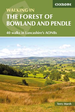
Читать книгу Walking in the Forest of Bowland and Pendle - Terry Marsh - Страница 17
На сайте Литреса книга снята с продажи.
ОглавлениеWALK 6
Clougha Pike
| Start/Finish | Birk Bank car park, Quernmore (SD526604) |
| Distance | 8km (5 miles) |
| Total Ascent | 350m (1150ft) |
| Terrain | Good paths and tracks, but some untracked heather moorland, and a rocky descent to a large boggy area (no dogs) |
| Maps | Explorer OL41 (Forest of Bowland and Ribblesdale) |
This energetic walk makes a splendid ascent to one of the finest viewpoints in Lancashire, concluding through a delightful wooded ravine and across a stretch of marshy ground bright in spring with bog-loving plants. There is a small amount of trackless wandering, which presents no difficulty in clear weather conditions.
Leave the rear of the Birk Bank car park by walking to a gate giving onto a broad track at the edge of Access Land. Follow the track through bracken, and when it forks, branch left.
When the track later curls to the right, leave it by branching left onto a narrower path that continues easily to pass a stone pillar, and then reach Ottergear Bridge spanning a gully near a disused quarry. Over the bridge, bear left on a broad green track that heads round to a T-junction. Here, turn right, climbing gently for a while and then levelling as the track passes through a gully. Cross a ladder-stile, and climb steeply out of the gully onto an ascending shooters’ track rising onto the moorland.
The track on to Clougha Pike is popular with cyclists too
The track casts about to ease the gradient, and offers a splendid range of views that improve with every step. Follow this for 2km (a little over a mile) to its highest point as it reaches the 400m contour near another small quarry area. This is where you now leave the track by simply stepping into the adjacent heather, heading in a roughly southwest direction to locate and cross a low step-stile in a fence, about 300m to the east of Clougha Pike. The heather is not especially deep, and a rash of gritstone boulders ease progress a little, but this is trackless walking and care should be taken.
Over the stile, bear right now to the trig pillar and shelter that mark the top of Clougha Pike. On most days you can see the fells of Lakeland, and the peaks of Yorkshire, the Isle of Man and the Clwydian Hills of North Wales.
Set off from the top of Clougha Pike by following a broad peaty path, punctuated by gritstone, that roughly follows the edge of the escarpment on the left, and aims first for a large cairn. Then descend, again on a clear path, with a fenceline converging from the right.
Where the fence and wall meet, bear left to clamber down a short rock step. Follow the wall for about 400m until it reaches a more level stretch, and here look for a path branching left (ignore the tempting ladder-stile ahead). Drop through bouldery terrain, and then continue the descent, now across a sloping rough pasture to a gate in a wall corner.
Through the gate bear right through reeds, still descending. The path winds round to Windy Clough. Windy Clough is an ice-age ravine, and Little Windy Clough, also ice age, is seen clearly a little higher.
Windy Clough, Clougha Pike
At the edge of Windy Clough go left to a ladder-stile and descend through a shallow gully flanked by bilberries and bracken. The path is often overgrown but easy enough to follow, and descends through light woodland of oak, ash, birch, willow and hawthorn. Later, the path runs beside a stream, and passes through an area of gorse and on to a stretch of boardwalks around the edge of a marshy area, filled in spring and summer with rafts of bog cotton and bog asphodel.
The summit of Clougha Pike is a fine viewpoint
The path soon meets a track beside a gate. Turn right, and when it forks a short way further on bear left over a slight rise to a track junction, and there go left again to descend to the car park.