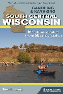
Читать книгу Canoeing & Kayaking South Central Wisconsin - Timothy Bauer - Страница 10
На сайте Литреса книга снята с продажи.
table of contents
ОглавлениеOVERVIEW MAP
OVERVIEW MAP KEY
ACKNOWLEDGMENTS
INTRODUCTION
What Is and Isn’t Included
Cue the Violin: Trips That Didn’t Make the Cut
How to Use This Guide
Planning for a Safe Trip
Public Access and Trespassing
Leave No Trace
TRIPS AT A GLANCE
PART ONE NORTHEAST OF MADISON
1 Beaver Dam River: Beaver Dam to County Road J
2 Crawfish River A: Columbus to Astico Park
3 Crawfish River B: County Road I to County Road G
4 Duck Creek: Wyocena to Duck Creek Road
5 Fox River A: Indian Hills Campground to Portage Canal
6 Fox River B: Portage to Buffalo in Columbia and Marquette Counties
7 Horicon Marsh: Greenhead Landing to Bowling Green Park
8 Maunesha River: Marshall to Waterloo
9 Mecan River: 11th Road to Dixie Avenue
10 Montello River: County Road J to Montello Lake Boat Landing
11 Oconomowoc River: Loew Lake
12 Puchyan River: Green Lake Dam to County Road J
13 Rock River: Harnischfeger Park to Kanow Park
14 Rocky Run Creek and Wisconsin River: US 51 to County Road V
15 Token Creek: Portage Road to Cherokee Marsh
16 White River (Green Lake County): Neshkoro Dam to White River Road
17 Yahara River A: DeForest to Windsor
PART TWO SOUTHEAST OF MADISON
18 Badfish Creek: Old Stage Road to Casey Road
19 Bark River A: Nemahbin Lake to Atkins-Olson Memorial Park
20 Bark River B: Rome Dam to Hebron
21 Bark River C: Koch Road to Burnt Village Park
22 Illinois Fox River: County Road H to County Road ES
23 Koshkonong Creek: Cambridge to Hoopen Road
24 Mukwonago River: County Road LO to County Road I
25 Pewaukee River and Illinois Fox River: Pewaukee to Waukesha
26 Red Cedar Lake State Natural Area: Cambridge in Jefferson County
27 Sugar River C: Avon Bottoms to Yale Bridge Road in Illinois
28 Turtle Creek A: Fairfield Area in Walworth and Rock Counties
29 Turtle Creek B: South O’Riley Road to Sweet-Allyn Park
30 Turtle Creek C: Sweet-Allyn Park to Dickop Street in Illinois
31 White River (Walworth County): Sheridan Springs Road to Burlington
32 Yahara River B: Dunkirk Dam to Rock River
PART THREE SOUTHWEST OF MADISON
33 Governor Dodge State Park: Cox Hollow and Twin Valley Lakes
34 Little Platte River: Quarry Road to County Road O
35 Little Sugar River: Schneeberger Road to Albany
36 Pecatonica River A: County Road O to Darlington
37 Pecatonica River B: Roller Coaster Road to Walnut Road
38 Pecatonica River East Branch A: Hollandale to Blanchardville
39 Pecatonica River East Branch B: Blanchardville to Argyle
40 Pecatonica River East Branch C: Argyle to Blackhawk Memorial Park
41 Platte River: Platte Road to Big Platte Road
42 Sugar River A: Verona to Paoli in Dane County
43 Sugar River B: Brodhead Dam to Avon Bottoms
PART FOUR NORTHWEST OF MADISON
44 Baraboo River A: Wonewoc to La Valle
45 Baraboo River B: La Valle to Lake Redstone
46 Baraboo River C: Rock Springs to North Freedom
47 Baraboo River D: Baraboo Rapids
48 Black Earth Creek: Olson Road to Lions Park
49 Dell Creek and Mirror Lake: Dellwood and Lake Delton in Sauk County
50 Devil’s Lake State Park: Baraboo in Sauk County
51 Lemonweir River: Mauston Dam to Two Rivers Boat Landing
52 Neenah Creek A: Chauncey Street to County Road A
53 Neenah Creek B: County Road P to Muskrat Road
54 Neenah Creek C: Muskrat Road to County Road CX
55 Pine River A: Pier Natural Bridge Park to County Road AA
56 Pine River B: County Road AA to Bohmann Drive
57 Pine River C: Twin Bluffs Drive to Wisconsin River
58 Wisconsin River A: Upper and Lower Dells
59 Wisconsin River B: Prairie du Sac Dam to Spring Green
60 Wisconsin River C: Lone Rock to Blue River
APPENDIXES
APPENDIX A: Madison Metropolitan Area Trips
APPENDIX B: Honorable Mentions
APPENDIX C: Illinois Trips Within 60 Miles of Madison
APPENDIX D: How to Read USGS and NOAA Water Level (Gage) Data Online
APPENDIX E: Paddling Resources
APPENDIX F: Safety Code of American Whitewater
APPENDIX G: Glossary of Paddling Terms
APPENDIX H: Glossary of Geologic/Aquatic Terms
ABOUT THE AUTHOR
MAP LEGEND
