Читать книгу The Wild North Land - William Francis Sir Butler - Страница 10
На сайте Литреса книга снята с продажи.
CHAPTER V.
ОглавлениеTable of Contents
The Forks of the Saskatchewan.—A perverse Parallel.—Diplomatic Bungling.—Its results.
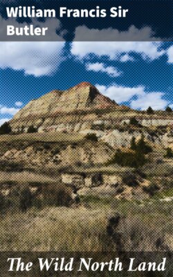
Two hundred and fifty feet above water level, the narrow tongue of land rises over the junction of the two Saskatchewan rivers. Bare and level at top, its scarped front descends like a wall to the rivers; but land-slip and the wear of time have carried down to a lower level the loose sand and earth of the plateau, and thickly clustering along the northern face, pines, birch, and poplar shroud the steep descent. It is difficult to imagine a wilder scene than that which lay beneath this projecting point.
From north-west and from south-west two broad rivers roll their waters into one common channel, two rivers deep furrowed below the prairie level, curving in great bends through tree-fringed valleys. One river has travelled through eight hundred miles of rich rolling landscape; the other has run its course of nine hundred through waste and arid solitudes; both have had their sources in mountain summits where the avalanche thundered forth to solitude the tidings of their birth. And here at this point, like two lives, which, coming from a distance, are drawn together by some mysterious sympathy, and blended into one are henceforth to know only the final separation, these rivers roll their currents into one majestic stream, which, sinking into a deep gorge, sweeps eastward through unbroken pine forest. As yet no steamboat furrows the deep water; no whistle breaks the sleeping echoes of these grim scarped shores; the winding stream rests in voiceless solitude, and the summer sun goes down beyond silent river reaches, gleaming upon a virgin land.
Standing at this junction of the two Saskatchewan rivers, the traveller sees to the north and east the dark ranks of the great sub-Arctic forest, while to the south and west begin the endless prairies of the middle continent. It is not a bad position from whence to glance at the vast region known to us as British North America.
When the fatal error at Saratoga had made room for diplomatists of Old and New England, and removed the arbitrament of rebellion from the campaign to the council, those who drew on the part of Great Britain the boundary-lines of her transatlantic empire, bungled even more conspicuously in the treaty-chamber than her generals had failed in the field. Geographical knowledge appears ever to have been deemed superfluous to those whose business it was to shape the destinies of our colonial dominions, and if something more tangible than report be true, it is not many months since the British members at a celebrated conference stared blankly at each other when the free navigation of a river of more than two thousand miles in length was mooted at the Council Board. But then, what statesman has leisure to master such trifles as the existence of the great river Yukon, amid the more important brain toil of framing rabbit laws, defining compound householders, and solving other equally momentous questions of our Imperial and Parochial politics? However to our subject. When in 1783 the great quarrel between Britain and her Colonies was finally adjusted, the northern boundary of the United States was to follow the 49th parallel of latitude from the north-west angle of the Lake of the Woods to the river Mississippi, and thence down that river, &c., &c.
Nothing could possibly have been more simple, a child might comprehend it; but unfortunately it fell out in course of time that the 49th parallel was one of very considerable latitude indeed not at all a parallel of diplomatic respectability, or one that could be depended on, for neither at one end or the other could it be induced to approach the north-west angle of the Lake of the Woods or the river Mississippi. Do all that sextant, or quadrant, or zenith telescope could, the 49th parallel would not come to terms.
Doggedly and determinedly it kept its own course; and, utterly regardless of big-wig or diplomatic fogie, it formed an offensive and defensive alliance with the Sun and the Pole Star (two equally obstinate and big-wig disrespectful bodies), and struck out for itself an independent line.
Beyond the Mississippi there lay a vast region, a region where now millions (soon to be tens of millions) draw from prairie and river flat the long-sleeping richness of the soil. Then it was a great wilderness, over which the dusky bison and his wilder master roamed, in that fierce freedom which civilization ends for ever.
To the big-wigs at the Council Board this region was a myth—a land so far beyond the confines of diplomatic geography that its very existence was questioned. Not so to the shrewd solicitor, admiral, auctioneer, general conveyancer, and Jack-of-all-trades in one, who guided the foreign policy of the United States.
Unencumbered by the trappings of diplomatic tradition, he saw, vaguely perhaps, but still with prescient knowledge, the empire which it was possible to build in that western wild; and as every shifting scene in the outside world’s politics called up some new occasion for boundary rearrangement, or treaty rectification, he grasped eagerly at a fresh foothold, an additional scrap of territory, in that land which was to him an unborn empire, to us a half-begotten wilderness. Louisiana, purchased from Napoleon for a trifle, became in his hands a region larger than European Russia, and the vast water-shed of the Missouri passed into the Empire of the United States.
Cut off from the Mississippi, isolated from the Missouri, the unlucky boundary traversed an arid waste until it terminated at the Rocky Mountains.
Long before a citizen of the United States had crossed the Missouri, Canadian explorers had reached the Rocky Mountains and penetrated through their fastnesses to the Pacific; and British and Canadian fur traders had grown old in their forts across the Continent before Lewis and Clark, the pioneers of American exploration, had passed the Missouri. Discovered by a British sailor, explored by British subjects, it might well have been supposed that the great region along the Pacific slope, known to us as Oregon, belonged indisputably to England; but at some new treaty “rectification,” the old story was once more repeated, and the unlucky 49th parallel again selected to carry across the Mountains to the Pacific Ocean, the same record of British bungling and American astuteness which the Atlantic had witnessed sixty years earlier on the rugged estuary of the St. Croix.
For the present our business lies only with that portion of British territory east of the Rocky Mountains, and between them, the Bay of Hudson and the Arctic Ocean.
From the base of the great range of the Rocky Mountains, the Continent of British America slopes towards North and East, until, unbroken by one mountain summit, but in a profound and lasting desolation, it dips its shaggy arms and ice-bound capes into a sea as drear and desolate.
Two great rivers, following of necessity this depression, shed their waters into the Bay of Hudson. One is the Saskatchewan, of which we have already spoken; the other, that river known by various names—“English,” because the English traders first entered the country by it; “Beaver,” from the numbers of that animal trapped along it in olden time; “Churchill,” because a fort of that name stands at its estuary; and “Missinipi,” or “much water,” by the wild races who dwell upon it. The first river has a total length of 1700 miles; the last runs its course through worthless forest and primeval rock for 1200 miles.
“OUR HUT AT THE FORKS OF THE SASKATCHEWAN”