Читать книгу The GR11 Trail - Brian Johnson - Страница 12
На сайте Литреса книга снята с продажи.
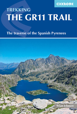
ОглавлениеINTRODUCTION
Punta Chistau (Stage 20)
The Pyrenees is the mountain chain which forms the border between France and Spain, stretching over 400km from the Atlantic Ocean to the Mediterranean Sea. The GR11, which stays on the Spanish side of the border, provides a very varied scenic route through magnificent, often remote, high or deserted mountains.
As the GR11 leaves the border town of Irún on the Atlantic Coast, it follows ridges on the gentle grassy and wooded hills of the Basque Country and Navarre. There is then a rapid transition into steep limestone mountains, passing through the world-renowned Ordesa Canyon before the fantastic granite peaks of the High Pyrenees are reached. The High Pyrenees rise to over 3000m, with snowfields surviving well into the summer and the remnants of the glaciers which carved out the deep valleys. The GR11 generally heads up these alpine valleys before crossing a high pass and descending into the next valley. These rough, tough mountains continue into Andorra. The mountains become gentler once Andorra is passed but, surprisingly, the highest point on the GR11 is reached after the High Pyrenees are left behind. As the Mediterranean is approached, the GR11 follows a line of steep, rugged, wooded hills to reach the sea at the spectacular peninsula of Cap de Creus.
National and natural parks
The GR11 passes through two national parks and six natural parks:
Parque Natural de Valles Occidentales
Parque Nacional de Ordesa y Monte Perdido
Parque Natural de Posets-Maladeta
Parc Nacional d’Aigüestortes i Estany de Sant Maurici
Parc Natural Alt Pirineu
Parc Natural Valls de Comapedrosa
Parc Natural Val del Madriu
Parc Natural Cap de Creus
The Valles Occidentales (western valleys) of Aragón is predominantly composed of limestone and is a relatively gentle introduction to the tough alpine terrain ahead of you.
Ordesa and Monte Perdido, a UNESCO World Heritage site, is the largest limestone massif in Western Europe. The highest peak is Monte Perdido (3355m) but it is the deep valleys, with thundering cascades and waterfalls edged by towering limestone, which attract the tourist.
Posets-Maladeta is a granite massif containing half the 3000m summits in the Pyrenees including Aneto (3404m), the highest mountain in the Pyrenees. Highly glaciated granite mountains provide some of the most spectacular mountain scenery in the world with thousands of little sparkling lakes nestling in a landscape dominated by bare rock.
As you pass into Catalonia, you pass through Aigüestortes and Sant Maurici National Park, another magical granite massif, and then the Parc Natural Alt Pirineu, the largest natural park in Catalonia. Alt Pirineu continues into Andorra as the Parc Natural Valls de Comapedrosa. The Val del Madriu as you leave Andorra is the final alpine section, with more fine granite scenery.
The GR11 ends with the Parc Natural Cap de Creus, which is a complete contrast: a rocky dry region, with almost no trees, on a peninsula sticking out into the Mediterranean Sea.
From the Atlantic to the Mediterranean
Col d’Angliós from Ibón d’Angliós (Stage 22)
There are three long-distance paths along the Pyrenees from the Atlantic to the Mediterranean:
GR10
High-level route (Haute Randonnée Pyrénénne, HRP)
GR11 (La Senda Pirenaica)
The oldest and most popular of these routes is the GR10, which is entirely in France. This well-waymarked path is not so wild and rough as the GR11 but it passes through equally spectacular terrain. Frequent visits to towns and villages means accommodation and supplies are not usually a problem. Staying to the north of the watershed, the GR10 has a much cooler and cloudier climate than on the GR11.
The HRP, which passes through France, Spain and Andorra, is not so much a walk as a mountaineering expedition. The route is not waymarked, except where it coincides with other routes, and you must expect to get lost! There is a lot of very rough terrain, including some very steep, possibly dangerous descents, and a lot of snow can be expected until late summer. Visits to towns and villages are infrequent so resupply is difficult and you will have to camp most of the time. You will spend a lot of time on high mountain ridges with a serious risk of thunderstorms and even fresh snow. The HRP is a daunting route for the inexperienced but is a magnificent expedition for those with the right experience.
The GR11 is a well-waymarked path which passes through Spain and Andorra. Like the HRP, it crosses many high mountain passes where there are boulderfields, scree and some easy scrambling at about the maximum difficulty the inexperienced would want when carrying a heavy rucksack. The weather tends to be considerably sunnier and drier than on the GR10 and thunderstorms are less of a problem than on the HRP as you don’t spend long periods on high ridges. Frequent visits to towns and villages mean that resupply isn’t much of a problem. Those who prefer not to camp or bivouac will find that a few of the days are rather long and that some of the alternative routes featured in this guide will need to be taken. There could be problems with snow in early season, but not later in the summer. Although the GR11 stays much higher than the GR10, there is actually considerably less climb.
Chisagüés on the descent to Parzán (Stage 18)
The GR11 is more difficult than the GR10 and takes you into tougher terrain, but they are both magnificent walks. Unless you are an experienced mountaineer you should prefer the GR10 or GR11 to the HRP.
The GR11
The total route is about 820km long with 46,000m of ascent and is described here in 47 stages. It can be seen as breaking into three broad sections.
The first 11 stages through the lower and more verdant Basque Country and Navarre, gradually climbing into the higher mountains south of Lescun before dropping to the Puerto de Somport cross-Pyrenees (Jaca–Pau) road. This section covers about 210km, and includes some long initial stages.
The High Pyrenees section from Candanchú through to Puigcerdà to the E of Andorra is covered in 25 stages and 380km, taking in the most remote and beautiful parts of the mountains. Access to the route, if needed, can be through Torla, Benasque, Espot and Encamp before reaching the busy main road/rail access at Puigcerdà running between Barcelona and Toulouse.
The final section runs through Catalonia from Puigcerdà to the Mediterranean, and is described in 11 stages, covering about 230km. It is here that the GR11 reaches its highest point (2780m) before crossing steep wooded terrain and descending to the dry and probably hot coast at Cap de Creus.
As well as these main access points, at many places the route crosses smaller mountain roads serving high villages, generally well served by bus, allowing the trekker to access or leave the route. Most routes quickly reach main bus and rail routes including the east/west rail lines between Bilbao, Pamplona, Zaragoza, Lleida and Barcelona in Spain or Hendaye, Pau, Toulouse and Perpignan in France.
Walkers with earlier editions of the Cicerone guide to the GR11 or maps should note that there was considerable rerouting of the GR11 between 2008 and 2011 and a major reroute in 2017.
The GR11 doesn’t pass over many summits, but suggestions are made for climbing many of the easier peaks which could be attempted while walking the route. If you want to climb some of the more difficult, higher peaks you should ask for advice from the guardians of the refuges.
It would be possible to walk the GR11 from Mediterranean to Atlantic, but this guide describes the route from the Atlantic so that you have the prevailing wind/rain on your back and have time to acclimatise to the heat before reaching the Mediterranean.
Weather and when to go
The Spanish south-facing slopes of the Pyrenees are much sunnier and drier than the French side and although you can expect good weather, you should be prepared for rain and thunderstorms. The hills of the Basque Country and Navarre have a reputation for mist and spells of gentle rain, but the author has known temperatures approaching 40°C.
The weather in the Central Pyrenees is often hot and dry, but these are high mountains and can be subject to terrific thunderstorms. Thunderstorms in high mountains are usually thought of as being an afternoon phenomenon, but in the Pyrenees the storms are often slow to build up and can arrive in the evening or even in the middle of the night! As the Mediterranean is approached you are reaching an arid region and can expect hot sunny weather.
Vignemale from Barranco deros Batans in July 2012 (top), and then in July 2013 (Stage 14)
Summer snowfall is unusual, but the author has experienced snow as low as 1500m on the GR11 in August. In 2012 there was hardly any snow on the high passes when the author through-hiked the GR11 with a mid-June start, and there would have been no problem starting in early June. However, a mid-June start in 2013 was a serious mountaineering expedition and there was still significant snow on the high passes well into August. Snow conditions vary tremendously from year to year. The inexperienced would be advised to wait for late June or July before setting off from Irún.
The best months to walk the GR11 are July, August and September, but if you are only intending to walk the lower sections of the GR11 in the Basque Country, Navarre or Catalonia, you may prefer May, June or October when the weather will be cooler.
Wildlife
You are bound to see – or hear – a marmot!
The Pyrenees are very popular with birdwatchers. The mountains act as a big barrier to migrating birds and in the spring and autumn they funnel birds along the Atlantic and Mediterranean coastlines and through the lower passes. The casual birdwatcher will be most impressed with the large number of birds of prey.
The massive Griffon vulture, with a wingspan of about 2.5m, will frequently be seen soaring on the high ridges, while the smaller Egyptian vulture, which is distinctively coloured with a white body and black-and-white wings, is also likely to be seen. You may also see Europe’s largest and rarest vulture, the lammergeier, which has a wingspan of up to 2.8m. The lammergeier feeds mainly on bone marrow, which it gets at by dropping bones from a great height to smash on the rocks below. Golden, booted, short-toed and Bonelli’s eagles may be seen, too. Arguably, the most beautiful bird you will see is the red kite, with its deeply forked tail. You can also expect to see black kites, buzzards and honey buzzards as well as smaller birds of prey such as the kestrel, peregrine falcon, sparrowhawk and rarer birds such as the goshawk and even a migrating osprey.
One species which seems to be thriving is the alpine chough, which you will see in large flocks. This member of the crow family is all black except for a yellow bill and red legs. Rarer small birds to look out for are the wallcreeper, crossbill, crested tit, red-backed shrike, bullfinch and alpine accentor.
You are much less likely to see some of the rare mammals which used to frequent the Pyrenees. There are no Pyrenean brown bears left on the Spanish side of the border and the Pyrenean Ibex seems to be extinct. Fortunately, you will have frequent sightings of the chamois (isard/izard) which was hunted to near extinction for the production of chamois leather, but has now made a remarkable recovery with numbers increasing to about 25,000. Other mammals you will see include marmot, several species of deer, fox, red squirrel and the reintroduced mouflon. There are badgers and wild boar, although these are less likely to be seen.
The most notable of these are the marmots, which are large ground squirrels that live in burrows. You will certainly know they are present when you hear their alarm signal, a loud whistle which sends them scurrying back into their burrows.
You are likely to see many reptiles and amphibians including several species of snake, lizard, toad, frog and the dramatic fire salamander.
Clockwise from top L to centre: Edelweiss, Anemone narcissiflora, Gentian, White Asphodel, Martagon Lily, Great Yellow Gentian, Aquilegia vulgaris, Androsace villosa, Bracket fungus
Pyrenean plant life is very diverse with at least 160 species of flower endemic to the Pyrenees, as well as many species, such as edelweiss, which will be familiar to those visiting the Alps.
Getting to the start
Access to the GR11 will be by car, coach, train or plane. (Useful websites are given in Appendix D.)
By car
You could to drive down to Irún through France or from Bilbao or Santander (by ferry from Portsmouth or Plymouth with Brittany Ferries) in northern Spain. You will need to find somewhere to leave your car and at the end of your walk you could return to Irún by rail.
By coach
It is possible to reach the Pyrenees by overnight coach from London (Victoria Coach Station). National Express run links to London and then Eurolines run coaches throughout Europe. The most convenient destinations for those walking the GR11 are Irún and Figueras. Eurolines also operate services to Bayonne, Orthez, Pau, Tarbes, San-Gaudens, Toulouse and Perpignan in northern France.
By rail
Paris can be reached by Eurostar. From here SNCF run high-speed trains to a variety of destinations including Hendaye, Pau, Toulouse and Perpignan. Although the GR11 is in Spain you will probably find the rail links on the French side of the Pyrenees are more useful for those wanting to hike sections of the GR11. You can connect with the GR11 using SNCF services to Hendaye, Candanchú (Col du Somport), Latour-de-Carol or Cerbère.
Hendaye is the French border town adjacent to Irún. From Pau you can take a train to Bedous then SNCF bus to Candanchú. From Toulouse there are trains to Latour-de-Carol which is only an hour’s walk from the GR11 at Puigcerdà. There are trains from Perpignan to Cerbère and then frequent trains crossing the border from Cerbère to Llançà, on the GR11. There is also a useful rail link from Perpignan to Villefranche and on by narrow-gauge railway (Train Jaune) to Latour-de-Carol or a direct bus link from Perpignan to Latour-de-Carol.
The main west–east line joins Hendaye, Pau, Toulouse and Perpignan.
By plane
At the time of writing, Ryanair fly from Stansted and some regional airports in the UK to Biarritz, Lourdes, Carcassonne, Perpignan, Gerona and Barcelona. British Airways fly direct to Toulouse and Barcelona. Air France have flights from London to Pau and a big choice of destinations if you fly via Paris. Easyjet fly from London to Biarritz and Bristol or London to Toulouse.
Getting home
There is no public transport from Cap de Creus. Your main option is to walk, take a taxi or hitch a lift to Cadaqués, which has now developed as a holiday resort. There is a 'tourist train' from Cap de Creus to Cadaques at about 1pm in the main holiday season.
From Cadaqués there are frequent buses to Figueras from where you can get trains to Cerbère to connect to the French rail network. There are also buses to Barcelona and Barcelona Airport. From Barcelona you could connect with the French rail network by taking a train to Puigcerdà (Latour-de-Carol).
If you have time to spare, the author would recommend walking back to Port de la Selva, exploring some of the beaches on the Cap de Creus peninsular, and then follow part of the coastal path, the GR92, to Llançà or even to Cerbère.
Equipment
GR11 hikers at Coll de Tudela (Stage 29)
This is a serious expedition so you should have previous experience of backpacking or long-distance walks before attempting this fantastic route. A few general points are made on equipment here.
Keep your load as light as possible. If you don’t need it, don’t carry it!
If you are using accommodation you may still want to carry a lightweight sleeping bag and camping mat to enable you to bivouac if necessary
Your waterproofs should be able to cope with thunderstorms in the High Pyrenees or steady rain in the Basque Country
You should have sufficient clothing to cope with sub-zero temperatures
A sun-hat is strongly recommended
Use plenty of sun-screen
Shorts are preferred by most hikers
Good quality walking shoes are the best footwear. You could use lightweight boots, but heavy boots aren’t necessary. Trainers aren’t really robust enough for the terrain. Make sure you have a good tread on your shoes or boots.
As a minimum you should have containers capable of carrying 4 litres of water, possibly with one easily accessible water bottle and the remaining capacity as water bags
It is recommended that you use two walking poles to aid climbing, protect the knees on steep descents, to provide stability when crossing rough terrain, snowfields or mountain streams and for protection from dogs! If you are not carrying walking poles you may need an ice-axe to cope with snow on the high passes. Crampons may be needed in early season in a high snow year.
Culture and language
Catalan flag, Molló
Spanish holidays
The main Spanish holiday season is from about 15 July–20 August. During this period all facilities will be open, but accommodation could be fully booked, especially at weekends.
Spanish siesta
You can expect shops to be open in the morning, closed during the afternoon and open again in the evening. Typically, shops may be closed from 12 noon to 4 or 5pm. In larger towns they are more likely to be open all day.
Languages
Although you may think you are walking through the ‘Spanish’ Pyrenees, the locals won’t think of themselves primarily as Spanish.
You are passing through Euskadi (Basque Country), Navarra (Navarre), Aragón, Andorra and Cataluña (Catalonia). In the Basque Country and the north of Navarre the main language is Euskera (Basque) and in Catalonia it is Catalán. It is less likely that you will encounter Aragonés and Aranés, but you will see the legacy of these languages in the confusion of place names. Spanish (Castilian) will be an official language in these provinces and you can expect all the locals to speak Spanish as a second language. English is now spoken much more widely than it was in the 20th century, especially by younger people, and is gradually taking over from French as a third language.
There is a lot of confusion with place names in the Pyrenees, with many different spellings. When Spain was a centralised fascist state, Spanish names were imposed on the provinces, but with the coming of democracy, the provinces have been able to show a greater degree of independence and one expression of this is the return to place names in the local language. This means that on maps and signposts names may be given in Spanish, a local language, or even in French.
Politics
When they were independent states, the Basque Country and Catalonia were much larger than at present and included large chunks of the Pyrenees which are now in France. They have a great deal of autonomy and the independence movements in both provinces have a lot of support.
The Spanish Civil War had a devastating effect on the people of the Pyrenees and the effects can still be seen today with the destruction or desertion of many mountain villages. The Civil War broke out in 1936 with a coup d’état by reactionary elements in the army. The position in the Pyrenees was particularly complicated as there were not only the Fascist and Republican armies, but also independence movements among the Catalans and the Basques. By the time the Republicans were defeated in 1939 about 700,000 lives had been lost and about 500,000 refugees had fled across the Pyrenees into France.
Andorra
Although Andorra is not in the European Union (EU), it uses the Euro. Be aware that if you buy ‘duty free’ products, you have not paid tax in an EU country and customs controls are in operation on road crossings to France or Spain. Catalán is the official language of Andorra, but English, French and Spanish are widely spoken. Camping laws are the same as in Spain: no daytime camping, except with the landowner’s permission, but you can bivouac (with or without a tent) on uncultivated land away from habitation. Fires are not permitted!
Accommodation
Refugio de Biadós (Stages 19 and 20)
There is a wide range of accommodation on the GR11.
Paradors are luxurious and expensive hotels
Hotels vary greatly in quality and cost but they would have all the facilities you expect of an hotel in Britain
Hostals are basic hotels. Some will just offer accommodation, but most will also have a bar-restaurant (a hostal is not a hostel).
Pensions are rather like the British guest house
Casa Rural or Turisme Rural are private houses offering accommodation similar to the British bed & breakfast
Albergue are ‘youth hostels’, but as in Britain they do take adults
Manned Refugios or Refugi are mountain huts which offer accommodation (possibly in communal dormitories). They have a drink and meals service, open to both residents and non-residents and most provide packed lunches.
Many campgrounds will have cabins, normally called ‘bungalows’, and some will have bunkhouse accommodation
Unmanned Refugios or Refugi are open for the use of mountaineers and walkers. They are equivalent to the Scottish ‘bothy’. They range in quality from purpose-built buildings that are well maintained by mountaineering clubs, to buildings that are no better than unmaintained cow sheds.
The facilities described during the course of each stage description are summarised in a box at the end of each stage, in route order, with full contact details.
If desperate, ask at the bar-restaurant; they will often know locals who are willing to offer accommodation outside the official system.
Manned mountain refuges
Pico Llena Cantal over Refugio de Respomuso (Stage 13)
Refuges vary greatly, but as a guideline you can expect the following:
Basic accommodation for walkers and climbers
Refuge hours and rules are designed for walkers, not for late-night drinkers
You may be able to get a discount if you are a member of an Alpine Association
People staying in refuges usually book half board (supper, bed and breakfast) or full board (half board with the addition of a picnic bag for lunch)
Some, but not all, refuges will have self-catering facilities
There are mattresses and blankets in the dormitories but you need to bring a sleeping bag or a sheet bag
GR11 hiker above Estany de Monges (Stage 24)
Some refuges are open all year and others only during the summer. Many will only be open at weekends in the spring or autumn and some will open out of season if you make a reservation.
It is recommended that you make reservations in high summer and at weekends
Refuges offer a bar and snack service to walkers outside normal mealtimes
Refuges will normally have a room which can be used as a bothy when the refuge is closed
Camping is not permitted in the vicinity of most manned refuges
Many of the refuges don’t have their own website, but use a regional website which operates central booking (see Appendix D)
Camping
West summit, Tuca d’Angliós, from Estany Cap de Llauset (Stage 22)
In this guide the American term campground has been used for commercial or organised campsites, to distinguish them for wilderness campsites.
Car-camping used to be widespread alongside roads and dirt roads with visitors setting up camps, often for weeks at a time, in many of the most beautiful places in the mountains or around the coast. To prevent this, a law was passed to ban wild camping and this law is enforced by the police. As is often the case laws have unintended consequences and this law, intended to prevent car-camping and the setting up of long-term camps, also applied to backpackers.
The compromise, in practice, is that backpackers are allowed to bivouac for one night, with or without a small tent, well away from roads and habitation. This exception to the law has been defined in some areas such as in the ‘Parc Natural’ in Catalonia, where wild camping is permitted between 8pm and 8am.
You should ask permission if you want to camp near villages, in farmers’ fields, or close to a refuge. There is rarely any problem camping high in the mountains but discretion should be used when camping at lower levels. The daily stages given in this guide are intended for those using overnight accommodation. Those who are wild camping will want to ignore these stages and camp well away from the towns, villages and refuges.
If you are accustomed to always camping beside water, you will often have difficulty in finding a suitable campsite, especially in the Basque Country and eastern Catalonia. In the High Pyrenees camping beside streams often means you are sharing the grass with cows and mosquitoes. If you are prepared to camp away from water, you have much more flexibility and you can often find campsites with spectacular views.
Suggestions have been made in this guide as to the best campsites. These will normally be places where camping overnight is legal and with good grass which will take a tent peg. The experienced backpacker will find plenty of other places to camp.
The author tends to camp as high as possible. Not only is there magnificent scenery, it’s legal and there is less chance of being disturbed. What is more, there are likely to be fewer cows, better grass, and fewer mosquitos and biting insects.
The three types of camping gas commonly available are:
The ones you pierce, referred to in this guide as ‘original’ cylinders
‘Easy-clic’ resealable cylinders, the main resealable system used in Southern Europe
Screw-on resealable cylinders, such as manufactured by Coleman and Primus; these are the most widely used in Britain, Northern Europe and the USA, and in this guide have been called ‘Coleman-style’ gas cylinders
Where these are mentioned in the text they were in stock when the author passed through in 2013, but it cannot be guaranteed that they will be in stock when you pass through. ‘Coleman-style’ cylinders are becoming more readily available, but the locals mainly use the ‘original’ or ‘easy-clic’ cylinders and these still have greater availability. Liquid fuels are most likely to be available at the ferreteria (ironmongers), but make sure you know what you are buying!
Water
Swedish GR11 hiker collecting water from a stream (Stage 2)
Water can be a problem if the weather is hot. When walking in temperatures of 25–30°C, you will need at least ½ litre (1 pint) of water for each hour of walking, plus about 2 litres for a ‘dry’ camp, (ie one without a source of water). This is a guideline; actual needs will vary considerably from person to person and will depend on the temperature.
Most towns, villages and hamlets in the Pyrenees have fountains with untreated spring water. The locals and most walkers will drink the water without further treatment.
You will often find fountains or ‘piped’ water as you walk along the trail. It should be obvious whether this water comes from a spring or a surface stream. Spring water is usually of a high quality and can be drunk with confidence. You should be more cautious about surface streams, especially woodland streams or streams in areas which are well stocked with sheep or cattle.
Unless otherwise indicated, the streams, springs and water-points mentioned in the text were running in dry years, 2012 and 2017, and in 2013, a wet year, on through-hikes starting from Irún in mid-June. During snow melt and in a wet year there will be far more water sources, especially in the High Pyrenees.
Using this guide
The route has been split into stages with the walker who wants to use accommodation in mind. Those who are camping are advised to ignore these sections and to camp well away from towns and villages. Accommodation is limited at the endpoint of some sections so booking would be advisable in peak season. There are some sections where those requiring accommodation will have to follow the alternative route given rather than the ‘main’ route.
In good visibility, when the ground is free of snow, it is possible to follow the GR11 using the waymarking, route description and 1:100,000 maps in this guidebook, but we would always recommend carrying a map. You should certainly carry more detailed maps if you intend following the route in early season, when there could be extensive snowfields, or if you intend to cross high passes in bad weather.
GR11 waymarks
Most navigational mistakes occur because the walker does not look at the map or guidebook until they are lost! The route descriptions and maps in the guide are designed to prevent you getting lost and they will be of little use when you are already lost! Keep the guidebook handy, not buried in your rucksack.
Right or left side of streams always refers to right or left in the direction of travel.
Note on the maps
The base maps used in this guide were developed from publicly available information. The contours are generally very good, and other tracks and paths are taken from open source information and they are considered to give a reasonable representation of the area and features surrounding the route.
Water information has only been checked on the route of the GR11; streams shown on the route can be expected to run throughout the summer and the water-points marked on the map are likely to be reliable through the summer.
Not all tracks and paths are marked. This is particularly noticeable at the Atlantic and Mediterranean ends of the route where mapping the multitude of paths and tracks would have made the maps unreadable.
Timings
The timings given in this guide are the actual walking times recorded by the author when he backpacked the route in 2017. This does not include time for breaks or breathers and actual walking time will depend on other factors such as navigational ability, fitness, load and conditions. Times to climb peaks assume you are walking without a pack. The author typically allows nine hours for a six-hour walking day.
Distances, climb and height profiles
Distances don’t mean very much in the Pyrenees, where the steepness or roughness of the terrain can be a lot more important than the distance or the amount of climb. Distances and climb have been estimated from the maps. The height profiles are intended to show the general trend of the day’s walk and won’t show all ups and downs.
GPS
A GPS device is not needed to follow the GR11, but GPS co-ordinates (latitude and longitude) have been included for key points along the route for those who insist on using one.
Fresh snow on Pico Royo in August (Stage 20)