Читать книгу Tent Work in Palestine: A Record of Discovery and Adventure - C. R. Conder - Страница 8
На сайте Литреса книга снята с продажи.
CHAPTER III.
THE SURVEY OF SAMARIA.
ОглавлениеTable of Contents
IT is a remarkable fact, but one which can scarce be disputed, that while the descriptions given of tribe boundaries and cities in the Book of Joshua are full and minute in the territory of Judea, and scarcely less so in Galilee, they are fragmentary and meagre within the bounds of Samaria. A short inspection of the topographical lists will convince any student of this fact; he will find there is no account of the conquest of Samaria, that the list of Royal Cities does not include the famous Samaritan towns, Shechem, Thebez, Acrabbi, and others; that no list of the cities of Ephraim and Manasseh is included in the topographical chapters of the Book of Joshua, no description of the northern limits of Manasseh, and only a very slight one of the southern border, where that tribe marched with Ephraim. However it may be accounted for, the plain fact remains that this portion of the Book of Joshua is manifestly incomplete.
The places of primary interest between the pass of the Robber’s Fountain on the south and the Great Plain of Esdraelon on the north, are five in all. Shiloh just south of the Samaritan boundary, Samaria, Tirzah, Ænon, and Dothan, north of the Vale of Shechem.
There is no site in the country fixed with greater certainty than that of Shiloh. The modern name Seilûn preserves the most archaic form which is found in the Bible in the ethnic Shilonite (1 Kings xi. 29). The position of the ruin agrees exactly with the very definite description given in the Old Testament of the position of Shiloh as “on the north side of Bethel (now Beitîn), on the east side of the highway that goeth up from Bethel to Shechem, and on the south of Lebonah” (Lubben) (Judges xxi. 19). It is just here that Seilûn still stands in ruins. The traveller leaves Bethel, descends into the gorge of the Robber’s Fountain, and emerges into open ground near Sinjil (Casale St. Gilles of the Crusaders). Here he leaves the main road to Shechem on the west, and passes over the corn-plain of Turmus Eyya (the Thormasia of the Talmud). The scenery of the wild mountains is finer than that in Judea; the red colour of the cliffs, which are of great height, is far more picturesque than the shapeless chalk mounds near Jerusalem; the fig-gardens and olive-groves are more luxuriant, but the crops are poor compared to those in the plain and round Bethlehem; Judea is the more fertile district, Mount Ephraim the more rugged and picturesque.
We approached Shiloh from the south, by a mountain-road of evident antiquity, from the little plain. The ruins of a modern village here occupy a sort of Tell or mound. On the east and north the site is shut in by bare and lofty hills of grey limestone, dotted over with a few fig-trees; on the south the plateau looks down on the plain just crossed. A deep valley runs behind the town on the north, and in its sides are many rock-cut sepulchres; following its course westward, we again reached the main road, thus avoiding a steep pass, and turning northwards found the village of Lebonah perched on the hillside to the west of the road and north of Shiloh, as described in the Bible.
Shiloh was for about 400 years the chosen abode of the Tabernacle and Ark. It is a question of no little interest whether this was the first spot selected after the conquest of the hills by Joshua. That Shiloh became the gathering-place after the conquest of Shechem there is abundant proof (Josh. xxii. 12), and it may be inferred that the Tabernacle was placed there early; but, on the other hand, we find “Sanctuary of the Lord” (or Holy Place of Jehovah) mentioned, by the Oak near Shechem (Josh. xxiv. 26), and we may perhaps gather that, though not recognised by the doctors of the Mishna, there was a time when the Tabernacle stood, as is believed by the Samaritans, near Shechem. The date which they give for its transference to Shiloh, in the time of Eli, whom they consider to have been the first schismatical leader of the children of Judah, does not, however, accord with the Biblical account, and the story no doubt originated in consequence of religious hatred.
The site being so certainly known, it becomes of interest to speculate as to the exact position of the Tabernacle. Below the top of the hill, on the north of the ruins, there is a sort of irregular quadrangle, sloping rather to the west, and perched above terraces made for agricultural purposes. The rock has here been rudely hewn in two parallel scarps for over 400 feet, with a court between, seventy-seven feet wide, and sunk five feet below the outer surface. Thus there would be sufficient room for the court of the Tabernacle in this area, and it is worthy of notice that the measurement north and south agrees very closely with the width of the court (fifty cubits), which was also measured north and south. From the Mishna we learn that the lower part of the Tabernacle erected at Shiloh was of stone, with a tent above.
There are, however, two other places which demand attention as possible sites, one being perhaps a synagogue, the other a little building called the “Mosque of the Servants of God.”
The building which I have called a synagogue is situate on a slope south of the ruins of Shiloh. It is thirty-seven feet square, and built of good masonry. The door is on the north, and is surmounted by a flat lintel, on which is a design in bold relief, representing vases and wreaths. Inside there are pillars with capitals seemingly Byzantine. A sloping scarp has been built against the wall on three sides, and a little mosque sacred to El Arb’ain—“the Forty” Companions of the Prophet—is built on to the east wall. There is a pointed arch on the west wall. Thus we have at least three periods—that of the old synagogue represented by the lintel, which is similar to the lintels of Galilean synagogues, that of a later Christian erection, and finally the Moslem mosque, built probably where the apse of the chapel would have been placed.
The Jami’a el Yeteim, or “Mosque of the Servants of God,” is situate at the southern foot of the Tell. It is shaded by a large oak-tree, and is of good masonry like that of the last; there was nothing very remarkable in the little low chamber within, but the name seems to preserve a tradition of the position of the Tabernacle.
The only water close to the village was once contained in a little tank with steps, south of the lower mosque. There is, however, a fine spring placed, as is often to be observed in Palestine, at a distance of no less than three quarters of a mile from the town, at the head of the valley which comes down behind the ruins from the east. A good supply of water here issues into a rocky basin, and was once carried by an underground aqueduct to a rock-cut tank, but is now allowed to run waste.
The vineyards of Shiloh have disappeared, though very possibly once surrounding the spring, and perhaps extending down the valley westwards, where water is also found. With the destruction of the village desolation has spread over the barren hills around.
A yearly feast was held at Shiloh, when the women came out to dance in the vineyards (Judges xxi. 21). It is possible that a tradition of this festival is retained in the name Merj el ’Aid, “Meadow of the Feast,” to the south of the present site.
Shiloh lies in so remote a situation, so hidden by its surrounding hills, and so out of the main highways, that neither the early pilgrims nor the Crusaders seem to have ever known of its position, and it is unnoticed by any writer but Jerome before the sixteenth century. The Crusaders considered Neby Samwîl (or Mount Joy, as they preferred to call it) to be Shiloh, and also Ramathaim Zophim, or Gibeah of Saul. Such wild ideas are sufficient to show their ignorance of the Bible, and are only noticeable as among the curiosities of Palestine geography.
The Tabernacle and Ark remained so long at this spot that it was regarded by the Jews as only second to Jerusalem in sanctity. A curious peculiarity of their worship is noticed in the Mishna, where they are said to have been allowed to eat certain sacrifices at any spot whence the Tabernacle could be seen, but not farther from it. As Shiloh was shut in by mountains, the effect must have been to gather the congregation much oftener to this remote valley, than when, at Nob or Gibeon, the same sacrifices (the second tithes) might be eaten in any of the cities of Israel.
The road from Shechem to Samaria leads down the course of the western valley through groves of ancient olives with gardens of pomegranates and figs. The olives are more picturesque than in Judea, as the trees are not regularly arranged in quincunx order, but grow almost wild with a tangled underwood. Those in the valley beneath Nâblus seem to be of great age, and have split up into two or three stems from one root, with numerous suckers. Leaving these groves, the road climbs the side of a white chalk swell, where the ground is strewn with gravel from the huge blocks of beautiful brown flint conglomerate like agate, which runs in bands through the rock. It finally descends into a valley, open and well watered, and passes beneath the Hill of Samaria, which is thickly covered with olives.
Samaria is in a position of great strength, and though it would now be commanded from the northern range, it must, before the invention of gunpowder, have been almost impregnable. It stands some 400 feet above the valley, the sides of the hill being steep, and terraced in every direction for cultivation, or perhaps for defensive purposes, as Josephus tells us the hill was scarped by Herod the Great (Ant., xv. 8, 5); broad and open valleys stretch north and south, and the hill is thus almost isolated, being joined only by a low tongue on the east to the chain of Ebal. The view northwards extends to the high ridge a few miles off which divides the Nâblus district from the outskirts of the great plain. On the east the lower slopes which run out of the great dome of Ebal are visible, on the south and west the flat Samaritan hills stretch away, covered with olives, and crowned by numerous villages which stand on high knolls, generally with a central tower or larger house. It is wonderful to reflect how great the antiquity of most of these hamlets is. For four thousand years, in some instances, the little hill has been covered by a succession of probably just the same sort of cottages which now rise upon the ruins of their predecessors; for four thousand years the women have gone down to the same spring, quarrelled, talked scandal, and returned with their brown jars on their heads; for four thousand years the cattle have trampled the corn and the wind has borne the chaff from the great yellow corn-heap; for all this time the same race has lived on, and has handed down the same village name, scarcely changed from the time of Abraham to the present day.
The village of Sebŭstieh, representing the ancient Samaria, is built on the brow of the great white hill, and immediately north-east of the mud-hovels are the ruins of the beautiful Crusading church of St. John Baptist, where, in a crypt, now held sacred by the Moslem peasantry, the saint was supposed to have been beheaded. The tradition, though erroneous, is ancient, and existed in 380 A.D. The church is a mere shell, its roof and the pillars of the nave having been destroyed.
The site of the Paradise of Samaria, mentioned in the Talmud, is perhaps represented by the spring and gardens to the south of the hill. The ancient tombs, which included those of the Kings of Israel, seem to have been situate to the north, on the opposite side of the valley, and none have as yet been discovered on the hill itself.
The most interesting ruins, however, are those of Herod’s colonnade to the west of the modern village. This building seems to have run round the hill on a flat terrace, in the middle of which rises a rounded knoll on which the Temple, dedicated to Augustus, and stated by Josephus to have been in the middle of the town, presumably stood.
The cloister measures about 2100 feet east and west, and 660 feet north and south; the walk being fifty feet wide in the one case, and 100 feet in the other. The total circuit is thus some 5500 feet, but Josephus (Ant. xv. 8) estimates it at twenty furlongs or 10,000 feet; his statement is therefore considerably exaggerated, but is no doubt to be considered as conjectural only.
In the south-west angle there seems to have been a gateway flanked by small towers, the rock scarps of which remain. On the north-east there is another street of columns at the bottom of the hill, running in a line oblique to the sides of the upper colonnade. This seems to have been an avenue of approach 180 feet wide, 1450 feet long; but it may have been a distinct building, as no pillars remain on the upper slopes.
The pillar shafts are principally monoliths; they are not, however, of colossal size like Herod’s work in Jerusalem, but only sixteen feet high and two feet thick.
Samaria is not a city which can compare in antiquity with Shechem or Hebron, for only just before Ahab’s time Omri bought the Hill of Shemer. In the Talmud we find it called Shomron or “watch-tower” as in the Bible, and also Sebustieh as at present, Sebaste being Herod’s name for the town in honour of Augustus, to whom the Temple was dedicated. Strategical reasons may be supposed to have dictated the choice of the capital of Omri, for on the north the hill commands the main road to Jezreel over a steep pass, on the west it dominates the road to the coast, and on the east that to the Jordan through Wâdy Fâr’ah, the highway to Gilead. Thus we find that when the Syrians, under Benhadad, raised the siege, and fled by night down the great Fâr’ah valley to Jordan, their panic was due to the fear of reinforcements which they imagined they could hear advancing over the pass from the northern land of the Hittites, and on the west up the open valley from Egypt (2 Kings vii. 6).
The history of Samaria has often been summarised. It shared the vicissitudes of Shechem, and was destroyed by John Hyrcanus in 129 B.C. when he demolished the Temple on Gerizim. It rose to importance under Herod, and then disappears for a time from history. It became the see of a Crusading bishop about 1155 A.D., and is mentioned by many of the Christian pilgrims. It is not, however, connected with the religion of the people like Shechem, and there is therefore comparatively little to describe in the political capital of Israel.
The traveller who rides across from Samaria behind Ebal, or who follows the stony road in the magnificent gorge east of the same mountain, finds himself gradually descending to the springs which lie at the head of the great Fâr’ah valley, the open highway from the Dâmieh ford of Jordan to Shechem. It was up this valley that Jacob drove his flocks and herds from Succoth to Shalem near Shechem. It was along the banks of its stream that the “garments and vessels” of the hosts of Benhadad were strewn as far as Jordan. It was here also that Israel, returning from captivity (according to the Samaritans), purified themselves before going up to Gerizim to build the Temple; but the place possesses a yet higher interest as the probable site of “Ænon near to Salem” where John was baptizing, “because there was much water there” (John iii. 23).
The head-springs are found in an open valley surrounded by desolate and shapeless hills. The water gushes out over a stony bed, and flows rapidly down in a fine stream surrounded by bushes of oleander. The supply is perennial, and a continual succession of little springs occurs along the bed of the valley, so that the current becomes the principal western affluent of Jordan south of the Vale of Jezreel. The valley is open in most parts of its course, and we find the two requisites for the scene of baptism of a multitude—an open space and abundance of water.
Not only does the name of Salem occur in the village three miles south of the valley, but the name Ænon, signifying “springs,” is recognisable at the village of ’Ainûn four miles north of the stream. There is only one other place of the latter name in Palestine, Beit ’Ainûn near Hebron, but this is a place which has no very fine supply of water and no Salem near it. On the other hand, there are many other Salems all over Palestine, but none of them have an Ænon near them. The site of Wâdy Fâr’ah is the only one where all the requisites are met—the two names, the fine water supply, the proximity of the desert, and the open character of the ground.
The identification has been questioned on the assumption that Ænon should be found near the desert of Judea, where John first preached (Matt. iii. 1), but it will afterwards be seen that there is good reason for placing Bethabara, where also he baptized, far from Judea and higher up the valley of the Jordan than even this site of Ænon; and the large area thus supposed to have been the theatre of the Baptist’s wanderings fully accords with the words of the third Gospel, “He came into all the country about Jordan, preaching the baptism of repentance” (Luke iii. 3).
Here then in the wild desert valley, beneath the red precipices where the hawk and kite find nests in “the stairs of the rocks,” or by the banks of the shingly stream with its beautiful oleander blossoms shining in the dusky foliage of luxuriant shrubs, we may picture the dark figure of the Baptist in his robe of camel’s hair, with the broad leather Bedawi belt round his loins, preaching to the Judean multitude of pale citizens, portly grey-bearded Rabbis, Roman soldiers in leathern armour and shining helmets, sharp-faced publicans, and, above all, to the great mass of oppressed peasantry, the “beasts of the people,” uncared for, stricken with palsy, with blindness, with fever, with leprosy, but eagerly looking forward to the appearance of that Messiah who came to preach the Gospel of the poor.
The scenery of Samaria differs from that both of Judea and of Galilee; with the exception of the rugged hills south of Gerizim—the Mount Heres (or “rough mountain”) of the Bible—the greater part of the district consists of chalk hills covered with olives, and of open valleys and plains which are wonderfully fertile. The great mountain blocks of Galilee belong to the wilder ranges of Lebanon, and the long ridges of hard limestone in Judea to a class of far less picturesque scenery.
It was among these hills and valleys that the Survey was extended during the months of July and August, 1872. The land was stony and colourless, dried up by the sun, the flowers long dead, and the glare from the white rock very trying; between the ledges the little owls stared out on us; the huge grey lizards lifted their tails like race-horses, scampering across the path, or nodding angrily behind a stone with a sort of mimicry of Moslem prayer-attitudes which causes them to be killed by the Mohammedans whenever caught. In the olive-groves the hoopoes were strutting with their crests lifted, on the rocks the gazelles now and then bounded past, or a stray jackal was to be seen gazing from a safe distance. Herds of black long-eared goats, tended by the ragged shepherd boys, roamed over the uncultivated hills; by the springs the little red cattle, scarcely larger than an English calf, were huddled in the shade, flipping off the flies; and processions of blue-robed women came down from the dust-coloured villages to fetch back water.
The slabs of rock were slippery from the smooth feet of the great camels which came swinging along the highway, led by men on diminutive brown donkeys. All was grey and dusty under a sky of lead in the east wind, or deep blue when it came from the west. At the villages the corn was being threshed and winnowed with instruments as old as the time of Abraham, in their peculiarities of form. Palestine was in fact at its worst as far as picturesqueness is concerned; but all was novel and strange, and the interest had scarce time to subside before the fine changes of autumn set in.
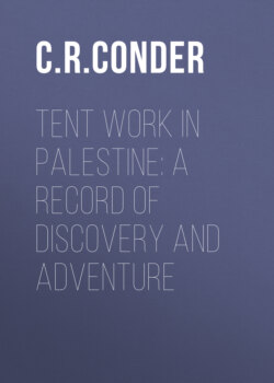
On one of our rides we visited the little village of Kuriet Jît, west of Nâblus, in which there was a very high house fitted for a point in the triangulation. It was generally better to choose a mountain-top, as the curiosity of the villagers is often annoying. They were, however, here unaccustomed to travellers, and behaved with the solemn courtesy which used to be distinctive of the peasantry before European vulgarity and European “backsheesh” had spoiled them. They stared hard at the theodolite, which was variously conjectured to be a watch, a compass, a telescope, or a combination of all three. At noon we retired into the room which is kept especially for chance guests in every village. Here we consumed breakfast, the Sheikh and elders sitting opposite to see us feed, and afterwards invited to share the remains with our native followers. The scene in colouring was almost equal to that of Rembrandt’s interiors, the bright light through the little door touching here and there the outlines of the swarthy figures in their mantles of tawny camel’s-hair, striped with darker brown. The Sheikh was glad of our escort back, as he was carrying the taxes to Nâblus. He inquired, as he rode with us, how soon the English were coming to take the country and “build it up again.”
GUEST HOUSE, KURIET JIT.
On the 16th of August we left Nâblus and moved the camp northwards to the village of Jeb’a.
The district thus entered is very rich, the villages large and flourishing, with good stone houses in them, and the olives and corn very fine. It is called the “Eastern District of the Jerrâr,” from the name of a famous family of native chiefs, once the governors of all the hills from the Great Plain to Nâblus on the south. The Sheikh of the village at which we camped was one of this family, and we were treated by its members with much courtesy, although this politeness may not have been altogether disinterested.
The village of Jeb’a was on the east of our camp, on a hillside, and well built of stone, with olives around it; on the north we looked across a narrow plain to Remeth of Issachar, and other ancient villages perched on heights; behind us the hills rose suddenly and stretched westwards in the long spur from Mount Ebal. East of Jeb’a stands the strong fortified village of Sânûr, on an isolated hill guarding the pass into a small plain, called the “Drowned Meadow,” which has no natural drainage, and thus becomes a marsh in the winter, drying up only in May or June.
This fortified village has often been supposed identical with the Bethulia of the Book of Judith, a place which was near Dothan; but Sânûr does not fulfil one of the main requisites for the site, as it does not command a view of the Plain of Esdraelon. It is curious that the village of Mithilia, a little farther north, has been overlooked, the name of which approaches closely to that of Bethulia, whilst the plain is seen from the ridge near the village.
The head of the house of the Jerrâr lived at Sânûr, his nephew was Sheikh of Jeb’a; the younger members of the family were innumerable, and we were plagued with endless visits from them all. The Jeb’a family invited us to dinner, and we were thus able to witness a phase in peasant life not often seen by Europeans.
About six in the evening a man was sent to the camp to escort us, and we walked through the village to the highest house, that of the Sheikh. The inhabitants are wonderfully fine men, and used to be famous for their feuds with the men of ’Arrâbeh, some miles to the north; they are still redoubtable thieves, but in 1868 the Government came down on them after a riot, killed some thirty or forty, fined the village heavily, and took most of the young men for soldiers. The Sheikh’s house was well built and new; the reception-room, on an upper floor, had a raised daïs, with a low wooden rail, about six inches high, on the step. It was carpeted, and pillows arranged against the walls at the upper end in the corners, where we were requested to sit. The walls were covered with plaster very brown and cracked. A gallery for sleeping was built at the lower end of the room.
The Sheikh now appeared in his white robe, with a yellow silk kufeyeh on his head bound with a black cord; removing his red slippers from his well-washed feet, he stepped on to the daïs, touched our hands and then his own breast, lips, and head, in token of the submissive formula, “On my heart, my mouth, and my head.” The oft-repeated greetings, “How is your health?” “How is your excellency?” “your worship,” “your lordship,” next followed, with repetitions of the former signs, which are, very gracefully executed. The host sat at a distance, or rather knelt, until pressed to come near, when he gradually approached and sunk sideways on one thigh, with his feet carefully hidden. An aged elder followed, and then the son of the host; a third and fourth dropped in, and as each appeared we rose and the same ceremonies were repeated with a dignity and decorum which made one forget for a time that we were dealing with ignorant and degraded peasants.
The Natûr, or village-watchman, and some servants now brought in a round wooden table, about a yard in diameter, on legs some six inches high; it was of rough wood, and folded down the centre. A huge brass basin followed, with a brass ewer having a long spout like a coffee-pot; the Sheikh’s son distributed towels, and we washed our right hands preparatory to eating with them—to eat with the left hand being almost as bad a breach of manners as to show the sole of the foot. A dozen dishes were then brought in succession, taken by the young man from the servants and placed on the board; they contained lentils, tomatoes, and kuzah, a sort of vegetable-marrow, which were stuffed with rice; bowls of sour milk (leben), a delicious sauce to such fare, were placed between, but the centre of the table was still bare, until three huge wooden dishes of rice, piled up in cones, with fragments of boiled meat sticking out, were brought in. The most delicate dish, however, was a kid (as we then thought, but afterwards doubted whether it were not our own little gazelle which was lost soon after) dressed whole, with its head and legs still on.
As we were Europeans, the great innovation of a pewter spoon and fork was allowed, no doubt being considered as a wonderful mark of civilisation by the Sheikh; thin discs of bread, unleavened and very leathery, about a foot in diameter, were scattered on the carpet beside each guest. We were invited to draw near, but had to press our host for some time before he ventured to eat with us; finally he sat down with two more, and the son carved—that is to say, pulled the meat in pieces with his right hand, and made up little parcels wrapped in a funnel of bread for us to eat: the liver and kidneys of the kid were placed inside the ribs and considered great delicacies; the whole fare was tender and good, but rather too oily for European palates, and the want of salt rendered it insipid. No water was placed on the board, but a servant brought it when required in a green glass; as each guest drank, his nearest neighbour turned with a bow and said, “Digestion,” to which the answer is (for every formula has its proper answer), “The Lord increase your digestion,” accompanied by a touching of the head with the hand.
The meal completed we retired to our corners, and the basin was brought again with water and soap—a necessity after using the fingers in eating. Coffee was then handed round, whilst a fresh batch of guests fell upon the feast, and was succeeded by a third, who left but little remaining. The coffee was made clear, as among the Bedawin, which is far more delicious than the thick Turkish coffee usually given to travellers. The guests drank quickly, with a loud sipping sound, the cups being about the size of an egg-cup and only half full, for to fill the cup is an intimation that the host is anxious for you to go soon, as is also the offer of a third cup soon after the second. A narghili or hubble-bubble followed for each of us two, with pipes and cigarettes, and Drake talked, describing England, London, and the railways, while I, naturally, had to sit silent, not as yet knowing the language. The Sheikh supposed we were looking for crosses cut on the ruins, and that we should afterwards claim ownership of all such places—a belief probably originating from the crosses cut on the lintels of every ruined monastery of Crusading and Byzantine times.
About seven p.m. we retired, the host accompanying us to his door. We slipped a coin into the servant’s hands, and afterwards sent a present of gunpowder to the Sheikh.
Some days later we had a repetition of this scene at Sânûr. The host, an unwieldy man in a black cloak, was yet more dignified, and the purple jackets and green waistcoats of the younger men marked them out as great dandies and local grandees. This village was so strong that it once stood several days’ assault by regular troops, and only yielded on being bombarded by the Pacha. An aged elder described seeing a cannon-ball enter a room where cotton was stored, and roll the soft heap round itself. The old Sheikh, once governor of the district, declaimed bitterly against the Turks. “They rob and impoverish me,” he said. “Are my women to carry wood and fetch water? Are my sons to plough the ground?” The Government were following the same policy with the Jerrâr family which has ruined the Zeidanîyin in the north, and the Abu Ghôsh in the south, and has certainly broken the national spirit, while curbing the turbulence of the factions which caused constant local outbreaks between neighbouring villages.
The most remarkable point in the behaviour of these native gentry was the reverence for age shown even by grey-bearded men to those some ten years older. We noticed also that the religious Sheikh of the village sat above our host after the Jeb’a banquet.
On Friday, the 30th of August, we left Jeb’a and moved on to Jenîn.
By noon we reached Dothan, the scene of Joseph’s betrayal by his brethren, and halted under a spreading fig-tree beside a long cactus hedge. Just north of us was the well called Bîr el Hŭfîreh, “Well of the Pit,” and east of us a second, with a water-trough, thus accounting for the name Dothan, “two wells.” Above the wells on the north rises the shapeless mound where the town once stood, and on the west spread the dark brown plain of ’Arrâbeh, across which runs the main Egyptian road—the road by which the armies of Thothmes and Necho came up from the sea-coast, and by which the Midianite merchants went down with their captive. The cattle stood by the well, huddling in the shade, waiting to be watered, and rude cowherds and goatherds gathered around us in groups which were no doubt not far different in dress or language from Joseph’s brethren four thousand years ago.
One place of interest must be noticed in concluding this chapter—Tirzah, once the capital of Israel, famous for its beauty.
It is the only Samaritan town mentioned among the royal cities taken by Joshua, and even this name was changed by the Rabbinical writers into Tiran, a place in Galilee.
Just twelve miles east of our Jeb’a camp, on a plateau where the valleys begin to dip suddenly towards Jordan, stands the mud hamlet of Teiâsîr. We afterwards visited it from the Jordan camp, and found it to have been once a place of importance, judging from the numerous, rock-cut sepulchres burrowing under the houses, the fertile lands and fine olives round, and the monument of good masonry, seemingly a Roman tomb. Just north of it we discovered a ruin called Ibzîk, which is unquestionably a Bezek known to Eusebius, and probably the place where Saul collected his army before attacking the Ammonites (1 Sam. xi. 8).
In the latter ruin is a little chapel dedicated to Neby Hazkîn, “the Prophet Ezekiel,” and the high mountain crowned with thicket behind is called “Ezekiel’s Mountain.”
This name Teiâsîr I suppose to be Tirzah. It contains the exact letters of the Hebrew word, though the two last radicals are interchanged in position, a kind of change not unusual among the peasantry. The beauty of the position and the richness of the plain on the west, the ancient remains, and the old main road to the place from Shechem, seem to agree well with the idea of its having once been a capital; and if I am right in the suggestion, then the old sepulchres are probably, some of them, those of the early kings of Israel before the royal family began to be buried in Samaria.
VIEW FROM JENIN.