Читать книгу One Best Hike: Grand Canyon - Elizabeth Wenk - Страница 9
На сайте Литреса книга снята с продажи.
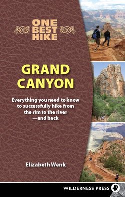
ОглавлениеOpposite and above: Enjoying the view from Plateau Point
1
Introduction
“Stand at some point on the brink of the Grand Canyon where you can overlook the river, and the details of the structure, the vast labyrinth of gorges of which it is composed, are scarcely noticed; the elements are lost in the grand effect, and a broad, deep, flaring gorge of many colors is seen. But stand down among these gorges and the landscape seems to be composed of huge vertical elements of wonderful form.”
—John Wesley Powell,
Explorations of the Colorado River and Its Canyons
The Grand Canyon is one of the most recognizable natural features in the world: It earns a spot as one of the seven natural wonders of the world and is the best-known national park in North America. Five million people visit the Grand Canyon each year to enjoy the incomprehensibly grand views from the rim. However, as John Wesley Powell candidly wrote in 1875, you haven’t really visited the Grand Canyon until you descend below the rim.
Each time I visit the Grand Canyon and stop at my first rim vista point, I anticipate the indescribably grand view, sit down, and stare in disbelief at the landscape. Can this place really exist? But the view satisfies me for only a short period of time; the rim views have an aerial feel and I want to be on the ground exploring. As I stare at the canyon, my mind begins to travel downward, tracing side canyons, following plateaus, and peering toward the river.
Before long my legs begin to twitch—at least figuratively—wishing to explore the intricacies of the landscape. In a mountainous wilderness, many people are motivated to hike to a summit to enjoy an otherwise unattainable vista. There are equally hidden vistas buried deep in the canyon: the walls of the Inner Gorge, the views of the inner canyon buttes once you are among them, mesas that merge with the landscape until you are below the rim, and of course the raging river. The landscape feels much more complex once you are in it, rather than looking down on it.
Therefore, don’t allow yourself the complacency of sitting on the rim, enjoying the splendid panoramas and believing that you have “seen” the Grand Canyon. If you have ever stared at a view of the Grand Canyon—even if only a picture of the view—consider challenging yourself to descend to the bottom of the canyon. The two well-maintained trails, termed corridor trails, descending from the South Rim of the Grand Canyon, the Bright Angel Trail and the South Kaibab Trail allow tens of thousands of hikers to “see” the inner canyon and reach the Colorado River each year.
A Location Hike
Hiking is more than exercise—it is a time to be outdoors and therefore to absorb your surroundings. I am always a little disappointed to pass people so intent on reaching a destination or staring so closely at the bottoms of their hiking poles that they don’t notice the flowers, the rocks, the birds, or the general landscape.
Hikes can be thought of as somewhere on a continuum from “destination hikes” to “location hikes.” On a destination hike the sights along the way are overshadowed by those at the end point—many a summit hike or walk through forest to a spectacular lake fits into this category—and hikers are mostly forgiven for just trekking to the end. On a location hike, there is something new and spectacular to see every few steps down the trail, yet no single location that is universally judged “most beautiful.” Hikes in the Grand Canyon are the ultimate location hikes, so plan an itinerary that gives you down time—be that many extra five-minute breaks to see what you pass or an extra day to give you more time to wander around.
WHY YOU SHOULD BUY—AND CARRY—THIS BOOK
If you have ever searched for books on the Grand Canyon you were likely overwhelmed by the large number of generally excellent books written on its trails, natural history, human history, accidents, and more, leaving you wondering whether there’s space for yet another title. If you wish to read individual books that delve into the region’s botany, geology, prehistory, pioneer history, tourist attractions, on-trail hiking, or off-trail exploration, then the bibliography suggests a healthy foundation for a Grand Canyon library. However, if you plan to visit the Grand Canyon infrequently (until its spirit captures you and you decide to return often), this book provides you an introduction to most of these topics, all focused on the two corridor trails descending from the South Rim: the Bright Angel and South Kaibab trails.
The primary goal of this book is to help you plan: how to get permits, what gear you should carry, how fast you should walk, what dangers you should avoid, and so on. However, it is also slim enough to tuck into your backpack for your journey to the river. Trail descriptions and maps aid you on your endeavor. In addition, ample human history and natural history sections inform you about topics from trail construction to commonly observed birds and plants. As you proceed first down to the Colorado River and then back up to the rim, you will take water, food, and rest breaks. As you sit in the shade on a hot summer day or enjoy a bit of midwinter warmth, pull out this book and learn about your surroundings.
WHY YOU SHOULD NOT DAYHIKE
Grand Canyon National Park has a clear policy of telling people not to attempt to hike to the river and back in a day, and as a result, this book focuses on the information needed to complete an overnight trip to the Colorado River. When I first learned of the park’s policy, it seemed quite extreme. I had not found the dayhike particularly taxing, and I have, on my trips to the canyon, met a lot of other hikers completing the hike in a single day without difficulty—granted these trips were in spring, fall, and winter, not midsummer. It seemed that a better approach would have been to emphasize attempting such a committing walk only during cooler months and emphasizing the need to start very early, be “slow and steady,” and take sufficient breaks, especially during the heat of the day. Maybe they should instead instruct people to stay out of the Inner Gorge when midday temperatures exceed 85°F?
However, as rangers rattled off the number of rescues and fatalities suffered by people attempting a dayhike to the river, even in spring and fall, it became clear that a blanket recommendation was a pragmatic approach. Indeed, there are more deaths resulting from environmental conditions in May and June than in July and August, presumably because visitors don’t appreciate how hot temperatures are during late spring, especially in the Inner Gorge where there is little shade during these near-solstice months. Many people do not know their physical limits and do not know when they are approaching their limit, leading to severe cases of hyponatremia and heatstroke (see page). Moreover, the enormous number of midsummer rescues endangers the lives of rescuers and costs the park—and the hikers being rescued—a lot. The information in this book is of course still accurate if you wish to dayhike, but I dissuade you from doing it.
Inner Gorge refers to the steep gorge of Vishnu Schist and Zoroaster Granite below the Tonto Platform. Inner Canyon is anywhere below the canyon rim.
Leaving national park policy aside, there are many more good reasons to take multiple days: Completing the hike as a dayhike accentuates the endurance aspects of the hike and takes away from the magic of the canyon and the natural history, because you have much less time to sit and absorb your surroundings. Plus you miss the beautiful morning and evening light from its depth. Many people probably attempt a dayhike because they did not reserve a wilderness permit. Others are people who do not enjoy the extra weight of an overnight pack or simply do not enjoy camping. If you fall into these categories, consider returning for a second trip when you have a backpacking reservation and can travel very light, when nighttime temperatures are warm or you have made a reservation to spend the night at Phantom Ranch.
Human History
NATIVE PEOPLES
The Colorado Plateau, although not the Grand Canyon, has been inhabited for at least 13,000 years, as evidenced by spearheads found in the region. The first of the southwestern Paleo-Indians, the Clovis culture, preferred the open plains areas to canyon country and are thought to have entered the Grand Canyon region rarely. More artifacts have been found from the ensuing Folsom culture, but their population densities on the Colorado Plateau would also have been low. The people of both cultures hunted the large mammal species that went extinct at the end of the ice age—possibly in part because of the hunting pressure. (It makes sense that these groups spent little time along the Colorado River. Can you imagine wooly mammoths and giant sloths descending into contorted canyons?)
The Archaic culture began by definition 8,500 years ago, and by 8,000 years ago people of this culture inhabited the Grand Canyon area. They too were a nomadic hunter-gatherer culture and had no permanent habitations. Over the subsequent six millennia, the distribution of people and especially their population densities fluctuated greatly, dictated largely by natural climatic fluctuations. During dry periods there were fewer predictable water sources and probably fewer game animals to hunt.
The descendants of the Archaic culture are the people of the Basketmaker culture, distinguished by the beautiful baskets they made. The Basketmaker culture began around A.D. 1, and by A.D. 500, at the latest, the people of this culture were farming corn, squash, and beans. This change in food source meant that the people were no longer nomadic, instead building more permanent habitations: pithouses as living quarters and shelters for food storage. However, even after they began to farm, the Basketmaker people living in the Grand Canyon continued to depend partially on wild game and wild plants. This flexibility gave them an advantage over tribes to the south that relied more heavily on farming; because of their use of wild food sources they maintained a more balanced—and healthier—diet than the tribes relying mostly on corn did.
Around A.D. 700 the Basketmaker culture transitioned to the Puebloan culture, designated by its aboveground rock and clay living quarters and its creation of ceramics. Pithouses were no longer used as houses, but in some regions, including the Grand Canyon, similar-shaped ceremonial kivas were central to the culture. The several centuries from A.D. 700 until A.D. 1140 were a period of cultural expansion and population growth across the Colorado Plateau and also a time of sufficient rainfall. The Puebloan villages from this era dot the entire Colorado Plateau—see page for possible locations to visit after your Grand Canyon hike.
Particularly during the period from A.D. 1050 to A.D. 1100 settlements were established at many locations deep within the Grand Canyon. The small deltas that exist where side tributaries merge with the Colorado River were ideal for farming, including the mouth of Bright Angel Creek (see sidebar). River terraces, which are built up during periods of abundant runoff, were also used for farming. Many of the people had a second farm site on the canyon rim, allowing them to grow crops across more months of the year.
Then, a 50-year drought from A.D. 1100 until A.D. 1150 coincided with a period of mass exodus from the Grand Canyon to the south. In the Grand Canyon an extended drought meant many springs dried up and the Colorado River terraces eroded. However, anthropologists do not believe that the climatic shift was solely responsible for their departure. The Kachina religion, practiced to the south, also enticed the Puebloan people southward. Despite the various pressures to move southward, some artifacts indicate a few Puebloans stayed in pockets of the Grand Canyon for many years after most people disappeared. (The Basketmakers and the Puebloan people are also known as the Anasazi, a frequently used term for the prehistoric people of the Colorado Plateau region. The Hopi, their descendants, prefer that this term not be used, as it is a derogatory Navajo term, meaning “enemy ancestor.”)
A second group of people, the Cerbat/Pai, migrated from the Mojave Desert to the Grand Canyon region close to the time of the collapse of the Puebloan culture and settled the plateau country and fertile tributary valleys to the south of the Colorado River. The only Native Americans in the Grand Canyon region today are descendants of these people: the Havasupai tribe inhabiting Havasu Canyon to the west (downstream) of the corridor trails and the Hualapai tribe living on a reservation west of Grand Canyon National Park. While the tribes now live farther west, the Havasupai once farmed Indian Garden on the Bright Angel Trail.
The Southern Paiute also inhabited the Grand Canyon region for approximately six centuries until the arrival of white men, predominantly living on the north side of the Colorado River. The Paiute were not farmers; they lived solely on what they hunted and gathered.
PUEBLO AT BRIGHT ANGEL CREEK
The ruins of a pueblo are visible at the mouth of Bright Angel Creek, between the Bright Angel Creek Campground and the mule bridge. The kiva was built when the site was first occupied, around A.D. 1050, while the living area dates to A.D. 1100. By A.D. 1140 this site, like most habitations along the Colorado River, was abandoned because of increasing drought. Major John Wesley Powell recorded this site during his first descent of the Colorado River.
PIONEERS
The first view of the Grand Canyon by a nonnative person was in 1540 by a Spanish party led by Francisco Vasquez de Coronado. They were unimpressed with the difficult landscape, and Native Americans continued to be the only inhabitants of the area for many years. Only in 1826 did a party of fur trappers reach the rim; they were likewise disappointed by the steep, deep, contorted canyon and large river—and didn’t recruit others to the location.
Explorers and settlers were first drawn to the area in larger numbers after Major John Wesley Powell explored the length of the Grand Canyon by boat in 1869 and 1871. He too discovered that the country was rough and dangerous, but viewed the difficulties as an adventure and the Grand Canyon as a place of scientific interest, rather than somewhere to avoid. Indeed, just two years after his first, rather disastrous trip, he returned to descend the river a second time and continue his scientific explorations. Following the 1871 excursion he began to promote the Grand Canyon as a tourist venue. However, it was initially the possibility of mineral riches that drew people, with hundreds arriving at the North Rim of the Grand Canyon in 1872 for a short-lived gold rush. No mineral riches were found in the vicinity of Bright Angel and South Kaibab trails, but many prospects and a few larger mines exist within the park, including the prominent Orphan Mine, a copper and then uranium mine that can be viewed at Powell Point, as well as a large copper vein along the Grandview Trail. A few small mine shafts exist along the Bright Angel Trail, both near the top of Devils Corkscrew and partway down Pipe Creek.
MAJOR JOHN WESLEY POWELL
Because of his two pioneering descents down the Colorado River in 1869 and 1871, John Wesley Powell’s name is synonymous with the Grand Canyon region. When he boarded the Emma Dean, a boat he had named after his wife, he was not new to river exploration. Already in 1856, at age 22, he had rowed a length of the Mississippi River, followed by the Ohio River the next year.
Powell grew up in the Midwest on a succession of farms, as his parents moved about. His strong interest in natural history emerged in 1857 while taking a botany course at Oberlin College in Ohio. In subsequent years he made extensive botanical and zoological collections across the Midwest, before changing his focus to geology. With the onset of the Civil War, he enrolled immediately in the Union Army and had risen to the rank of captain when he lost an arm at the Battle of Shiloh. After the Civil War he accepted a geology professorship at Wesleyan University. He was recognized as being an outstanding scientist—in particular one who had high standards and was very resourceful and endlessly inquisitive. This position allowed him to spend the summer of 1867 making scientific collections in what is now Colorado. In 1869 he returned west with the goal of exploring the virtually unmapped Green and Colorado rivers.
On May 24, 1869, his party of ten men departed Green River, Wyoming (not Green River, Utah), with ten months of provisions; six men exited at the mouth of the Colorado River, near the confluence with the Virgin River more than three months later. They were nearly out of supplies, because of losses each time boats capsized. (One man left just days into the expedition, unnerved by the adventure. The other three exited the Grand Canyon near Separation Rapid, just two days before the end of the canyon and were likely killed by either Indians or Mormons as they made their way back to civilization.)
With the knowledge gained on this first expedition, he returned in 1871 with a new crew. Less drama pervaded this descent of the Colorado River, allowing important natural history collections to be made and much geologic information to be recorded.
The well-known Powell continued to make important scientific and “societal” contributions in the western U.S. He was involved in the creation of the U.S. Geological Survey, established to administer surveys like those he carried out in the Grand Canyon, and served as its second director from 1881 to 1894. He advocated against dividing the southwestern U.S. into the standard 160-acre homesteads, realizing that this approach was inappropriate for the region; much larger blocks of lands and boundaries along water divides were required. He realized as well that water was a limited resource that must be shared downstream. Also, unlike many others in this era, he greatly respected for the Native American tribes in the Southwest, studying their cultures and languages and petitioning the U.S. government to care better for them.
Tour guides and tourists soon displaced most of the miners. John Hance was the first true settler on the South Rim, arriving in 1883. A drifter drawn to the Grand Canyon’s possible mineral riches, he quickly realized mining was not an efficient way to earn money and began guiding tourists to the Colorado River the following year. In subsequent years, the tourism business expanded rapidly, as more and more prospectors arrived on the South Rim and many realized that tourism was a more reliable source of income.
Among the miner-turned-tour-guides are Ralph Cameron, his brother Niles Cameron, and partner Pete Berry. In 1890 they obtained a mining claim at Indian Garden from the previous claimants. They quickly expanded the Havasupai route along the Bright Angel Fault into a trail, the predecessor of the contemporary Bright Angel Trail, and charged tourists a dollar to descend the trail. They soon constructed a tent camp at Indian Garden and Cameron’s hotel on the rim followed in 1903. (See section on trail history and construction, for more information.)
The tourism business required more than tour guides, and many settlers found profitable niches. Among them, Ellsworth Kolb and his brother Emery began a South Rim photography business in 1902, building a studio, today’s Kolb Studio, near the start of the Bright Angel Trail. They photographed parties descending the trail and then rushed to Indian Garden—the closest source of freshwater—to develop the photographs so that people could purchase prints on their return later than day.
Tourism was helped along by the fact that the Santa Fe Railway had completed tracks across northern Arizona in 1883, stopping in Williams just 65 miles from the South Rim and thereby providing relatively easy access for visitors from across the U.S. Before long, plans were in progress to build a spur line to the South Rim. William O’Neill, an early South Rim entrepreneur, organized funding and began to construct the route in 1897, laying tracks due south to meet the Santa Fe Railway’s tracks in Williams. Following his death in 1898, the Santa Fe Railway purchased the tracks and constructed the last 10 miles of track to the canyon. Opened in 1901, it ferried visitors in comfort—especially once the railway company and concession partner, the Fred Harvey Company, constructed elegant hotels and restaurants on the canyon rim. The construction of the new road to the South Rim during the 1920s triggered the demise of the train service, and the railway ceased to run in 1968. In 1989, the historical route was resurrected and the historical depot in Williams refurbished.
PHANTOM RANCH
Phantom Ranch is a collection of backcountry cabins, bunkhouses, and a dining hall located approximately one mile north of the mouth of Bright Angel Creek—a third of a mile upstream of the Bright Angel Creek Campground. The current structures were built beginning in 1922, designed by Mary Colter under contract with the Fred Harvey Company. She initially designed five buildings, but the resort was so popular that they built more structures. By 1930 the ranch appeared much as it does today. Only the hiker dorms were added much later.
The first structures at this location predate this. In 1903, Edwin “Dee” Woolley, a rancher from Kanab, Utah, and colleagues formed the Grand Canyon Transportation Company with the intent of building a cable across the Colorado River and a trail up to the North Rim via Bright Angel Creek, to be called the Grand Canyon Toll Road. They viewed a South Rim to North Rim trail system as the easiest way to increase tourism on the North Rim; to the north, the rail line stopped in Marysvale, approximately 200 miles north of the North Rim. They decided upon Bright Angel Creek as the best corridor, for François Matthes, a surveyor and geologist, had already created a rudimentary trail in 1903. They viewed the lower reaches of Bright Angel Creek as a good place for a guesthouse.
Only slight progress was made until 1906 when David Rust, Woolley’s son-in-law and a schoolteacher, took on the job of trail foreman. His journal indicates that the construction of the trail proceeded much as expected, but the construction of the cable involved much effort and numerous false starts. The first party finally crossed the Colorado River on September 20, 1907. In 1906, Rust and his crew also built the first dwellings at the Phantom Ranch site. They planted a garden, a small orchard, and many hundreds of cottonwood cuttings, obtained upstream from Phantom Creek, for shade. In subsequent summers they upgraded the accommodations and planted more trees in anticipation of a stream of wealthy guests. Unfortunately, relatively few tourists made use of this cross-canyon corridor, and although Rust continued to spend each summer until 1915 running his cable car and the Rust Camp, it never earned money for the Grand Canyon Transportation Company. In 1919 the newly founded national park took over possession of his cable car and trail.
MARY COLTER
Mary Colter’s name is inexorably linked with Grand Canyon architecture. She was first hired by the Fred Harvey Company to decorate Alvarado Hotel in Albuquerque in 1901. She began her work on the South Rim of the Grand Canyon in 1905, designing Hopi House. In subsequent years she designed Lookout Studio (1914), Hermit’s Rest (1914), the Watchtower at Desert View (1932), Bright Angel Lodge (1935), and most relevant for a Grand Canyon hiker, Phantom Ranch in 1922. She designed her buildings to be in harmony with the natural surroundings, using local materials and architectural designs that caused the buildings to effectively merge with the landscape. Her buildings are beautiful exemplars of the style known as National Park Service rustic. At Phantom Ranch, for example, the cabins are built (mostly) of local rock, colored to blend with the surroundings, and spaced at irregular intervals.
TRAIL HISTORY AND CONSTRUCTION
The Bright Angel Trail is a historic Indian trail used by people for millennia to access the inner canyon and the Colorado River. By the 1870s miners were entering the Grand Canyon and descending this same route. Ralph Cameron and his brother Niles acquired mining claims along the Bright Angel Trail in 1890. They quickly realized that the money was not in mining, but instead in tourism. They therefore took advantage of a law that allowed the “builders of a trail” to collect a toll for its use. In 1890 and 1891 they improved the Havasupai trail to Indian Garden and in 1898 completed a new trail down to the Colorado River. From 1903 until the 1920s they charged each person a dollar to descend the Bright Angel Toll Road (also called the Cameron Trail). These fees were introduced to keep money flowing their way once competing South Rim accommodations were constructed and disrupted their previous near-monopoly on housing Grand Canyon Village visitors.
The Santa Fe Railway and Fred Harvey Company, which ran the concessions associated with the railroad (and had built Phantom Ranch), the National Park Service, and other government agencies wished to invalidate Ralph Cameron’s mining claims and take control of the trail that departed from the rapidly expanding Grand Canyon Village. Moreover, Ralph Cameron took poor care of “his” trail and the Indian Garden Campground. In 1913 the U.S. Forest Service sued Ralph Cameron over his unused claims, which led to a 1920 U.S. Supreme Court decision that dissolved his claims and turned the trail over to Coconino County. However, Cameron succeeded in continuing to collect tolls. He was also active in local politics and in 1924 convinced the citizens of Coconino County to vote against selling the Bright Angel Trail to the National Park Service.
To avoid requiring tourists to support the Cameron brothers, as soon as the Grand Canyon became a national park in 1919, the park service began arranging for the construction of an alternative route, which would become the South Kaibab Trail. They moved forward quickly following the November 1924 election and by December 1 of that year had $50,000 for the project, had ordered construction materials, and had amassed two 20-worker teams. One team would begin at the Colorado River and the other at Yaki Point. They had hoped to complete the trail by May, but it took until mid-June for the two teams to meet up because of the difficulty in blasting into solid rock and winter storms that delayed work. The final cost for the project was $73,000. The trail was dedicated on June 15, 1925. Except for the section of the trail below the Tipoff, the South Kaibab Trail did not follow an existing route.
The new trail was named for the Kaibab Plateau, a name suggested by J. R. Eakin, the first superintendent of Grand Canyon National Park. National Park Service Director Stephen Mather selected this name over other possibilities: Yaki Trail, indicating its descent from near Yaki Point and Phantom Trail, an option promoted by the Fred Harvey Company since the trail descends directly to their Phantom Ranch.
The National Park Service finally took control of the Bright Angel Trail in 1928, when Coconino County traded it in return for the park service funding a new road from Williams to Grand Canyon Village. The park service then reconstructed the Bright Angel Trail between 1929 and 1938; they decreased the grade of the trail, including the section above the 3-Mile Resthouse (1930–1931) and through the Devils Corkscrew (1929), built a trail alongside the wash upstream of Indian Garden (1930), routed the trail through the Tapeats Narrows (1929), and built a trail alongside Pipe Creek (1938). The trail had previously dropped down the Bright Angel Fault at nearly three times the grade it is today, simply followed the Garden Creek wash, diverted east of Garden Creek on the Tonto Platform, dropped down the Salt Creek Drainage (the seep you cross toward the top of Devils Corkscrew), and continued nearly straight down to Pipe Creek. The old, much steeper switchbacks can still be seen as you descend the Devils Corkscrew to Pipe Creek.
In addition to acquiring and retrofitting these important corridor trails, the park service lost no time in building a bridge across the Colorado River that was accessible to stock. In 1921 they completed a wooden suspension bridge to replace Rust’s cable car. Unfortunately this bridge was susceptible to great contortions, even flipping over, and in 1928 a sturdier bridge, the current Kaibab Suspension Bridge (or “black” or “mule” bridge), was constructed. The eight 550-foot-long main suspension cables were each carried to the bottom of the canyon by a team of 42 Havasupai Indians.
The River Trail, the 1.7-mile trail along the Colorado River between the Bright Angel Trail and the Kaibab Suspension Bridge, was built between 1933 and 1936 by the Civilian Conservation Corps, under park service supervision. Long sections were blasted into vertical rock, providing hikers with airy views into the river. Until its construction, hikers descending the Bright Angel Trail and wishing to cross to the north side of the river, would leave the Bright Angel Trail just beyond Indian Garden and cross over on the trail that followed the Tonto Platform to the South Kaibab Trail. The last of the corridor trail network, the Silver Bridge was constructed in the 1960s as part of the transcanyon water system.
Natural History
In many locations, people interested in natural history, which includes all information about the natural world, focus their attention on the plants and animals, and think of the geology as a backdrop. In the Grand Canyon the geologic features strike even the most ardent biologists. Not only is the geology visually grabbing, but also it is quickly apparent what a strong influence the geology, from rock type to topographic features, has on where plants and animals live. Consider for instance that different rock layers decompose to form soils with different nutrients and textures, affecting water-holding capacity and water availability, and therefore plant cover.
Even more apparent to a casual hiker, consider how variable the topography can be. For instance, some rock layers erode easily forming slopes, while others are cliffs, each creating unique habitats required and tolerated by different species. Where a north-facing cliff and gentler topography meet is a small patch of real estate that remains shadier and cooler, allowing a unique collection of species to establish. Rock formations with alternating layers of sandstone and shale, may create small platforms of soil underlain by fractured rock—if a tree takes root, it might find moister soil deep down. A wash that carries water occasionally will host different species than the dry terraces to either side. This variation in physical features creates patchiness in resources and in turn leads to a surprising diversity in plants and animals. As you explore the inner canyon, consider the interactions between the physical and biological worlds.
GEOLOGY
Quite simply, the Grand Canyon is unbelievable because of its geologic features. As you stand at a vista point and peer into and across the canyon, you are marveling at the geology: staring at the exceptionally wide and deep canyon and the nearly horizontal layers of colorful rock. Generations of talented geologists have sought to understand what combination of geologic events created this landscape. Individuals with different geologic specialties have contemplated different aspects of the picture, weaving together their conclusions with the data collected by others to present a coherent story of the Grand Canyon’s geologic history. However, the sleuthing continues—evidence to decipher some pieces of the story is simply missing. The story of the Grand Canyon presented today, in this book and at vistas throughout the park, may stand the test of time or may be quite different if you revisit the park in a generation.
Questions will probably leap to mind as you gaze at the canyon. You may wonder why such a deep canyon exists and how it formed. Or you may contemplate why there are so many different layers or rock, how they got there, and why some are flat, but others steep?
To answer these clusters of questions, and others, I describe the tectonic regimes to which the Grand Canyon area was subjected from 1.8 billion years ago until today, as the tectonic surroundings dictate many of the geologic processes that are recorded. These descriptions include information about the environments that led to the creation of the three main rock groups in the Grand Canyon: the Grand Canyon Metamorphic Suite, the Grand Canyon Supergroup, and Paleozoic sedimentary layers. (See page for descriptions of features that identify each rock layer.)
This brief description of the Grand Canyon’s geology is obviously incomplete. If learning a few tidbits piques your curiosity to learn more about the past and present processes that have created the landscape, check out the numerous books written on Grand Canyon geology (see page). Carving Grand Canyon by Wayne Ranney is especially recommended both to learn about what forces combined to create the Grand Canyon and to understand how geologists use field evidence to discern geologic processes. Ancient Landscapes of the Colorado Plateau’s scope (by Ron Blakey and Wayne Ranney) is broader than the Grand Canyon, but it does a superb job of describing historical environments in the Grand Canyon region, both through narrative and maps. Hiking the Grand Canyon’s Geology by Lon Abbott and Terri Cook provides a good introduction to the region’s geology, detailed information on the formation of the many rock layers, and a geologic guide to take with you as you hike along either of the trails described in this book. The U.S. Geological Survey provides an online geologic map and annotated photos from the South Kaibab and Bright Angel trails at: http://3dparks.wr.usgs.gov/grca/index.html.
CATEGORIZING ROCKS BASED ON ORIGIN
Geologists divide rocks into three categories. A sedimentary rock is formed either when mineral grains are transported to a site of deposition and subsequently cemented together or by chemical precipitation at the depositional site. An igneous rock is formed by the solidification of molten rock, or magma. Igneous rock that has solidified above the Earth’s surface is termed volcanic and that below the Earth’s surface is termed intrusive. A metamorphic rock forms when an existing rock is deformed because of high temperature or pressure, causing its mineral composition and/or texture to change. The Grand Canyon contains igneous and metamorphosed sedimentary and igneous rocks (in the Inner Gorge) and sedimentary rocks (the near-horizontal layers above the Inner Gorge).
The tectonic regimes and resultant rocks
The nearly two-billion-year-old rock record at the Grand Canyon shows that a succession of different tectonic regimes occurred over time, which led to the formation of the three different rock groups that outcrop along the Bright Angel or South Kaibab trails. There were also periods of time when little occurred, rocks were being eroded away, or canyons carved.
Collisions, 1.8 billion to 1.4 billion years ago: About 1.8 billion years ago the location that would become the Grand Canyon was an oceanic basin that lay between the incipient North American Plate (to the northwest) and a volcanic island chain (the Yavapai Arc to the southeast). By 1.7 billion years ago the oceanic crust that carried the Yavapai Arc was being pushed over the edge of the North American Plate. In the process, the sediment in the intervening ocean basin was buried, twisted, heated, and hence metamorphosed to form the Vishnu, Brahma, and Rama schists, collectively known as the Grand Canyon Metamorphic Suite, or colloquially as the Vishnu Schist or basement rocks. Meanwhile, deeper sediments were completely melted. The resultant magma rose through cracks in the schist and cooled to form the intermingled Zoroaster Granite (and related rocks), a light-colored, often pinkish rock. Later, there was a collision with a second volcanic island chain, the Mazatzal Arc. These collisions added much material to the edge of North America, moving its boundary well south of the Grand Canyon region.
PLATE TECTONICS
The surface of the Earth is composed of thin, rigid pieces termed plates. The 14 larger plates and many smaller microplates float and rotate slowly atop the more liquid inner layers of the Earth. Each of these plates is constantly moving—and in different directions from one another, so the plates collide, slide past one another, and pull away from one another, changing their position on the Earth’s surface in the process. Colliding plates have created—and continue to create—the world’s mountain ranges. In some cases, two plates move toward one another, the type of collision that created the European Alps. In other cases, one plate collides into and is shoved beneath a second plate, a process called subduction. Plates sliding past one another create large strike-slip faults like the San Andreas Fault in western California. Plates pulling apart create new and ever larger ocean basins, a process currently occurring in the Red Sea.
Little tectonic activity, 1.4 billion to 1.2 billion years ago: Having the plate boundary south of the Grand Canyon set the stage for a long period of tectonic calm in the region. The mountain range that had formed from the collisions was slowly eroded, eventually allowing the deeply buried Vishnu Schist and Zoroaster Granite to rise to the surface. Some of their mass was eroded, flattening them by 1.2 billion years ago. The eroded surface is termed the Greatest Unconformity.
Formation and existence of supercontinent Rodinia, 1.2 billion to 750 million years ago: While the Grand Canyon was experiencing a period of tectonic calm and associated erosion, the global stage was being set for a set of massive collisions that formed the supercontinent Rodinia. Rodinia incorporated most of the Earth’s land masses. Australia and Antarctica were welded onto the western edge of the North American continent, west of the Grand Canyon. Along the eastern edge of North America, the Grenville Orogeny, beginning 1.1 billion years ago, created the mountains of the eastern seaboard and apparently caused the western edge of North America to tip downward, creating a narrow sea at the border of North America and the Australian/Antarctic landmasses.
When sedimentary rocks are horizontally layered, the layers indicate the order in which the sediment was deposited—the oldest sedimentary layer is at the bottom and the youngest on top.
The Grand Canyon region was now a costal environment and the sediment that comprises the Grand Canyon Supergroup began to be deposited. Initially the shallow Bass Sea covered the area, depositing the calcareous sediment that constitutes the Bass Limestone. Subsequently, a decrease in water level led to the deposition of mud atop the limestone, creating the Hakatai Shale. Additional decrease in water level caused beach sands to be deposited, coalescing into the very erosion-resistant Shinumo Quartzite. What followed were small-scale encroachments and retreats of the sea, creating bedding shales and sandstones, the Dox Formation. The final formation in the first group of Supergroup rocks is the Cardenas Lava, dating to 1.1 billion years ago, coinciding with the Grenville Orogeny and small-scale rifting in the Grand Canyon region. These first five formations are collectively known as the Unkar Group. The remaining Supergroup formations were deposited in the sea deep within Rodinia. Since they outcrop on neither the South Kaibab nor the Bright Angel trails, they are not described here.
WHY ARE THERE SO MANY DIFFERENT TYPES OF SEDIMENTARY ROCK?
The type of sediment that is deposited is determined by a location’s position on the landscape. Consider a shoreline environment: dunes along the coast (or farther inland) and beach sands become sandstones or quartzites (metamorphosed sandstones); mud and silt are deposited farther out to sea and become mudstones, siltstones, and shales; calcite accumulates in shallow tropical waters, both precipitating from the water and from the deposition of sea creatures. Fewer sediments are deposited and preserved in the interior of continents, which is why most sedimentary rocks are from shores, deltas, or shallow marine environments.
For different types of sediment to overlie each other, the shoreline’s location must keep shifting. Many factors lead to never-ending movement in the position of the shoreline, including continuous variation in the strength of the sun’s radiation and consequent changes in the amount of the Earth’s water stored as ice. Over hundreds of thousands to millions of years, a single location will experience different sedimentary environments—a history preserved as consecutive layers of sedimentary rock.
Breakup of supercontinent Rodinia, 750 million to 525 million years ago: By 750 million years ago Rodinia was beginning to be pulled apart, as Antarctica and Australia headed westward. As the continents were separated, a series of large faults formed in the Grand Canyon region, including the Bright Angel Fault. These were normal faults, which form as a region is stretched and expanded, and result in some blocks of rock being dropped downward. The formation of these faults caused the Grand Canyon Supergroup strata to be tilted and blocks of Grand Canyon Supergroup rocks to be “dropped into” the basement rocks.
The period of breakup and faulting was also one of erosion and thousands of feet of sediment were removed from the landscape, including most of the Grand Canyon Supergroup strata and some depth of the basement rocks. These changes created the Great Unconformity, the boundary between the Grand Canyon Supergroup and the overlying Paleozoic sedimentary rocks.
Today the only Grand Canyon Supergroup strata that are preserved in the vicinity of the Bright Angel and South Kaibab trails are those on a down-dropped block below the Tipoff, termed Cremation Graben (German for “grave”). And even here, only the three lowermost strata, the Bass Limestone, Hakatai Shale, and Shinumo Quartzite are preserved.
GEOLOGY DETERMINES WHERE THE TRAILS ARE LOCATED
If you visited vista points on the South Rim before embarking on your hike, you likely stared at the steep Kaibab Formation that forms a 350-foot-high cliff just about everywhere, providing few locations to descend below the rim. The Coconino Sandstone and Redwall Limestone form similarly impenetrable barriers. The Bright Angel Trail follows the Bright Angel Fault: Movement along the fault broke the solid rock, allowing erosion to proceed more rapidly. Eventually steep talus piles formed along the fault zone, allowing passage through otherwise vertical cliffs. In addition, the faulting has caused the rock on the southeast side of the fault to be about 200 feet lower than that on the northwest side, and the trail can snake back and forth across the fault depending on which side provides easier passage. The benefit of the fault scarp is especially visible where the Bright Angel Trail cuts through the Coconino Sandstone above the 1.5-Mile Resthouse and along Jacobs Ladder below the 3-Mile Resthouse. This fault first formed during the breakup of Rodinia 750 million years ago.
In contrast, the South Kaibab Trail is predominantly a ridge route that exploits locations where the normally steep rock layers have begun to erode, because they are outcropping along a narrow ridge. And here too, the passage through the Redwall Limestone follows a small fault.
Passive margin, 525 million to 320 million years ago: The breakup of Rodinia created a “passive margin,” or tectonically quiet region, along the then western edge of North America, the Colorado Plateau region. Along such margins the seafloor often sinks rapidly continually creating more space for sediment to accumulate and allowing thick rock strata to form. The prominent striped layers in the Grand Canyon, a series of strata 4000 thousand feet thick, were deposited during this tectonic regime with the type of sediment changing with shoreline position and water depth. (Up to 18,000 feet of sediment was deposited on the Colorado Plateau, but only the lower strata are preserved in the Grand Canyon.)
The oldest (and lowest) of the layers is the Tapeats Sandstone, formed from former beach sands. The Bright Angel Shale, formed in shallow offshore waters, follows; the mud-sized particles comprising the shale were carried a short distance out to sea before being deposited. The Muav Limestone, the third layer, is constituted of a combination of calcite that precipitated and calcite-bearing shells that were deposited. Together, these three layers represent a 20-million-year period of rising sea level: While sand-sized sediment was amassing at one location, silt was being deposited in shallow water to the west, and calcite was accumulating even farther west. As the sea level rose, each environment shifted eastward, such that the three sediment types overlay each other in the Grand Canyon.
No records remain from the following 120 million years, probably because decreasing sea level at the end of this period allowed the upper sediment layers to erode. One intermediate layer, the Temple Butte Limestone, is present as a thick stratum in the western Grand Canyon, where waters were deeper, but along the Bright Angel and South Kaibab trails it exists only in eroded channels in the Muav Limestone. Note that each of the Grand Canyon’s rock layers above the Muav Limestone is separated by an unconformity; some gaps in the rock record are brief, but others correspond to the removal of considerable sediment.
When rock strata abutting one another do not represent a continuous time sequence, the surface between the two layers is referred to as an unconformity. This gap in time indicates that sediment was eroded from atop the lower stratum before the upper stratum was deposited.
By 340 million years ago sea level was again rising, and much of the Colorado Plateau region was submerged beneath a large, shallow sea. Rivers transported little sediment to the region, creating the clear water environment that promoted the deposition of the thick layer known as the Redwall Limestone. The sea then retreated, eroding the top of this layer.
Passive margin, but tectonic collisions to the east as Pangaea forms, 320 million to 250 million years ago: Around 320 million years ago the supercontinent Pangaea, a landmass composed of all continents with North America along its western shore, began to form. The continental margin west of the Grand Canyon was still passive, but to the east, an ancestral mountain range, the Ancestral Rockies, rose. As this mountain range was uplifted, large quantities of sediment were eroded, first filling large basins immediately west of the mountain range, and later spilling westward to the Grand Canyon region. It was a desert environment all the way to the coast.
The Supai Group is composed of sediments from 320 to 285 million years ago. It is primarily red desert sands from the eroding mountains to the east. This sediment was deposited in an extensive coastal plain with enormous river deltas. During this time period Pangaea was centered over the South Pole and recurring glaciations (due to changes in sun strength) tied up vast quantities of water. As a result, sea level fluctuated more than 400 feet every 100,000 years, leading to repeated incursions of the sea, creating thin deposits of shale and limestone between the layers of desert sand.
The environment was similar when the next stratum, the Hermit Formation, was deposited, except that sea levels were lower and the formation is exclusively terrestrial. Large rivers continued to carry red mud and fine sand from the deserts to the east. As the continent became ever drier and the shoreline retreated farther west, large dunes spread across the Grand Canyon area. These giant sand dunes are preserved as the Coconino Sandstone (275 million years ago).
While the inland drought was continuing, the shoreline crept east again: By 273 million years ago, a very shallow sea again covered the area, leading to the deposition of intertidal deposits (the Toroweap Formation) and then deeper water where calcite accumulated (the Kaibab Formation; 265 million years ago). The Toroweap Formation contains gypsum and salt crystals, minerals formed by the evaporation of water.
This marks the end of the sequence of sedimentation that is preserved today—the 4000-foot-thick sequence of multicolored strata that makes the Grand Canyon so spectacular. However, the subsequent 250 million years are important as well: Those rocks needed to be lifted far above sea level and carved by flowing water. The remainder of the geologic description is therefore focused on the sequence of events that led to the creation of the Grand Canyon.
Initial breakup of Pangaea, 250 million to 145 million years ago: The Grand Canyon region was an arid terrestrial environment throughout this time. The 4000 feet of sediment, mostly desert sand, deposited atop the Paleozoic strata have since eroded. No sediments from this time period, the Mesozoic, survive in the Grand Canyon, but they are visible farther north on the Colorado Plateau.
Subduction of the Pacific Plate begins, 145 million to 70 million years ago: During this period, Pangaea continued to breakup, causing North America to be pushed westward, and the Pacific Plate to begin subducting beneath it. This new subduction zone created the beginnings of California’s Sierra Nevada and thickened the continental crust west of the Grand Canyon, causing the Colorado Plateau to be depressed. An internal sea, the Mancos Sea, flooded the central parts of North America, including much of the Colorado Plateau. The water retreated toward the end of this period. Around 70 million years ago, the strata that are now on the rim of the Grand Canyon were still at sea level.
Subduction expands eastward, 70 million to 18 million years ago: Around 70 million years ago the effect of the subduction zone at the western edge of North America began to be felt much farther east, leading to rapid uplift inland. The uplift includes the Laramide Orogeny (the uplift of the Rocky Mountains), the formation of the Mogollon Highlands in southeastern Arizona, and the uplift of the Colorado Plateau. In the Grand Canyon, the outside pressures caused the buried rock strata to be uplifted, raising the rocks we see today far above sea level. In order for the Colorado River to later carve such a deep canyon, the strata needed to be elevated; an ocean-bound stream can, after all, only carve down to sea level. The strata were also compressed, leading to the formation of the East Kaibab Monocline, the arching of the rock layers into an elongate dome in the central Grand Canyon region. This episode of uplift was completed by 40 million years ago.
The Colorado Plateau, although raised far above sea level, remained lower than the surrounding mountain ranges. During this period, rivers in the Grand Canyon region flowed to the northeast, as sediment and water were transported out of the Mogollon Highlands, into giant lakes in northern Arizona and Utah. This drainage pattern persisted until at least 30 million years ago and possibly as recently as 18 million years ago.
Sometime between 30 and 18 million years ago drainage patterns may have begun to change, but very few details are known. The Colorado River system did not exist. Some water may have drained southward, but most stream systems still headed north. Much water may have drained into internal basins that did not connect to the ocean.
WHY ARE THE RIMS DIFFERENT ELEVATIONS—AND DOES IT MATTER?
Both the South Rim and North Rim sit atop the Kaibab Formation. Although the layers appear flat from either vantage point, they are slightly slanted, and the North Rim is approximately 1000 feet higher than the South Rim, for these layers are bent into a broad arch, the East Kaibab Monocline. The apex of the arch is 12 miles north of the North Rim. The southern side of the arch slants gently downward from that point and drops 1000 feet between the North and South rims.
This difference in elevation has other implications: The angle of the rock layers means that water falling on the rims flows away from the South Rim, but is funneled toward the North Rim. Therefore, relatively little water flows down creeks from the South Rim, but considerable amounts flow down drainages beginning on the North Rim. As a result, less side-stream erosion has occurred on the south side of the canyon and the descent from the canyon rim to the Colorado River is much shorter and steeper than from the North Rim. The landscape is accordingly less complex; there are far more buttes and intricate side canyons on the north side of the river.
Extension to the west, 18 million to 6 million years ago: During this time period, stretching and thinning of western North America caused the Basin and Range Province in Nevada to form and the land surrounding the Colorado Plateau to decrease in elevation. Once the regions to the south and west were lower than the plateau, runoff began to etch south-flowing drainages, the direction of today’s Colorado River.
However, sediment deposits suggest that the Colorado River itself did not exist until approximately 6 million years ago. Instead, there were still large inland lakes and shorter waterways that were not connected. Water likely flowed along some of the Colorado River’s present path and through some of its major tributaries, although possibly opposite from the direction it does today. For instance, water may have flowed down the Little Colorado and then up Marble Canyon, but not through the main Inner Gorge of the Grand Canyon to the west of the confluence of these two drainages.
What caused these many rivers to coalesce into a single large drainage system is not definitively known, but two theories rise to the forefront. One is that the inland lakes suddenly joined together, possibly because of a catastrophic overflow of one of them, providing the force to cut through topographic barriers and integrate previously disconnected drainage systems. A second theory is headward erosion, whereby erosion causes waterways to move progressively upstream, cutting into slopes. Eventually this process destroys a ridge that had previously divided two drainages and connects the two stream systems. A combination of these two processes likely integrated the Colorado River system.
The final big event required for the creation of the modern Colorado River course is the creation of the Gulf of California, which occurred about 6 million years ago, and provided the Colorado River’s outlet to the ocean.
Glaciations and fault movements, 6 million years ago to present: By 6 million years ago, the Colorado River followed its current course to the Gulf of California. Events during the past 2 million years contributed to significant downward erosion, allowing the canyon to achieve its depth. First, the past 2 million years have been a time of recurring glaciations and at the end of each glacial cycle, greatly increased runoff from the Rocky Mountains would have resulted in giant floods with enormous erosive power.
Second, the Colorado River is crosscut by multiple faults, where the side of the fault that descends coincides with the downhill side of the river. Each time the fault moved, the downhill side of streambed would suddenly have been lowered, creating a step termed a knickpoint. A river’s erosive power slowly moves knickpoints upstream, in the process deepening the riverbed.
A second geologic event also created large and probably temporary knickpoints: There were large lava flows that dammed the Colorado River approximately 640,000 years ago. Although probably short-lived, these dams would have allowed enormous reservoirs to form along the Colorado River’s course. When the dams broke or were eroded upstream, the water stored behind the dam would have been instantaneously released, providing massive erosive force.
AN EVOLUTIONARY STORY
The physical conditions that create the rock strata you traverse are repeated again and again, creating multiple layers of limestone, shale, or sandstone. However, the Grand Canyon’s sedimentary strata were deposited over 500 million years, and the fossils in successive strata record much of the evolutionary history of life.
At the time the Bass Limestone was deposited, the only lifeform was single-celled colonial bacteria called stromatolites, visible in the rock as wavy bands. Multicellular, shell-bearing, aquatic animals evolved by the start of the Cambrian era, 542 million years ago; the Bright Angel Shale contains abundant trilobites, an early shell-bearing creature. Worm burrows, termed trace fossils, are also abundant. By the time the Redwall Limestone was deposited, different invertebrates dominated the seas, and crinoids (a stalklike relative of starfish) and brachiopods are abundant in this layer. Unlike at the time of the Bright Angel Shale’s deposition, plants and animals now colonized the land. Along the South Kaibab Trail, plant fossils are visible in the Hermit Formation; some specimens of ferns are on display on the west side of Cedar Ridge for all to observe. The Coconino Sandstone preserves reptile footprints. Stop and consider that these critters didn’t exist when you are just a couple of miles farther down the trail.
VEGETATION
Most hikers will consider their walk from the Grand Canyon’s rim to the Colorado River—and back up again—to be simply “desert.” Spring, summer, and fall temperatures are hot, the humidity is low, and the vegetation is sparse and prickly. However, you will in fact pass through four vegetation zones, each existing due to a specific combination of elevation, moisture availability, and temperature and each dominated by specific species. They are:
Pinyon-juniper woodland: Pinyon pine and juniper are the dominant species in this widespread southwestern plant community. At the Grand Canyon, this community exists on the South Rim and inside the canyon down to the Redwall Limestone. Ecologically, it demarcates the elevation that receives significant snow during the winter months. (For the first 1000 feet below the rim on the Bright Angel Trail, this community is interspersed with the mountain scrub and chaparral community, composed of species including Gambel oak, fernbush, serviceberry, and snowberry.)
Blackbrush scrub: This community is defined by the dominance of blackbrush and covers the Tonto Platform. Unless you head toward Plateau Point, the characteristic monostands of blackbrush are not observed along the Bright Angel Trail, since the trail descends along the Garden Creek drainage, first down the dry wash below Jacobs Ladder and then through riparian (streamside) vegetation below Indian Garden. On the South Kaibab Trail, you are in blackbrush scrub as you cross the Tonto Platform and approach the Tipoff.
Mojave Desert scrub: This community exists below the Tonto Platform down to the Colorado River. The species growing here can withstand extremely high summer temperatures and many require milder winters. Although it is informally termed Mojave Desert scrub, the plant community contains many species not present in the Mojave Desert of southeastern California. For instance, species such as brittlebush and catclaw acacia that are typical of the warmer Sonoran Desert of southern Arizona exist in the Inner Gorge. Farther downstream, species such as honey mesquite, characteristic of the Chihuahuan Desert, enter the mix. Indeed, along the Colorado River corridor a unique combination of species grow, for three of North America’s four deserts merge in this region.
Riparian: This community exists only in locations with permanent water, such as along the banks of the Colorado River and its side canyons. The availability of water means that large trees and dense thickets of shrubs and herbs are able to grow in these locations. The dominant species include Fremont cottonwood, coyote willow, seepwillow, saltcedar, honey mesquite, and catclaw acacia. The riparian vegetation along the Colorado River has changed significantly since the completion of the Glen Canyon Dam in 1964; water flows are now restricted and the river no longer floods as severely, a process that once scoured the vegetation along the banks and deposited vast quantities of sediment. Beginning in 1996 the Bureau of Reclamation has three times released higher flows from Glen Canyon Dam to replicate historic flooding. The largest flow occurred in March 2008, when they released twice the usual flow of water. Preliminary research indicates that this flood effectively mimicked natural floods, creating large sandbanks, reducing the establishment of nonnative plants, and creating backwater environments.
These vegetation zones can be identified by just a few dominant shrubs and trees, but more than 900 species occur below the canyon rims and in spring a diligent botanist might locate several hundred species along this walk. Any attentive hiker will notice many tens of distinctive and, when flowering, colorful species. Such diversity exists because the landscape is complex, creating many unique combinations of physical, chemical, and biological conditions. Each species prefers a certain soil depth, soil made from a specific rock, a specific small-scale climate, and a specific topographic position. Your walk will take you past geographic features that include solid rock, washes, steep slopes, seeps, small dunes, river terraces, the Tonto Platform, stream banks, ridges, and valleys, each home to a different collection of species.
DESERT ADAPTATIONS
Colorful flowers attract your attention—and that of pollinators—but stare also at the leaves and stems of plants, for they you will remind you what life is like for plants in the region. For instance, shrubs and perennial herbs that grow in a desert environment must have traits that minimize water loss: Lack of leaves (e.g., cactus), drought-deciduous leaves (leaves that fall off in summer; e.g., blackbrush), small leaves (e.g., Mormon tea) and hairy leaves (e.g., brittlebush and big sagebrush) are all common desert adaptations. Most water loss occurs because plants need to cool their leaves by transpiring (evaporating) water, a process much like humans sweating. Minimizing leaf area and having leaf hairs to reflect light and keep leaves cooler are two very effective ways to preserve water.
However, plants require leaves, or at least green surfaces; the green color indicates plant parts that can photosynthesize, or turn the sun’s energy into the sugars necessary for the plants to grow. In many species green stems compensate for limited leaf area. Drought-deciduous shrubs and many perennial herbs sprout leaves in spring when water is available and effectively hibernate during the hot summers. Other species are annuals. These plants grow for only a single season, germinating when soils are sufficiently moist and producing flowers and seeds in quick succession to avoid dry soils.
Below are descriptions of 38 species along the Bright Angel and South Kaibab trails, including the most common species, as well as some showy, difficult-to-miss species that occur along a specific stretch of trail. They are organized by growth form (trees and larger shrubs, herbs and small shrubs, and cacti and agaves) and are approximately in order of their appearance from the canyon rim to bottom. A list of all species in the Grand Canyon is available on the Southwest Environmental Information Network: http://swbiodiversity.org/seinet/checklists/checklist.php?cl=94.
Trees and Larger Shrubs