Читать книгу Fragments of Earth Lore: Sketches & Addresses Geological and Geographical - Geikie James - Страница 8
IV.
The Cheviot Hills. 7
IV
ОглавлениеIn the first of these papers some reference was made to the configuration of the ground in the Cheviot district. We have seen that the outlines assumed by the country have been determined in large measure by the nature of the rocks. Thus where igneous masses abound, the hills present a more or less irregular, and broken or lumpy contour, while the valleys are frequently narrow and deep. In the tracts occupied by Silurian strata, we have, as a rule, broad-topped hill-masses with a smoothly-rounded outline, whose slopes generally fall away with a long gentle sweep into soft green valleys, along the bottoms of which the streams often flow in deep gullies and ravines. Where the country is formed of sandstones, and other associated strata, the hills are generally broad and well-rounded, but the outline is not infrequently interrupted by lines of cliff and escarpment. These strata, however, are confined chiefly to the low-grounds, where they form a gently-undulating country, broken here and there, as in Dunian Hill, Bonchester Hill, Rubers Law, etc., by abrupt cones and knobs of igneous rock.
It is evident, then, that the diversified character of the Cheviot Hills and the adjoining low-grounds depends on the character of the rocks and also, as we shall see presently, upon geological structure. Each kind of rock has its own peculiar mode of weathering. All do not crumble away under the action of rain, frost, and running water in precisely the same manner. Some which yield equally and uniformly give rise to smooth outlines, others of more irregular composition, such as many igneous rocks, break up and crumble unequally in a capricious and eccentric way, and these in the course of time present a hummocky, lumpy, and rough irregular configuration. And as soft and readily-weathered rocks must wear away more rapidly than indurated and durable masses, it follows that the former will now be found most abundantly at low levels, while the latter will enter most extensively into the composition of the hills. But the contour of a country depends not only upon the relative durability of the rocks, but also upon the mode of their occurrence in the crust of the earth. Strata, as we have seen, do not all lie in one way; some are horizontal, others are inclined to the horizon, while yet others are vertical. Again, many rocks are amorphous; that is to say, they occur in somewhat thick masses which show no trace of a bedded arrangement. Such differences of structure and arrangement influence in no small degree the weathering and denudation of rocks, and cannot be left out of account when we are seeking to discover the origin of the present configuration of our hills and valleys. Thus, escarpments and the terraced aspect of many hill-slopes are due to inequalities in the strata of which such hills are built up. The softer strata crumble away more rapidly under the touch of the atmospheric forces than the harder beds which rest upon them, and hence the latter are undermined, and their exposed ends or crops, losing support, fall away and roll down the slopes. The igneous rocks of the Cheviots are arranged in beds; but so massive are these, that frequently a hill proves to be composed from base to summit of one and the same sheet of old lava. Hence there is a general absence of that terraced aspect which is so conspicuous in hills that are built up of bedded rock-masses. Here and there, however, the beds are not so massive, several cropping out upon a hill-side; and whenever this is the case (as near Yetholm) we find the hill-slopes presenting the usual terraced appearance – a series of cliffs and escarpments, separated by intervening slopes, rising one above the other. In the Silurian districts no such terraces or escarpments exist, the general high dip of the strata, which often approaches the vertical, precluding any such contour. In a region composed of highly-inclined greywacké and shale, however, we should expect to find that where the strata are of unequal durability, the harder beds will stand up in long narrow ridges, separated by intervening hollows, which have been worn out along the outcrops of the softer and more easily-denuded beds. And such appearances do show themselves in some parts of the Silurian area. As a rule, however, the Silurian strata are not thick-bedded, and harder and softer bands alternate so rapidly that they yield on the whole a smooth surface under the action of the atmospheric forces. In the low-lying districts, which, as I have said, are mostly occupied by sandstones and shaly beds, all the abrupt isolated hills are formed of igneous rocks, which are much harder and tougher than the strata that surround them. It is quite evident that these hills owe their present appearance to the durable nature of their constituent rocks, which now project above the general level of the surface, simply because they have been better able to resist the denuding agents than the softer rocks that once covered and concealed them.
We see, then, that each kind of rock has its own particular mode of weathering, and that the configuration of a country depends primarily upon this and upon geological structure. Indeed, so close is the connection between the geology and the surface-outline of a country, that to a practised observer the latter acts as an unfailing index to the general nature of the underlying rocks, and tells him at a glance whether these are igneous like basalt and porphyrite, aqueous like sandstone and shale, or hardened and altered strata like greywacké. But while one cannot help noticing how in the Cheviot district the character of the scenery depends largely upon the nature and structure of the rocks, he shall, nevertheless, hardly fail to observe that flowing outlines are more or less conspicuous over all the region. And as he descends into the main valleys, he shall be struck with the fact that the hill-slopes seem to be smoothed off in a direction that coincides with the trend of these valleys. In short, he cannot help noticing that the varied configuration that results from the weathering of different rock-masses has been subsequently modified by some agent which seems to have acted universally over the whole country. In the upper reaches of the Cheviot valleys, the rocks have evidently been rounded off by some force pressing upon them in a direction coinciding with that of the valleys; but soon after entering upon their lower reaches, we notice that the denuding or moulding force must have turned gradually away to the north-east – the northern spurs of the Cheviots, and the low-grounds that abut upon these being smoothed off in a direction that corresponds exactly with the trend of that great strath through which flow the Teviot and the Tweed, from Melrose downwards. Throughout this broad strath, which extends from the base of the Lammermuirs to the foot of the Cheviots, and includes the whole of Teviotdale, the ground presents a remarkable closely-wrinkled surface, the ridges and intervening hollows all coinciding in direction with the general trend of the great strath, which is south-west and north-east; but turning gradually round to east, as we approach the lower reaches of the Tweed.
Passing round the north-eastern extremity of the Cheviot range into Northumberland, we observe that the same series of ridges and hollows continues to follow an easterly direction until we near the sea-board, when the trend gradually swings round to the south-east, as in the neighbourhood of Belford and Bamborough, where the ridges run parallel with the coast-line.
The ridges and hollows are most conspicuous in the low-grounds of Roxburghshire and Berwickshire, especially in the regions between Kelso and Smailholm, and between Duns and Coldstream. The dwellers along the banks of the Tweed are quite familiar with the fact that the roads which run parallel with the river are smooth and level, for they coincide with the trend of the ridges and hollows; whilst those that cross the country at right angles to this direction must of course traverse ridge after ridge, and are therefore exceedingly uneven. In this low-lying district most of the ridges are composed of superficial deposits of stony and gravelly clay and sand, and the same is the case with those that sweep round the north-eastern spurs of the Cheviots by Coldstream and Ancroft. Some ridges, however, consist either of solid rock alone, as near Stichill, or of rock and overlying masses of clay and stones. In the hilly regions, again, nearly all the ridges are of rock alone, especially in the districts lying between Melrose and Selkirk and between Selkirk and Hawick. Indeed, the hills drained by the upper reaches of the Teviot and its tributaries are more or less fluted and channelled, as it were – many long parallel narrow hollows having been driven out along their slopes and even frequently across their broad tops. This scolloped and ridged aspect of the hills, however, disappears as we approach the upper reaches of the hill-valleys. From Skelfhill Pen (1745 feet) by Windburgh Hill (1662 feet), on through the ridge of the Cheviot watershed, none of the hills shows any appearance of a uniformly-wrinkled surface.
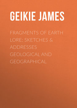
A close inspection of the rock-ridges satisfies one that they have been smoothed off by some agent pressing upon them in a direction that coincides with their own trend; and not only so, but the smoothing agent, it is clearly seen, must have come from the watersheds and then pressed outwards to the low-grounds which are now watered by the Teviot and the Tweed. This is shown by the manner in which the rocks have been smoothed off, for their smooth faces look towards the dominant watersheds, while their rough and unpolished sides point away in the opposite direction. Sometimes, however, we find that more or less steeply projecting rocks face the dominant watersheds. When such is the case, there is usually a long sloping “tail” behind the crag – a “tail” which is composed chiefly of superficial deposits. The hills between Hume and Stichill afford some good examples. The two kinds of appearances are exhibited in the accompanying diagram. The appearance shown in is of most common occurrence in the upland parts of the country, while “crag and tail” is seen to greatest advantage in the open low-grounds. In both cases it will be observed that superficial deposits (t) nestle behind a more or less steep face of rock.
When the rocks have not been much exposed to the action of the weather, they often show a polished surface covered with long parallel grooves and striæ or scratches. Such polished and scratched surfaces are best seen when the superficial deposits have been only recently removed. Often, too, when we tear away the thick turf that mantles the hill-slopes, we find the same phenomena. Indeed, wherever the rocks have not been much acted upon by the weather, and thus broken up and decomposed, we may expect to meet with more or less well-marked grooves and stride. Now the remarkable circumstance about these scratches is this – they agree in direction with the trend of the rock-ridges and the hollows described above. Nor can we doubt that the superficial markings have all been produced by one and the same agent. In the upper valleys of the Cheviots, the scratches coincide in direction with the valleys, which is, speaking generally, from south to north, but as we approach the low-grounds they begin to turn more to the east (just, as we have seen, is the case with the ridges and hollows), until we enter England to the east of Coldstream, where the striæ point first nearly due east, but eventually swing round to the south-east, as is well seen upon the limestone rocks between Lowick and Belford. In Teviotdale the general trend of the striæ is from south-west to north-east, a direction which continues to hold good until the lower reaches of the Tweed are approached, when, as we have just mentioned, they begin to turn more and more to the east. Thus it becomes evident that the denuding agent, whatever it was, that gave rise to these ridges and scratched rock-surfaces must have pressed outwards from all the dominant watersheds, and, sweeping down through the great undulating strath that lies between the Cheviots and the Lammermuirs, must have gradually turned away to the east and south as it rounded the northern spurs of the former range, so as to pass south-east over the contiguous maritime districts of Northumberland.