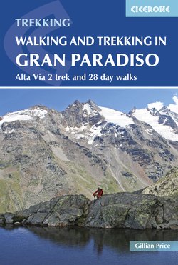
Читать книгу Walking and Trekking in the Gran Paradiso - Gillian Price - Страница 10
На сайте Литреса книга снята с продажи.
ОглавлениеALTA VIA 2
This exhilarating long-distance route cuts its strenuous way across the rugged southern flanks of the Valle d'Aosta, unimaginable worlds away from the busy traffic artery.
Heading due south from the main valley a succession of formidable ravine-like valleys gouged out by the impetuous passage of water lead between soaring ridges. They terminate abruptly, almost surprisingly in open pasture basins, havens of tranquillity and home to man and livestock alike. It is the task of the Alta Via 2 to traverse these high parallel barriers one by one. Originating just outside the eastern edge of the Gran Paradiso National Park, the AV2 offers 12 memorable, energy-packed days on a roller-coaster walk through the heart of the protected area, touching on well-established settlements in Vallon di Cogne, Valsavarenche and Val di Rhêmes, then on to Valgrisenche, Valle de la Thuile and Val Vény. It also offers views of some magnificent peaks – the Grivola, Herbetet and Ruitor for starters and the massive Gran Paradiso in the distance. Europe's sovereign Mont Blanc – Monte Bianco for the Italians – provides the breathtaking finale to the trek.
As if the AV2 needed any more to recommed it, the route is relatively untrodden, making for sublime solitary days after which all effort is amply rewarded with warming meals in well-run mountain huts and cosy village guesthouses. The 12 stages are split equally between high altitude huts and valley hotels to keep everyone happy. This also means that picnic supplies can be replenished at shops on a fairly regular basis. Only one day – Stage 9 – concludes at an unmanned hut, but a short extension to the route links in a comfortable B&B. For each stage, we have given a selection of accommodation in the villages but more options can be found on the websites of the relevant tourist offices (see ‘Information’ in the Introduction).
Alta Via 2 waymarks
Waymarking, maps and variants
The route is consistently marked with the symbol of a black-edged yellow triangle around the number ‘2’. The going is generally straightforward, suitable for almost every walker, although there is the odd stretch of unusually steep or exposed terrain rated Grade 3 (Stages 5, 7 and 9). Each stage would be suitable as an individual walk and could be easily be adapted for a day excursion.
You could also walk the AV2 in reverse, although that would mean – alas! – missing the thrill of the Mont Blanc conclusion. An approximate timing for walking in the opposite direction is given at the beginning of each stage description.
Two optional opening stages for the AV2 have now been added, doubling as a link with the wilder Alta Via 1 that crosses the northern reaches of the Valle d’Aosta. Starting out at Donnas, on the main valley floor, the way climbs via Crest (overnight stay at the dortoir, open May–Oct, tel 328 0514516, crestristorante@hotmail.com. Meals at the local restaurant a short walk away unless you self cater) to Champorcher. See www.lovevda.it and go to the Alta Via n. 2 page.
Bridge crossing en route to Rifugio Vittorio Sella (AV2 stage 4)
Glorious Mont Blanc (AV stage 12)
Three-day extension: If you have three more days to spare, an extension to the AV2 is warmly recommended to include an exploration of the spectacular snow-and ice-bound upper southernmost parts of Valsavarenche, Val di Rhêmes and Valgrisenche. Leave the official AV2 route at Eaux Rousses (at the end of Stage 5) for Pont (summer bus or 5km by road). Then follow Walk 12 to Pian del Nivolet and on to Col Rosset and Rifugio Benevolo (Walk 15). After this, follow Walk 17 via Col Bassac Déré to Rifugio Bezzi and down towards Uselères, where there is a link to Rifugio Chalet de l'Epée to resume the AV2 at Stage 8.
Getting to the start: Coaches and slow Ivrea-Aosta trains stop at Hône-Bard in Valle d'Aosta. Year-round buses run up the Valle di Champorcher to Chardonney from the small square near the railway station, in the shadow of the fortress.
