Читать книгу Orkney and Shetland - John George Flett Moodie Heddle - Страница 8
На сайте Литреса книга снята с продажи.
5. Geology and Soil
ОглавлениеTable of Contents
The geological formation of the Orkney Islands is, in its main features, of a very simple nature. If we except a comparatively small strip of land running northwestward from Stromness to Inganess in the West Mainland, and a still smaller patch in the neighbouring island of Graemsay, practically the whole county is underlain by the Old Red Sandstone formation. The two small areas above-mentioned—practically one, save for the intervening sea—are occupied by older crystalline rocks, consisting of fine-grained granite, and micaceous schist at times running into foliated granite, the whole traversed by veins of pink felsite. These formations are flanked on either side by a narrow band of conglomerate of the Middle Old Red Sandstone period, composed of the rounded pebbles of the underlying schist and granite. Of the Old Red Sandstone two divisions are found in the Islands—the Middle or Orcadian, and the Upper Old Red Sandstone. There are also in various parts but especially in Hoy and Deerness, local outcrops of volcanic material. Orkney thus constitutes practically a continuation of the north-eastern Highlands of Scotland, and, as in Caithness, flagstone is by far the most widely distributed rock.
The Orcadian or Middle Old Red Sandstone is known to be a fresh water deposit, laid down by a large system of lakes which once extended over the north-eastern Highlands as far south as Inverness and Banff, and the same species of fossil fishes are found in the grey and black flagstones near Stromness as in the red sandstones on the south coasts of the Moray Firth. Leaving out of account the small area of crystalline rocks near Stromness, which are of age long anterior to any of the Old Red Sandstone deposits, the West Mainland parishes of Stromness, Sandwick, and Birsay contain the oldest rocks within the county, the Stromness flagstones with the fishes embedded in them being coeval with the Achanarras beds of Caithness. Next in point of age, come the flagstones of the East Mainland and the North Isles, corresponding in date and fossil remains to what are known to geologists as the Thurso Beds of Caithness. Following these in order of antiquity come the yellow and red sandstones and the dark red clays or marls which occur in the northern part of South Ronaldshay, and in Deerness, Shapinsay, and Eday. These are known as the John O’ Groats Beds, from their occurrence in that part of Caithness also, where indeed they were first exhaustively investigated. These three members of the Middle or Orcadian Old Red Sandstone are supposed to have a combined thickness of not less than 7000 feet, though this pile of sediment represents only the upper half of the formation, the lower beds of Caithness apparently not being represented north of the Pentland Firth.
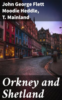
Berry Head, Hoy
After the Middle Old Red Sandstone had stood for many ages as dry land, the eroding action of the atmosphere, rain, and streams gradually eliminated all inequalities and produced a nearly level surface, upon which by degrees a new lake was formed, occupying a large part of Orkney and Caithness. In this lake sand accumulated, which now forms the highest hills of Orkney. The yellow sandstones of the Hoy and Walls hills are deposits of this lake, and belong to the Upper Old Red Sandstone, which is not represented in the other islands of the archipelago, but reappears at Dunnet Head on the south side of the Pentland Firth.
Flagstone is a material that yields readily to the influence of the weather, and the subsoil formed is a rubble consisting of loose fragments of rock embedded in a brown clay formed by the softer and more weathered portion of the underlying rock. This gives a well-drained soil, and as the flagstones always contain lime, potash, and phosphates, and are frequently mixed with sand, the resultant soil may be generally described as a clayey loam of moderate fertility. Soil of this character covers a large part of the flagstone formation of Orkney, especially where the land is of moderate elevation, and surface accumulations of boulder-clay, or alluvium are at a minimum. At higher elevations on the other hand the character of the flagstone soils is frequently modified by the presence of peat. The soils of the sandstone formation, which occur in parts of South Ronaldshay and Hoy, and to a larger extent in Burray and Eday, are of inferior fertility, partly on account of their more porous nature. In Burray and Eday a large portion of the sandstone districts are in consequence left uncultivated, and utilised only as rough pasture. The same is true of the soils of the Upper Old Red Sandstone formation, which covers by far the larger portion of the parishes of Hoy and Walls, but most of this land is, in any case, above the altitude to which cultivation is usually carried in Orkney.
Of “drifts,” or loose surface deposits, the boulder-clay is the only one that materially affects the agricultural quality of the soils of the Islands as a whole. The boulder-clay of Orkney, which on account of the particular direction—northwestwards over the Islands from the North Sea—taken by the ice at the period when the archipelago was subjected to glaciation, contains a considerable additional quantity of lime in the form of shells scraped up from the bed of the ocean, overlies the rock formations in the lower grounds over a large portion of the county. This deposit, which varies in thickness from less than a foot up to forty feet or more, has been calculated to occupy at least one-third of the area of the Islands, and it provides the most fertile soil that the county contains, particularly where the land has been improved by long cultivation and artificial drainage.