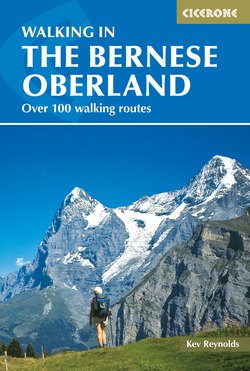
Читать книгу Walking in the Bernese Oberland - Kev Reynolds - Страница 16
На сайте Литреса книга снята с продажи.
ОглавлениеROUTE 4
Innertkirchen (625m) – Urbachtal – Gauli Hut (2205m)
| Start | Innertkirchen (625m) |
| Distance | 13km (one way) |
| Height gain | 1580m |
| Grade | 3 |
| Time | 6hrs |
| Location | South of Innertkirchen |
Cutting into the mountains south of Innertkirchen, the Urbachtal is an uninhabited pastoral valley rising here and there in gorge-like narrows between high walls of rock. Its western wall is a stupendous flank of limestone – the Engelhörner – which divides the Urbachtal from that of Rosenlaui. This strenuous walk goes all the way through the valley to its inner recesses below the Gauligletscher which, with other icefields, forms a glacial cirque containing the valley’s headwall. Set upon a remote alp the Gauli Hut commands fine views of the Ewigschneehorn and Hienderstock.
From Innertkirchen follow the narrow road which cuts away to the south of the Aare river to Grund, and then climbs in a long series of hairpins among forest, eventually levelling above a rocky cleft to enter the Urbachtal. There are footpath short-cuts in places. The road then crosses the Urbachwasser and heads into the valley proper after about 1hr 20mins.
On the trail to the Gauli Hut, great slab walls flank the Urbachtal
Continue along the road heading southwest, passing a string of farmhouses and haybarns dotted on either side among the meadows. The vast Engelhörner wall on the right is streaked with slender waterfalls and the whole scene is reminiscent of parts of Norway. High above, at the head of the valley, modest glaciers and snowfields may be seen draped from the Hangendgletscherhorn.
The road ends and becomes a stony track that winds upvalley, passes the little hut of Röhrmatten (seen to the left) and continues as a footpath. Ahead the valley narrows almost to gorge-like proportions and is heavily wooded. The path takes you up into the woods, gaining height steeply in places, then rounds a bend below a solitary cabin at 1364m and eases across a steep gully with a stream pouring through it. (Early in the season this gully may be choked with snow; in which case you should proceed with caution.) Beyond the gully the way becomes a gentle terrace, now out of the trees.
The valley has broadened again, opening to a wide stream-sliced basin. Shortly after, you come to Schrätteren, a rough pasturage with a handful of alp huts above to the left. The path leads on, crosses the Urbachwasser stream and soon forks. Take the left-hand path which climbs on over increasingly rough terrain to gain another 300m or so before making another fork at 1850m.
Both the ongoing trails lead to the Gauli Hut, but the left branch swings round to take the shaft of river-cut valley to visit the hidden tarn of the Mattensee before climbing on to reach the hut. This is perhaps of more interest than the shorter, direct route which climbs over the lower reaches of the Tëlligrat (2222m) before making a steady descending traverse to the hut itself, set in a remote alp at the head of the Urbachtal.
With places for 65 in its dormitories, the Gauli Hut has a guardian in residence in April and May, and from July to mid-October (sometimes wardened in June), when meals and refreshments are available. It is owned by the Bern Section of the SAC. For reservations (Tel 033 971 31 66 www.gauli.ch).
Other routes in the Urbachtal
If Route 4 seems to be rather longer or more demanding than you’d care to tackle, don’t despair, for the valley is well worth a visit no matter what your demands may be. It’s also possible to drive there from Innertkirchen, thus reducing the time and effort otherwise required to explore it. Should you decide to drive into the valley, park with discretion in its lower reaches soon after entering. You should be able to find a space to park just off the road in order not to block it.
By following Route 4 a very pleasant walk may be had to Schrätteren (allow 3–4hrs for the walk there and back; Grade 2). Or, if this is still too far, simply wander to Röhrmatten and back for an overview of a valley that is practically unique in the Bernese Alps.
