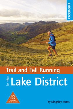
Читать книгу Trail and Fell Running in the Lake District - Kingsley Jones - Страница 11
На сайте Литреса книга снята с продажи.
ОглавлениеROUTE 1
Loughrigg Fell circuit
| Start/Finish | Royal Oak pub, Ambleside |
| Distance | 9.8km (6 miles) |
| Ascent/Descent | 410m (1345ft) |
| Grade | Trail running, Level 2 |
| Time | 1hr 40min |
| High point | Loughrigg Fell (335m/1099ft) |
| Maps | 1:25,000 OS Map OL7, 1:40,000 Harvey Lake District |
| Public transport | Bus 555/599 from Windermere/Keswick |
| Parking | Pay & display car park on Lake Road |
Ambleside is the main tourist hub of the South Lakes, and this short run is a great introduction to the vast range of terrain and running opportunities in the region. While the ascents are relatively modest, you are rewarded with spectacular views such as that of Grasmere from Loughrigg Terrace, and from the summit down the length of Windermere. There are few runs in this book where such great views are rewarded for so little effort, so this is a perfect choice of run for someone who only has a short time available. The name Loughrigg is derived from the Gaelic lough meaning lake, and Norse hyggr meaning ridge.
Saving the strain
There are some steep sections on this route. When fell running uphill, consciously shorten your stride and aim to use the whole foot in contact with the ground, rather than running on tiptoes, to reduce the strain on your calf muscles. There are two other techniques to try: you can look for stones to support your heel to reduce the angle the foot is hyper-extended by on a steep incline, or on smoother surfaces you can turn your feet slightly outwards across the fall line of the slope.
1 Turn R out of the pub and run down Church Street to the bottom where the road splits, then run R along the edge of the Crazy Golf course and go SA at the corner into the Churchyard. Exit this in the far R corner, and turn sharp L past the primary school and into Rothay Park. Run straight down the track across the middle of the park, and over Miller Bridge on the far side. Turn R on the road over a cattle grid, then almost immediately L over another grid, to ascend a steep road. Pass the buildings of Loughrigg Brow, and as you pass through the farmyard of Brow Head Farm the road turns sharply L, then R.
2 At this corner you’ll see some stone steps over a wall; take them to reach a footpath that heads off L through the trees. After 100m you’ll reach a narrow footbridge to gain access to the open fell. Run up the stepped track SA, and then turn R at the path junction. You’ll climb quickly, and you’ll soon see a gate through the wall ahead. Beyond this, cross a boggy section before arriving at Lily Tarn, with a silver birch tree growing on the island in the middle. Take the track to the R of the tarn, and follow it SA until you reach a wall. Follow this around to the R. Pass through another gate through a wire fence and keep running with the wall on your L until it turns away sharply as you reach a small stream. Cross this and reach the main bridleway track which crosses from Ambleside to Skelwith Bridge.
3 Cross the bridleway and veer slightly R over the marshy ground next to the stream for 200m until you reach a large footpath. Turn L up this path, which climbs directly away from the stream. Follow this obvious trail as it ascends the hillside, gaining 50m of height before the gradient eases and you pass a small valley with three tarns in a row. Just beyond, a wall is visible to your L as you head in a NW direction into a broad, gently rising valley. At its end the path veers slightly L; run up some stone steps to reach the summit of Loughrigg Fell (335m). Take in the panoramic views of the Helvellyn range to the N and the Coniston Fells to the W.
Grasmere from Loughrigg Terrace
4 From the summit, head N and start the descent towards Grasmere. The descent becomes increasingly technical, and on a couple of occasions you may need to use your hands on rocky steps. As you near Loughrigg Terrace, run down steep stone steps, then turn R once you reach the main track and follow the balcony track above Grasmere. At the end of the Terrace, keep your eye out for a small track cutting off R. Follow this up and around to reach a different path, which you follow to reach Rydal Caves. These were quarried 200 years ago for local roofing slate and are worth a look.
5 Run down the track below the caves until you cross a stream. Turn R here and ascend a small single-track path, gently heading S. This route climbs over the fell and after 1.5km brings you to the bridleway you crossed earlier. Turn L and go through the gate to follow the rocky path down the hillside. At the next gate you’ll pass a house on the L, and at the next gate after that you’ll reach a walled track that turns to concrete and tarmac at the corner, where you earlier climbed the steps over the wall. Follow the road all the way down and retrace your initial route back over Miller Bridge and into Ambleside.