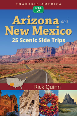
Читать книгу RoadTrip America Arizona & New Mexico: 25 Scenic Side Trips - Rick Quinn - Страница 7
На сайте Литреса книга снята с продажи.
ОглавлениеScenic Side Trip 2
Las Cruces to Lordsburg
via Gila Cliff Dwellings National Monument and Silver City
252 miles, 7 hours 30 minutes for drive time, more for optional routes, stops, and sightseeing
From the ancient past to outer space and back, on the Trail of the Mountain Spirits
This scenic detour will add 130 miles and most of a day to your journey between Las Cruces and Lordsburg. What would have been a rather monotonous 2 hours on a flat, straight freeway becomes an amazing expedition over magnificent mountain highways and a fascinating journey through time—with some very hot chiles thrown in.
Las Cruces and Hatch
Leave Interstate 10 at Exit 140 in Las Cruces, on the Avenida de Mesilla. While you’re in town, check out Las Cruces’ Museum of Nature and Science. It has, among other exhibits, fossilized footprints of animals that predate the dinosaurs in slabs of rock taken from nearby Prehistoric Trackways National Monument, which is possibly the world’s richest source for this type of Permian Age fossil. Contact the BLM in Las Cruces if you’d like to tag along on a guided hike to the fossil beds, which contain tracks left by lizard-like critters, giant bugs, and sea creatures anywhere from 250 to 300 million years ago.
Otherwise, head north on Valley Drive, NM 185, which will lead you through the agricultural area north of town. The highway runs through the valley of the Rio Grande, the same Rio Grande that marks the 1,200-mile border between Texas and Mexico. At Radium Springs, pull off the road for the Fort Selden State Historic Site, the crumbling adobe remains of a 19th-century Army outpost, a relic of the days when marauding bands of Apaches preyed on pretty much everyone who came near their territory. After the last of the renegade Apache warriors were disarmed and herded onto reservations, small garrisons like Fort Selden were no longer needed; this post was decommissioned and abandoned in 1891.
Lovers of chile peppers will have something to celebrate when they reach the little town of Hatch, the official Chile Capital of New Mexico and site of the annual Hatch Chile Festival. The spicy food and music extravaganza is held each year over Labor Day weekend, and draws as many as 30,000 visitors. There’s no question that the farms in this area produce some of the finest, hottest peppers you would ever dare to eat, and local shops do a brisk business. You can get the chiles fresh when they’re in season, from August through mid-September; the rest of the year they’re available dried, frozen, and pickled, along with every conceivable chile-related food product and curio. Favorite souvenirs include beautiful decorative wreaths made entirely of dried chile peppers, and traditional ristras: strings of dried chiles, as much a staple of Southwestern décor as they are of Southwestern cooking.
Ristras of Hatch Chiles, New Mexico
| Spelling LessonIn New Mexico, everything related to hot peppers is spelled chile, with an ‘e’, not chili, with an ‘i.’ That’s official, and they’re serious about it. Per the New Mexico Legislature: Any citizen caught using the word chili will be deported to Texas. |
From Hatch, drive 30 miles north on NM 187 to the intersection of NM 152, near Caballo Lake, a large reservoir on the Rio Grande that offers all the usual boating, fishing, camping, and picnicking opportunities. The route heads west from here, but you might consider an optional side trip: 15 miles north is the town of Truth or Consequences, the official gateway to Spaceport America, the world’s first “purpose-built, FAA-certified commercial spaceport.” It’s not an amusement park, and it’s not a movie set. It’s an actual spaceport, owned and operated by the State of New Mexico, with a 12,000-foot runway, launch pads for rockets, hangars for spacecraft, and a passenger terminal that boosters compare to the Sydney Opera House. When trips into outer space become available to paying passengers, this is where they’ll fly from.
There’s not a lot going on out at the Spaceport just yet, but if you’d like to take a look at the staging area for what could well become the Next Big Thing, you can take a tour, the “Spaceport America Experience”; it lasts about 4 hours, counting travel time. All tours leave from, and return to, the Spaceport America Visitors Center in downtown Truth or Consequences, and advance reservations are required. If you stay overnight in the area, take advantage of the natural hot springs for which Truth or Consequences has long been famous. Several of the local hotels, including Riverbend Hot Springs and La Paloma Hot Springs, have private thermal pools right on their properties.
Gila Cliff Dwellings National Monument
Leaving Caballo Lake, head west on NM 152 up into an impressive wall of mountains known as the Black Range, or Sierra Diablo. If you like to drive, you’ll love this road. This segment, known as the Geronimo Trail Scenic Byway, is widely considered one of the finest driving roads in the United States. You’ll negotiate one S curve after another on a climb to almost 9,000 feet at Emory Pass, which marks the Continental Divide. Pull off the road at the scenic viewpoint for awesome vistas and some great photographs.
Mural on the wall of the Hillsboro Cafe on the Geronimo Trail
Seventeen gloriously curvy miles beyond the pass will drop you 3,000 feet to the Mimbres River, which runs along the base of the Black Range. When you reach the intersection with NM 35, in the small town of San Lorenzo, check your time. If you plan to visit the Gila Cliff Dwellings, be aware that the gate to the ruins closes promptly at 4 p.m.—no exceptions. The distance from San Lorenzo to the site is only 45 miles, but you should allow at least 90 minutes for the drive. Late afternoon is a wonderful time of day to photograph the ruins—just don’t cut it too close.
Wildflowers, Mimbres Valley, New Mexico
The route to the cliff dwellings begins with NM 35, known as the Trail of the Mountain Spirits Scenic Byway. The highway follows the Mimbres River upstream, through the town of Mimbres. Twenty miles farther along is Lake Roberts, a small but quite beautiful lake popular with trout fishermen and bird-watchers. There are cabins and motel rooms for rent here, and a lovely campground. Four miles beyond the lake is the intersection with NM 15; turn right (north) and follow it all the way to the end, about 18 miles, to the Gila Cliff Dwellings National Monument. The road to the ruins is narrow and winding, very slow going, with some sheer drop-offs and many hairpin turns posted as low as 10 mph—and for good reason! At one point, the highway skirts the edge of a collapsed volcanic caldera. Timeworn, overgrown, but still plainly visible, the caldera is a graphic reminder of the region’s violent geological past. Stop at Anderson Scenic Overlook for a breathtaking view of the Mogollon Range, the tallest mountains in southwestern New Mexico, and Gila River Canyon, 2,000 feet below.
Gila Cliff Dwellings National Monument
Continuing north on NM 15 you’ll pass Gila Hot Springs a few miles before the end of the road. Much of this area is geothermally active and there are several natural hot springs nearby, some on public land, some private. There are a few campsites here, with access to the hot springs included.
At the National Monument visitors center, you can pick up maps and information about the ruins and the trails in the park. Even if you’ve seen your share of cliff dwellings, you’ll find this one is special. The setting is a narrow, wooded canyon with a perennial stream. On the west side of the ravine there’s a sheer cliff, and hollowed out from the face of it, high above the canyon floor, you can see a series of natural alcoves: interconnected caves that are open to the morning sun. In the late 13th century, a small group of perhaps 15 farming families from the Native American culture we now call the Mogollon moved into the caves and built an elaborate communal home there.
It was a perfect spot: protected from the elements, easily defended, close to water. A lot of craftsmanship went into the construction, and the wonderful organic structure that they created is still standing and largely intact. There are graceful, curving walls built of flat stones stacked like bricks, cemented with adobe mortar, and then plastered. The walls enclose more than 40 interconnected rooms that fill the alcoves: large common areas, smaller private living quarters, a granary. Many of the outward-facing walls had windows, and some sections were left open. Clearly, the builders appreciated their view!
There’s a tour every day at 11 a.m., but you can hike to the ruins and explore them on your own any time between 9 a.m. and 5 p.m., when the park closes. It takes about an hour to see the ruins, including the 1-mile hike up and back.
Gila River Valley, 2000 feet below New Mexico Route 15
Leaving the ruins, head back the way you came in, on NM 15. When you reach the junction with NM 35, bear right, staying with NM 15, which continues south from here to Pinos Altos, at an altitude of more than 7,000 feet. The distance isn’t great, just 30 miles from the national monument, but it will seem much farther. This is a wonderful corkscrew of a road, but it’s very, very narrow, with poor shoulders, no center stripe, and very few signs, so you have to take it slow. Be extremely careful on blind curves, as there is little room to pass vehicles coming from the other direction. I would not recommend driving this stretch in the dark, so if you’re not staying the night at Lake Roberts or camping near the monument, be sure to be on your way south well before dusk.
Pinos Altos (Tall Pines), once a booming gold-mining town, was largely abandoned more than 100 years ago. It has found new life as a recreation area for the desert dwellers in Silver City and points south. The Buckhorn Saloon and Opera House is a restaurant and bar that offers live music several nights a week, and Bear Creek Motel & Cabins is a quite decent place to stay, if you’re ready to call it a day at this point.
| Gila Cliff Dwellings Highlights |
| Lake Roberts Cabins & General Store869 NM 35 N., Silver City, NM 88061(575) 536-9929lakeroberts.comGila Hot Springs CampgroundHC 68, Box 80, Silver City, NM 88061(575) 536-9944gilahotspringscampground.comGila Cliff Dwellings National Monument(575) 536-9461nps.gov/giclBuckhorn Saloon and Opera House32 Main St., Pinos Altos, NM 88053(575) 538-9911buckhornsaloonandoperahouse.comBear Creek Motel & Cabins88 Main St., Pinos Altos, NM 88053(575) 388-4501bearcreekcabins.com |
Silver City
From Pinos Altos, it’s less than 10 miles to historic Silver City, which stands at 5,900 feet. The pine trees disappear as you descend, and the surrounding area more closely resembles the sagebrush-and-juniper landscape you left behind earlier on this route. Silver City was a mining town first prospected in the 1870s, when New Mexico was still a territory. The Silver City Museum, located in a historic home in the old downtown area, has an interesting collection of artifacts and thousands of photographs from the early days of the town. The Western New Mexico University Museum, also in town, has an excellent collection of Mimbres pottery and baskets.
Silver City is, without a doubt, the best overnight stopping place in this part of the state, considering all the great options for lodging: The Palace, a hotel dating to the late 1800s; Murray Hotel, an Art Deco-style establishment dating to the late 1930s; and The Inn on Broadway, a historic bed-and-breakfast in the heart of the old downtown.
City of Rocks State Park, Silver City, NM
| City of Rocks and the Chino Copper Mine LoopBefore leaving the Silver City area, consider this optional loop, which will take you an extra 83 miles and requires about 2 hours. Follow US 180 south toward Deming. After 30 miles, at the junction with NM 61, turn left and follow signs to City of Rocks State Park (327 NM 61, Faywood, NM; 575-536-2800). The park is 5 miles east, set back a bit from the road. The main attraction is a wild display of standing stones: massive volcanic boulders as much as 40 feet tall, carved by the elements over millions of years into an extraordinary variety of shapes and poses. If it had been created by man instead of nature, this place would be far more famous than Stonehenge. There’s a cool campground with some campsites nestled among the rock formations, and there are hiking trails. Other popular activities include birding, stargazing, and rock climbing (free climbing only).From City of Rocks, drive 22 miles north on NM 61, following the Mimbres River upstream to San Lorenzo. At the intersection with NM 152, turn west and drive another 10 miles to the northern edge of the Chino Copper Mine, an open pit that’s a mile and three-quarters wide and a quarter of a mile deep. Pull over at the Chino Mine Overlook, where you can view the whole operation. The trucks working on the terraced slopes below look like toys from the rim of the pit. Up close? Each of those 80-ton ore haulers is nearly the size of a two-story house! This mine has been actively worked since the time of the Spanish conquistadores. The pit you see today was opened in 1910, making it the third-oldest, as well as the second-largest pit-mining operation in the world.From the overlook, take NM 152 west to NM 356 and follow that road south past mountains of tailings from the pit. At Bayard, you’ll rejoin US 180, back to Silver City. |
Note. If you’re planning to take Scenic Side Trip 3 immediately after this one, you should definitely stay in Silver City. You’ll not only have a better selection of hotels, you’ll save some time and distance, because that route, which starts in Lordsburg, comes right back through Silver City on its way north.
| Silver City Highlights | |
| Silver City Museum (The Ailman House)312 W. Broadway, Silver City, NM 88061(575) 538-5921silvercitymuseum.orgWestern New Mexico University Museum1000 W. College Ave., Silver City, NM 88061(575) 538-6386museum.wnmu.eduPalace Hotel106 W. Broadway, Silver City, NM 88061(575) 388-1811silvercitypalacehotel.com | Hotel Murray200 W. Broadway, Silver City, NM 88061(575) 956-9400murray-hotel.comThe Inn on Broadway411 W. Broadway, Silver City, NM 88061(575) 388-5485 |
To Lordsburg and Beyond
The end of this route is in Lordsburg, a small town with about 2,700 people, a Greyhound stop, and an Amtrak station. It lies 45 miles south on NM 90 (for a description of this relatively flat stretch of road, see Scenic Side Trip 3). When you drive into the town from Silver City, you’ll notice signs for Motel Drive. Don’t be fooled. The street name refers to the string of old motor courts along that stretch of road, only a few of which are still operating. They’re relics of a bygone era, and their singular virtue is being very inexpensive. Beware of that. When it comes to hotels, you generally get what you pay for. There’s an assortment of newer, nicer, chain hotels clustered near the I-10 interchange at the center of town (off Main Street).
If you’re continuing on to Phoenix or points west, the Interstate is certainly the fastest way to get there, but if you don’t mind skipping Tucson, you should take a look at Scenic Side Trip 4. That route is actually a shortcut to Phoenix, and it passes through some amazing terrain. There are also three full-day scenic side trips between Lordsburg and Tucson, another full-day side trip that surrounds Tucson, and yet another that follows back roads from Tucson to Phoenix. Study the routes. Decide how much time you have to spare. If all you know of Arizona is what you’ve seen from the Interstates, you’re going to be very pleasantly surprised!