Читать книгу Trekking in Greece - Tim Salmon - Страница 11
ОглавлениеPART 1 THE PELOPONNESE WAY
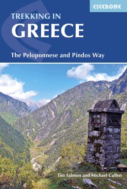
Mt Ménalo: the descent to Kardharás (Stage 6)
Ascent to Méga Spílio (Stage 1)
The Peloponnese is the detached, three-fingered landmass south-west of Athens, which is neither really part of the mainland, nor considered to be one of the Greek islands. The name means the ‘island of Pelops’, after a mythical king venerated at Olympia; the Byzantines called it the Morea (‘mulberry leaf’), and modern administrative boundaries often group it with Attica or the western mainland. It can be thought of it as a region unto itself: a dense, varied, self-contained landscape of long sandy beaches and ancient cities, of rolling vineyards, hilltop hamlets and olive groves, market towns and unexpectedly wild mountain ranges – seven of them reaching around 2000m (6500ft) or more – all packed into an area the proverbial (and actual) size of Wales, or of New Jersey, if that means more to you.
It is this variety which makes the two-week hike across it – from north to south, in our book, starting and ending at the sea – such a memorable trip. On Mt Khelmós there are alpine meadows carpeted with flowers in May, high crags pocked with snowpack until June, and a river gorge threaded by a tiny, gravity-defying rack-and-pinion railway line. In rural Arkadhía (yes, that’s ancient Arcadia, home of wilderness-loving Pan and bear-hunting Arcas), you’ll still find isolated shepherds’ hamlets and maquis-covered hills where time ticks at a slower pace. After a brush with modern life at Trípoli, you’ll escape again to the fir forests and historic monasteries of Mt Párnonas (or Párnon), then the citrus groves and ancient ruins of Sparta and Mistrás, before a final hurrah across the steep flanks of lunar Mt Taïgetos and down to the coast in sunset-facing Messinía. If time permits, linger on in one of the lovely, low-key resort villages of Áyios Nikólaos, Stoúpa or Kardhamíli: fresh fish, olive groves, clear seas. Or you can, if you prefer, end the trail at the handsome harbour town of Yíthio (Gythion), which has ferry links to Crete.
The length of it – two full weeks, a bit more if you want to bag the summits, a bit less if you’re prepared to cab or bus the flatter stretches – is very manageable, with the town of Trípoli handily placed midway in case you want to break it into two week-long chunks (express buses whisk you to Kalamáta or Athens along the E65 motorway). If you have more time, three or four additional days are outlined below, which can be slotted in after Stage 5 (to visit Dhimitsána, Stemnítsa and the monasteries of the Loúsios gorge), during Stage 6 (to summit Ostrakína, 1981m, the highest point on Mt Ménalo), and after Stage 12 (to summit Taïgetos, 2405m).
Finally, the logistics are not – touch wood – too complex. Staying in village guesthouses or hotels every night, plus one night in a mountain refuge, means you can hike light – no camping gear necessary – but you will need to check and book these ahead of time, as some have a habit of closing midweek, or randomly, or altogether. Our route, which follows the E4 trail for large parts, is generally well waymarked; and the excellent website www.e4-peloponnes.info (in German only, at the time of press) gives free GPS/route information on those sections, as well as handy tips for accommodation and taxi transfers. Our own www.thepeloponneseway.com is also useful for additional photos, updates and help with accommodation bookings. In terms of altitude, the trail rises to 1600m four times – once for each of the major ranges crossed – but no higher, unless you choose to bag a summit. This helps you avoid spring snowpack and extends the season: April and November are feasible if you don’t mind the cooler weather and shorter days, May–early June and mid September–October are ideal.
Two planning tips. Check accommodation in Vamvakoú (Stage 9) first – the hostel may well be restricted to weekend openings, or closed completely (some alternatives are suggested in Stage 9). Contact the mountain refuge (Stage 12) second – the warden charges a hefty fixed fee (€120 in 2017) to come and open it, so flexibility on dates may help you coincide with other hikers and share this cost. The refuge provides food, bunks and blankets; just bring a sheet sleeping bag and torch. The alternative to the refuge is a crude stone shelter at Pendavlí (1hr further), for which you would need sleeping mat, sleeping bag and food, but no tent.