Читать книгу Trekking in Greece - Tim Salmon - Страница 13
ОглавлениеSECTION 2 TRÍPOLI TO PANTAZÍ BEACH
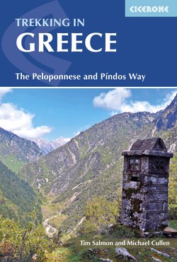
Track from Metamórfosi to Faneroménis monastery (Stage 11)
The second half of the Peloponnese Way crosses the massifs of Párnonas and Taïgetos, the former rounded and forested, the latter jagged and rocky, although firs and venerable black pines do shade your way in parts. In between these is Sparta, a modern town with ancient roots, sitting in the olive- and citrus-cultivated Evrótas valley; here our continuous walking route is interrupted with a taxi or bus ride.
Note that the last part of our route diverges from the E4, which descends the south-eastern flanks of Taïgetos to the harbour town of Yíthio (Gythion) in Lakonía. We, instead, descend the more direct south-western side to reach the Messinian coast near a village called Áyios Nikólaos. Note that there is another village of the same name on the eastern side, which – to add to the confusion – is an overnight stop on the E4.
Location
Trípoli is in the centre of the Peloponnese, capital of the modern administrative region of Arkadhía. It is 160km (1hr 45min by motorway) south-west of Athens, and 85km (1hr by motorway) north-east of the city of Kalamáta.
Maps
Anávasi Topo 50 (1:50,000) 8.7 Mt Parnon
Anávasi Topo 50 (1:50,000) 8.1 North Taygetos
For the last day: Anávasi Topo (1:20,000) 8.10 Exo Mani
Looking north past Kastrí village (Stage 8)
Bases
Mistrás has restaurants, a few shops, hotels and guesthouses, including the Hotel Byzantion (www.byzantionhotel.gr) and the Mystras Inn (www.mystrasinn.gr). Anavrití has one guesthouse, the Arhontikó (tel 27310-82671 or 27310-22938, mob 698-7101555, 698-7128554 or 697-9118855, https://kaneltrekking.gr), run by Yiórgos Kanelópoulos, a trekking aficionado who also maintains the E4 Peloponnese route. Áyios Nikólaos, Stoúpa and Kardhamíli are three lovely villages near the trail’s endpoint, offering hotels, restaurants and further gentle hikes.
Access
Regular daily buses run from Athens (Kifisoú Street terminus) to Trípoli (www.ktelarkadias.gr in Greek only) and from Kalamáta to Athens (Kifisoú Street terminus) (www.ktelmessinias.gr).
There are two or three buses a day between Kalamáta and Áyios Nikólaos, passing Stoúpa and Kardhamíli (www.ktelmessinias.gr see Kalamáta–Ítilo route).
STAGE 8
Psilí Vrísi (720m) to Áyios Pétros (930m)
| Start point | Psilí Vrísi |
| Distance | 20km |
| Difficulty | 2 |
| Walking time | 6hr 15min |
| Height gain | 840m |
| Height loss | 630m |
| Waymarks | E4 all the way |
Today’s scenery is not dramatic, but the afternoon’s long views and easy striding give a great sense of satisfaction. From Trípoli, the 13km road to Psilí Vrísi is flat, hot and dull, so it really is worth taking a taxi, especially since the onward walk is still long (6hr 15min). The first part of the trail follows an undulating farm track over scrublands and fields; then there’s a shady but pathless streambed up to pretty Dholianá, where there are cafés and seasonal hotels (including Erásmion, tel 2710-234072, mob 697-2706580, www.erasmion.gr). A steep ascent brings you to an open watershed with views south over rolling hills as far as distant Mt Taïgetos; undulating farm tracks and a stretch of road complete the journey to the small but lively village of Áyios Pétros at the foot of Mt Párnonas – which is itself tomorrow’s target.
Taxi drivers may not know Psilí Vrísi (it is a tiny hamlet, almost deserted now), nor the E4 trailhead, so ask to go through Áyios Sóstis and Garéa, after which the road splits. Head left through the main cluster of houses and stop 150 metres before a war memorial at a junction of three asphalt lanes. (If you fork right at the split, you will also reach this point, 150 metres after the memorial.) In winter or early spring, when the streambed will be impassable and the days shorter, you may want to take the taxi all the way to Dholianá.
White rock roses (cistus) bordering the track from Psilí Vrísi
Take the lane between a small breeze-block bus shelter (L) and two blocky houses (R), and immediately turn R (E4 arrow) and R again down a farm track. Descend gently SE towards a 1417m summit topped by masts (Dholianítiko) with the village of Dholianá visible halfway up the hillside. Stay on the main shadeless track, weaving between abandoned wheat fields lined with small hawthorn trees, white or purple cistus bushes and beehives in summer.
After 15min follow the main track forking L (E4 signpost). At the top of the rise, keep L (signpost), downhill. Cross a dry streambed and keep R. Where a track joins from the R (35min), keep L/straight (E4 on plane tree L) and shortly afterwards L/straight again (chestnut grove on L) and across a smaller track. At 45min you reach the whitewashed chapel of Panayía, a lovely spot in the shade of plane and cherry trees (water tap in wall).
After 50 metres, turn R up a plane-shaded streambed, usually dry from May. If it is impassable, you can pick your way along the R (true L) bank for the first 300 metres. It is cool here but prone to midges; a stick is useful, as dry leaves can cover hollows. Shortly after the first rubbish spill, it is best to climb L onto the true R bank and through a small orchard to the asphalt road by a ruined mill and a church-shaped shrine (1hr 5min). Continue S along the road for 100 metres to a concrete ford. If the stream is flowing strongly (typically Nov–Apr), you may want to continue along the road to Dholianá (about 3km).
To follow the stream, turn L along a small streamside track (E4 on plane tree) and, where it climbs L, continue along the streambed as best you can. After 15–20min it opens out; the path follows the R, then the L side. Around 1hr 40min you see two E4 arrows on a thin plane tree, pointing L away from the streambed along a path with walled fields on the R (E4 ribbons). After 6min, drop R to cross the streambed and up the earthy bank opposite into fields, bearing L to resume progress SE, with a side stream on your L. Watch out for silently sunbathing snakes (bang your stick), but don’t worry about loud rustles in the leaves (lizards). At 1hr 55min, drop L to the side stream and follow this R (E4), then up to the L (grassy track). At a jeep track, turn R (E4 on tree) and keep R/straight, to cross a stream. Just before a R bend, turn L along a path (E4 and red square), then up a side stream, across an old wheat field, then back alongside the stream.
Where the path heads L across the stream (2hr 15min), turn R (E4 arrow) and zigzag up a steep chestnut-strewn path (overgrown in places), before straightening out NW. At 2hr 25min, you emerge on the asphalt road at the bottom of Dholianá, by an S-bend with a mirror, and turn L (E4). Turn L again after 50 metres up a concrete path to the lower village square (950m; tap by graveyard gate; 2hr 30min).
Continue S up the cobbled lane and, at the T-junction, turn L and immediately R up a stepped path. At the asphalt road (2hr 35min), turn L to reach a parking area, with the village centre to your R. The village centre has a funky café, two restaurants and seasonal hotel(s). Stock up on water.
Dholianá village
For the onward route, continue along the road for 150 metres, then fork R up a small asphalt lane (E4 and yellow arrow), climbing steadily. Ignore a L fork and turn sharp R (E4 only) up a small concrete lane, passing an old spring on your L. Behind the house and chestnut tree (E4 arrow and optimistic 1100m altitude sign), turn L up a steep, overgrown path. At the concrete lane (2hr 50min), turn L (no sign). Look back for great views over the village to the plain of Trípoli, forested Mt Ménalo behind and the stark outlines of Mts Trákhis and Kteniás further right (north). Fork R and, at the last house, fork R again up a jeep track which climbs and then wiggles more gently upwards (broadly E).
At 3hr, you’ll see a grassy track ascending R with an E4 plaque on which someone has scribbled ‘Very thorny! Take the road’. By the time you read this, the thorny section should be passable, but if you prefer not to risk it, continue straight along the jeep track (another E4 sign) through still-tended chestnut groves to the asphalt road (3hr 12min), where you turn R (uphill) and after 5min L up a slightly prickly path (E4). Either way, you should reach the 1240m watershed and dirt road around 3hr 30min, with your first views south over rolling hills of untrampled maquis and low woods to the distant, jagged silhouette of Mt Taïgetos. In midsummer, this unshaded, blonde earth will be baking hot.
Turn L (E), away from the antenna-topped peak of Dholianítiko (1417m) along the watershed dirt road. Ignore the track L up to the gentle summit of Vígla (1318m), with its fire-watching tower. At the T-junction (3hr 50min), turn L and after 150 metres, by a hut, R (E4).