Читать книгу Walking on the West Pennine Moors - Terry Marsh - Страница 12
На сайте Литреса книга снята с продажи.
ОглавлениеWALK 2
Rivington Moor and Winter Hill
| Start/Finish | Car park, opposite Horwich and Blackrod High School (SD634128) |
| Distance | 10.5km (6½ miles) |
| Height gain | 360m (1180ft) |
| Terrain | Good tracks; some upland paths |
Winter Hill (456m/1496ft) is the highest point of the West Pennine Moors, and it – or often more precisely the towering mast on its summit – is in view from almost every walk in this book. As with many walks on the moors, there are numerous ways of reaching Winter Hill. This route begins in Rivington Country Park, and offers optional add-ons that have not been included in the calculations of distance and height gain, but which will not significantly add to the day’s tally.
Begin from the car park by walking out to the road and turning right to pass Horwich and Blackrod High School. Having crossed the entrance to the school, take the next turning on the left, a narrow, surfaced lane that runs up beside the school.
When you meet two wide, stony tracks branching off to the left, turn towards them, and then take the rising one on the right – you will return by the track you have just abandoned. Follow the right-hand track as it rises gently towards woodland far ahead. In due course, you pass another rising track coming up from the left, and a short way further on reach the edge of the woodland. The measured route turns sharply to the right here.
Winter Hill from the vicinity of Lead Mines Clough
Option
You have the choice of going forward into the woodland, where you will find numerous pathways that take you round Lord Leverhulme’s garden terraces. You can explore freely, but you will either have to retreat to the point where you entered the woodland, or find the track that leads up to the dovecote (SD639143) on the moorland road above.
Back on the main route, follow the stony track gently upwards to meet another, even wider track close by Rivington Pike.
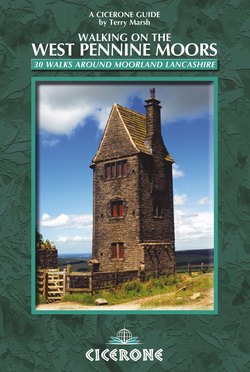
Dovecote, Rivington
Option
There is another optional add-on here, which allows you to go up to the pike. To do this, turn right for a short distance until you reach a clear track on the left, through a gate, leading up to the pike, from which a continuing path drops down the other side and rejoins the main track.
On reaching the broad track, turn left, and follow this to the dovecote. Now take the continuing track, known as Belmont Road, that contours around the northwestern edge of Rivington Moor. This part of the walk is shared with Walk 7, onto Noon Hill Slack, which is another add-on, if you have the time.
Now continue along Belmont Road for some distance until you reach a very obvious and large stile on the right, giving onto a boggy path that can be seen curving up and across the northern face of Winter Hill. Follow this path upwards, and finally you arrive at the hotchpotch of ironmongery on the summit. A surfaced service road is soon reached, and you should take this, as it now heads down across Smithills Moor.
WINTER HILL
Among the many radar communication masts on Winter Hill, one stands way above the others, reaching 300m (1000ft) into the sky. This towering transmitter is host to antennae that send analogue and digital terrestrial television and radio into millions of homes in the northwest of England.
Close by, the top of Winter Hill was the scene of an air accident on 27 February 1958, when, coping with heavy fog and snow, a flight from Douglas in the Isle of Man to Manchester crashed into the top of the hill. Only seven of the 42 on board survived. This was not the only air disaster on Winter Hill; there have been several. A two-seater aircraft crashed here in the 1920s. During the Second World War an American aircraft crashed on 7 August 1942, and in the following year, on 12 November 1943, the crew of a Wellington Bomber were killed when it crashed on Hurst Hill, on Anglezarke Moor (see Walk 9). In the following month, on 24 December 1943, an Airspeed Oxford crashed on the hill. Other crashes have included several Spitfires, Hurricanes and a Gloster Meteor, which crashed in 1953.
In September 1965 a De Havilland Chipmunk flew into the hill in cloud, without serious injury to the crew. The last crash occurred in October 1968, when a Cessna force-landed between Winter Hill and Rivington Pike.
On the way down, you pass a solitary pillar on the left; this is Scotsman’s Stump.
SCOTSMAN'S STUMP
Sometimes called Scotchman’s Stump, this pillar is a commemoration of the death of George Henderson, a 20-year-old pedlar from Annan in Dumfriesshire, and in the service of Mr Jardine, a draper of Blackburn. Henderson was murdered nearby on 9 November 1838. At a local beer house where he was a regular visitor, Henderson met another traveller, by the name of Birrell. On the morning of 9 November, Birrell arrived first and waited for an hour before deciding to leave. When Henderson did arrive, he had a beer and left around midday. A short while later, a local boy found Henderson badly wounded in the head, and ran for help. Henderson was returned to the beer house, but died a few hours later.
As reported in the Bolton Chronicle in 1839, James Whittle, aged 22, a collier who lived on Scout Road at Belmont, and who had been seen on the moors carrying a gun, was charged with the murder. Conflicting accounts suggest that Whittle had to face two trials: the first, at Liverpool Crown Court, finding him guilty of murder, but the second at Lancaster acquitting him. Another account tells that Whittle was found not guilty at the Liverpool Court. No one was ever convicted, and the crime still awaits diligent research into court proceedings, and the attentions of a ‘cold case squad’.
Scotsman’s Stump
As you follow the surfaced road down from the moor, keep an eye open for a chance to leave it, as it bends to the left, by taking to a broad path on the right and maintaining the original direction. This leads down to rugged Belmont Road, close by Pike Cottage, which has seen service in a number of guises, including as a café and kennels.
Rivington Pike from the Belmont Road
Turn right onto Belmont Road, and follow it to the track on the right that leads up to Rivington Pike. Just here, leave Belmont Road, and go through a gate on the left to descend sloping farm pastures above Higher Knoll Farm. Head down to join the farm access, now surfaced, and follow this down to reach the lane at the rear of the high school, used at the start of the walk, and follow this back to the start.