Читать книгу Walking on the West Pennine Moors - Terry Marsh - Страница 13
На сайте Литреса книга снята с продажи.
ОглавлениеWALK 3
Wilderswood and the edge of Rivington Moor
| Start/Finish | Car park, opposite Horwich and Blackrod High School (SD643128) |
| Distance | 8km (5 miles) |
| Height gain | 312m (1024ft) |
| Terrain | Generally good paths throughout; moorland fringe; often rough underfoot |
It is impossible to wander through the wooded lower reaches of Rivington Country Park and not wonder about that square building on the skyline. The structure, which goes by the name ‘Rivington Pike’, sits on the site of a beacon – a bonfire used to send warning messages in times of danger. This walk takes a roundabout route to the top of the pike, a spot that has a magnificent view when the air is clear and still. A moonlight walk up here, especially in winter snow, is simply quite magical.
Although this walk begins in the lower reaches of Rivington Country Park, there are two other possible starting points. One at Wilderswood (SD650124), where there is a convenient car park, and the other at SD638149. You might also want to leave some time to explore the terraced gardens built for Lord Leverhulme.
Lever Park and Rivington Pike
Leave the car park by walking out to the main road and turning right in the direction of the high school. Continue past the school entrance, and a short way further on, take the next turning on the left, a surfaced lane that runs up beside the school. Just after reaching the first of the school buildings, leave the lane by branching right through light woodland, and following a fence that guides you to a bridge spanning the infant River Douglas.
The River Douglas is a tributary of the River Ribble. It rises on the moorland slopes of Winter Hill at around 440m (1445ft), before flowing for 56km (35 miles) through the centre of Wigan and across the Lancashire Plain to enter the Ribble Estuary beyond Tarleton, about 10km (6 miles) downstream from Preston. The last 16km (10 miles) is tidal. When you encounter the Douglas at Rivington, the river, once a recognised salmon fishery, now supports a number of coarse fish, including chub, dace and perch, notably downstream of Wigan.
Over the bridge, keep forward to pass an isolated cottage. Soon, modern housing comes into view, and the track runs out to meet surfaced Green Lane. Turn left, ascending, but as the lane loops to the right, leave it by branching left at a footpath signpost. The path climbs as a rough track to Ormston’s Farm. Go past the farm, and forward along a fenced track towards Wilderswood.
Just as you approach the wood, the track descends to cross a stream. On the other side, you are faced with a number of possible routes. Begin by bearing right, but immediately taking the left-hand one of two tracks, which then leads you round the southern boundary of the wood, and runs alongside a high gritstone wall.
Shortly, the track meets a road end (surfaced), as it passes a row of cottages (Brinks Row). The narrow lane leads out to a junction. Here, turn left and walk up the side of Wilderswood (Old Rake) to meet another rough lane, where the road surfacing ends. (This is one of the alternative starting points for this walk.)
Turn left, now following a broad, stony track, and running along the easterly edge of Wilderswood. Beyond the woodland, the track continues and eventually reaches the base of Rivington Pike. On the way you pass isolated Pike Cottage, and about 200m further on, once again cross the infant River Douglas.
As you reach the base of Rivington Pike, branch right on another broad, stony track that leads through gates and up to the pike. It soon becomes clear that there is an obvious direct route to the top, and a less obvious, circling route that goes off to the right and comes back onto the summit from the north side. Take your pick.
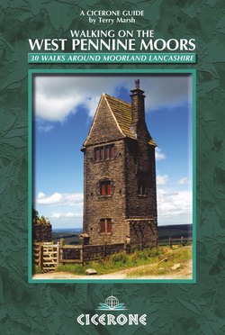
RIVINGTON PIKE
Another beacon, similar to Rivington’s, was Ashurst’s Beacon, southwest of Rivington. This chain of signals was set up around 1139 by Ranulph de Blundeville, the Earl of Chester. The Rivington beacon is known to have been fired on 19 July 1588, when the Spanish Armada was first engaged in the English Channel. There is an interesting entry in a 19th-century directory, which explains: ‘In the reign of Queen Elizabeth, when England was threatened with invasion by the “Invincible Armada” of Spain, the beacon upon Rivington Pike, standing at an elevation of 1,543 feet from the level of the sea, was kept for several months in a state of readiness, to apprise the inhabitants of the approach of the invaders. During the Napoleon dynasty, on the alarm of invasion by the French, the beacon was replaced, but in the 19th as in the 16th century, it has never yet been required to spread alarm within the breasts of England’s matrons, or its illumination over a peaceful country.’
More recently, the beacon was lit on the coronation of King George V in 1910, and on the ending of the First World War in 1918. Today it is just a very popular vantage point, and rightly so.
The square building on the pike today is a tower, built in 1733 by John Andrews, when he became owner of the Rivington estate in 1729. The stone used was taken from the original fire platform and from the bed of the River Douglas. At one time it had a wooden roof and windows on all four sides. The single internal room was 4m (13ft) square, with a stone-flagged floor, a fireplace and a cellar. It was used for shelter when grouse-shooting parties visited the moors, but this stopped in 1900 when William Hesketh Lever bought the estate. The tower is now bricked up and is a Grade II listed building.
From the top of the pike, descend a constructed pathway that goes steeply down the western face (or use the slightly easier circling path around the northern edge). Both routes rejoin just below the pike and descend to meet the main track near an isolated building. Turn right, and walk as far as a tall, slim building – a dovecote or ‘pigeon tower’.
At the dovecote, the main track forks. Here, take the left-hand branch, which soon starts to descend and becomes rough underfoot. Eventually the track leads down to a roadhead at a car park (alternative start). Turn abruptly left, through a gate, and once more following a broad stony track, here rising gently towards Rivington Terraced Gardens.
Rivington Terraced Gardens were created at the turn of the 20th century by William Hesketh Lever, later Lord Leverhulme, who had a great passion for landscape design. There are numerous pathways, terraces and walkways through 18 hectares (45 acres) of mixed woodland, including garden shelters, waterfalls, pools and footbridges. It is all quite fascinating, but perhaps the most intriguing structure is Lever’s Bridge, spanning the track. It is also known as Seven Arch Bridge, for reasons that are obvious when you see it, and was built to join together two halves of the Terraced Gardens. The design is attributed to Lever, inspired on one of his trips to Nigeria, where he saw a seven-arch bridge spanning a narrow gorge.
Rivington seven-arched bridge
The track passes beneath the bridge, and not far beyond, forks. The left branch goes through a pair of gate pillars, all that remain of the Stone House Lodge that stood here. Ignore this branch, and to continue the route, take the right-hand, descending track. This soon passes an ornamental pond.
Beyond the pond, you pass through a metal gate and join another track at a U-bend. Continue descending in much the same direction for some distance. Just beyond a gate another track appears below, to the right. Ignore this, instead continuing with the higher track – the two soon merge as they reach a surfaced lane.
Turn right down the lane, which is the one used at the start of the walk, beside the school. Walk down to the main road and turn right to return to the car park.