Читать книгу Yoho National Park: The Mountains, the Rocks, the Scenery - David M. Baird - Страница 6
На сайте Литреса книга снята с продажи.
ORIGIN OF THE MOUNTAINS
ОглавлениеTable of Contents
The surface of the earth has mountains of many different kinds: some stand as isolated masses whereas others occur in groups clearly related to one another; some tower thousands of feet above their surroundings whereas others (called ‘mountains’ by the people who live there) may be only a few hundred feet high. The wide variety of mountains points to a wide variety of origins.
In some parts of the world great masses of liquid lava and ash pour up from the depths of the earth to accumulate around volcanic vents. These are volcanic mountains. In other places, rivers and streams have cut deeply into high plateau areas over long periods of time to leave rough, mountainous terrain. In still other parts of the world, huge wrinklings in the earth’s crust are made by tremendous compressive forces, in the same way that you can wrinkle the carpet on a floor by pushing against it with your foot. These make folded mountains. Another type of mountain results in places where the earth seems to have split along enormous faults or breaks and one of the sides may be uplifted several thousands of feet. These are fault-block mountains.
When, however, we come to the great ranges of mountains—groups of clearly related mountains that extend for hundreds or even thousands of miles over the surface of the earth—we find a much more complicated story. One of the most interesting parts of this story is that the major mountain systems all over the world seem to have the same kind of history, with at least several chapters in common. We call [7] this type ‘geosynclinal mountains’ and it will help to know something about how they originate, for the mountains in the western Canadian National Parks are of this kind.
To begin the story of these mountains we must go back into geological time about 1,000 million years. North America then was very different from the land we know today. Where we now find the Rocky Mountain System from the Arctic Ocean to Mexico, there existed a great flat area which was very close to sea-level. Great forces in the interior of the earth caused the whole area to sink very slowly below sea-level. The rate of this depression was probably only a few inches in a thousand years but it continued over a long period. It meant that the sea eventually flooded the land over hundreds of thousands of square miles from the Arctic Ocean to the Gulf of Mexico. Into this vast shallow inland sea the rivers from the surrounding regions poured their loads of silt and mud, which spread evenly over the bottom. Waves along the shores of these ancient seas eroded the land, added more sediments, and made currents to distribute them over the bottom, far from shore.
As the millions of years passed, the accumulation of sedimentary materials—the mud, silt and sand from the rivers and shorelines, and limy precipitates from the sea itself—gradually filled the shallow inland sea. At times, vast areas must have become filled up to near sea-level. But one of the strange things about these great depressions in the earth’s surface is the way they seem to have continued to sink as the load of sedimentary material in their centres increased. By this gradual sinking and an almost equal rate of filling it was possible for thousands and thousands of feet of sand, silt and mud to accumulate, layer upon layer, and all show features of shallow-water origin.
Development of geosynclinal mountains:
The spectacular peaks and valleys of the Rocky Mountains as we know them today are made of rocks which record a story that began more than 600 million years ago. At that time part of western North America began to warp downward to form an elongated trough as in A.
Rivers poured sand, silt and gravel into the lowland area. Down-warping continued until the trough was filled with a shallow sea, into which poured a steady stream of sedimentary materials, as in B.
Downsinking continued, but it seems to have been at a rate that corresponded closely to the rate of filling, so that sedimentation was always into shallow marine waters. The mass of sedimentary materials slowly changed to sedimentary rock as the load increased until it had a form like that in C.
For reasons we do not yet understand the trough area was then severely compressed so that the rocks in it were folded and broken. At about this time in the history of such mountains great masses of molten materials commonly appear in the cores of the folded and broken rock, eventually solidifying into granite. D is what an enlarged section of C would look like.
Uplift accompanied the folding and faulting, and as soon as the rocks emerged from the sea they were subjected to erosion. Rivers and glaciers carved the valleys and formed the peaks as shown in E, an enlarged part of D. This is the stage of development of our Rocky Mountains now.
At a time in the earth’s history which geologists place at between 600 million and 500 million years ago, living things began to populate some parts of the seas fairly thickly. Some of these creatures had hard skeletons or outer coverings, and when they died these hard parts fell to the bottom and were promptly buried by the accumulating muds and silts.
In some places the hard parts of the dead animals made clear impressions on the sedimentary materials on the sea bottom. When the soft sedimentary materials hardened into solid rock (over a period of millions of years), the remains of the long-dead organisms became fossils.
How do we know these things took place where we now find the western mountains? We read it in the rocks where the story is fairly clearly written. The rocks of which the mountains are made are distinctly of sedimentary origin—that is, they are made of ancient gravels, sands, muds and various sediments that have become hardened into solid rock. They are layered or stratified as we would expect accumulating sediments to be, because from time to time there were changes in the composition of the material being laid down.
These changes may have been due to storms, changes in wave patterns, changes in drainage systems, or the changes that would take place as the land supplying the sediment was gradually being eroded away. On some of the rock surfaces we find ripple marks which are exactly like those found today in stream bottoms or in the shallow parts of the sea.
By splitting open the rocks we can find the fossilized remains of ancient sea creatures, some of them with modern counterparts. Other fossilized skeletons are from creatures that have been extinct for millions of years; yet we can tell a great deal about them by comparing their structures with those of living creatures and noting carefully their association with creatures we know something about.
The kinds of materials the rocks are made of and all the structures found in them can be observed today in different parts of the world in the actual process of formation. We can estimate the extent of the ancient seas by looking for the rocks that were deposited in them. We can tell something of the existence of former shorelines by looking for evidence of beach deposits in the rocks. We can tell whether rocks were laid down as sediments in deep water or in shallow water by comparing what we find in the rocks with what we see being deposited in those environments now.
As to the development of the Rocky Mountains we can conclude, by observing evidence of erosion still preserved in the rock record, that the seas withdrew temporarily from the region or that the sediments completely filled the shallow depression on the top of the continent. In short, by putting together and correlating hundreds of small pieces of scattered evidence we can unravel with some certainty the story of the rocks from which the mountains were later carved.
The next chapter in the history of the Rocky Mountains seems to have begun about 200 million years ago. The rock record tells us that a disturbance of the very shallow depression on the surface of western North America, which, as [12] we have observed above, became filled with sedimentary materials, began to change the pattern of development. Some areas of the old trough were lifted up out of the sea and were themselves eroded to supply sediments that were poured back into the remaining sea.
As the tens of millions of years passed the crust of the earth apparently became more and more unstable in the region of what we now call the Rocky Mountains. This unrest culminated about 75 million years ago in a complete change. From the Arctic Ocean to the Gulf of Mexico the great thickness of rocks which had been accumulating as sediments on the old sea-bottom in the previous billion years, was lifted above sea-level, broken in many places along great fractures called ‘faults’, and, in some places, strongly compressed. The compression or squeezing caused the great blanket of rocks to fold and buckle, and, in places, to break so that one part slid up over another part. The forces within the earth that would cause this kind of uplift and breaking are so vast that it is difficult to comprehend them at all. Yet we can go to the mountains and once again clearly see proof of this chapter in the development of the Rocky Mountain System.
In very old mountain systems of the world, where long-continued erosion has cut into the very core of the mountains themselves, we can often observe in some detail a third chapter in the development of geosynclinal mountains. It seems that during or just after the folding and faulting, great masses of hot molten rock appear in the cores of mountain systems. These push rocks aside or melt their way into the interiors of the belts of folded and broken sedimentary rock, where they cool down and eventually solidify. Canada’s Rocky Mountains have not been deeply enough eroded so we know nothing of this part of their history.
Waste from the erosion of the ring of mountains of the President Range pours through the narrow valley in the centre of the picture and spews out in a large alluvial fan. Emerald Lake, which lies in the bottom of the valley just to the left of the picture, is being encroached upon slowly by the spreading detritus.
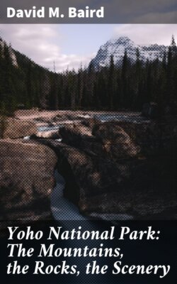
The great mass of the Chancellor Peaks rises above Kicking Horse River below Leanchoil. The silt-laden river deposits part of its load temporarily in its own course where driftwood snags on the muddy shoals. Trees grow on the mountainsides up to a fairly well marked timber-line, but the very steep slopes in the gullies are mostly bare.
The next phase in the development of all geosynclinal mountain systems seems to be one of quiet stability, during which the agents of erosion, glaciers, rivers, and wind contrive to cut deeply into the uplifted, complicated mass of broken and folded rocks. For some 70 million years now this has been the history of the Rocky Mountains in Canada.
At the present time, as we drive through the river valleys and among the mountain peaks, we can observe erosion as it proceeds. We can actually watch the glaciers pushing and scraping over the country, tearing off rock and grinding it up, some of it as fine as flour. We can see the rivers cutting into their rocky courses, wearing away the land, and carrying their loads of debris towards the ocean. We can observe great masses of gravel, sand and silt—the result of erosion of mighty mountains through tens of thousands of years—now spread out below the foot of the mountains. Erosion has cut valleys deep into the complicated rock structures to reveal much of the story of folding, faulting and uplift.