Читать книгу Yoho National Park: The Mountains, the Rocks, the Scenery - David M. Baird - Страница 7
На сайте Литреса книга снята с продажи.
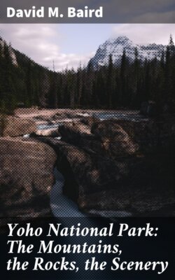
THE ROCKS
ОглавлениеTable of Contents
We have already seen how the rocks in Yoho National Park were almost all laid down as sediments in a succession of seas that covered this area in the distant geological past. Now let’s examine these sediments and the rocks that resulted from their consolidation.
If we could find a place in the park where a drill could penetrate the entire rock section—from the very youngest rocks on the top to the very oldest ones deep below—we could study the whole history in one place. But because these rocks have been folded and broken along great splits or faults, this is not possible. We can, however, piece together the broken parts of the record from different areas and thus figure out almost exactly what the whole sequence of rocks looked like before it was broken. Within the rock sequence, units of various sizes with different names occur.
It is the custom of geologists to give names to rock units; they are named after the place where they were first discovered and described, or after the place where they are best exposed. Where there are masses of layered rocks geologists use different names to indicate the different layers and groups of layers. An individual layer may be called a ‘bed’ or ‘stratum’; thus we might refer to a ‘limestone bed’, a ‘limestone layer’ or a ‘limestone stratum’. A group of such beds, layers, or strata that have some distinctive character in common throughout, is called a ‘formation’. An example in Yoho National Park is the Cathedral Formation—named for its occurrence on Cathedral Mountain and consisting of a number of beds or layers which have a generally similar age, composition, and appearance. A still larger unit of rock layers is termed a ‘group’. Now, having looked at how geologists name rock units, let’s look at some of the rock types and the units into which they are grouped in Yoho National Park.
The oldest rocks occur along the eastern edge of the park and in the bases of some of the peaks there. Here, in the [17] period of time known as ‘the Precambrian’ (more than 500 million years ago), great quantities of sand with occasional muddy layers and silty layers accumulated. These were succeeded at the beginning of the next period in history, the Cambrian, by a vast thickness of limestones and magnesium-rich limestones or dolomites. These rocks were laid down as sediments on the bottom of the sea, in much the same way that limy sediments are accumulating on the banks of the Bahamas at the present time. Hundreds and even thousands of feet of this kind of material accumulated, interspersed with occasional layers of mud and silt.
Now when we come to look at these sediments in the form of rocks we find that they can be divided into a number of different formations—the ones shown in the diagram on page 18, with the average thickness of each in parentheses.
As we travel to the western part of Yoho National Park we become aware that the rocks there are somewhat different from those of approximately the same age in the eastern section. This is not surprising, really, when we think that the kinds of sedimentary materials being laid down in the ancient seas would differ over the width of the several miles involved. When we go to places now where sediments are being laid down in the sea we can easily see this variation.
Near the mouths of rivers, muds and silts may be being deposited, while elsewhere, at exactly the same time but under different conditions, pure lime is being precipitated. This means that the rocks that ultimately form from these materials will be quite different in appearance, yet they were deposited at exactly the same time.
The table of formations in the eastern section of Yoho National Park is shown in the left column and the rocks to be seen in the individual peaks are shown in the other columns. The St. Piran Formation was largely made of sands but is now recrystallized to the hard, dense rock—quartzite. The others are mostly limestones with some shaly and sandy layers interspersed among them. All were laid down in the seas that covered this area in the Cambrian period.
Something of this nature seems to have taken place during the Cambrian period in the region which is now Yoho National Park. In the western part of the park we find a considerable thickness, perhaps 4,000 to 5,000 feet, of fine-grained sedimentary rocks which have been lumped together and called ‘the Chancellor Formation’. These rocks are [19] quite different from the limestones and shales of the Mount Stephen and Cathedral Mountain area but appear to be roughly the same age because they are overlain by rocks that are equivalent to the rocks overlying the Stephen and Cathedral rocks.
Overlying the Chancellor Formation is the Ottertail Formation, which in most places is a massive grey limestone or dolomite about 2,000 feet thick. Many of the great rock walls on the east side of the Ottertail Mountains from Mount Hurd southward are composed of this grey limestone unit, which is known to extend off to the south as far as Nevada. It must represent a time of long-continued precipitation of calcium carbonate under unusually stable conditions of land and sea. It is found in a few spots on the eastern side of the park, such as on the very cap of Mount Stephen and on Paget Peak which is north of Wapta Lake.
Down in the southern corner of Yoho National Park, in the tops of the Ottertail Mountains, a very large part of a great series of sedimentary rocks—called ‘the Goodsir Group’—is exposed. These rocks are named from the towers of Mount Goodsir, whose upper part is composed entirely of rocks belonging to this sequence.
A mass of rocks that is unique in the Rocky Mountain System occurs in the valley and on the flanks of Ice River in the southern section of the park. These are igneous rocks—that is, at one time they were molten but they solidified after they were emplaced. Their composition is quite different from most igneous rocks; geologists call them ‘nepheline syenite’. Besides being unusual in that their chemical and mineral compositions are different from most igneous rocks, the rocks in this mass contain veins and small masses of a beautiful blue mineral called ‘sodalite’.
Rock formations in the western section of Yoho National Park are shown in the left column and the rocks to be seen in the individual peaks are shown in the other columns. The thick Chancellor Formation on the bottom is made up largely of shaly material with some limestone layers. The overlying Ottertail Formation is a great mass of limestone. The Goodsir Formation, or Group, is composed of thin layers of shale and limestone. The Chancellor, the Ottertail and the lowermost 2,000 feet or so of the Goodsir were laid down in the Cambrian period. The age of the upper part of the Goodsir is Ordovician—the next period of geological time.
We’ve now seen what the rocks are made of and how most of them were laid down in the ancient seas that long ago covered this area, and we’ve mentioned the one small mass of igneous rock, but exactly how were these rocks carved into the mountains we see today?