Читать книгу The Handy Geography Answer Book - Paul A Tucci - Страница 11
На сайте Литреса книга снята с продажи.
ОглавлениеMAPS
HISTORY AND INSTRUMENTS
How old is the oldest known map?
Researchers often point to early Mesopotamia and Egypt, around 5000 B.C.E. to 2000 B.C.E., when discussing the earliest of maps. Around 2700 B.C.E., the Sumerians drew sketch maps in clay tablets that represented their cities. These maps are some of the oldest-known maps. Debate continues whether or not examples of cave drawings, which appeared tens of thousands of years before, actually depict maps. Knowing and depicting where we are is as old as civilization itself.
What is the oldest map using the word America?
The map, acquired by the Library of Congress and dated 1507, incorporates many of the findings of the Italian explorer Amerigo Vespucci. The map was thought to be lost but was rediscovered in 1901 and was kept in a castle in Wolfegg, Germany, for more than 350 years.
What is the oldest known map drawn to scale?
In the sixth century B.C.E., the Greek geographer Anaximander created the first known map drawn to scale. His map was circular, included known parts of Europe and Asia, and placed Greece at its center.
What makes a piece of paper a map?
No matter what the medium, all maps must be a representation of an area of the Earth, celestial bodies, or space. Though maps are commonly printed on paper, they can come in a variety of forms, from being drawn in the sand to being viewed on handheld devices like phones/tablets and computers. A map should have a legend (a guide explaining the map’s symbols), a notation of which way is north, and an indicator of scale. No map is perfect and every map is unique.
What is a good way to learn where places are?
The best way to learn about places that you have heard of is to look them up in an updated atlas, a collection of maps bound in a book. An atlas may include additional information, such as illustrations, statistical tables, topography, and other important information about a place or places. If you would rather use the Internet, you may try to enter the place in the search box at your favorite search engine, and then click on the results. You may also use online sites and apps for your mobile device, such as “Google Maps,” Apple’s “Maps,” MapQuest, Rand McNally, or Yahoo Maps. You will be surprised by the amount of information you can find!
Why is a book of maps called an atlas?
The term “atlas” comes from the name of a mythological Greek figure, Atlas. As punishment for fighting with the Titans against the gods, Atlas was forced to hold up the planet Earth and the heavens on his shoulders. Because Atlas was often pictured on ancient books of maps, these became known as atlases.
What is interesting about Google’s Street View?
Google’s Street View is interesting because it allows users to begin their journey by seeing images of the Earth and allows users to drill down to a geographic location at the view of the place on the street. Google even has Street View images under the ocean at the Great Barrier Reef, off the northeast coast of Australia, and at many other ocean sites around the world. Google has transformed maps that we may use every day, by offering satellite imagery, road maps, and street-level images for use on our smartphones, mobile devices, and computers of all types.
What do cartographers do for a living?
Cartographers are often employed in publishing, government, military, land surveying, and conservation sectors. They contribute to the scientific, technological, and artistic components to the making of maps. Additionally, cartographers frequently provide complex information, using diagrams, charts, and spreadsheets.
How do cartographers shape our world?
Cartographers are mapmakers and cartography is the art of mapmaking. Cartographers map neighborhoods, cities, states, countries, the world, and even other planets. There are as many types of maps to make as there are cartographers to make them.
What country would purposely create false maps?
Within the former Soviet Union, incorrect maps were produced as a matter of course. Soviet maps purposely showed the locations of towns, rivers, and roads in incorrect places. Often, in different editions of the same map, towns would disappear from one version to the next. Street maps of Moscow were particularly incorrect and nonproportional. This cartographic mischief of the former U.S.S.R. was an effort to keep the geography of the country a secret, not only from foreigners but also from its own citizens. Even official government agencies were not allowed to have accurate maps.
Who decides which names go on maps?
In the United States, the U.S. Board on Geographic Names (BGN, comprising of representatives of many federal agencies) approves the official names and spellings of cities, rivers, lakes, and even foreign countries. If a town would like to change its name, it must petition the BGN for approval. Upon approval, the name is officially changed and updated in federal government gazetteers and records, which official and commercial mapmakers use to make their maps.
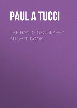
Cartographers make all kinds of maps, such as maps of the world, countries, states, or cities, such as this street map of Berlin.
How can maps be used to start wars?
Throughout history, many countries have used maps as a means to justify aggression to a neighboring country by asserting ownership of some land, based upon their version of a map. For example, prior to its 1990 invasion of Kuwait, Iraq produced official maps that showed the independent country of Kuwait as Iraq’s nineteenth province. Iraq used these maps as justification for its 1990 invasion and attempted annexation of Kuwait (Iraq was interested in Kuwait’s oil reserves). Maps have been, and still are, used by a multitude of countries, provinces, and cities to prove or disprove the ownership of a certain piece of land.
How do I get to the refrigerator in the dark?
Not all maps are written on paper. When trying to reach the refrigerator at night, we do not smell our way to food, we use a map based upon our memory of the room. If we stumble on our way, it is usually over a misplaced toy or shoe that we did not remember leaving there. Everyone has this mental imagery in his or her mind. These mental maps help you find your way not only to the refrigerator in the dark but also to the grocery store, to work, and to every place that we go. People not only have mental maps of common trips they make but also of their city, country, and even the world. Every person’s mental map is unique, based upon how wide an area that person travels and his or her knowledge of the world.
What other countries have disputes over lines drawn on maps?
Japan, China, and Taiwan all have a dispute over the Diaoyu/Senkaku islands in the Pacific Ocean. India and Pakistan have an ongoing dispute over ownership of the northernmost region of Kashmir in India. China has disputed claims of sovereignty by Taiwan. North and South Korea are still in conflict over lines drawn by Korean and American forces that split the country decades ago.
How does a sextant help navigators?
In 1730, the sextant was invented independently by two men, John Hadley and Thomas Godfrey. Using a telescope, two mirrors, the horizon, and the sun (or another celestial body), the sextant measures the angle between the horizon and the celestial body. With this measurement, navigators could determine their latitude while at sea.
When was the compass invented?
Ancient south-pointing compasses have been found in China, dating back to as early as 200 B.C.E., during the Han Dynasty period. These early, metal compasses pointed south and helped Chinese mariners stay on course at sea. It was not until 1600 C.E. that the use and innovation of the compass had migrated to Europe. As early as the eleventh century, the Chinese were using a magnetic needle to determine direction and to foretell events. At approximately the same time, the Vikings may have also used a similar device. A compass is simply a metallic needle that points toward the Magnetic North Pole.
Have compasses always pointed north?
No, they have not. Though compasses always point to the magnetic pole, the magnetic pole has not always been in the north, as it always moves. Every 300,000 to 1 million years, the magnetic pole flips from north to south or from south to north. If compasses had been around before the last time the magnetic pole reversed, their arrows would have pointed south rather than north.
What is true north?
True north is the direction that one can map along the surface of the Earth to the geographic North Pole.
What is Magnetic North?
Magnetic North refers to the direction that corresponds to the magnetic field lines to which compasses point. The core of the Earth acts like a giant spherical magnet, with two poles: one North and one South. The strength of the magnetic field changes with time and location. The main field that lies far below the surface of the Earth generates approximately 90% of the total magnetic field. The other 10% of Earth’s magnetic field is generated in our upper atmosphere and magnetosphere, where ions, electrons, and other particles help protect the planet from dangerous solar emissions.
What is a compass rose?
On old maps, the directions of the compass were represented by an elaborate symbol, known as a compass rose. Many of the older compass roses displayed 32 points, representing not only the four cardinal directions (north, south, east, and west) but also 28 subdivisions of the circle (southwest, south-southwest, etc.). This directional symbol resembled a rose, hence its name. Though compasses are now often drawn with only the four cardinal directions and the resemblance to the flower is minimal, the directional symbol is still called a compass rose.
What is an azimuth?
Azimuth is another method for stating compass direction. It is based on the compass as 360 degrees, with north at 0 degrees, east at 90, south at 180, and west at 270 degrees. You can refer to a direction as “head 90 degrees” instead of “head east.”
How and why does Magnetic North move?
Scientists aren’t sure why the Earth’s magnetic pole moves, only that it does. The European Space Agency’s SWARM mission launched three satellites in November 2013 to analyze the Earth’s magnetic fields, contributing significant data for global researchers.
How much has the Magnetic North Pole moved?
Since it was documented in 1831 by James Ross to be slightly north of 70 degrees north latitude, it has moved to north of 80 degrees north latitude at an average rate of more than 24 miles (40 km) per year. The amount of movement from decade to decade varies, but it’s never more than a few miles each year. During the twentieth century, the pole moved approximately 6.2 miles (10 km) per year. At the beginning of our current century, researchers have measured the movement to be as many as 24.85 (40 km) miles per year.
Unlike the geographic North Pole, the Magnetic North Pole does not stay in the same place but has shifted hundreds of miles over the last centuries.
LATITUDE AND LONGITUDE
Where is the equator?
The equator is the line located equidistant between the North and South Poles. The equator evenly divides the Earth into the Northern and Southern Hemispheres and is zero degrees latitude.
What are lines of latitude and longitude?
Lines of latitude and longitude make up a grid system that was developed to help determine the location of points on the Earth. These lines run both north and south and east and west across the planet. Lines of latitude (those that run east and west) begin at the equator, which is zero degrees. They extend to the North Pole and the South Pole, which are 90 degrees north and 90 degrees south, respectively. Lines of longitude (those that run north and south) begin at the Prime Meridian, which is the imaginary line that runs through the Royal Observatory in Greenwich, England. The lines of longitude extend both east and west from the Prime Meridian, which is zero degrees, and converge on the opposite side of the Earth at 180 degrees.
Are lines of longitude and latitude all the same length?
No, they are not. Only the lines of longitude are of equal length. Each line of longitude equals half of the circumference of the Earth because each extends from the North Pole to the South Pole. The lines of latitude are not all equal in length. Since they are each complete circles that remain equidistant from each other, the lines of latitude vary in size from the longest at the equator to the smallest, which are just single points, at the North and South Poles.
How wide is a degree of longitude?
Though there are only a couple dozen lines of longitude shown on most globes and world maps, the Earth is actually divided into 360 lines of longitude. The distance between each line of longitude is called a degree. Because the lines of longitude are widest at the equator and converge at the poles, the width of a degree varies from 69 miles (111 km) wide to zero, respectively.
Do other planets have longitude and latitude lines?
Yes, scientists have divided the other planets and their moons into longitude and latitude systems like the Earth. They use these lines just as they do on Earth: to pinpoint exact locations on the planet or moon.
Lines of latitude go from side to side (east and west) on this map, while lines of longitude run top to bottom (north and south).
How wide is a degree of latitude?
Though there are only about a dozen lines of latitude shown on most globes and world maps, the Earth is actually divided into 180 lines of latitude. The distance between each line of latitude is called a degree. Each degree is an equal distance apart, at 69 miles (111 km).
What do minutes and seconds have to do with longitude and latitude?
Each degree of longitude and latitude is divided into 60 minutes. Each minute is divided into 60 seconds. An absolute location is written using degrees (°), minutes (′), and seconds (″) of both longitude and latitude. Thus, the Statue of Liberty is located at 40°41′22″ North, 74°2′40″ West.
Which comes first, latitude or longitude?
Latitude is written before longitude. Latitude is written with a number, followed by either “north” or “south” depending on whether it is located north or south of the equator. Longitude is written with a number, followed by either “east” or “west” depending on whether it is located east or west of the Prime Meridian.
Why was the Prime Meridian established at Greenwich?
In 1675 the Royal Observatory in Greenwich, England, was established to study determination of longitude. In 1884, an international conference established the Prime Meridian as the longitudinal line that passes through the Royal Observatory. The United Kingdom and United States had been using Greenwich as the Prime Meridian for several decades before the conference.
Why was computing longitude so difficult?
It wasn’t until the sixteenth century that clocks were fabricated in such a way that they could accurately tell time both on land and at sea. The only way of determining how far east or west one could go is by plotting the stars in two locations and recording the exact time in both locations simultaneously, and then recording the time and position at the destination. As clocks became more accurate, the ability to measure speed and distance became possible.
How can I remember which way latitude and longitude run?
You can remember that the lines of latitude run east and west by thinking of lines of latitude as rungs on a ladder (“ladder-tude”). Lines of longitude are quite “long” because they run from the North Pole to the South Pole.
How can a gazetteer help me find latitude and longitude?
A gazetteer is an index that lists the latitude and longitude of places within a specific region or across the entire world. Many atlases include a gazetteer, and some are published separately.
How can I find the latitude and longitude of a particular place?
To find latitude and longitude of a particular location, you will need to consult either a gazetteer, database, or website that includes longitude and latitude data. Though gazetteers are readily accessible, they don’t include as many places as online databases. There are a number of sites on the Internet that have extensive databases of latitude and longitude and even include such specific places as public buildings.
READING AND USING MAPS
What is the difference between a physical map and a political map?
A physical map shows natural features of the land such as mountains, rivers, lakes, streams, and deserts. A political map shows human-made features and boundaries such as cities, highways, and countries. The maps we use in atlases and see on the walls of classrooms are typically a combination of the two.
What is a topographic map?
A topographic map shows human and physical features of the Earth and can be distinguished from other maps by its great detail and by its contour lines indicating elevation. Topographic maps are excellent sources of detailed information about a very small area of the Earth. The United States Geological Survey (USGS) produces a set of topographic maps for the United States that are at a scale of 1:24,000 (one inch equaling 2,000 feet [or 1 centimeter equaling about 240 km]). You can purchase these maps online, at sporting goods stores, or through the USGS itself.
Why are road maps so difficult to fold?
The problem lies with the multitude of folds required to return the map to its original, folded shape. The easiest way to fold a road map is to study the creases and to fold the map in the order that the creases will allow. But once you’ve made a mistake, the folds have lost their telltale instructions. To fold a road map, begin by folding it accordion style, making sure that the “front” and “back” of the folded design appear on top. Then, once the entire map is folded accordion style, fold the remaining slim, long, folded paper into three sections. And, voilà, your road map is folded!
Why is color important on a relief map?
A relief map portrays various elevations in different colors. But, a common color scheme found on relief maps causes a problem. On these maps, mountains are displayed as red or brown, while lowlands are shown in shades of green. This is confusing because the green areas on the map are often misconstrued as fertile land, while brown areas are mistaken for deserts. For example, an area such as California’s Death Valley, which is shown in green on relief maps because it lies below sea level, seems fertile, when actually it is an inhospitable desert.
What does the scale of a map tell me?
A scale indicates the level of detail and defines the distances between objects on a map. On a map, scales can be written as a fraction, a verbal description, or as a bar scale. A fraction, or ratio, using the example of 1/100,000 or 1:100,000, indicates that one unit of any form of measurement on the map is equivalent to 100,000 units of the same measurement in the area being represented. For instance, if you use inches as the unit of measurement, then one inch on the map would equal 100,000 inches in the area represented by the map.
A map scale will show you how a distance on a map translates to mileage in the real world.
A verbal description describes the relationship as if it were a verbal instruction, such as “one inch equals one mile.” This allows the versatility of having different units of measurement.
What is a bar scale?
A bar scale uses a graphic to show the relationship between distance on the map to distance in the area represented. The bar scale is the only type of scale that allows a reduction or enlargement of the map without distorting the scale. This is because when you increase the size of the map, the bar scale is increased proportionally. For a fraction or verbal scale, the proportion (1:1,000) is only true for the map at that size. For example, when enlarging a map, the map might become twice as large, but the numbers in a ratio do not change as they would need to in order to stay accurate.
How can I determine the distance between two places by using a scale?
By using a ruler, compare the distance between two points on a map with the information on the scale to calculate the actual distances between the two points. For example, if you measure the distance between two towns as being five inches and the ratio says 1:100,000, then the actual distance between the towns is 500,000 inches or 7.9 miles (12.7 km).
What is the difference between small- and large-scale maps?
A small-scale map shows a small amount of detail over a wide area, such as the world. A large-scale map shows a large amount of detail while representing a limited area, such as neighborhoods or towns.
Why is every map distorted?
No map is completely accurate because it is impossible to accurately represent the curved surface of the Earth on a flat piece of paper. A map of a small area usually has less distortion because there is only a slight curve of the Earth to contend with. A map of a large area, such as maps of continents or the world, are significantly distorted because the curvature of the Earth over such a large area is extreme. This means that many places around the world may appear smaller or larger than they actually are, depending on where on the map the place is located.
How is the Earth’s surface like an orange peel?
Any attempt to represent a sphere, like the Earth, in a flat representation results in distortions. The surface of the Earth is like the peel of an orange. When we try to take the “peel” of the surface of the Earth and lay that onto a flat piece of paper like a map, large, open areas are created. Mapmakers correct for these distortions, so there are as few distortions as possible. The strategies for correcting for these problems are referred to as “projections.”
In many types of projection maps, Greenland appears much larger than it actually is because of distortion caused by keeping the lines of latitude and longitude straight.
Why does Greenland appear larger on most maps than it actually is?
Because of the distortions that must appear on all maps, many maps place the distortion in the northern and southern extremes of the Earth. In one of the common projections, known as Mercator, Greenland appears to be similar in size to South America, despite the fact that South America is actually eight times larger than Greenland. The advantage of the Mercator projection is that the lines of latitude and longitude remain perpendicular; thus, the map is useful for navigation.
How can a legend help me read a map?
The legend, usually found in a box on the map, is information that explains the symbols used on a map. Though some symbols seem standard, like a railroad line, even those can be represented differently on different maps. Since there really are no standard symbols, each map’s legend should be consulted when reading a map.
Why is there often a cross next to the east direction on maps?
On old maps, a cross often sits next to the east direction on a compass rose. This cross represents the direction to Paradise and the Holy Land.
Where can I buy maps?
There are many places you can buy maps. Most brick-and-mortar and online bookstores offer an extensive collection of local and foreign travel maps, wall maps, and atlases. Also, many cities have specialty travel and map stores that offer a larger and more varied collection of maps, as well as maps of more exotic locales. Maps are also available to view or download at many websites. Just put in the name of the place, region, city, or country that you wish to find, and you will discover both maps that are either free or available for purchase. Look for the most up-to-date maps when selecting a map from more than one available vendor.
But what if I can’t find the map I’m looking for?
Not all maps can be found at bookstores or even in specialty stores. If you are looking for an extremely specific and relatively uncommon map, visit a local university’s map collection to obtain a copy. Their collections are often far greater in size and breadth than any store. If you need help locating a map, you should be able to discuss your map needs with a friendly map librarian. You can also try constructing a search on the Internet that is as specific as possible. Use advanced search options to filter out results so that you may find a precise and detailed map.
What are some interesting ways we can use maps?
When we superimpose data upon maps of all kinds, we are able to visualize data in a unique way and perhaps draw conclusions that we cannot see just by looking at tables, graphs, and raw data in columns. According to experts at the Washington Post in a blog post called “40 Maps That Explain the World,” some interesting maps include: the world’s major writing systems, the best/worst places to live, maps of world religions, language, psychological comparisons of people, early maps showing how countries were formed over time, racial tolerance/intolerance, and ethnic diversity.
What is the difference between relative and absolute location?
There are two different ways to describe where a place is located: relative location and absolute location. Relative location is a description of location using the relation of one place to another. For instance, using relative location to describe where the local grocery store is, you might say that it’s on Main Street, just past the high school. Absolute location describes the location of a place by using grid coordinates, most commonly latitude and longitude. For instance, the local grocery store would be described as being located at 23°23’57” North and 118°55’2” West.
MODERN MAPPING
Besides supporting telecommunication, how do satellites help us to understand our world?
Satellites capture images of the Earth’s weather patterns, the growth of cities, the health of plants, and even individual buildings and roads. Satellites circle the Earth, or remain geostationary (in the same place with respect to the Earth), and send data back to the Earth via radio signals.
How have satellites changed mapmaking?
Satellite images, which are accurate photographs of the Earth’s surface, allow cartographers to precisely determine the location of roads, cities, rivers, and other features on the Earth. These images help cartographers create maps that are more accurate than ever before. Since the Earth is a dynamic and ever-changing place, satellite images are great tools that allow cartographers to stay up-to-date.
Satellites have made much more detailed maps possible and are also actually easy to produce.
How old is Google Maps?
Google Maps first started in 2004, when Google acquired an Australian mapping-related company, Where 2 Technologies, which began the year before. Originally conceived as a downloadable piece of software, Google management transformed the software to purely Web based and began releasing developer versions (The Maps API) of the software in 2005 to further spawn development and use of maps to more sites and users. Google acquired several other firms in order to realize its dream of bringing maps of all kinds to all people. In 2008, Street View was introduced to give users a digital, street-level view of places of interest in all parts of the world, and it continues today.
How has GIS revolutionized cartography?
Geographic Information Systems (GIS) began in the 1960s with the popularity of computers. Though very simplistic in its beginning, new technology and inventions have expanded and enhanced the functions of GIS. GIS has revolutionized cartography by using computers to store, analyze, and retrieve geographic data, thus allowing infinite numbers of comparisons to be made quickly. The program formulates information into various “layers,” such as the location of utility lines, sewers, property boundaries, and streets. These layers can be placed together in a multitude of combinations to create a plethora of maps, unique and suitable to each individual query. The versatility of GIS makes it indispensable to local governments and public agencies.
How can GIS help my town?
Your community can use GIS on a day-to-day basis and in emergency situations. GIS allows public works departments, planning offices, and parks departments to monitor the status of the community’s utilities, roads, and properties. In an emergency, GIS can give emergency teams the information they need to evacuate endangered areas and respond to the crisis.
What is GPS?
GPS, or the Global Positioning System, is a network of satellites in orbit around the Earth that may give us a precise location of either ourselves or a point of interest. It began as early as 1973 with military defense in mind but was later expanded for general use in the early 1990s.
How does GPS work?
We often take GPS for granted because it is ubiquitous, found on phones, mobile devices, stand-alone units, and embedded in the navigation systems of our cars and many other products. It works by analyzing how long it takes for a time signal to travel from one of the three to four satellites to your receiver. This process is called trilateration. When satellites are above the horizon, the results are much more accurate.
How many GPS satellites are there?
Although we need only 24 functioning satellites in order to provide an accurate measurement of a location, there are currently 69 satellites orbiting the Earth. Some are not functional and had to be replaced by a working unit, while others are on reserve in case they are needed.
How does a GPS unit know where I am?
Individual Global Positioning System (GPS) units on the Earth receive information from a U.S. military-run system of 24 satellites that circle the Earth and provide precise time and location data. The individual GPS unit receives data from three or more satellites that triangulate its absolute location on the Earth’s surface. If you are carrying such a device, your absolute location is the same as that of the device.
How can GPS keep me from getting lost?
A GPS unit provides precise latitude and longitude for the location of the device. By using a handheld GPS unit or a GPS-enabled device, along with a map that provides latitude and longitude (such as a topographic map), you can determine your precise location on the Earth’s surface. This is a valuable tool for those who hike or travel in remote regions and for ships at sea. GPS is now widely available in cars; as stand-alone, portable, pocket-sized devices; on phones; and even on the boxes that ship products that you buy. In short, GPS is used in all aspects of our lives.