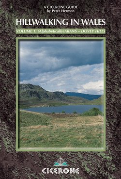
Читать книгу Hillwalking in Wales - Vol 1 - Peter Hermon - Страница 30
На сайте Литреса книга снята с продажи.
ОглавлениеArenig Fach
Arenig Fach looks singularly uninspiring from Arenig Fawr or the road; not worth climbing. What a contrast when it is viewed from the Migneint or Carnedd y Filiast! Then it assumes a dominating air and looks every inch a mountain, even though there is still no sign of the craggy E face that watches over the almost unknown Llyn Arenig Fach. This is a shy hill and one whose treasures must be coaxed.
The vast summit plateau is ideal for sunbathing: cushions of heather to lie on, bilberries to feast on, dips for shelter from the wind, plus views to uplift the spirit. All the Arenigs are splendid viewpoints but Arenig Fach is twice blessed, towering as it does over the Migneint's wilderness of moorland and bog. Even a dull day cannot entirely dispel the magic, while in sunlight the mosaic of purples and greens, yellows and browns, hillocks and dips, pastures and streams, casts an ethereal spell that will live in your memory.
Note Caution is de rigeur in mist; on three sides slopes are steep and quickly lead to rough trackless terrain. When in doubt steer a SE course, later trending E, to let the gentle Bryn Du ridge (AG12) bring you safely down.
S approach (AG10)
Leave the A4212 through a gate at 826400 (opposite the entrance to Rhyd-y-Fen Farm) and climb steeply N over ancient pastures, crossing several tumbledown walls on the way, until you meet a more substantial wall beyond which grass succumbs to unbroken heather. Continue slightly W of N, keeping to the crest of a shallow ridge. There is no track but despite the heather the going is a joy, with only the occasional hidden boulder to watch out for.
Avoid the urge to forge ahead when the trig point peeps over the skyline. Instead bear R above the lowering crags that cradle Llyn Arenig Fach in the stony depths below. Follow the N rim of the plateau round to the trig point with ever-widening views of the Migneint.
Llyn Arenig Fach route (AG11)
Leave the A4212 through a gate at 845418 and thread your way up gently wooded slopes until the crags guarding Llyn Arenig Fach rear ahead and you stand on its shoreline. Lack of a path is barely noticed. Continue to the N tip of the lake where a playful track snakes up the bilberry/heather-clad slopes with consummate ease, breasting the summit plateau close by the cairn.
Bryn Du ridge route (AG12)
The best way off in thick weather.
Leave the trig point in a SE direction but bear E after 0.5 mile for the ridge. The only problem is gaining access to the road. You could do worse than aim for 845418 and AG11.
Migneint route (AG13)
Do not underestimate this round trip of a good 12 miles of trackless walking. There are obvious shortcuts, so have a go – but choose a fine day!
This walk through the Migneint follows the grain of the land (in so far as there is one), takes in most of the sights and throws in an ascent of Arenig Fach for good measure.
Start from Pont ar Gonwy (778446), keeping W of the stream. The first objective is the minor top of Llechwedd-mawr (779436) and its small cairn. Then on to the first of Migneint's two lakes, Llyn Serw, where a 5min diversion W reveals one of the few rocky outcrops in this vast morass – an unsuspected little cliff watching over the infant Afon Serw.
Spot height 479m at 786425 is the next target, bringing the second cairn of the day. You are now on the crest of a shallow rise. Follow this SE until it falls away to a broad marshy depression. Nearby is an isolated farmstead, Cefngarw, still used for sheep shearing. Keep well S of it to ensure an easy crossing of the Serw.
So far, though trackless, the going has not been at all bad. However, reaching the next checkpoint – the cairn at Carnedd y Gors-gam (813417) – involves 1 mile of deep heather. Pretty to look at, but an ankle-twisting tormentor with only the odd sheep track for respite. Panting up the steep slopes beyond (past a primitive shepherd's hut) seems welcome relief and you will enjoy lunching on Arenig Fach's breezy top, reclining on springy cushions of heather and bilberries while marvelling at the mottled splendour of the Migneint below.
Arenig Fawr and Moel Llyfnant across the Migneint with Llyn Serw
For a fresh way home head for Mochowgryn (tussocky heather again) and then Carnedd Iago (easier going restored). Iago is the highest point of the day apart from Arenig Fach and a splendid vantage point for admiring the arc of encircling hills. When you resume, follow a faint track along the perimeter of the woods W, trending N of W. As you do this, look out for a line of boundary stones. Follow these for 0.75 mile after the woods desert you L, then strike out W for Llyn Dywarchen. Lying in a shallow, windswept hollow it is as cheerless a sheet of water as any in Wales.
For tired walkers the easiest way home is N to regain the road near Rhyd Cerig-gwynion. However, purists may prefer to take a compass bearing and keep to the moors via Llechwedd-mawr.
