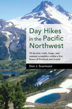
Читать книгу Day Hikes in the Pacific Northwest - Don J. Scarmuzzi - Страница 26
На сайте Литреса книга снята с продажи.
Оглавление| 19 | GOAT LAKE LOOP TO HAWKEYE POINT |
ELEVATION: 7431 ft; 6650 ft without the summit; with vertical gains of 3281 ft, and 2500 ft for Goat Lake loop alone
DISTANCE: 6¾ mi from Berry Patch TH (5½ mi to the high intersection with Lily Basin Trail, plus ½ mi from Snowgrass Flats TH), 16½ mi clockwise loop including the summit; 14 mi clockwise loop without the summit
DURATION: 3–4 hours directly up Goat Ridge Trail, 8–10 hours round-trip loop; 7–9 hours round-trip loop without the summit
DIFFICULTY: Very challenging. Steady trails, mosquitoes July into August, few steeps, well signed, obvious, fairly long, steeper summit block with snow/ice crossing okay without special gear in late summer, mountain goat encounters possible
TRIP REPORT: Most people camp at various locations throughout Goat Rocks Wilderness including at the THs, but several day hikes surrounding this one prove it’s not necessary for those in good shape getting an early start! The Snowgrass Trail to Snowgrass Flats is fairly crowded on summer weekends because of the camping options there and the short season. Northwest Forest Pass required at both THs, and an outhouse is located at Berry Patch TH.
TRAILHEAD: Snowgrass Flats TH or Berry Patch TH. Take I-5 N from Portland to exit 68 (Morton/Yakima), turn right on US-12 E 60 mi passing Morton and Randle, turn right (S) at milepost 128 on washboard gravel FR-21 (2 mi W of Packwood) 13 mi staying on main wide road. Fork left on FR-2150 for 3 mi, ignore the left turn down to Chambers Lake, and then either turn right more than ¼ mi on FR-405 to Snowgrass Flats TH or continue straight more than ¼ mi to Berry Patch TH, both with ample parking. From Seattle, take I-5 S to exit 142A (Auburn), merge onto WA-18 E, exit for WA-164 E (Enumclaw), turn left on WA-164 E 14 mi, turn left on WA-410 E (Chinook Pass Highway) 40 mi, turn slight right onto WA-123 S 16 mi, turn right on US-12 W 10 mi, turn left (S) on FR-21 and follow like above (155 mi, 2½–3 hours from Portland; 125 mi, 3½ hours from Seattle).
ROUTE: For the big clockwise loop from Snowgrass Flats TH, take Snowgrass Spur Trail 96A past a small lake briefly and turn left (W) on Trail 96 for ½ mi to Berry Patch TH (for Hawkeye Point and Goat Lake directly begin from Berry Patch TH). Turn right on Goat Ridge Trail 95 steeply N 1½ mi toward Goat Ridge and Jordan Basin through the forest. Pass Trail 95A on the left (moves around the cliffy W side of the ridge more than a mile to meet the main trail again) and hike ¾ mi up through meadows E of the ridge to the juncture on the ridgeline.
The spectacular wildflower display in late August under Hawkeye Point en route to Goat Lake.
Continue N on the W side of Goat Ridge almost ½ mi passing Jordan Creek Trail 94 on the left. Traverse up steadily, but never too steep, less than 3 mi more to the high intersection with Lily Basin Trail, passing through the top of the stunningly picturesque Jordan Basin en route to the ridge saddle. See Hawkeye Point ahead as the views are somewhat underrated on this side of the loop. There are open meadows littered with dazzling wildflowers along Jordan Creek (camp spots), waterfalls, ponds, grasses, wildlife, and then the final push easily to the intersection with Lily Basin Trail 86.
See Old Snowy to Gilbert Peak SE across the vast valley belonging to Goat Creek; you’ll be descending to the right on Trail 86 for the clockwise loop, but leave Trail 85 to continue on Trail 86 up the ridge ½ mi N to the junction with the summit spur path on the right for Hawkeye Point. Look S to Mount Adams standing impressively behind Goat Ridge with Mount Rainier past the ridge to Johnson Peak. Lily Basin Trail continues NW for several miles, but follow the spur instead ¾ mi NNE along the wide-open treeless ridge to the top as the trail becomes a bit steeper and rockier after cautiously crossing a lingering snowfield in a little saddle. Pick a safe angle past the snow/ice as a very steep wall remains most times of the year. See the vibrant Goat Lake below, which may be partly frozen until late August or even September, and take in the wonder from the boulder-topped peak before moving on!
Old Snowy Mountain reflects into a small pond below Snowgrass Flats.
From the main intersection at the saddle with the Goat Ridge Trail, walk left (NE) for the loop on Lily Basin Trail a mile to Goat Lake, passing thick, bright wildflowers mid-July into August choking the trail on the downward traverse under Hawkeye Point. The gorgeous lake partially to fully thaws for only a fraction of the year (if that) and thus sees most visitors in late September when the rampant mosquitoes of midsummer are mostly gone. Mountain goats love the rocky and snowy high basin and walls under Hawkeye Point as well as the lake itself for much of the year. Keep your distance from these endearing yet wild animals as you carefully cross the outlet creek coming from the lake and walk down the trail without any difficulty.
Enjoy the views of the cascade coming from Goat Lake behind as you stroll S by more surprises, beautiful creeks, an immense blanket of purple lupine, Western pasqueflower, paintbrush, and others, with Old Snowy looming above to the left. Mount Adams and Mount St. Helens are much farther to the S and SW. In around 2½ mi from Goat Lake is the end of Lily Basin Trail past a stream crossing near part of the Snowgrass Flats camping area, with Snowgrass Trail 96 moving steeply up to the left (E) a mile to the PCT or straight down. Walk down ¾ mi steeper to the lower meadows with Bypass Trail 97 heading left (E) to the PCT or Cispus Pass.
Hike steeply S down turns on Trail 96, then follow a flat traverse right (NW) turning SW past a pond or two with great reflections before you cross Goat Creek over the bridge. Finish the last couple of miles through the thickening forest up around 400 ft in elevation (gradual) and down to the Snowgrass Flats TH as you finish on Trail 96A just past Trail 96 moving right (W) to Berry Patch TH in ½ mi.