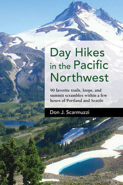
Читать книгу Day Hikes in the Pacific Northwest - Don J. Scarmuzzi - Страница 9
На сайте Литреса книга снята с продажи.
Оглавление| 3 | FALLS CREEK FALLS |
ELEVATION: 2375 ft, with 950 ft vertical gain to the top of the falls
DISTANCE: 2¼ mi directly to the falls on Lower Trail, 4½ mi round-trip; 6¼ mi round-trip loop with Upper Trail
DURATION: 2-3 hours round-trip
DIFFICULTY: Moderate. Steeper at times, uneven wet trails, well signed, humid in summer, a few drop-offs from Upper Trail
TRIP REPORT: Bring the family, possibly swim in the chilly creek, and enjoy a mostly laid-back walk with great benefits and options. Road may be gated 1½ mi from TH December through March. No fee required, and a restroom is present.
TRAILHEAD: Falls Creek Falls TH. Take I-84 E from Portland to exit 44 (Cascade Locks), continue under Bridge of the Gods and turn right up the circle to cross over it into Washington after paying the toll, turn right on WA-14 E 5¾ mi, turn left through Carson on Wind River Road (FR-30) 14 mi NW (¼ mi past National Fish Hatchery), turn right to stay on Wind River Road (FR-30) ¾ mi, take the first right on gravel FR-3062 for 2 mi, fork right on FR-057 almost ½ mi to the end at a large gravel lot (65 mi, 1½ hours from Portland).
Mossy boulders line the path the final feet to Falls Creek Falls.
ROUTE: Start a hundred yards past the sign, walking right (ENE) on Trail 152A at the juncture (opposite the return loop on Trail 152B) for 1 mi staying S of and close to Falls Creek with chances to work down to the water. You will rise up gradually and cross over a solid suspension bridge to the N side. Continue another mile steadily through big, old fir and cedar to the next signed intersection. Turn right more than ¼ mi SE to the Falls Creek Falls viewing area around the corner as you begin to hear the roar of the thunderous four-tiered waterfall.
There is a 30-ft mini falls (difficult to see) below the 60-ft drop into a mosslined pool directly in front of you, and the spread-out Middle Falls Creek Falls (90 ft high) is topped with yet another waterfall (60 ft high) just out of sight above. Watch for spray and return NW more than ¼ mi on Trail 152A. Turn right (N) to work steeper from the signage up to the return loop Trail 152 in ½ mi, but head right (SE) a mile to the top of the falls for a slight detour. The brief spur paths to the right from the detour give you good shots of Upper Falls Creek Falls but please use caution near the steeps close to the viewpoints of the waterfall, the valley, and the mountains W in Trapper Creek Wilderness.
The wider curtain of Middle Falls Creek Falls above the lower drops and just below the narrower uppermost drop.
Return on the Upper Trail 1 mi to the juncture for the counterclockwise loop, then walk 1¾ mi W down an easy grade on Trail 152 to a faint trail on the left that leads S immediately to a third footbridge. Cross it and fork left (ESE) instead of right (toward Fall Creek TH) on Trail 152B ½ mi along the creek through the forest and past a safe beach area to the end of the loop at a spur just a few feet to your vehicle.