Читать книгу Afoot and Afield: San Francisco Bay Area - David Weintraub - Страница 11
На сайте Литреса книга снята с продажи.
ОглавлениеIntroducing the San Francisco Bay Area
Whatever your favorite outdoor activity, you’re sure to find a place to pursue it in the Bay Area. There are about 1 million acres of public parklands within the nine counties that circle San Francisco Bay, featuring rugged coastlines, tree-filled canyons, cascading streams, grasslands sparkling with spring wildflowers, chaparral-cloaked ridges, and windy summits. No matter where you go, from Santa Rosa to San Jose, you are never far from a trailhead.
The Bay Area is usually divided into four regions—North Bay, East Bay, South Bay, and Peninsula. The North Bay includes Marin, Napa, Sonoma, and Solano counties; the East Bay consists of Alameda and Contra Costa counties; the South Bay takes in most of Santa Clara County; and the Peninsula covers San Francisco, San Mateo, and the northwestern part of Santa Clara County. Within these regions are bustling urban areas such as San Francisco, Oakland, San Jose, and the Silicon Valley, along with tranquil forests, mountains, beaches, marshes, and farmlands.
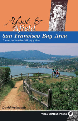
Hikers take a break just off Pine Mountain Road, with Mt. Tamalpais in the background.
Bay Area parklands are administered by various federal, state, and local agencies, listed in Appendix 3.
Climate
The Bay Area’s climate is perfect for outdoor activities, with a dry season that lasts from May through October and a generally mild, if damp, winter. In summer, expect fog and cool temperatures near the coast, thanks to Pacific Ocean. Inland, temperatures can soar. The generally clear days of autumn are fine for hiking just about anywhere. The first rains turn hillsides green and fill seasonal creeks.
Winter storms from the Gulf of Alaska can drench the Bay Area and even bring snow to the highest peaks. Cold, clear weather usually follows—a great time to bundle up and visit high-elevation vantage points. Spring can be sunny, rainy, tranquil, or blustery—or a combination, sometimes on the same day! This is when the Bay Area’s grasslands come alive with colorful displays of wildflowers.
The Pacific’s moderating influence diminishes as you go inland. Temperature differences—the spread between the average highs and lows for any given location—widen as you leave the coast. Here’s an example: The highest average high temperature for San Francisco is 68.5°F, whereas the same figure for St. Helena in Napa County—only about 65 miles away—is 89.2°F. But San Francisco’s lowest average minimum, 45.7°F (January), is about 10°F warmer than St. Helena’s.
Yearly rainfall totals, too, change as you travel around the Bay Area. Each successive range of coastal hills blocks more and more Pacific moisture, creating a rain-shadow effect. Kentfield, in Marin County, receives about 48 inches (that’s 4 feet!) of rain per year, whereas the town of Livermore, in eastern Alameda County, gets only about 15 inches. Yet the distance between these two towns is only about 55 miles.
Climate is one thing, but daily weather is another, so it’s a good idea to check with a local source for current conditions and forecasts before heading out. You can use a weather radio, available at Radio Shack, outdoor stores, and other outlets, to receive broadcasts from the National Weather Service. You can also find up-to-the minute weather information on the Weather Channel or on the Internet at www.weather.com.
Geology
The Bay Area lies within a geological province called the Coast Ranges, a complex system of ridges and valleys that stretches from Arcata to near Santa Barbara, and inland to the edge of the Central Valley. The Coast Ranges were formed millions of years ago, as the floor of the Pacific Ocean was dragged under the western edge of North American continent. This process scraped material from the ocean floor and piled it higher and higher on the continent’s edge, in what is now California.
Within the Bay Area are sub-ranges such as the Sonoma, Mayacmas, and Vaca mountains in the North Bay; the Diablo Range in the East Bay and South Bay; and the Santa Cruz Mountains on the Peninsula and in the South Bay. The tallest peak in the North Bay is Mt. St. Helena (4343’), at the corner of Sonoma, Napa, and Lake counties. Other prominent Bay Area summits include Mt. Hamilton (4213’), Mt. Diablo (3849’), Loma Prieta (3806’), Mt. Tamalpais (2571’), and Sonoma Mountain (2295’).
Olcott Lake in Jepson Prairie Preserve, a seasonal pool, hosts a variety of plants and animals, some quite rare.
Most of the surface rock in the Bay Area is sedimentary, but volcanic activity has occurred here in the past. Young volcanic rock caps the Mayacmas and Vaca mountains bordering the Napa Valley, and there are four extinct volcanoes in the East Bay, including Round Top (1763’). California’s state rock is serpentine (more properly, serpentinite), gray-green in color and often seen as outcrops beside the trail. Serpentine forms a soil that is toxic to many plant species, but some have adapted to it. Among these are Sargent cypress, leather oak, and a variety of uncommon wildflowers.
The San Andreas fault—which splits the Santa Cruz mountains and slices through Marin County—and a host of lesser faults crisscross the Bay Area. As the Pacific plate slides past the North American plate, tremendous bursts of energy are sometimes released in the form of earthquakes. Most of the time, however, the northward movement, which, over the last 25 million years has carried granite from southern California to Point Reyes, is imperceptible. Visit Point Reyes National Seashore in the North Bay, Sibley Volcanic Regional Preserve and Mt. Diablo State Park in the East Bay, and Los Trancos Open Space Preserve on the Peninsula to learn more about Bay Area geology.
Little Yosemite is a rocky gorge on Alameda Creek, perfect for picknicking and nature study.
Plants
California has a rich diversity of plant life. Some species, like coast redwoods, date back to the dinosaurs, whereas others have evolved within the past several thousand years. Roughly 30 percent of the state’s native plants grow nowhere else. These endemics, as they are called, include many types of manzanita (Arctostaphylos) and monkeyflower (Mimulus). Botanists divide the plant kingdom into several major groups: flowering plants, conifers, ferns and their allies, mosses, and algae. A plant community consists of species growing together in a distinct habitat. Here are the principal plant communities you will encounter along the trails.
OAK WOODLAND
Inland from San Francisco Bay, the fog-free hills between 300 and 3500 feet host a generally open woodland, sometimes called a savanna. Species here include various oaks, California buckeye, gray pine, California bay, buckbrush, toyon, coffeeberry, snowberry, and poison oak. Examples of this community can be found in Sugarloaf Ridge State Park, Black Diamond Mines Regional Preserve, and Henry W. Coe State Park.
RIPARIAN WOODLAND
Found beside creeks and rivers, these trees and shrubs provide the Bay Area’s best hope for an autumn display of color. Common riparian species include bigleaf maple, white alder, red alder, California bay, various willows, California rose, poison oak, California wild grape, elk clover, and giant chain fern. Point Reyes National Seashore and Monte Bello Open Space Preserve give you opportunities to enjoy this community.
REDWOOD FOREST
At one time, coast redwoods blanketed the Pacific coast from central California to southern Oregon. These giants are the world’s tallest trees and are among the fastest-growing. Commercially valuable, they were heavily logged, especially in the Santa Cruz Mountains. The remaining old-growth coast redwoods in the Bay Area are confined a few areas, most notably Muir Woods National Monument in Marin County and Armstrong Redwoods State Reserve in Sonoma County. Associated with redwoods are a number of plant species, including tanbark oak, California bay, hazelnut, evergreen huckleberry, wood rose, redwood sorrel, western sword fern, and evergreen violet. You can visit second-growth redwood forests and see a few old-growth giants at Muir Woods National Monument, Redwood Regional Park, and Purisima Creek Redwoods Open Space Preserve.
DOUGLAS-FIR FOREST
These majestic trees often occupy similar habitats as coast redwoods, but thrive where soil conditions do not favor redwood growth. In many parts of the Bay Area, Douglas-fir is the “default” evergreen, easily told by its distinctive cones, which have protruding, three-pointed bracts, sometimes called rats’ tails. Like redwood, Douglas-fir is prized for its lumber. Some of the common plants associated with Douglas-fir are the same as those associated with coast redwood, namely California bay, tanbark oak, and western sword fern. Others include blue blossom, coffeeberry, and poison oak. Point Reyes National Seashore, Mt. Tamalpais State Park, and El Corte de Madera Creek Open Space Preserve have beautiful Douglas-fir forests.
Coast redwoods grow in association wtih other trees and shrubs, creating a plant community.
MIXED EVERGREEN FOREST
A mixture of evergreen trees, including California bay, canyon oak, coast live oak, and madrone, comprises this community. The understory often contains shrubs such as toyon, blue elderberry, hazelnut, buckbrush, snowberry, thimbleberry, oceanspray, and poison oak. Carpeting the forest floor may be an assortment of wildflowers, including milk maids, fairy bells, mission bells, hound’s tongue, and western heart’s-ease. Take a stroll through a mixed evergreen forest at China Camp State Park, Dry Creek Pioneer Regional Park, Sierra Azul Open Space Preserve, and Edgewood Park and Preserve.
CHAPARRAL
This community is made up of hardy plants that thrive in poor soils under hot, dry conditions. Chaparral is very susceptible to fire, but some of its members, such as various species of manzanita, survive devastating blazes by sprouting new growth from ground-level burls. Although chaparral foliage is mostly drab, the flowers of many species are beautiful, with some blooming as early as December. The word chaparral comes from a Spanish term for dwarf or scrub oak, but in the Bay Area it is chamise, various manzanitas, and various species of ceanothus that dominate the community. Other chaparral plants include mountain mahogany, yerba santa, toyon, chaparral pea, and poison oak. You can study this fascinating assembly of plants on Pine Mountain, Mt. Diablo, and at Sierra Azul and Rancho San Antonio open space preserves.
GRASSLANDS
Few if any grasslands in the Bay Area have retained their native character. Human intervention, in the form of fire suppression, farming, and livestock grazing, along with the invasion of nonnative plants, has significantly altered the landscape. Gone from most areas are the native bunchgrasses, perennial species that once dominated our area. Remaining, thankfully, are native wildflowers, which decorate the grasslands in spring and summer. Among the most common are bluedicks, California poppy, owl’s-clover, checkerbloom, lupine, and blue-eyed grass. Look for these at Skyline Wilderness Park, Sunol Wilderness, Joseph D. Grant County Park, and Russian Ridge Open Space Preserve.
COASTAL SCRUB
Also called soft chaparral, this community consists mostly of shrubs and grasses growing near the coast. Among the most common members are California sagebrush, coyote brush, toyon, bush monkeyflower, and various brooms. Point Reyes National Seashore, Tilden Regional Park, and San Bruno Mountain are all excellent places to find coastal scrub.
Animals
MAMMALS
It’s always a thrill to see a coyote or a bobcat from the trail, but these sightings are uncommon. Glimpses of mountain lions are more rare still, but these large predators are present in the Bay Area, mostly in the more remote parks. Other, more common mammals in our area include squirrels, rabbits, deer, gray fox, raccoon, skunk, opossum, and chipmunk. Wild pigs have invaded some Bay Area parks and their rooting does extensive damage. Stay away from these dangerous animals.
BIRDS
Located on the western edge of the Pacific Flyway, the Bay Area is a great place to go birding. The large variety of species results from the wide range of habitats—seashore to mountain—present here. Birders at Point Reyes National Seashore, the area with perhaps the greatest variety of birds, have logged an impressive 440 different species, or just under half of all bird species found in North America north of Mexico. Large numbers of individual birds reside in the Bay Area year-round, pass through on migration, or winter here. For the common names of birds of the continental United States and Canada, the American Ornithologists’ Union’s (AOU) checklist is the authoritative resource. It can be found at www.aou.org/checklist/north/index.php.
Early spring is a good time to spot birds at Sonoma Valley Regional Park.
Common birds seen from the trails include acorn woodpeckers, western scrub-jays, Steller’s jays, spotted towhees, dark-eyed juncos, sparrows, and California quail, the state bird. Hawks, falcons, vultures, golden eagles, and kites soar above many Bay Area parks. If you learn to “bird by ear,” identifying species by their distinctive notes, calls, and songs, you will quickly expand your list, because many birds are frustratingly hard to spot, especially in dense foliage. Birding with a group also improves your odds of seeing and identifying a large number of species, including rarities.
REPTILES AND AMPHIBIANS
A variety of snakes are present in the Bay Area, including California kingsnake, rubber boa, California whipsnake, yellow-bellied racer, garter snake, gopher snake, and western rattlesnake. Gopher snakes are often mistaken for rattlers, but a gopher snake has a slim head and a fat body, whereas a rattlesnake has a relatively thin body compared with its large, triangular head. Gopher snakes are common, but rattlers are seldom seen.
The ubiquitous western fence lizard is probably the Bay Area’s most commonly seen reptile. Also here are the California whiptail, a lizard with a tail as long as its body, the alligator lizard, and the western skink. An animal resembling a lizard but actually an amphibian is the California newt, which spends the summer buried under the forest floor, then emerges with the first rains and migrates to breed in ponds and streams. Briones Regional Park and Monte Bello Open Space Preserve are among good places to witness these migrations. Other amphibians you might see or hear include western toad and Pacific tree frog.