Читать книгу Afoot and Afield: San Francisco Bay Area - David Weintraub - Страница 19
На сайте Литреса книга снята с продажи.
ОглавлениеTRIP 5 Marin Headlands
| Distance | 5.4 miles, Loop | |
| Hiking Time | 3 to 4 hours | |
| Elevation Gain/Loss | ±1100 feet | |
| Difficulty | Moderate | |
| Trail Use | Backpacking option, Mountain biking allowed1 | |
| Best Times | All year | |
| Agency | GGNRA | |
| Recommended Maps | Marin Headlands Trail Map (GGNPC), Trails of Mt. Tamalpais and the Marin Headlands (Olmsted) | |
| Notes | 1Bicycles are not allowed on the northern half of the Miwok Trail, and must instead use the Old Springs and Marincello trails to complete the trip |
HIGHLIGHTS This scenic loop uses the Miwok and Bobcat trails to circle Gerbode Valley, an area slated in the 1960s for urban development but later protected as part of the Golden Gate National Recreation Area (GGNRA). The hills surrounding Gerbode Valley, part of the Marin Headlands, are vibrant in the spring with wildflowers, and alive with birdsong and avian acrobatics most of the year, but especially during the fall raptor migration. Views of San Francisco, Marin, and the Pacific coast from the high points along this loop are superb.
DIRECTIONS From Highway 101 northbound, just north of the Golden Gate Bridge, take the Alexander Ave. exit, go north 0.2 mile, and turn left on Bunker Road. After 0.1 mile you reach a one-direction-only tunnel where traffic is controlled by a stoplight. At 2.5 miles from Alexander Ave. there is roadside parking on the right. Additional parking is available at the Marin Headlands visitor center (see below).
From Highway 101 southbound, just south of the Waldo Tunnel, take the Sausalito exit, which is also signed for the GGNRA. Bear right (despite the left-pointing GGNRA sign) and go 0.25 mile to Bunker Road Turn left, and follow the directions above.
FACILITIES/TRAILHEAD The Marin Headlands visitor center — which has interpretive displays, books and maps for sale, helpful rangers, restrooms, and water — is on Field Road, which is 0.2 mile past the roadside parking area. Turn left onto Field Road and go 0.1 to the visitor center. There are no facilities at the trailhead, which is on the north side of the roadside parking area near its midpoint.
Walk north on a dirt-and-gravel path, cross a bridged creek, and reach a T-junction with the Miwok Trail, a dirt road. An information board here describes the fight to save Gerbode Valley from development. On your right is a low-lying marsh, formed by the creek that drains the valley and empties into Rodeo Lagoon. At the next junction, where the Bobcat Trail goes right, you continue straight.
In fall, the Marin Headlands is one of the best places on the West Coast to observe hawks and falcons in migration. These southward-bound raptors take advantage of rising air currents, called thermals, to gain elevation for their crossing of the Golden Gate.
Soon the trail begins a moderate but relentless and unshaded climb toward the east end of Wolf Ridge. Finally, just past 1 mile, you reach a notch with views northwest to Mt. Tamalpais, and west, over a declivity in a neighboring ridge, to the Pacific Ocean. A few paces ahead is a junction with the Wolf Ridge Trail, left. This trail is for hiking only, and dogs must be leashed. Your route, which from here on is closed to dogs, continues straight.
At a four-way junction, you meet the Old Springs Trail, left, open to hikers, horses, and bicycles. Your route, from here on closed to bicycles, continues straight and begins to climb over severely eroded ground that alternates between moderate and steep.
In addition to the ever-present turkey vultures, you may see another large black bird, the common raven. These relatives of jays, crows, and magpies are able to make an astounding variety of sounds. And while Poe’s “Nevermore” may not truly be part of their vocabulary, other weirdly human sounds certainly are. Ravens are also great aerial acrobats, and seem to enjoy chasing each other in frenzied pursuit.
Wild for Flowers
In spring, especially after a wet winter, the hills are decorated with a dazzling display of California poppy, mule ears, paintbrush, Ithuriel’s spear, yarrow, blow wives, and blue-eyed grass. Nearly 50 species are listed in the pamphlet Frequently Seen Wildflowers of the Marin Headlands, available at the visitor center.
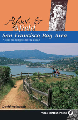
View northwest of Mt. Tamalpais from a high point on the Miwok Trail in the Marin Headlands.
A single-track trail, right, climbs to a vantage point beside a fenced-in communication facility, used by the FAA to direct commercial aircraft. Just left of this junction are a few large rocks, a convenient place to sit and rest. After enjoying the scenery, continue uphill on a gentle grade, and then begin a moderate descent. The 1041-foot high point on the ridge dividing Tennessee and Gerbode valleys, home of the FAA facility, is uphill and right.
Where a dirt road goes right to the FAA facility, you bear left and descend to a junction. Here the Miwok Trail turns left, but you go straight, now on the Bobcat Trail. Soon the Marincello Trail, part of the Bay Area Ridge Trail, joins from the left. This trail is open to hikers, horses, and bicycles. Continuing straight and passing several unsigned dirt roads, you come to a junction with the road to Hawk Camp, right.
Passing the road to Hawk Camp at about 3 miles, your route continues downhill on a gentle and then moderate grade, then follows a rolling course to a junction. Here, a short connector goes left to the Alta Trail, closed to bicycles, but you continue straight on the multi-use Bobcat Trail. Soon your route makes a sweeping right-hand bend and passes the Rodeo Valley Cutoff, a hiking-only trail veering left.
The Bobcat Trail now zigzags gently down into Gerbode Valley. After passing through a eucalyptus grove, you enjoy a level walk parallel to the creek, which remains hidden from view behind a screen of willow thickets. You pass the Rodeo Valley Trail, left, then cross the creek, which passes under the road through a culvert. In about 50 feet, you close the loop at the Miwok Trail. Here you turn left and retrace your route to the parking area.
Hawk Camp
Hawk Camp is the most primitive of the three walk-in campgrounds in the Marin Headlands. It has three sites that can each hold up to four people. There are picnic tables and a toilet, but no water. No fires are allowed, so if you want to cook, you need a camp stove. For reservations, call (415) 331-1540 between 9:30 A.M. and 4:30 P.M. You must pick up your permit at the visitor center during the above hours. Reservations may be made up to 90 days in advance.