Читать книгу Afoot and Afield: San Francisco Bay Area - David Weintraub - Страница 13
На сайте Литреса книга снята с продажи.
ОглавлениеUsing this Book
The trips in this book are organized in 10 chapters, with each chapter centered on a major population area. Chapter 1 is San Francisco/Marin, and from there the chapters (and trips) proceed roughly clockwise around the Bay Area, ending with the Peninsula. Thus the book reflects geography, and parklands that are neighbors will be found on neighboring pages. (Appendix 1 is a selection of highly recommended trips.)
In addition to the route description, each trip has highlights of the route, directions to the trailhead from the nearest major roadway, and what facilities, if any, are available at or near the trailhead. Each route has a map, along with symbols and capsulized summaries, which are explained below.
Capsulized Summaries
DISTANCE AND TRAIL TYPE
DISTANCE An estimate of the total mileage of the trip, exactly as described. Mileage for each out-and-back trip is the sum of its outbound and return legs.
LOOP, SEMI-LOOP, OUT-AND-BACK These designations identify the type of trip. Loop and semi-loop routes, the most common in this book, have been designed to minimize steep downhill sections whenever possible.
HIKING TIME
An estimate of the time it takes an average hiker to complete the trip, including stops along the way.
TOTAL ELEVATION GAIN/LOSS
Approximate sum of all the uphill and downhill segments of the trip (includes outbound and return legs for out-and-back trips).
DIFFICULTY
A subjective rating based on distance, total elevation gain/loss, and terrain. Here is an explanation of the four categories:
EASY Short trips with little or no elevation gain.
MODERATE Trips of several hours or more, with some ups and downs but no significant elevation changes.
DIFFICULT Extended trips with significant elevation changes.
VERY DIFFICULT The longest, most rigorous trips in this book.
TRAIL USE
BACKPACKING OPTION A few Bay Area parklands have campsites along or near the trip as described. Most of these require advance registration, as noted in the text.
MOUNTAIN BIKING ALLOWED Bicycling is allowed on the trip as described. Always check for seasonal closures and obey all posted restrictions. If a trip segment is closed to bicycles, and an alternate route is possible, this is noted in a footnote.
LEASHED DOGS In areas where dogs are allowed, they generally must be on a leash no longer than 6 feet.
GOOD FOR KIDS These are easy, short trips with not much total elevation gain, or longer trips that can be modified.
BEST TIMES
Most Bay Area parks can be visited all year, but there are a few caveats to keep in mind. Summer brings fog and often wind to areas near the coast and along the crest of the Peninsula, but inland the heat can be extreme. Many trails may be muddy in wet weather, and there may be snow/ice on the highest peaks in winter. On the bright side, spring brings wildflower displays to Bay Area grasslands, and fall is usually perfect for enjoying the outdoors just about anywhere.
AGENCY
This is almost always a government agency, either federal, state, or local. (Skyline Park Citizens Association, a volunteer group, runs Skyline Wilderness Park in Napa.) A listing of agencies, along with the abbreviations used in this book, is in Appendix 3.
RECOMMENDED MAP(S)
Most agencies administering Bay Area parklands produce maps that cover the trips in this book. In many cases, these maps are available at the trailhead. Sometimes, however, maps are available only at entrance kiosks or visitor centers, and these may be closed when you visit. Some agencies have maps available by mail, by phone, or on the Web (agencies are listed in Appendix 3). There are also excellent, commercially available maps that cover some of the trips in this book.
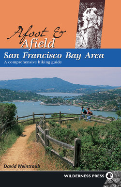
Overleaf: A couple enjoys a quiet stroll on the Shoreline Trail in China Camp State Park.