Читать книгу Afoot and Afield: San Francisco Bay Area - David Weintraub - Страница 22
На сайте Литреса книга снята с продажи.
ОглавлениеTRIP 8 China Camp State Park
| Distance | 4.9 miles, Semi-loop | |
| Hiking Time | 2 to 3 hours | |
| Elevation Gain/Loss | ±400 feet | |
| Difficulty | Moderate | |
| Trail Use | Mountain biking allowed | |
| Best Times | All year | |
| Agency | CSP | |
| Recommended Map | China Camp State Park (CSP) |
HIGHLIGHTS This semi-loop starts at China Camp Point and uses the Village, Shoreline, Oak Ridge, and Peacock Gap trails, and the Miwok Fire Trail, to explore the western part of this fine park. Except for a short but rigorous climb up the Miwok Fire Trail, most of the route is in the shade, making it pleasant on a warm day. Most of the park’s signed and maintained trails are open to hikers, bicyclists, and equestrians. Be sure not to miss the visitor center, open daily 10 A.M. to 5 P.M., in the village just downhill from China Camp Point.
DIRECTIONS From Highway 101 northbound in San Rafael, take the N. San Pedro Road exit, which is also signed for the Marin County Civic Center and China Camp State Park. After exiting, bear right, following the lane marked EAST. After 0.3 mile you join N. San Pedro Road.
Go another 5.1 miles to the China Camp Village entrance, left, and a large paved parking area. If this parking area is full, continue downhill 0.1 mile into the village, which has a large dirt parking area and a self-registration station.
From Highway 101 southbound in San Rafael, take the N. San Pedro Road exit, which is also signed for the Marin County Civic Center and China Camp State Park. After 0.2 mile, you come to a stop sign. Turn left, go 0.1 mile to a stoplight, and turn left again, onto N. San Pedro Road. At 0.3 mile, the exit ramp from Highway 101 northbound joins on your right. From here, follow the directions from the second paragraph, above.
FACILITIES/TRAILHEAD A visitor center with displays on the Chinese shrimp industry is in the village, along with picnic tables, restrooms, phone, and water. The snack bar and fishing pier here are open weekends only. Maps are for sale from a coin-operated machine at the visitor center. There are restrooms near the trailhead, which is on the northwest corner of the upper parking area.
China Camp State Park takes its name from a Chinese fishing village that flourished here during the late 1800s, one of 26 on San Francisco Bay. The early 1900s saw the passage of a series of restrictive laws, including bans on bag nets, peak-season fishing, and even possessing dried shrimp. These laws effectively shut down the Chinese shrimping industry, and the village soon suffered a precipitous decline.
Songbirds
Some of the songbirds found in the park’s wooded areas include dark-eyed juncos, warblers, kinglets, chickadees, and towhees. These, in turn, may attract predators such as Cooper’s and sharp-shinned hawks.
Take the Village Trail about 100 feet to a fork and bear left. When you reach North San Pedro Road, cross it and regain the Village Trail, which soon merges with the Shoreline Trail. Coast live oak, madrone, black oak, and California bay grow along here.
The trail follows a mostly level track until it descends to park headquarters, where you will find a ranger station, picnic tables, and water. Maps are usually available from a self-serve bin at the ranger station.
From the ranger station, cross a paved road and continue on the Shoreline Trail, climbing gently via several switchbacks. Meeting the Peacock Gap Trail, left, your route continues straight on the Shoreline Trail, then zigzags through the forest. Around 1 mile, the route rounds the end of a ridge and begins a gentle descent, soon reaching level ground.
Near the head of a gully spanned by a bridge, you pass an unofficial trail going uphill and left. Your route swings right, crosses the bridge, and jogs left. At the next gully, you cross another bridge, turn right, and begin to climb on a gentle grade. Breaking out of the trees, you have the best views yet of San Pablo Bay.
Burning as Stimulus
Park personnel use prescribed burns to remove nonnative plants such as French broom and star thistle, and to stimulate native grasses and other native plants.
Leaving the clearing and returning briefly to forest, you cross another bridge over a deep gully, and then, in a few paces, come into the open again.
Nearly at sea level, with a marsh sporting cattails just ahead, you reach a fork and bear left. Ahead is a four-way junction, where you turn left on the Miwok Fire Trail, a dirt road. Climb steadily for about 0.5 mile — the first part steep, the rest moderate and gentle — over eroded ground, with only patches of shade. Watch for bicycles careening downhill!
Around 3 miles, turn left on the Oak Ridge Trail, entering a cool, shady forest. Uphill and right is a ridge that slopes gradually down to meet your trail. Soon you merge with the McNears Fire Trail and in about 60 feet reach a fork. Here, at a low point on the ridge, the McNears Fire Trail veers left, but you bear right, still on the Oak Ridge Trail.
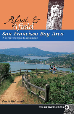
Hikers check map near the junction of the Miwok Fire Trail and the Shoreline Trail.
Now on the south side of the ridge, the vista expands dramatically, taking in San Francisco, Angel Island, and Mt. Diablo. Descend on a gentle grade to cross the McNears Fire Trail again and continue straight, still on the Oak Ridge Trail. A switchbacking descent in dense forest brings you to the end of the Oak Ridge Trail. Here you continue straight, now on the Peacock Gap Trail. Close the loop at the Shoreline Trail, turn right, and retrace your route to the parking area.