Читать книгу Afoot and Afield: San Francisco Bay Area - David Weintraub - Страница 21
На сайте Литреса книга снята с продажи.
ОглавлениеTRIP 7 Ring Mountain Open Space Preserve
| Distance | 3.3 miles, Semi-loop | |
| Hiking Time | 2 to 3 hours | |
| Elevation Gain/Loss | ±650 feet | |
| Difficulty | Moderate | |
| Trail Use | Leashed dogs | |
| Best Times | All year | |
| Agency | MCOSD | |
| Recommended Map | Southern Preserves (MCOSD) |
HIGHLIGHTS Ring Mountain Open Space Preserve, surrounded by residential development near busy Corte Madera, perfectly demonstrates the value of land conservation and protection. Its slopes are home to a wonderful array of trees, shrubs, and wildflowers, some quite rare, and one, the Tiburon Mariposa lily, is found nowhere else in the world. As a vantage point with great views, Ring Mountain’s summit rivals better-known Bay Area peaks. This route uses the Loop and Phyllis Ellman trails, along with the Taylor Ridge Fire Road, to explore the mountain’s slopes and summit.
Boldface numbers in the route description below refer to numbered markers along the trail, which are keyed to an MCOSD brochure that is no longer available. Some text from the brochure is summarized below and appears as part of the trail description.
DIRECTIONS From Highway 101 in Corte Madera, take the Paradise Dr./Tamalpais Dr. exit and go east on Tamalpais Dr., staying in the right lane, which becomes San Clemente Dr. After 0.1 mile, San Clemente Dr. bends right; follow it and go another 0.5 mile to a stoplight at Paradise Dr. Turn left onto Paradise Dr., go 0.9 mile, and park in a turnout on the right, near a gated dirt road.
FACILITIES/TRAILHEAD There are no facilities at the trailhead, which is on the south side of Paradise Dr., at a gated dirt road.
Head south on a dirt trail, with a seasonal creek in a gully on your right. After about 100 feet, where a faint trail continues straight, you turn right and cross a bridge over the creek. Climb on the Phyllis Ellman Trail past an information board detailing the history of the fight to save Ring Mountain. Shortly after a leftward bend, the trail reaches a junction. Here your route, the Loop Trail, goes straight, and the Phyllis Ellman Trail, which you rejoin later, veers right.
About 75 feet past the junction is marker 2, right, which calls attention to soil differences between the mountain’s upper and lower reaches. Sandstone soil, lower down, is perfect for a wide variety of plants, including wildflowers such as Ithuriel’s spear, blue-eyed grass, false lupine, suncup, wild iris, and miniature lupine. Serpentine soil, higher up, is toxic to most plant species, but tolerated by a few, including the preserve’s rarities.
A line of California bay and coast live oak, left, borders a seasonal creek that flows through a ravine and into the marsh, saturating it with water during the rainy season. Just before you reach the ravine, you pass a trail, right. Your trail dips down to cross the ravine, and once across, turns sharply left to marker 3, right. The large boulders seen from here are schists, composed of 12 to 15 different types of minerals — a relatively large number. (In comparison, Sierra granite contains only three to five different minerals.) The colored blotches on the boulders are lichens, composite plants containing both a fungus and an alga.
Out in the open, you reach marker 4. Just beyond it, at an unsigned junction, the trail forks. Here you stay right and climb over rocky ground. Nearing the seasonal creek, you come to marker 5.
At a T-junction just ahead, you turn left and climb to a junction, where the trail that forked left just beyond marker 4 rejoins your route. Ahead on the right is marker 6, which refers to birds found in the preserve, including raptors and songbirds, and also to the large rock formation, described as “a gigantic Indian warrior” standing guard on the hill to your left.
Now you climb gently across an open hillside, heading for an obvious watercourse and marker 7. Growing here are moisture-loving plants such as giant chain fern, rushes, and wax myrtle.
The source of Ring Mountain’s creeks and wet areas is rainwater that cannot penetrate deeply into the rocky soil on the mountain’s upper reaches, and instead emerges as seeps and springs.
Turning left, you cross a wet area via two plank bridges, and then climb a set of wooden steps that take you out of the watercourse. At an unsigned T-junction you turn right, soon reaching a fork, where you bear left and continue climbing. About 100 feet past the fork is marker 8, for an oak grove on the right.
Oaks — How Mighty?
Oaks may seem invincible, but practices such as land clearing, firewood cutting, and over-grazing are threatening California’s oak woodlands. Restoration projects, combined with public awareness, may help reverse this trend.
Continuing straight on the main trail, you pass a four-way junction and then reach a junction marked by a blank trail post. Here a trail continues straight, but you turn right, into a grotto of bay trees strewn with rock boulders, where marker 9 awaits. This grotto is called a tree island, and like a real island it stands in marked contrast to its surroundings — a shady shelter for birds, small mammals, and insects in the midst of wind-swept, sun-baked fields. Within the grotto, the trail becomes indistinct, but keeping marker 9 on your left, you go about 30 feet past it, turn left, and continue uphill.
Leaving the grotto behind, you merge with the trail that went straight at the blank trail post. About 75 feet ahead, you pass a trail on the right, and your route bends left. At a fork marked by a trail post, you bear left, pass marker 10, left, and continue winding your way uphill toward a grove of bay and coast live oak. When you reach the grove, turn right.
As you emerge from the grove, a fabulous scene greets you — the San Francisco skyline, the Marin Headlands, Sausalito, Richardson Bay, and the towers of the Golden Gate Bridge. Before the glaciers melted at the end of the last Ice Age, San Francisco Bay and San Pablo bays, also visible from the mountain, were a river valley, and the coastline was 20 to 30 miles farther west. As you walk downhill, passing marker 11, right, the view improves, as Alcatraz and the Bay Bridge come into view.
About 75 feet past marker 11, you reach a four-way junction at the Taylor Ridge Fire Road, around the 1-mile point. Ahead is a short path leading to a boulder sometimes used by rock climbers for practice. Turning left onto the fire road, you begin to gain elevation as you near the mountain’s summit, a high point to the southeast.
At a T-junction with a paved road, you turn right, following this road for about 150 yards and then bearing left onto a dirt-and-gravel road interrupted by stretches of broken pavement. The summit of Ring Mountain (602’) is in a grove of trees just left of the road, which dead-ends in a broad, gravelly area. From this dead end, a path heads south to a viewpoint. When you are ready, retrace your route to the junction of the Loop Trail and the Taylor Ridge Fire Road.
Survivor Tactics
Plants, being fixed in one place, use a variety of strategies to disperse their seeds. For example, birds eat berries and then deposit the seeds after digestion. Other animals that depend on seeds for food often drop some during transport. The wind also spreads the seeds of many plants. To survive, plants must develop defenses against being eaten by insects, birds, and other animals. These defenses can involve toxic chemical agents, like tannins, and physical barriers, like spines. Oaks are well defended, but their seeds, acorns, are eagerly consumed by mammals and birds.
Plants use chemical inhibitors to prevent premature sprouting: only when enough rain falls will the inhibitors leach out, thereby allowing the seed to sprout at the right time.
Continuing west on the fire road, you drop steeply over rough ground and then reach a junction where a road branches left. Here you continue straight, and in about 75 feet come to a four-way junction marked by a trail post missing its number — it should be marker 12. From this junction, the Phyllis Ellman Trail, your return route, goes right, and a trail to a rock inscribed with petroglyphs heads left. Turtle Rock, just east of the junction, looks like it has a turtle crawling up it. The exact age of the ancient petroglyphs is uncertain, but they resemble ones in the Sierra that are two to three thousand years old.
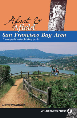
Ring Mountain: view south across Richardson Bay to the Marin Headlands.
Preservation Island
Development around the Bay Area has taken its toll on the environment, including habitat loss, the introduction of invasive nonnative plants, and the extinction of species. Ring Mountain is an important island of preservation, especially for native grasslands, one of the area’s most threatened ecosystems.
From the four-way junction, descend the Phyllis Ellman Trail, a single track heading northwest. In about 100 yards, you come to marker 13, right, indicating the tree island ahead and right. Trees can grow on this site because the rock is fractured, allowing roots to penetrate until they find water.
About 100 feet ahead, at a trail post, you turn left. The trail gains a little elevation and then levels, taking you across a rocky hillside in the heart of the serpentine belt. Now descending, you pick your way over rocky ground to marker 14. This is the area to look for rare plants, such as Marin dwarf flax, Tiburon paintbrush, serpentine reedgrass, and the Tiburon Mariposa lily, a late-May bloomer that grows nowhere else in the world.
Level for a while, the trail curves right and then drops on a moderate grade. At a junction where a trail merges from the right, you bear left and continue downhill. In about 100 yards, at the next junction, a sign with an arrow prompts you to turn right.
Marker 15, right, refers to soap plant, identified by its long, wavy leaves. The bulb of soap plant had several uses for Native Americans: it yields a cleansing substance when crushed; it contains toxins that stun fish; and, when detoxified by cooking, it can be eaten. Soap plant, which blooms from May through July, carries its flowers aloft on tall stalks, but these don’t open until shade falls in the late afternoon.
Before you reach the next line of vegetation, turn sharply left at a junction, where a path goes straight to the creek bed. After a leftward bend, the trail reaches a four-way junction just shy of a tree-lined ravine. Here you make a hard right and then work your way downhill on a moderate grade, aided in places by steps, to marker 16, right.
Nearing the seasonal creek again, your route bends left, winding downhill over rocky ground and passing a trail, right. Close the loop where the Loop Trail heads right, then retrace your route to the parking area.