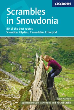
Читать книгу Scrambles in Snowdonia - Rachel Crolla - Страница 13
На сайте Литреса книга снята с продажи.
ОглавлениеINTRODUCTION
Area covered by the guide
Nearly all the described routes lie within the northern half of the Snowdonia National Park, where the most rugged mountains are found. Good scrambling in the southern half is scarce, the rock here being typically loose or vegetated, but a handful of good routes have been included.
Northern Snowdonia naturally divides into four regions. From north to south these are: the Carneddau, the Glyders, the Snowdon group and Eifionydd. The best scrambles will be found in the Glyders, with the large majority concentrated on Tryfan, Glyder Fach and Glyder Fawr. The Snowdon group also boasts many excellent routes, whereas the Carneddau and the Eifionydd regions provide only a handful. In this book, each region is introduced by a general description of the terrain and an indication of the scrambling potential. The best routes in the outlying areas of the Rhinogs, Moelwyns and Cadair Idris have been added to the updated edition of this guide to give wider coverage of the Snowdonia National Park.
Selection of routes
The choice of routes is, by necessity and design, a selective one. All the best scrambles, along with the most worthwhile routes in the outlying areas, have been included. The range of difficulty extends from scrambly walks to short sections of proper rock climbing. Average fitness and a head for heights will suffice at one end of the scale, whereas nothing short of mountaineer’s skill and daring will do at the other. Some routes fit neither category: scrambling over loose rock and up dripping, vegetated gullies seems to require a special cunning, for which neither hill walking nor rock climbing provides adequate preparation. The proficient all-round scrambler is a unique beast with some cautionary tales to tell.
Using this guide (including explanation of grades)
Route information boxes
Basic information has been included in a box at the start of each route in order to help readers decide whether the scramble is suitable for them. The headings are fairly self-explanatory: ‘Location’ refers to the mountain or mountain group where the scramble can be found and the grid references given here refer to the location of the actual scramble. (Parking details and corresponding grid references can be found in the longer ‘Approach’ section at the start of the main route description.) ‘Approach time’ is provided from the point at which most people would begin walking, up until the start of the scrambling. ‘Altitude’ is the height at which the scrambling, rather than the approach, begins. ‘Aspect’ simply refers to the approximate direction the route faces. The ‘Route length’ information is a rather subjective estimate of how much scrambling you can expect to find and whether the route is a long or short outing. This should be treated with caution because people move at vastly different speeds on steep ground, especially if ropework is sometimes involved. Approximate scrambling vertical height gains are often included, but again it is worth bearing in mind that scrambles are rarely vertical. The ‘Conditions’ heading is essential reading; it takes account of aspects such as rock quality and weather.
For the longer ridge circuits that include more than one scramble, such as the Snowdon Horseshoe, a rough circuit time based on an average unroped party has also been included.
Route descriptions
After an introduction and approach description, the routes are described generally or in detail according to the intricacy of the terrain. Remember that the described line is often only one of several ways of ascending the face. Use it as a guide, but be prepared to find easier or harder variations as the situation demands. A ‘Descent by this route’ section gives advice on using the route as a descent; if this section is not present, a descent is impractical or unduly difficult.
Descents and combinations have been given for all the routes to suggest interesting combinations for those seeking a longer mountaineering day. (See also Appendix B.)
Within route descriptions, alternative options are given as bullet points.
Early on the Cwm Glas Ridge with Esgair Felen behind (Route 63)
Route classification
The routes have been classified 1, 2, 3 or 3S, according to difficulty and level of risk. The progression from the very easiest grade 1 routes, such as the Southern Ridge Circuit or Seniors’ Gully, through to the hardest grade 2 routes, such as Bastow Buttress or Bryant’s Gully, is considerable; this increase in standard should not be underestimated. To give as much detail as possible we have sub-divided the grades for this edition. Borderline cases formally indicated by a grade of 1/2 or 2/3 are now indicated by the use of + or - symbols. However, it is impossible to apply any grading system rigorously, and at best it can serve only as a rough guide.
Above the Great Pinnacle Gap on Bristly Ridge (Routes 8 and 30)
Grade 1: This grade denotes routes that require no special mountaineering skills (eg Snowdon Horseshoe, Tryfan North Ridge, Bristly Ridge), and which should be within the capability of any adventurous and experienced hill walker with a head for heights. These routes are unlikely to require rope protection, and may be considered for descent or during doubtful weather.
Grade 1-: A particularly simple grade 1 route that limits exposure and is ideal as an introduction to scrambling (eg Moel Siabod, Seniors’ Gully, Cwm Glas Ridge).
Grade 1+: A grade 1 route likely to have increased steepness, technicality and exposure (eg East Gully, Milestone Gully, Nor’ Nor’ Groove).
The initial slabs on Direct Approach to Seniors’ Ridge (Route 44)
Grade 2: Things are getting much more serious now. These include the difficult gullies and ridges, and the easier face routes (eg Y Gully, Eastern Ridge of Black Ladders, North Buttress Variant). You may have to wait for optimum weather conditions, and even then difficulties that require rope protection may be encountered. Grade 2 routes often involve short passages of Moderate grade rock climbing. A wide experience of scrambling, or a background in mountaineering, is essential. Such routes are rarely suitable for descent. Note also that a grade 2 climbed unroped may be potentially far more dangerous than a grade 3 climbed with rope protection.
Grade 2-: Routes that provide an introduction to the grade (eg Llechog Ridge, South Face of Rhinog Fawr).
Grade 2+: The hardest routes in the grade (eg Bastow Buttress, Bryant’s Gully).
Grade 3: These routes have the attributes of grade 2 scrambles but with the additional complication of one or more short ‘pitches’ of simple rock climbing, often up to Difficult standard, on which rope protection is usual (eg Chasm Face, Dolmen Ridge). Someone whose background is limited to hill walking and scrambling will need to acquire a knowledge of basic rope technique before attempting these routes – in particular an ability to select belay anchors, fix running belays, and, in the event of a forced retreat, to abseil.
Grade 3-: Routes that offer an introduction to the grade (eg Craig Lloer Spur, South Gully, South Ridge Variant Rhinog Fach).
Grade 3S: Particularly challenging grade 3 terrain (eg Yr Esgair, Devil’s Kitchen, Jammed Boulder Gully). The scrambles given grade 3S have more sustained or exposed passages of Difficult grade rock climbing or crux sections on wet or suspect rock. They present mountaineering experiences where good judgement and knowledge of rope work are essential. Experienced climbers who solo grade 3 scrambles should be wary of 3S routes.
Star ratings
Routes have been allocated a quality rating from zero to three stars. Obviously this is a subjective assessment, although few will argue over the merits or otherwise of routes at either end of the scale:
| *** | acknowledged classics or routes of exceptional quality and interest |
| ** | routes of high quality |
| * | routes of merit but which lack continuous interest |
| no star | routes described for completeness or because they are the best available in that particular region. |
Equipment
Small first aid kit: Essential and should include: bandages, plasters, antiseptic cream/wipes, sun cream and surgical swabs. A tiny roll of duct tape can be surprisingly advantageous for holding swabs and plasters in place.
Whistle,compass and head torch.
Clothing: Your normal hill-walking clothing will generally be suitable for scrambling, but ensure that it gives adequate free movement for high leg and arm reaches. Mountain weather is changeable; it is wise to always pack a lightweight waterproof. Fingerless gloves or liner gloves that offer sensitivity and grip can be useful for scrambling up cold or wet rock but are no substitute for the sensitivity offered by gloveless hands.
Footwear: Specialist climbing approach shoes designed for scrambling and easy climbs are produced by all the major climbing brands and are recommended for scramblers venturing onto the grade 2 and 3 routes. However, be aware that approach shoes have their downsides: their soft soles can wear down very quickly; they offer very little ankle support; are no fun during boggy or wet approaches; and are not great on mud, wet grass or angular scree. Lightweight walking boots, particularly those with a firm (not rigid) rather than floppy midsole, are also good for scrambling – especially on easier routes that involve a lot of hiking. Rigid-soled mountaineering boots are unnecessarily clumsy and uncomfortable for scrambling.
Rucksack: Choose a neat daysack, ideally fitted with stabilising waist and chest straps but with as few other fittings as possible. Remember, ‘light is right!’
Rope: The typical 50m or 60m single and double ropes used for climbing are unduly heavy and cumbersome for scrambling, where a rope is often needed only for a short section of the overall route. The best compromise might be 30–50m of 9mm diameter half-rope. Half-rope can be used double in ascent and will allow significant abseils. Better, although more expensive, is a specialised superlight 9mm single rope. If using either a half-rope or a narrow diameter single rope, scramblers should be aware of its limitations: it is unlikely to be ‘sharp-edge’ tested and will wear out faster.
Note
The Devil’s Kitchen (Route 49) requires an abseil. Yr Esgair (Route 53) requires exactly 50m of rope to reach a good belay on its hard step.
It is essential your rope is a climbing rope with a ‘dynamic’ quality (in other words it must be capable of stretching to help absorb the energy of a fall), so it is no use buying caving or yachting rope, which has a low-stretch ‘static’ quality. Note that rope sold off the reel in 8mm diameters or less for making into runners and slings is low-stretch ‘static’ rope and should not be used as a main rope for scrambling. The rope should carry the UIAA label of approval.
Practising ropework at the difficult chockstone in Main Gully, Glyder Fach (Route 32)
Harness: The days of back breaking by tying a rope around your waist are long gone. Ensure you have a UIAA-rated climbing harness with a belay/abseil loop.
Other protection equipment: On some of the more technical routes, especially grade 3 and 3S routes, it is a good idea to include: three or four Nylon or Dyneema slings of 120cm and 240cm in length with a minimum 22KN rating; three additional screwgate locking karabiners; two HMS karabiners and two belay devices (although knowing how to use an Italian/Munter hitch belay, a waist belay and a direct belay are essential skills).
The benefits offered by additional gear – such as extra protection and speed in setting up belays – need to be weighed against the hindrance of carrying it. Nonetheless, it is well worth supplementing slings with a very small selection of mixed-sized nuts (for speed of placement include one each of Wild Country or DMM nut sizes 1 to 8 and one larger hex or chock). Include four quickdraws. Cams are not essential, but Wild Country Friend-size cams 1, 2 and 3 can be handy on harder routes. All equipment should conform to the current UIAA and CE standards.
Helmets: The slight irritation experienced when wearing a climbing helmet must be weighed against the partial but valuable protection it offers against falling stones or glancing blows sustained during a fall. Wearing or not wearing a helmet is entirely a matter of personal choice. For routes where friable or ‘suspect’ rock is noted under ‘Conditions’, such as Sentries’ Ridge or the Western Terrace of Clogwyn Du’r Arddu, a helmet is a good idea even if solo.
Basic rope technique
Instruction in rope technique is beyond the scope of this guide. Rock climbers and mountaineers will be able to adapt their normal belay methods to suit scrambling terrain. Hill walkers will need instruction from experienced companions. Failing that, they may wish to enrol on a course at an outdoor centre (advertised online or in specialist climbing/outdoor magazines). Climbing instruction guidebooks and reputable online videos are invaluable reference points, but are no substitute for face-to-face instruction and practice.
Maps
The vast majority of routes appear on the OS Explorer OL17 1:25,000 Snowdon – Conwy Valley sheet. The Rhinogs are covered by OL18 and Cadair Idris by OL23. The location of every scramble in this book is shown on OS mapping in the relevant chapters. For longer ridge circuits and lengthy isolated outings, the entire routes are shown on the maps. Do not rely on a smartphone as a substitute for a map.
Strutting up the Catwalk of the Chasm Face (Route 31)
Access
Approaches have been carefully described to avoid crossing land where access is restricted or in dispute. Improvising unrecognised approaches across lower pastures merely antagonises farmers. Besides, there is plenty of scope for wandering at will on the higher ground.
Bases
For the Carneddau and Glyders routes, a base in the Ogwen Valley is best. Those with private transport will find anywhere between Capel Curig and Bethesda will do. Both villages provide basic amenities and a range of accommodation can be found throughout the valley, including campsites (those offering facilities are marked on OS maps – enquire locally for other sites); bunkhouses; youth hostels (Idwal and Capel Curig – the latter is now privately run); bed and breakfast; and hotels.
For routes in the Snowdon group, the best bases are the Llanberis Pass and, to a lesser extent, Nant Gwynant. Both have campsites and bunkhouse accommodation (Nant Peris has two campsites and a pub). Bed and breakfast and hotel accommodation, along with amenities, can be found in and around Llanberis and Beddgelert and there are youth hostels at Bryn Gwynant, Llanberis, the Snowdon Ranger at Llyn Cwellyn and Pen y Pass.
Most people will visit Eifionydd and the outlying areas from a base in the northern mountains or on separate trips. Dolgellau is a good base for Cadair Idris.
Further information can be found in Appendix C.
Public transport
Regular rail and bus services link Conwy to Bangor and Betws-y-Coed. Bus routes from Caernarfon extend only as far as Nant Peris and Beddgelert. At the time of writing there was no service along the Ogwen Valley road from Bethesda to Capel Curig – a situation likely to change. In summer the Sherpa bus service makes a circuit around the Snowdon group by linking Beddgelert and Nant Peris via Pen y Gwryd. This service is extremely useful, allowing car owners to park and ride up to Pen y Pass and facilitating other unusual combinations of ascent and descent routes (search Sherpa bus timetable for details).
The remote cliffs of Craig Cwm Du (Route 75)
Accidents and emergencies
Always carry a small first aid kit (see ‘Equipment’) and know how to use it. Consider attending an emergency first aid course including CPR. The National Mountain Centre (www.pyb.co.uk) runs these in Snowdonia and St John Ambulance (www.sja.org.uk) has details of affordable, regular courses across the UK.
With minor injuries, especially during cold or wet weather, it is nearly always best to keep moving – so attempt to descend the mountain by a known route. The danger from hypothermia in mountains is often much greater than the danger from a broken arm or a sprained ankle. Use a whistle to summon help from others on the mountain (sequence of six blasts). Head torch flashes are common on these mountains at night and less likely to raise an alarm (use a sequence of six flashes).
Take responsibility for your own safety. Mountain rescue should only be used as a last resort; teams in Llanberis and Ogwen Valley have seen a massive increase in callouts over the last few years, many of which could easily have been avoided.
Looking across Nor’ Nor’ Buttress at a coastguard rescue helicopter, East Face of Tryfan
To alert mountain rescue
Even in areas with no mobile phone signal, there is a high chance 999 will connect. Dial 999, ask for police/mountain rescue, and try to have the following details ready:
precise position of the injured person on the crag (eg name of route)
location of the crag (including grid reference if possible)
time and nature of accident
extent of injuries
indication of prevailing weather at the scene (cloud base, wind strength, visibility, etc).
Keep the phone to hand until met by a member of the emergency services.
Rescue helicopters
Secure all loose equipment before arrival of helicopter (weight rucksacks and jackets, for example, with stones).
Identify yourself by raising your arms in a ‘V’ as helicopter approaches. Do not wave.
Protect injured person from rotor downdraught (which is intense).
Allow winchman to land without interfering.
Do not approach helicopter unless directed to do so by one of the crew.
A final cautionary note
A guidebook of this sort reflects the author’s and updaters’ reactions and responses to the routes. Not everyone will agree on the exact lines to follow, the levels of difficulty encountered, or the best techniques to apply. The author climbed all the routes personally, specifically with the guide in mind, and at least once in every case without rope protection. All routes have been re-climbed by the updaters for this edition, often several times and in various conditions and ways. Nevertheless, when faced by an unexpected route-finding problem you must be prepared to trust your own mountain sense or judgement.
The same goes for loose rock encountered on the routes. Coping with unstable blocks, shattered rock and treacherous vegetation is all part of the game. Even the easiest scrambles can never be made completely safe, and some are potentially more dangerous than most rock climbs.
All the described scrambles are ‘summer’ routes. Even the simplest of them would be a totally different proposition in winter conditions, when ice-axe, crampons and winter-climbing skills are required. Remember that even when snow is absent the rocks may be coated in verglas – the thin veneer of ice rendering an ascent extremely difficult and dangerous.
A further consideration: the proliferation of indoor climbing and localised bouldering in the years since the last edition of this guide has led to a generation of technically gifted climbers who have not necessarily served a traditional mountain apprenticeship. Although such gymnastic practice is useful, it does not develop the skills required on an exposed mountainside at 900m in strong winds, a thundershower imminent and nightfall looming. Neither does it teach you to tap holds, to distrust certain blocks, spot the best line and avoid false trails. No grade of scramble should be taken lightly. Experience should be developed gradually: consider your limitations and the limitations of others in your party before setting out.
Above all, scrambling demands good judgement of terrain and an ability to assess the potential risk at every stage. These skills are learned gradually, beginning with the grade 1 ridge scrambles. This book can suggest only where the routes go and give advice on how to overcome some of the obstacles you will meet. Knowing when and how to turn back or when to carry on are skills in themselves; no-one can decide for you whether or not it is safe to continue. Ultimately the choices and the adventures are yours.